ALERTS: Severe Thunderstorm Watches Issued for Today
Top Stories
17 May 2018 3:28 PM
Multiple severe thunderstorm watch areas have been issued this afternoon for the combination of large, damaging wind and hail. Here are the areas we are watching:
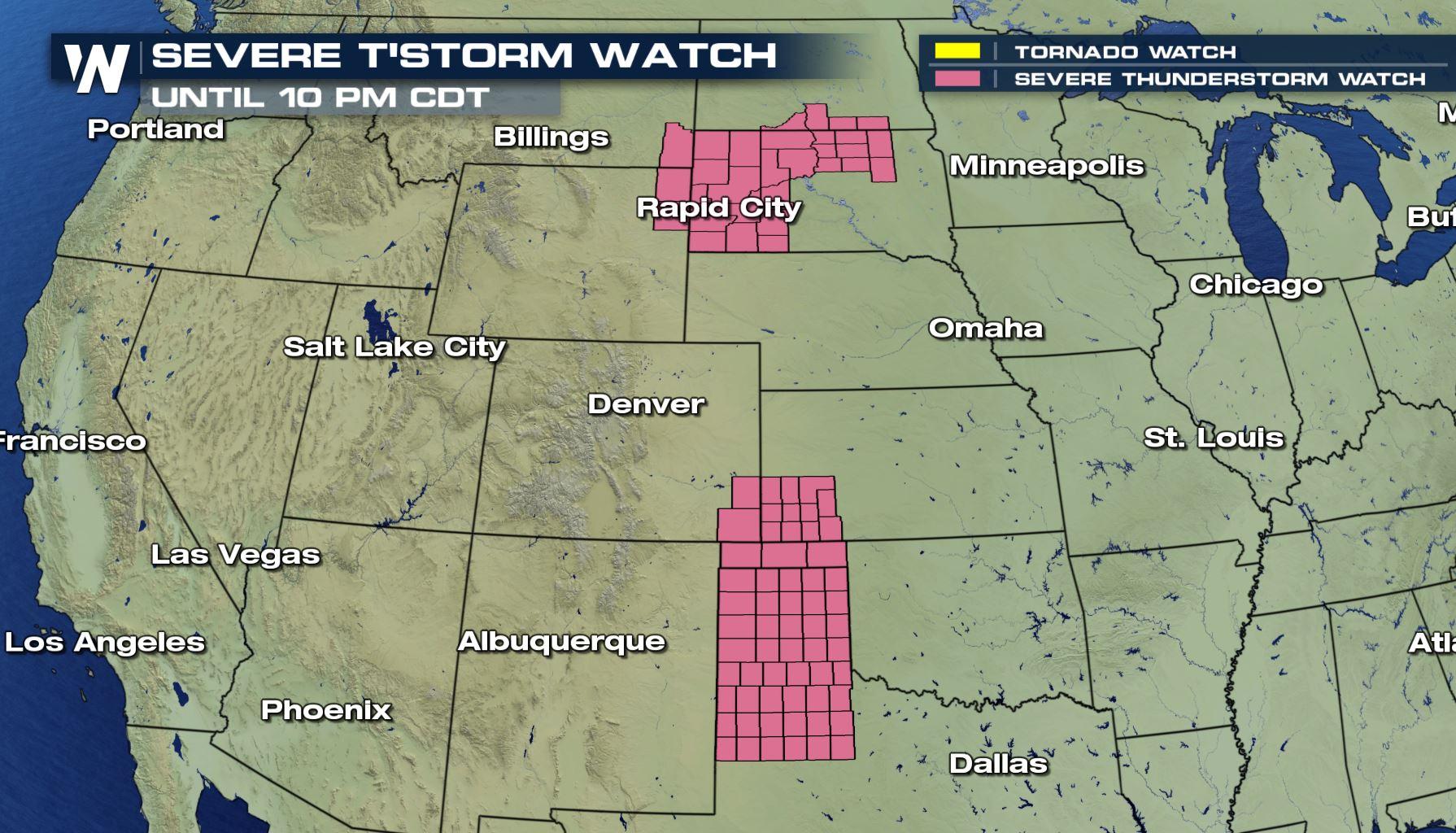
 A severe thunderstorm watch is in effect until 9 p.m. mountain, 10 p.m. central Thursday, May 17.
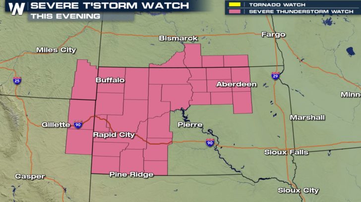
 A severe thunderstorm watch is in effect until 10 p.m. central Thursday, May 17.
This means that these areas are at risk for the *potential* of severe thunderstorms including hail larger than one inch in diameter, winds of 58 mph or stronger, and/or a tornado.
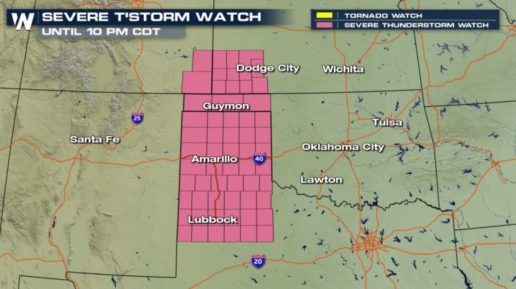
A severe thunderstorm watch is in effect until 10 p.m. central Thursday, May 17.
This means that these areas are at risk for the *potential* of severe thunderstorms including hail larger than one inch in diameter, winds of 58 mph or stronger, and/or a tornado.
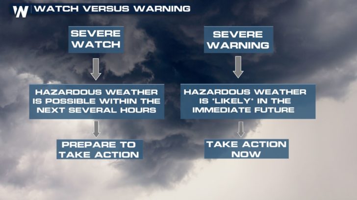 If a warning is issued for your area, it means that a storm has formed and is about to move through (or very close to) your location! That means action must be taken immediately. In most scenarios, it means getting into the lowest level of a secure building.
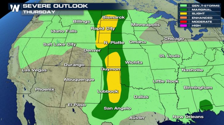 The severe weather outlook for Thursday, May 17 where yellow shows the highest storm potential, followed by dark green and then light green.
Most of these thunderstorms will remain intense through 10 p.m. central, 9 mountain, but may even remain strong until midnight.
The severe weather outlook for Thursday, May 17 where yellow shows the highest storm potential, followed by dark green and then light green.
Most of these thunderstorms will remain intense through 10 p.m. central, 9 mountain, but may even remain strong until midnight.
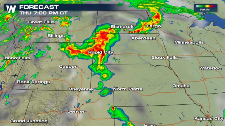 The projected radar for parts of Wyoming and South Dakota at 7 p.m. central Thursday.
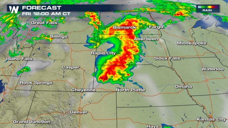 The projected radar for parts of Wyoming, the Dakotas, and Nebraska at midnight Friday.
The above images show the projected radar where yellow is moderate rain and reds indicate strong to severe thunderstorms. Let's take a look to the south in Texas!
The projected radar for parts of Wyoming, the Dakotas, and Nebraska at midnight Friday.
The above images show the projected radar where yellow is moderate rain and reds indicate strong to severe thunderstorms. Let's take a look to the south in Texas!
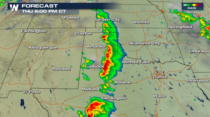 Projected radar: 6 p.m. central Thursday.
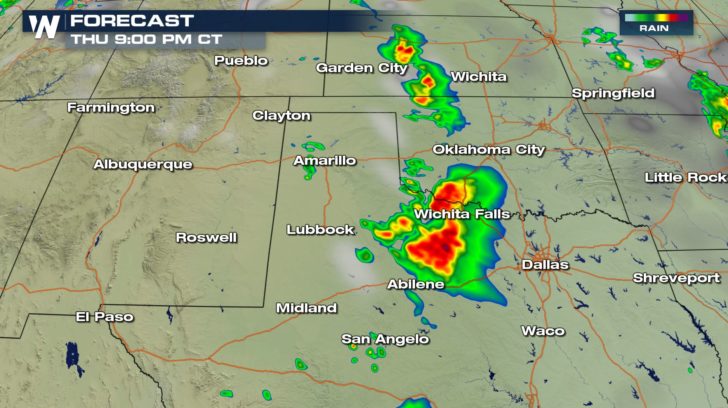 Projected radar at 9 p.m. central Thursday.
Stay up to date with the weather happening around you, especially if you happen to be within these severe thunderstorm areas. Check our Facebook or Twitter pages for any updated information this evening!
For WeatherNation, Meteorologist Steve Glazier
Projected radar at 9 p.m. central Thursday.
Stay up to date with the weather happening around you, especially if you happen to be within these severe thunderstorm areas. Check our Facebook or Twitter pages for any updated information this evening!
For WeatherNation, Meteorologist Steve Glazier
A severe thunderstorm watch is in effect until 9 p.m. mountain, 10 p.m. central Thursday, May 17.
A severe thunderstorm watch is in effect until 10 p.m. central Thursday, May 17.
This means that these areas are at risk for the *potential* of severe thunderstorms including hail larger than one inch in diameter, winds of 58 mph or stronger, and/or a tornado.
If a warning is issued for your area, it means that a storm has formed and is about to move through (or very close to) your location! That means action must be taken immediately. In most scenarios, it means getting into the lowest level of a secure building.
The severe weather outlook for Thursday, May 17 where yellow shows the highest storm potential, followed by dark green and then light green.
Most of these thunderstorms will remain intense through 10 p.m. central, 9 mountain, but may even remain strong until midnight.
The projected radar for parts of Wyoming and South Dakota at 7 p.m. central Thursday.
The projected radar for parts of Wyoming, the Dakotas, and Nebraska at midnight Friday.
The above images show the projected radar where yellow is moderate rain and reds indicate strong to severe thunderstorms. Let's take a look to the south in Texas!
Projected radar: 6 p.m. central Thursday.
Projected radar at 9 p.m. central Thursday.
Stay up to date with the weather happening around you, especially if you happen to be within these severe thunderstorm areas. Check our Facebook or Twitter pages for any updated information this evening!
For WeatherNation, Meteorologist Steve GlazierAll Weather News
More
East Gears Up for Stormy, Wet Weekend
A low pressure system crashing through the Mi
1 Aug 2026 11:35 AM


Flooding, Severe Storms Target the Midwest Again
After an active week of storms across the nor
1 Aug 2026 1:40 AM


After Reaching Category 5, Genevieve Weakens in the Pacific
PacificFausto is now a post-tropical cyclone.
31 Jul 2026 1:30 AM

Flooding Risk Increases as Heavy Rain Targets the Tri-State Area
Tuesday, heavy rainfall moved across the Nort
30 Jul 2026 12:25 AM

Severe Weather: Energy From the Midwest Now in the Southeast
UPPER MIDWEST - Through Monday, dangerous tor
29 Jul 2026 10:30 PM