An Area to Monitor in the Atlantic

After getting off to a record fast start with named systems, the Atlantic Basin has been largely quiet over the past month. A stalled boundary spinning up an area of low pressure is trying to change that. The National Hurricane Center officially highlighted an area off of the coast of Carolina with a low-end chance to develop. Here's what we know.
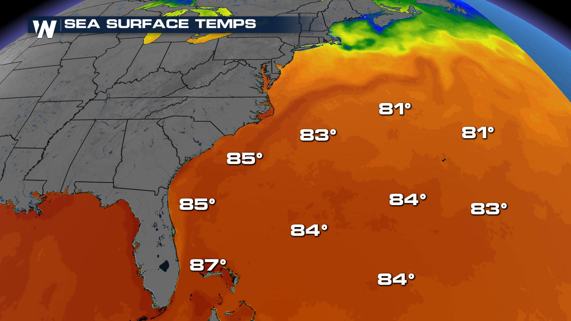
An area of low pressure is expected to form sometime Saturday. Once it forms, it will be traveling over some pretty undisturbed waters in the Atlantic. Temperatures on the surface out here are past 80, which would help maintain any tropical characteristics if they were to form.
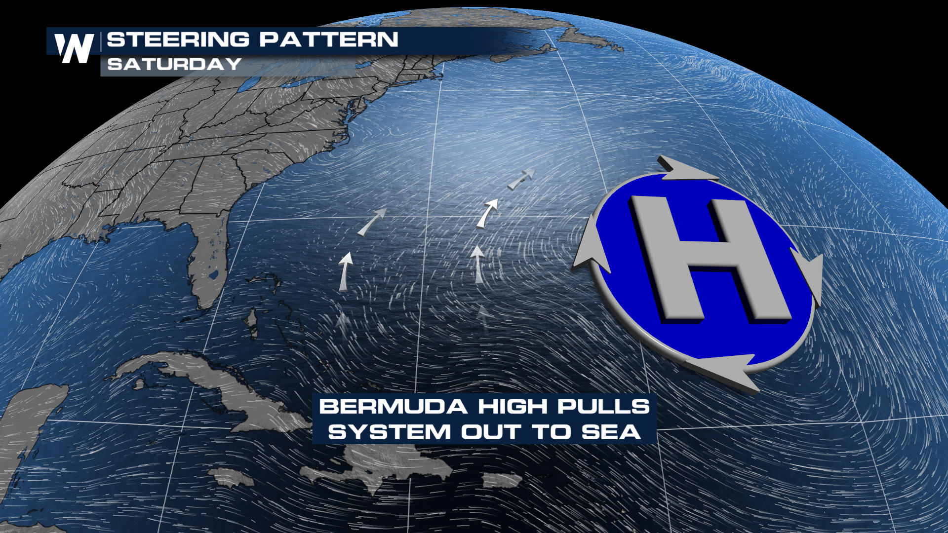 If anything were to develop, it will get swept out to sea, courtesy of a high parked on top of Bermuda. That's not to say we won't see any impacts stateside, however.
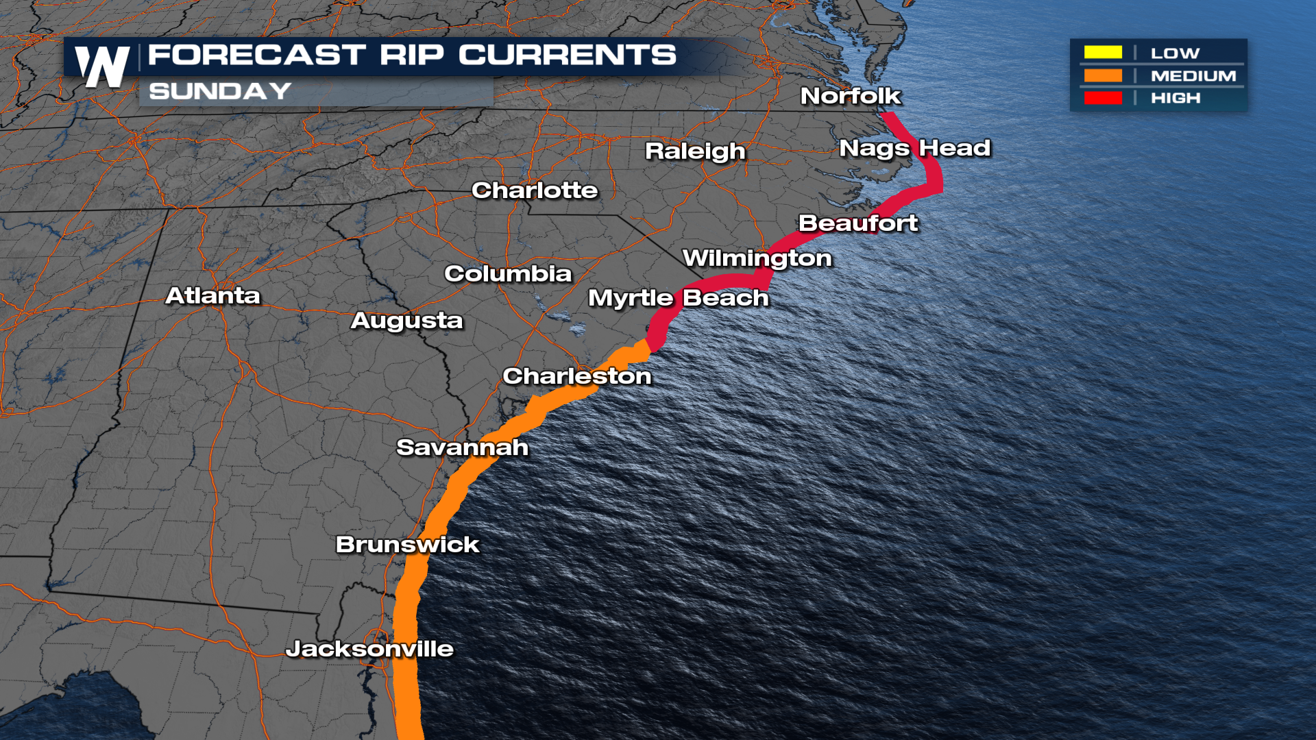
Rip currents will likely be the biggest concern from coastal Carolina down through the northeastern portion of Florida. Waves could reach as high as 10 feet in some offshore areas late Saturday night into Sunday morning, but the wind direction is going to be what causes the rip current concern. Be sure to heed the advice of the flags on the beaches into Sunday.


