An Atmospheric River Eyeballs The Pacific Northwest
Top Stories
5 Apr 2019 2:41 PM
An elongated, steady stream of moisture commonly referred to as an 'atmospheric river' is forecast to arrive at the Pacific Northwest coastline this weekend.
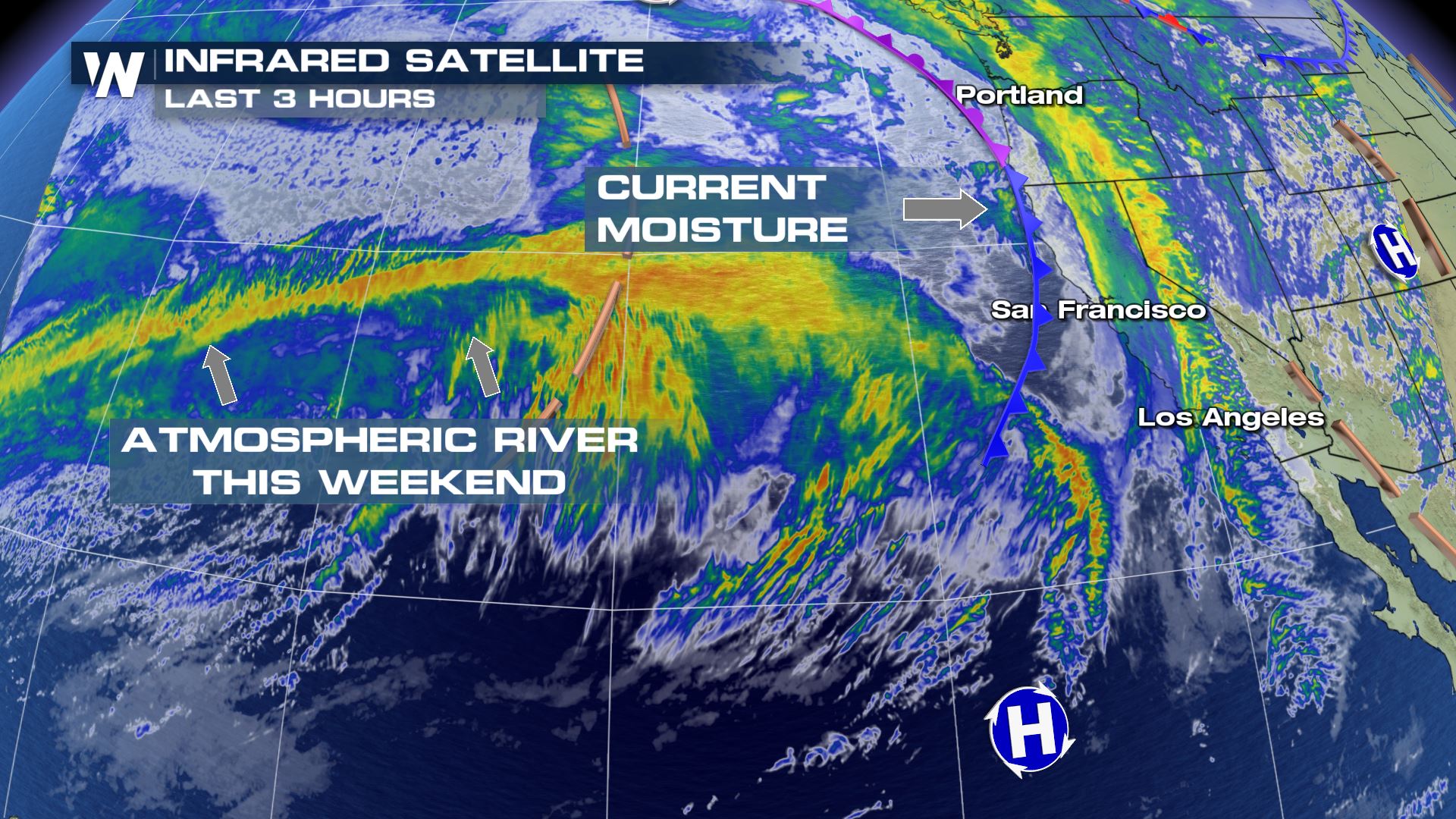 Infrared Satellite imagery Friday afternoon, April 5th showing the current cold front and associated moisture (yellows) followed by the next atmospheric river (left).
Late this week, the river of moisture across the Pacific was still well out to sea. It will arrive quickly by Saturday night or early Sunday morning.
Infrared Satellite imagery Friday afternoon, April 5th showing the current cold front and associated moisture (yellows) followed by the next atmospheric river (left).
Late this week, the river of moisture across the Pacific was still well out to sea. It will arrive quickly by Saturday night or early Sunday morning.
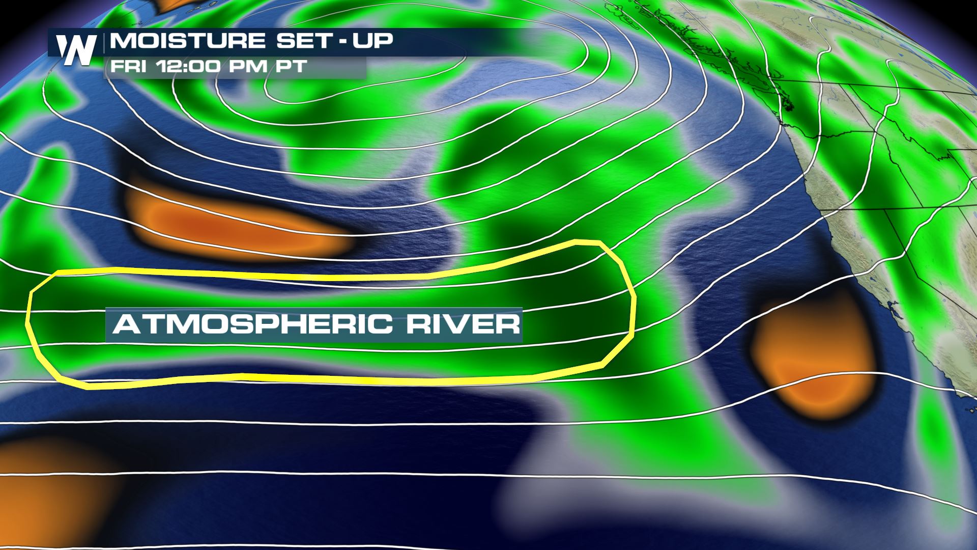 The moisture levels indicated Friday afternoon, April 5th.
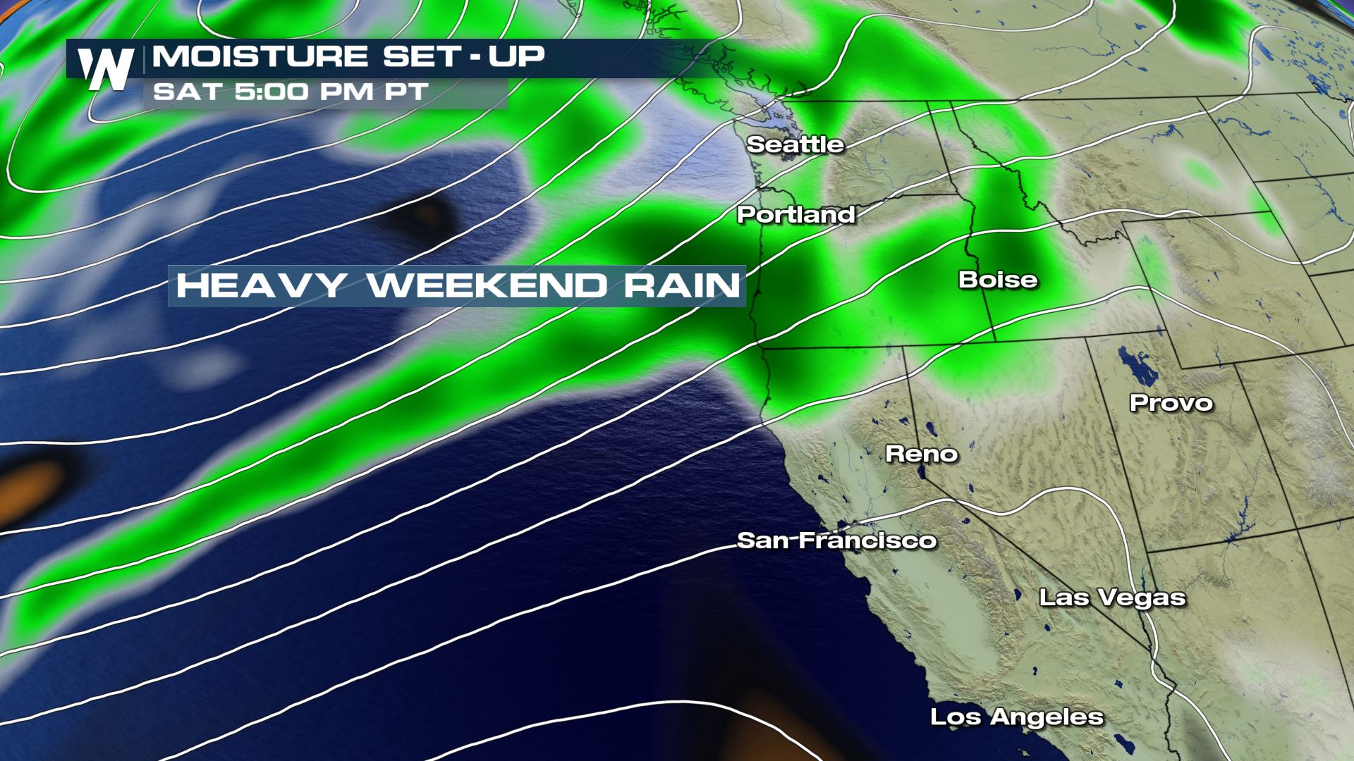 The forecast position of the higher moisture levels (green) by Saturday evening, April 6th.
First up will be Oregon, far southern Washington as well as far northern California on Saturday evening. This will translate to another batch of heavy rain showers and mountain snow showers Saturday night. Another steady stream of moisture will reinforce those rain/snow showers on Sunday and even into Monday for the Pacific Northwest.
The forecast position of the higher moisture levels (green) by Saturday evening, April 6th.
First up will be Oregon, far southern Washington as well as far northern California on Saturday evening. This will translate to another batch of heavy rain showers and mountain snow showers Saturday night. Another steady stream of moisture will reinforce those rain/snow showers on Sunday and even into Monday for the Pacific Northwest.
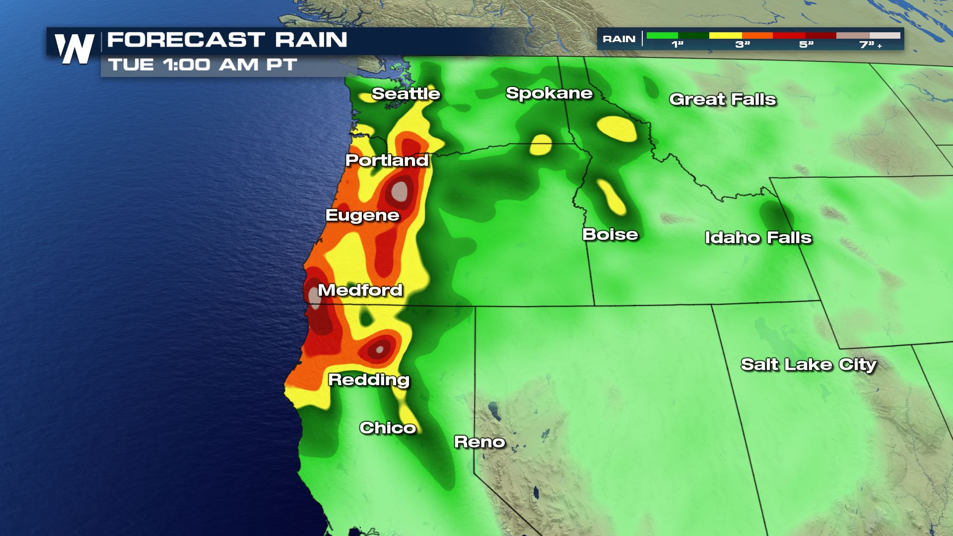 Forecast rainfall through Monday, April 8th where yellow shows up to 3", orange up to 4" and maroon up to 5" by the end of the week.
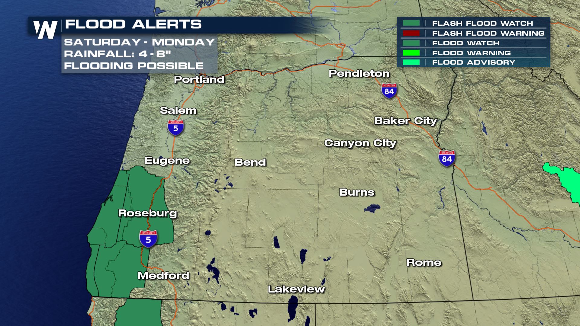 A flood watch (green) is in effect between Saturday and Monday, April 6th-8th for potential flooding.
As a result of the heavy rain, a flood watch has been issued for southwest Oregon and northwest California. That means there is the potential for river flooding and street flooding. Remember: Turn Around, Don't Drown! With some snow still left to melt and the incoming rain, flooding will be a possibility across parts of the Northwest.
A flood watch (green) is in effect between Saturday and Monday, April 6th-8th for potential flooding.
As a result of the heavy rain, a flood watch has been issued for southwest Oregon and northwest California. That means there is the potential for river flooding and street flooding. Remember: Turn Around, Don't Drown! With some snow still left to melt and the incoming rain, flooding will be a possibility across parts of the Northwest.
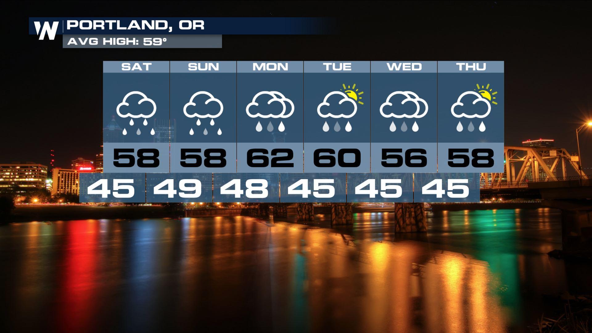
 Portland, Oregon's forecast between Saturday, April 6th and Thursday, April 11th
For WeatherNation, Meteorologist Steve Glazier
Portland, Oregon's forecast between Saturday, April 6th and Thursday, April 11th
For WeatherNation, Meteorologist Steve Glazier
Infrared Satellite imagery Friday afternoon, April 5th showing the current cold front and associated moisture (yellows) followed by the next atmospheric river (left).
Late this week, the river of moisture across the Pacific was still well out to sea. It will arrive quickly by Saturday night or early Sunday morning.
The moisture levels indicated Friday afternoon, April 5th.
The forecast position of the higher moisture levels (green) by Saturday evening, April 6th.
First up will be Oregon, far southern Washington as well as far northern California on Saturday evening. This will translate to another batch of heavy rain showers and mountain snow showers Saturday night. Another steady stream of moisture will reinforce those rain/snow showers on Sunday and even into Monday for the Pacific Northwest.
Forecast rainfall through Monday, April 8th where yellow shows up to 3", orange up to 4" and maroon up to 5" by the end of the week.
A flood watch (green) is in effect between Saturday and Monday, April 6th-8th for potential flooding.
As a result of the heavy rain, a flood watch has been issued for southwest Oregon and northwest California. That means there is the potential for river flooding and street flooding. Remember: Turn Around, Don't Drown! With some snow still left to melt and the incoming rain, flooding will be a possibility across parts of the Northwest.
Portland, Oregon's forecast between Saturday, April 6th and Thursday, April 11th
For WeatherNation, Meteorologist Steve GlazierAll Weather News
More


More Storms for the East Through Monday
A low-pressure system that moved through the
3 Aug 2026 1:50 AM

After Reaching Category 5, Genevieve Weakens in the Pacific
PacificGenevieve formed last Friday south of
3 Aug 2026 12:30 AM

Flooding, Severe Storms Target the Midwest Again
After an active week of storms across the nor
1 Aug 2026 1:40 AM

Flooding Risk Increases as Heavy Rain Targets the Tri-State Area
Tuesday, heavy rainfall moved across the Nort
30 Jul 2026 12:25 AM

Severe Weather: Energy From the Midwest Now in the Southeast
UPPER MIDWEST - Through Monday, dangerous tor
29 Jul 2026 10:30 PM