Blizzard Conditions In the Upper Midwest, Portions of I-35 Shutdown

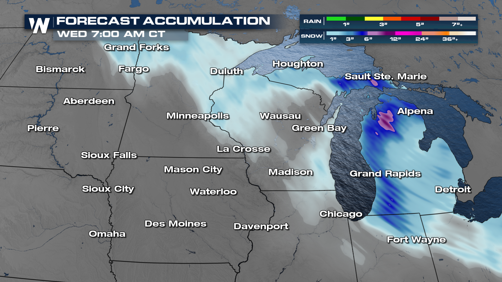
UPPER MIDWEST - Blizzard alerts are in place for portions of the Upper Midwest through Monday. Blizzard warnings are issued when visibility is less than 1/4 mile, winds are greater than 35 mph, and lasting for more than 3 hours. Additional alerts are in place, including winter storm warnings and winter weather advisories. 4 - 14" of snow will be possible and white out conditions will stick around long after the snow stops falling.
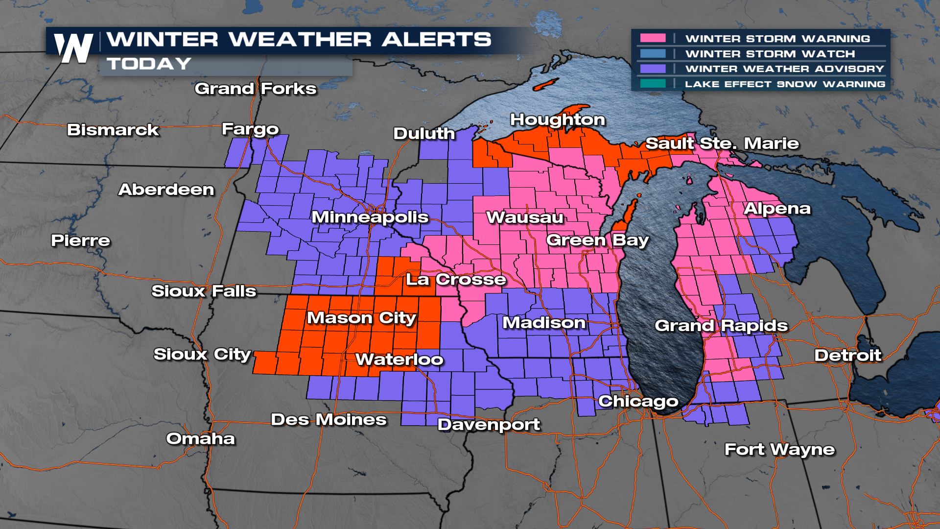
The Iowa Department of Transportation reports that portions of the heavily traveled Interstate 35 are closed from Clear Lake to Ames due to hazardous weather conditions.
As the frontal system moves through, temperatures will turn colder, and winds will increase, allowing blizzard conditions to continue into the beginning of the workweek.
Snowfall totals could reach several inches, especially with the added influence of lake-effect bands near Lake Superior.
For more coverage, be sure to watch us live on WeatherNation!


