Another Round of Ice and Snow for the Northeast

As we are coming off the heels of our last winter system, more winter mischief is in the forecast. We are expecting two rounds of precipitation. Both rounds could be impactful especially the first round on Sunday. Winter Weather Advisories are up for parts of New England for Sunday and Monday. Most of the impacts will be freezing rain and a wintry mix!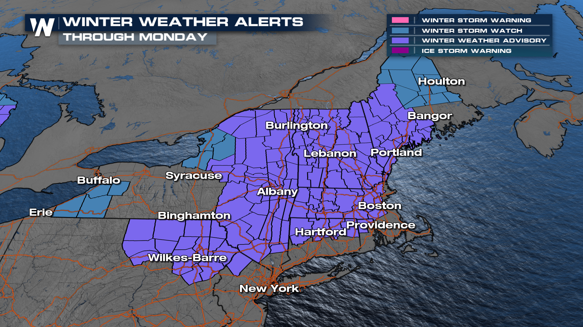
Setup
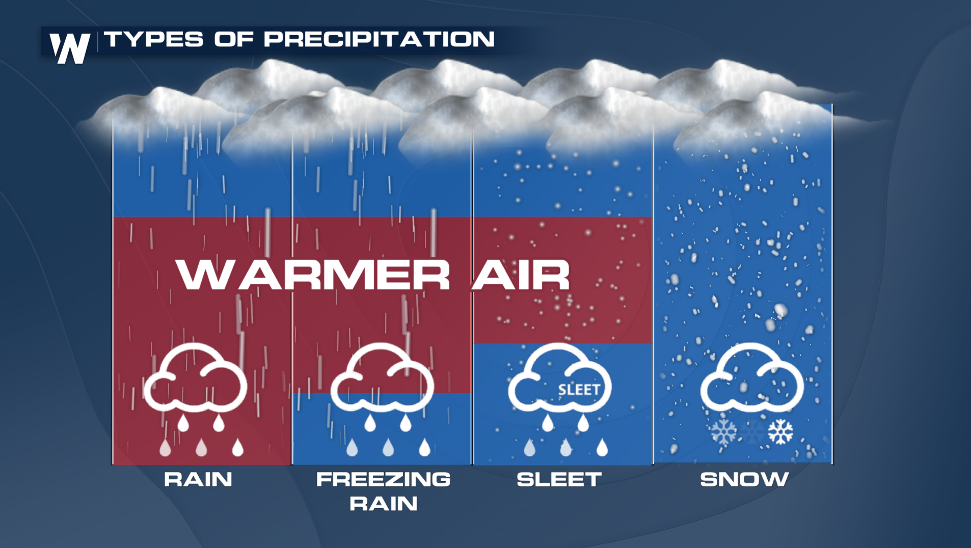
Sunday morning, we are going to wake up to temperatures well below freezing for many. However, as our next system moves in from the west it is bringing in lots of warm air for the upper levels that is going to make this forecast tilt more to an ice and rain event instead of snow for NOW.
FORECAST
Staying with Sunday's event, check out this temperature profile for Albany, NY. You will notice that the temperature at 5,000 feet is well above freezing compared to the number at the surface. Rain drops at this level is freezing in the colder air creating the ice issue for Sunday!
A range of a tenth to a half an inch of ice could fall across parts of New England and driving across parts of Interstates 81, 90, 87, and 90 will be very dangerous. In addition power outages could be an issue too!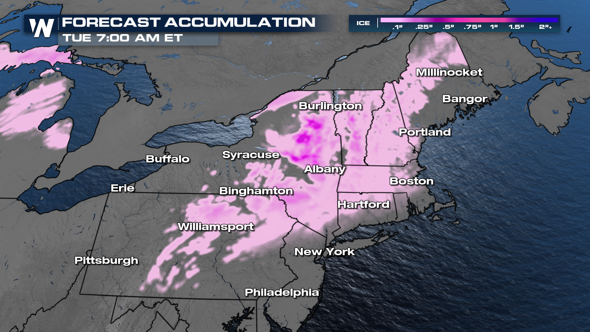
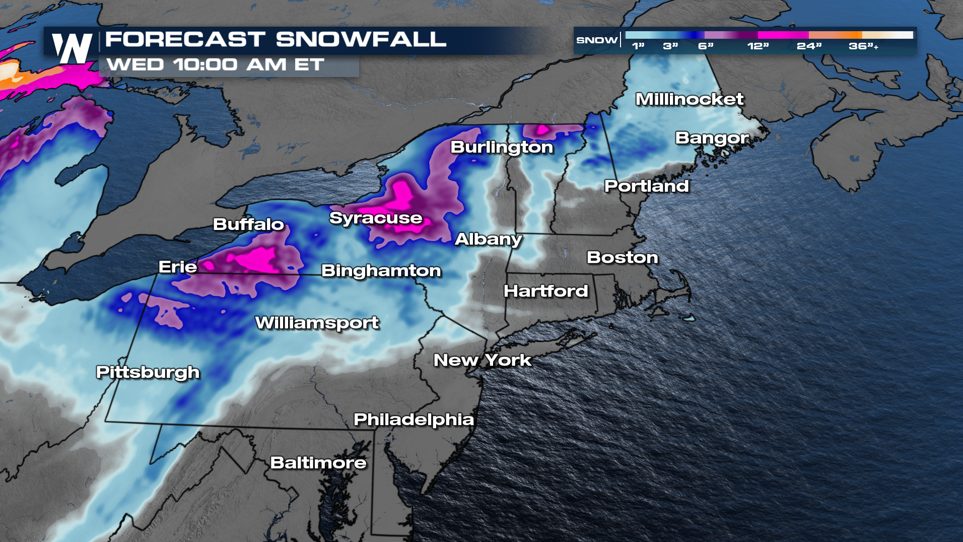
The second round of moisture will occur along the cold front. Thankfully, temperatures will be much colder top down and creating more snow chances. The heaviest snow will be along the Great Lakes into next week!