Another System Targets Post Holiday Travel

Another day. Another clipper. We've been stuck in the highway with wave after wave passing through. The most recent one dropped 7-8 inches of snowfall, leading to some slick roads in the northeast Tuesday morning.
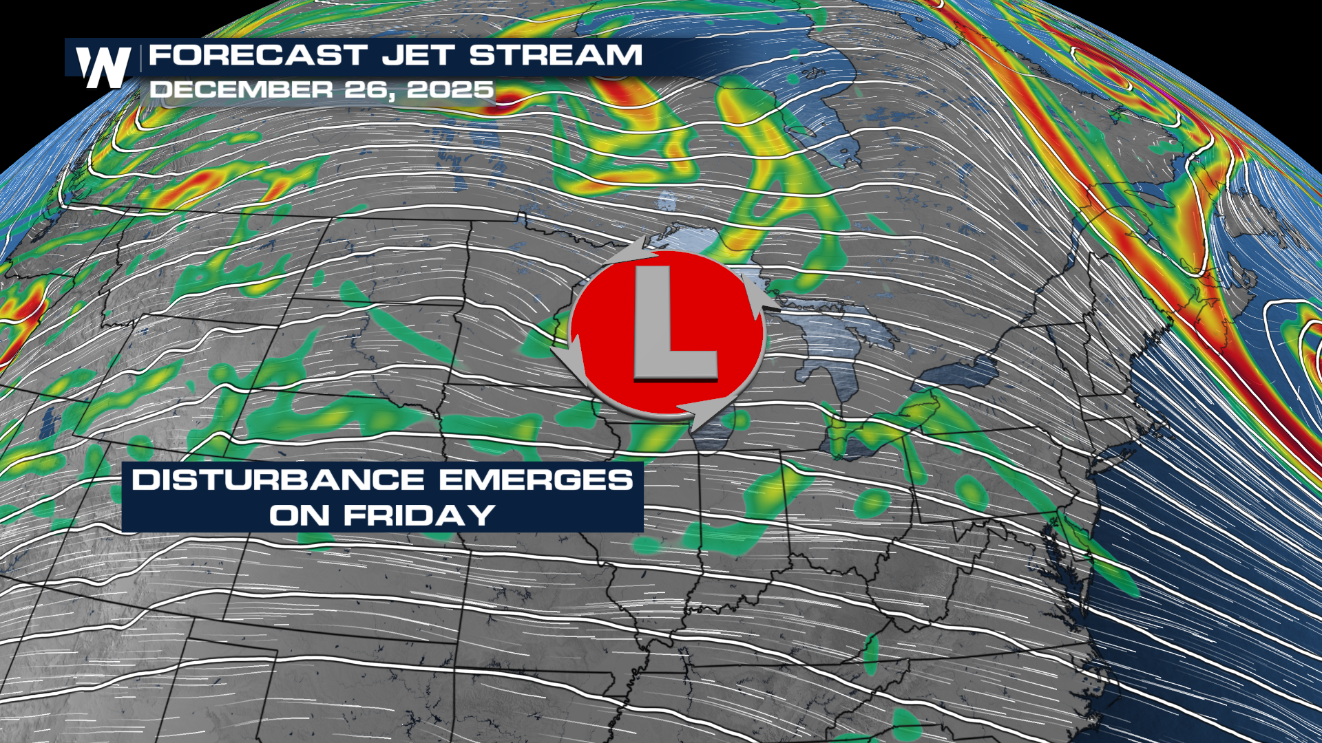 This next system has a little bit more of an attitude, however. As this wave emerges out over the high plains, snow and ice will be the biggest concerns associated with it.
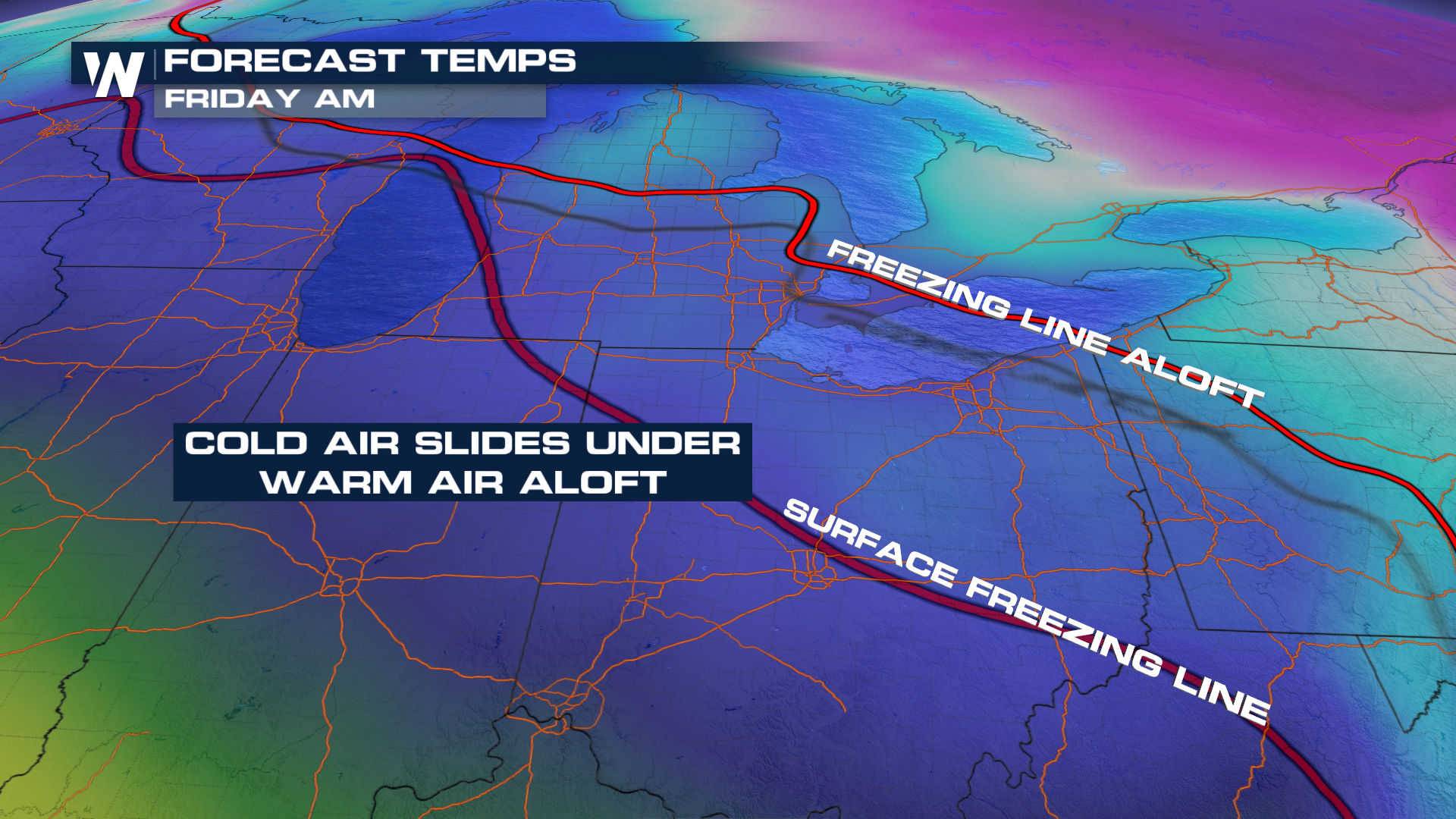
 As with most of these clippers, some gusty winds and fast-moving snow will be easy to come by. With this one, however, freezing rain and sleet will be something to watch out for. High pressure will try to shove cold air farther south, undercutting the warm air overhead. That setup will melt the snowflake but have a chance to refreeze it closer to the surface.
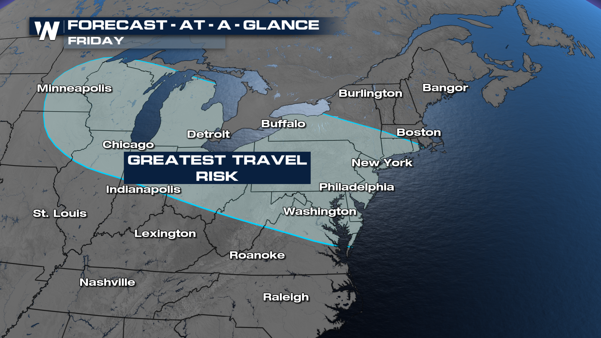
 A line from about Detroit to Pittsburgh to Philadelphia is the area of greatest concern with the most recent modeling.
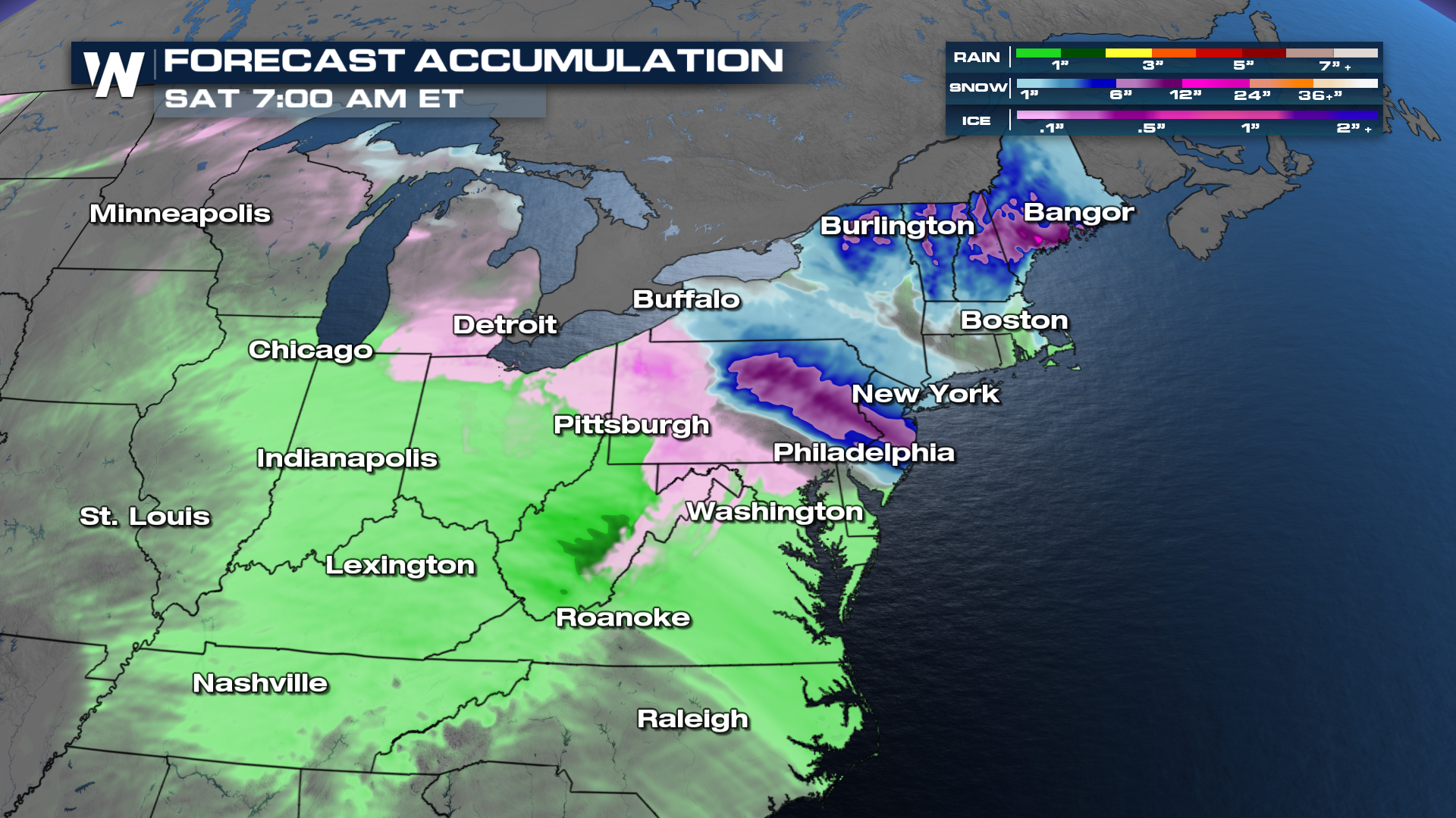 Timing looks to favor Thursday night into Saturday morning. As with any winter setup, small-scale details like temperature profiles will matter a great deal. Be sure to stay tuned to the forecast going into and coming out of the holiday!


