Record Warmth For One More Day

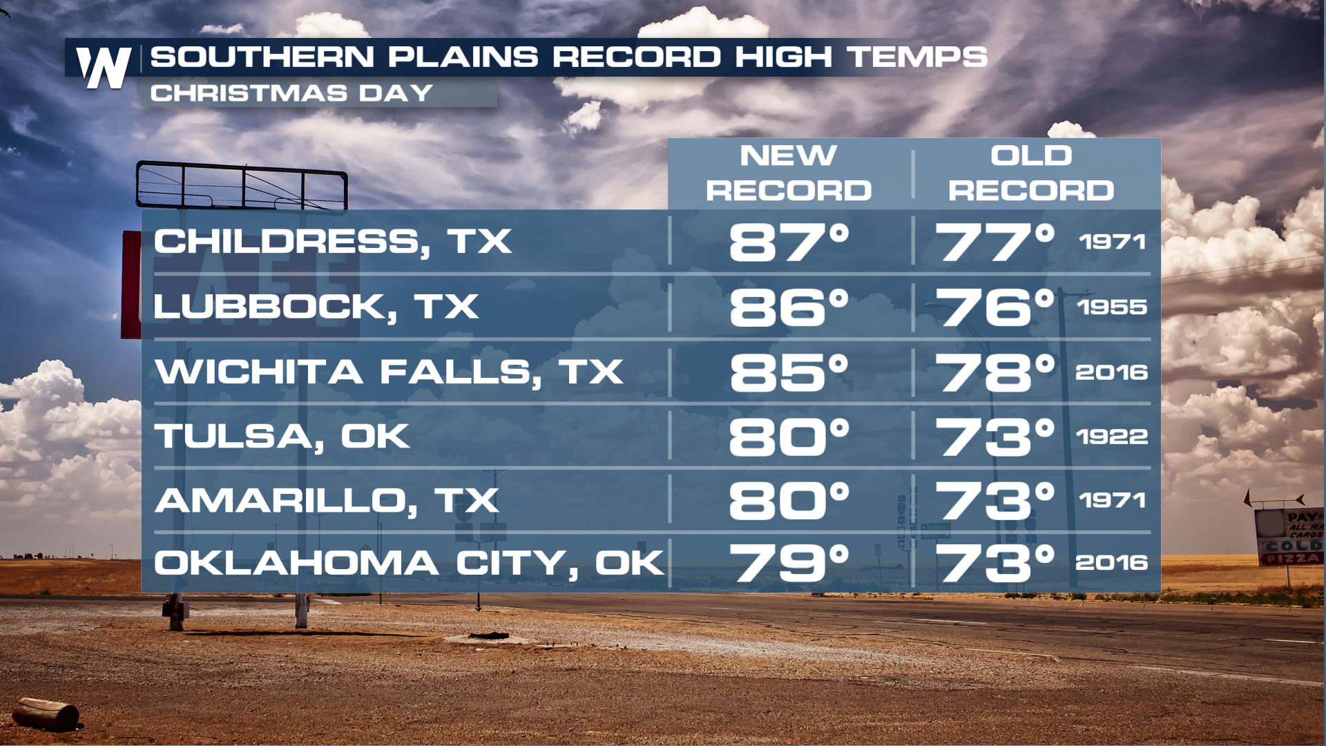
Unseasonably warm temperatures continue to prevail in much of the central and southeastern United States, as an area of high pressure maintains the jet stream north, allowing warm air to build up. Widespread record highs have been noted for days now, with Christmas being a particularly warm day down in Oklahoma and Texas!
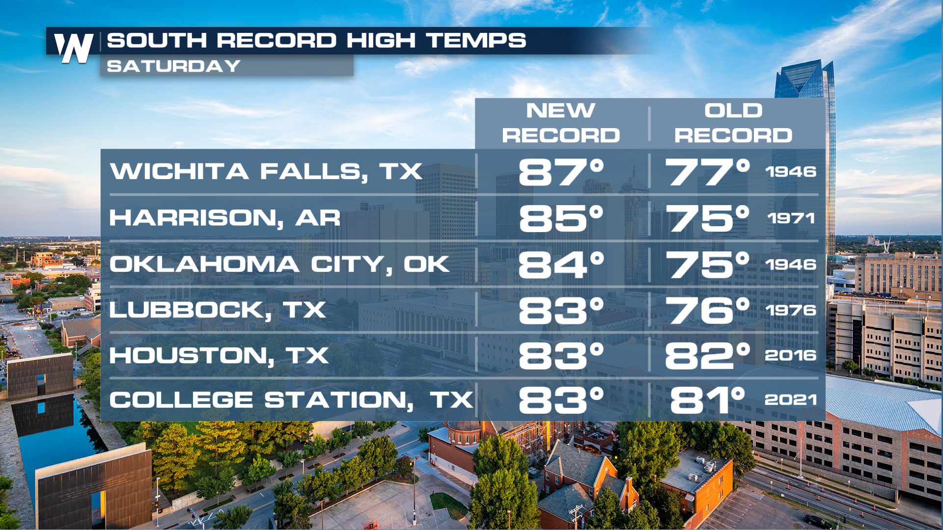
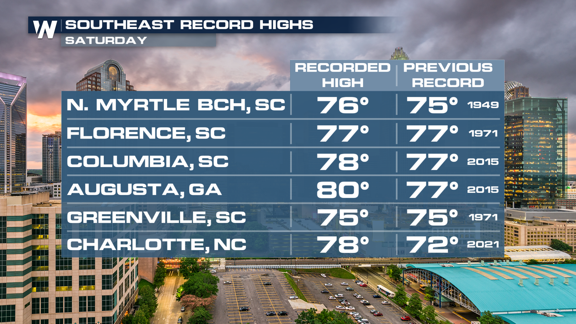
More records have been falling throughout the day on Saturday. It's not just that many records have been falling recently; it's how easily they are going down. We've seen multiple records fall by 10° or more, including a record of 87° in Wichita Falls!
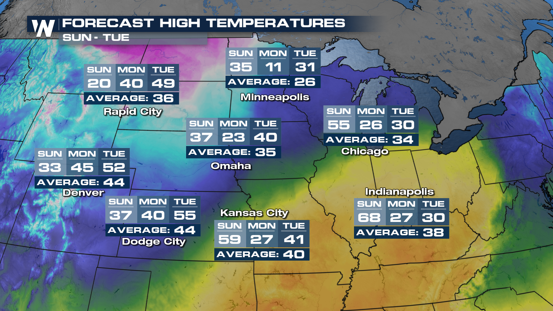
A PATTERN CHANGE ON SUNDAY
Feast your eyes on Sunday! Some cities will see a HUGE drop in temperatures as a cold front blasts south. Denver will go from near 60° on Saturday to a high of just 34° on Sunday. Salt Lake City will drop to the mid-30s on Sunday as well. Omaha, Nebraska, will see a high of 60° on Saturday, but by Monday, temperatures will only rise into the low 20s! (Read more here)
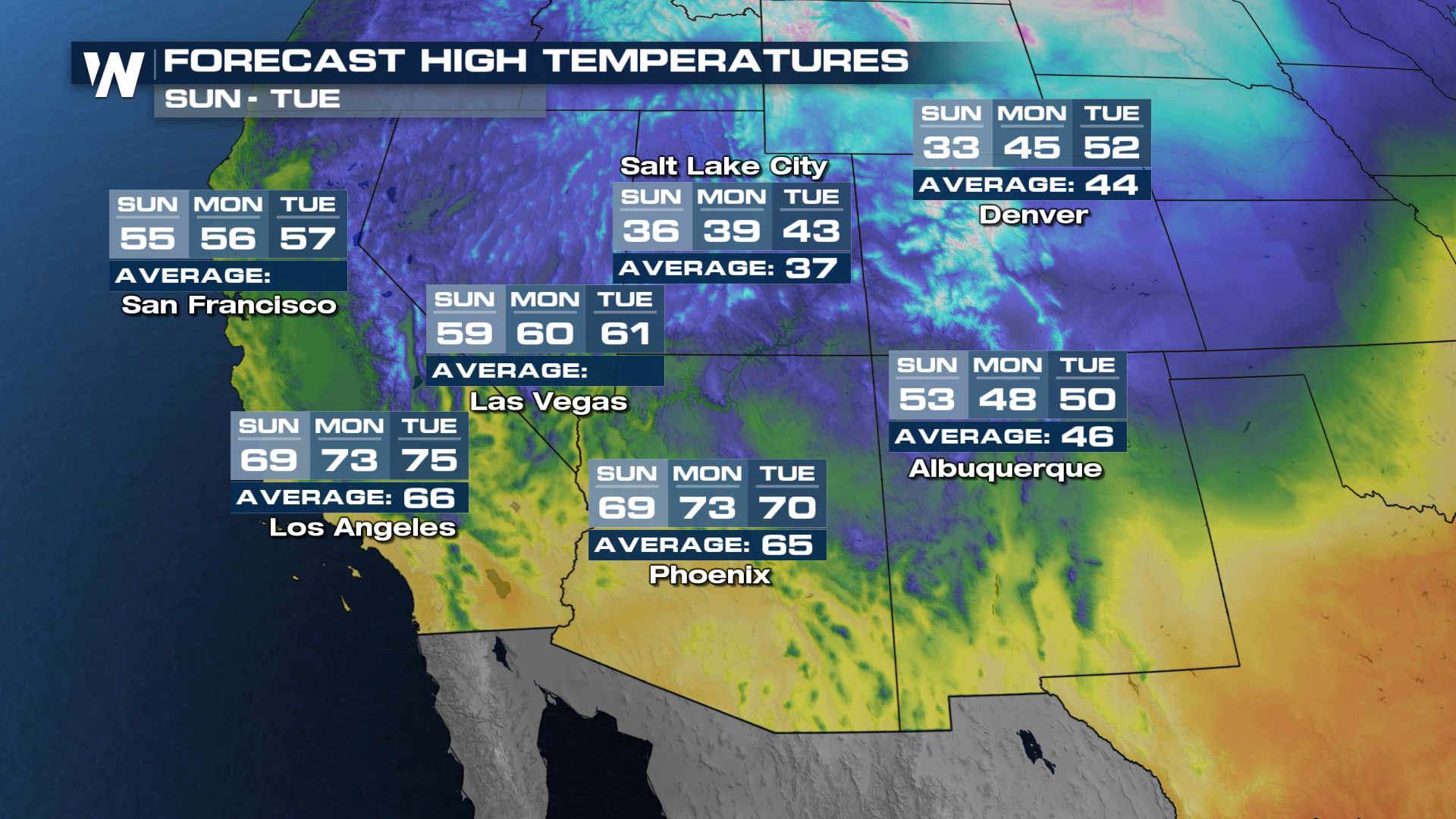
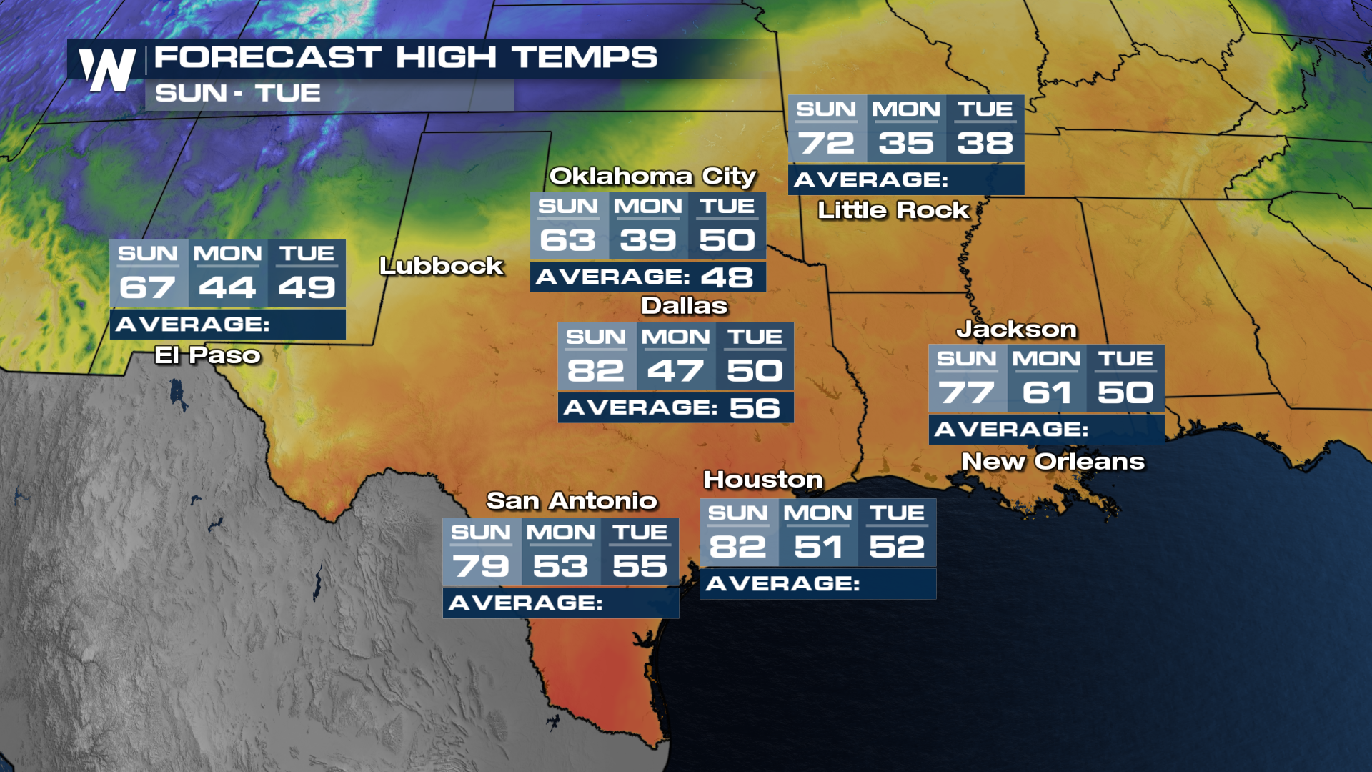
The South Central will remain firm in the above-average temperatures through the weekend, but here too temperatures will crash down by the beginning of next week.