West Facing Record Low Snow Levels

Does it feel like deja vu? This persistent pattern, locked in for most of December, has some side effects. No snow for the west! While areas around the Midwest are experiencing their snowiest start to the Winter in years, areas out west are looking at their slowest start to the water year.
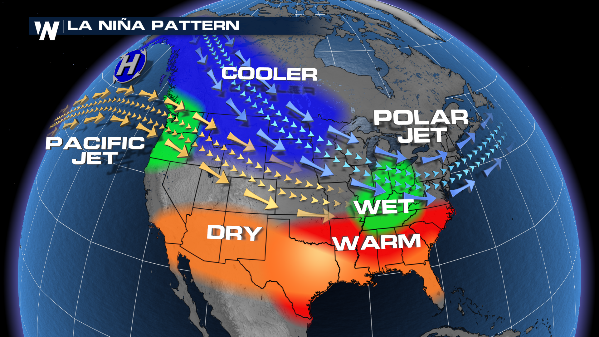
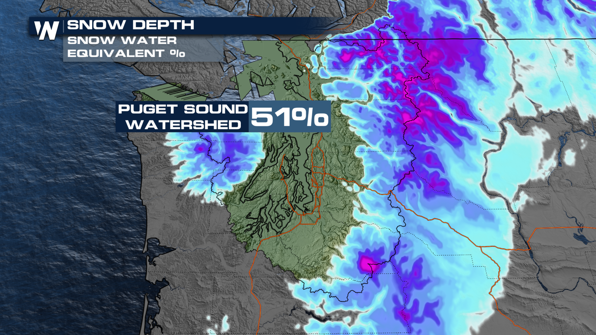
Take, for instance, the Pacific Northwest. They've been seeing the worst of both patterns: warm systems that bring inundating rainfall to the area, without the benefits of slow-melting snowfall, keeping watersheds fed with a much-needed, consistent water source.
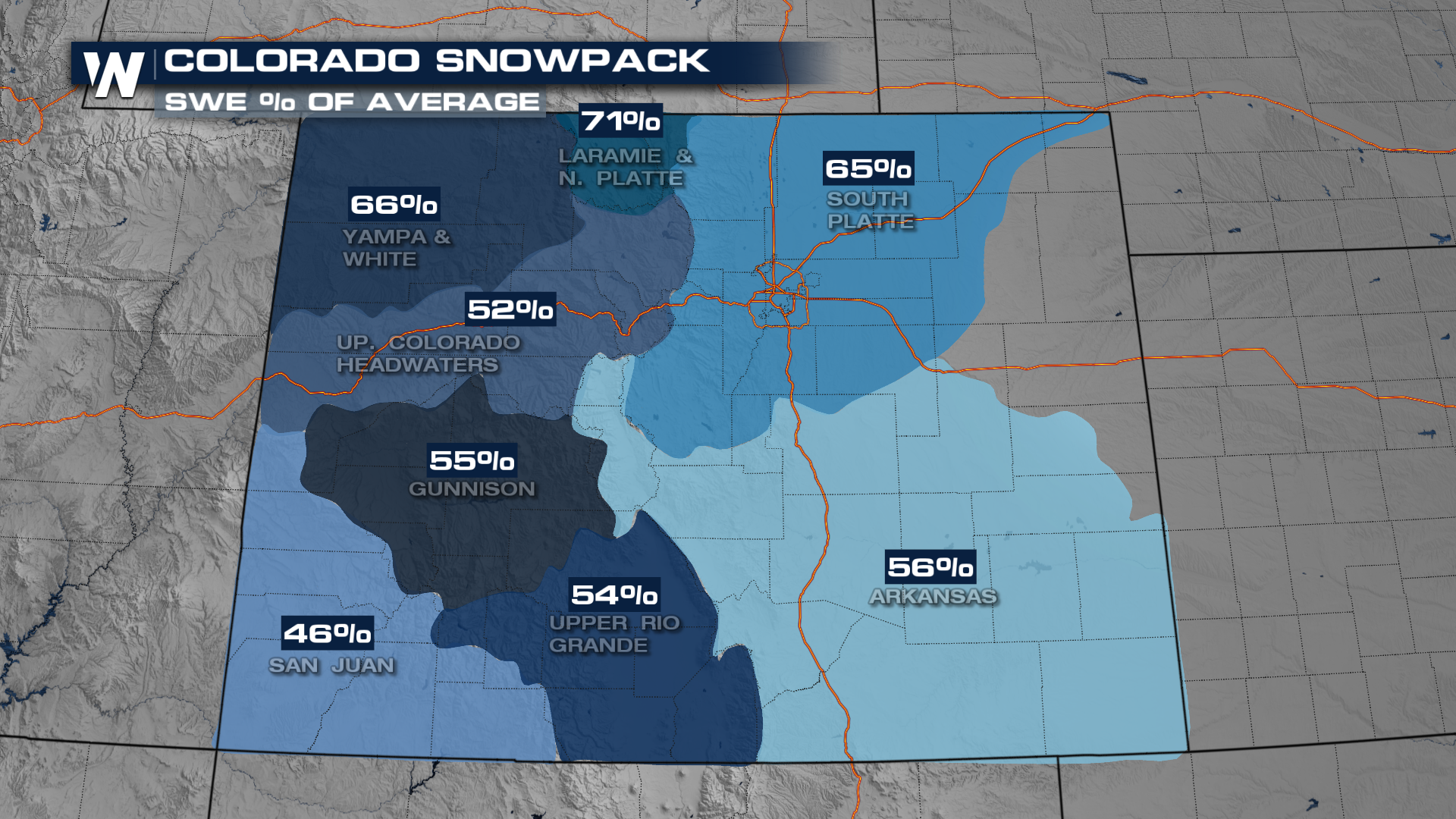
Other areas like Colorado have seen a fairly soggy past month, but got off to one of the latest starts to winter on record in Denver. Similarly, like the northwest was struggling, any shot at moisture fell at once, as rain.
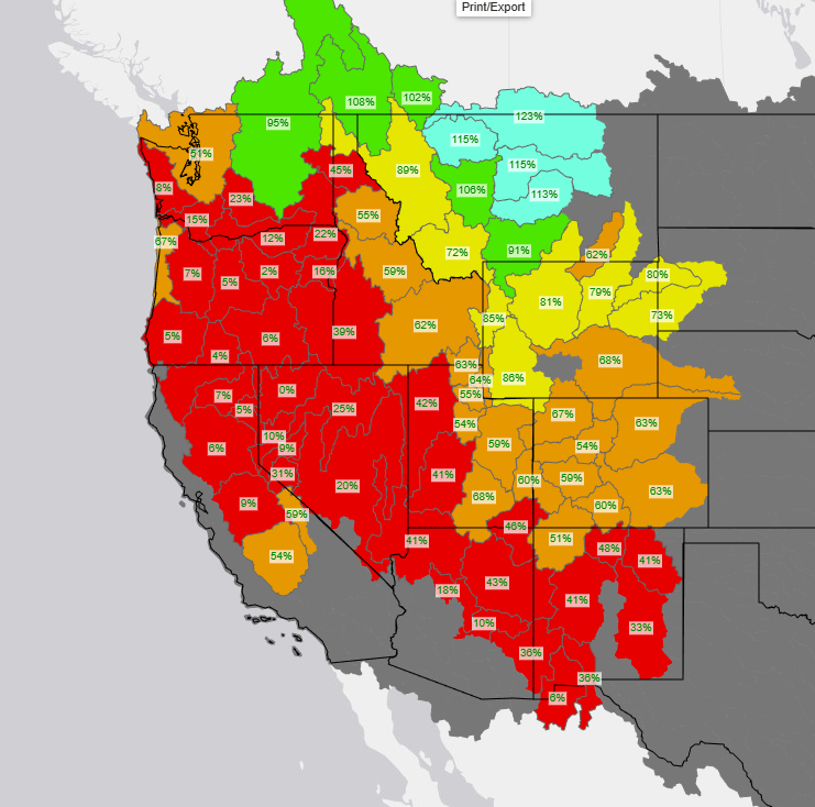
All of this information comes from the National Integrated Drought Information System, an offshoot of NOAA
Interactive Map at this link here
So what would help? A breakdown of the pattern would be a great place to start, with some signs that we might get some help. As the jet stream dips into the holiday week, confidence is growing in heavy rain targeting California


