Flooding Risk In California Continues

CALIFORNIA - Over the past few days, tropical moisture has brought flooding through portions of California. Although the main atmopsheric river is gone, multiple disturbances over the next few days will bring more rain and storms and the chance for more flooding. Flooding, mudslides, and severe storms will all be threats over the next few days. Portions of California have seen almost a foot of snow just since Wednesday morning.
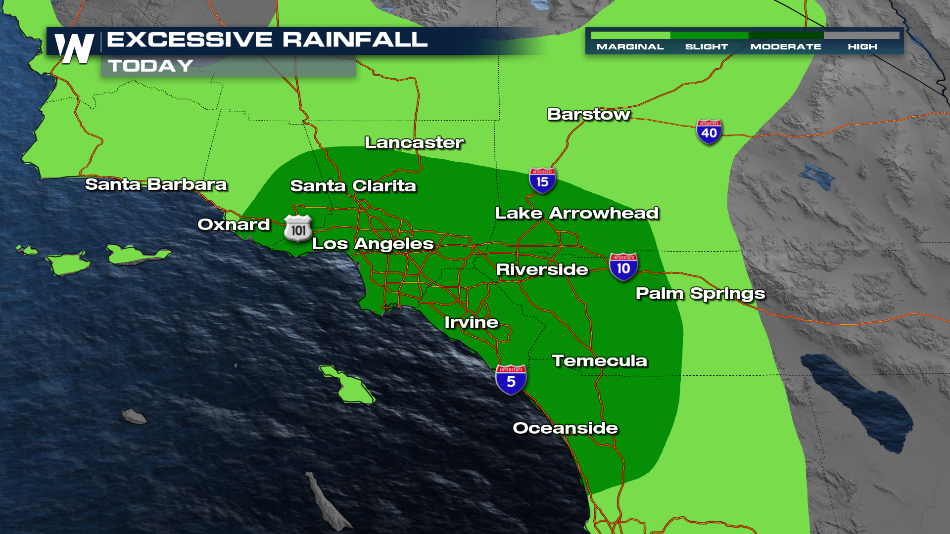
Rain & Flooding
Although winding down, we still have a slight risk (level 2 out of 4) for flooding on Friday. The major impacts of today are expected to stay in the LA area.
TIMING
There will be rounds of rain and snow with breaks, as multiple waves move through over the next few days. On Saturday, things clear out with calmer conditions for the rest of the weekend.
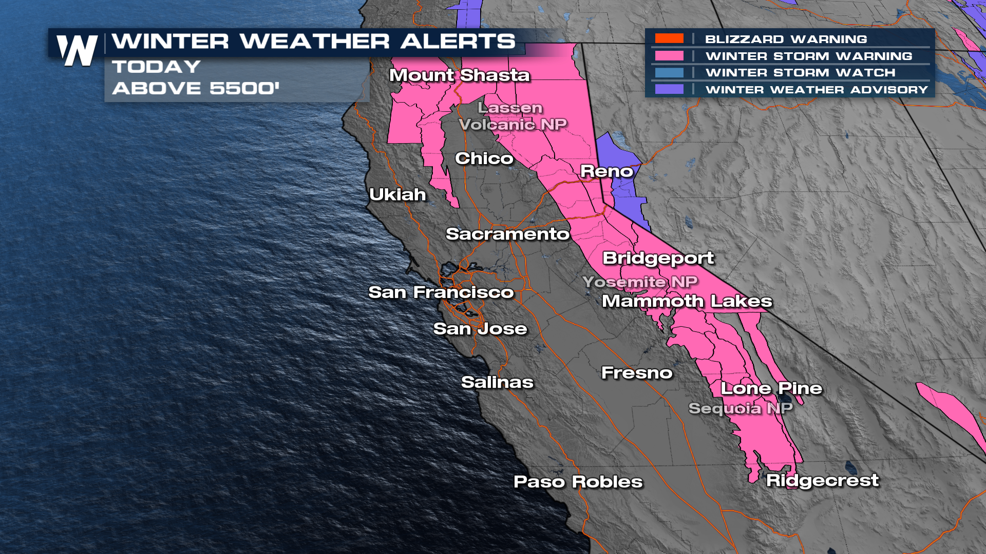
Heavy Snow
Heavy snow will accumulate over the Sierra Nevada Mountains through Friday, leading to travel impacts and the potential for delays. Winter Storm Warnings have been issued all across California. 3-5 feet of snow is expected, with some areas seeing higher totals.
For more details on your forecast out west, tune in to your Western Regional :50 past the hour.


