Sunday Severe Threat Across Portions of Midwest & Midsouth

WHAT TO EXPECT
A cold front will move through portions of the Midwest & Midsouth, interacting with a moist airmass. This front will tap into warm air with dew points in the 50s and 60s. This combination will bring a threat for isolated severe storms on Sunday afternoon through Monday morning. Damaging winds will be the primary concern.
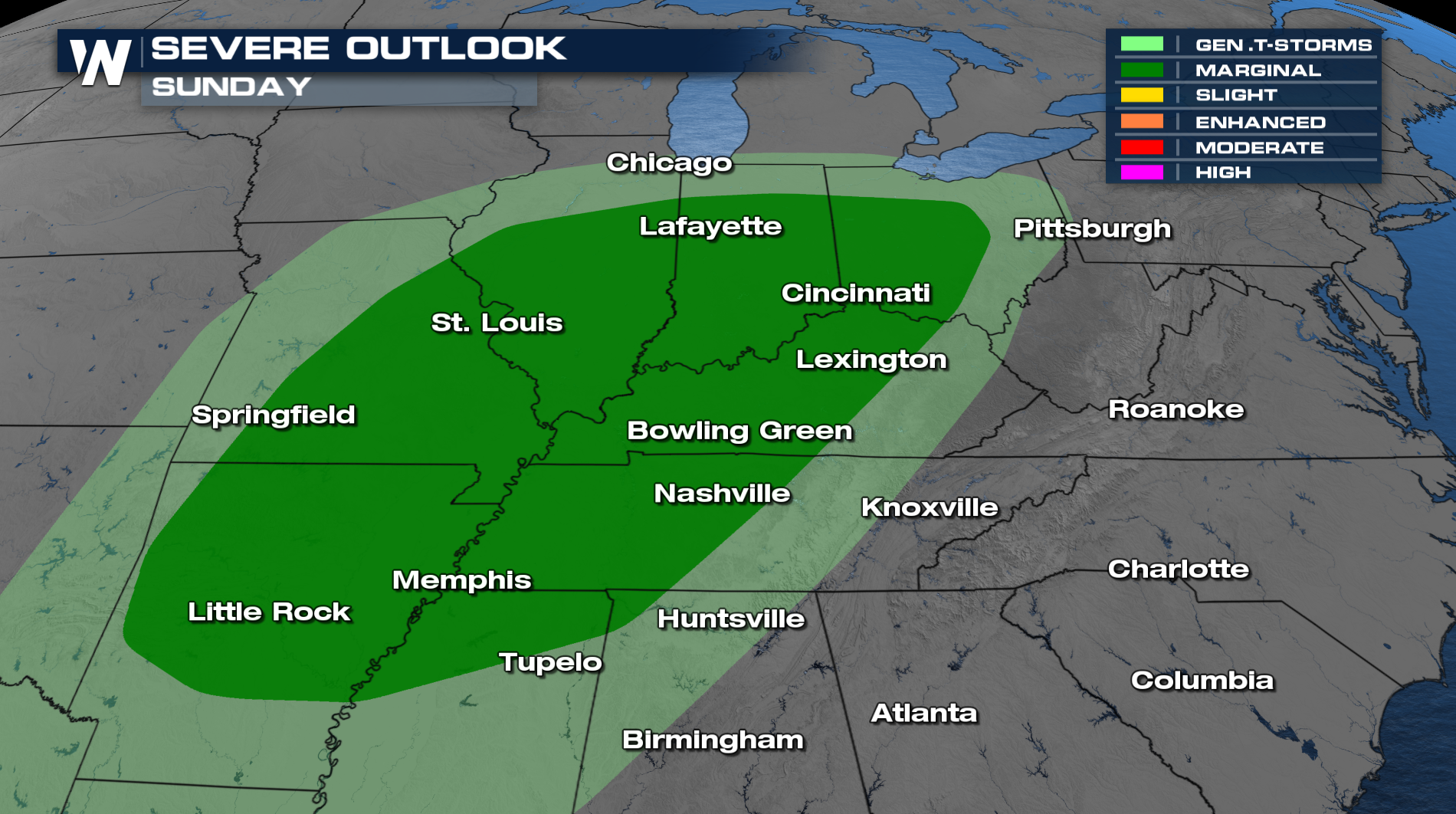
 The SPC has issued a marginal risk for damaging wind gusts on Sunday, including the cities of Cincinnati, Nashville, St. Louis, Memphis, and Little Rock.
TIMING
The front will roll through Sunday afternoon and into Monday morning. As it moves through, strong to severe storms can develop along it, bringing damaging winds and areas of isolated heavy rain. On the back side, there will be isolated snow, where the moisture meets the very cold air behind the front.
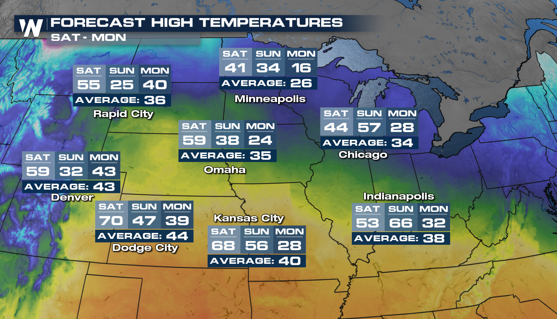
This front is going to really impact temperatues once it moves out. Temps will drop 30°+ for some. Indianapolis will be 66° on Sunday, and on Monday, it will reach a high of only 32°. Kansas City will go from 68° on Saturday to a high of only 28° on Monday.