Weather for the Ball Drop: What to Expect as 2026 Begins

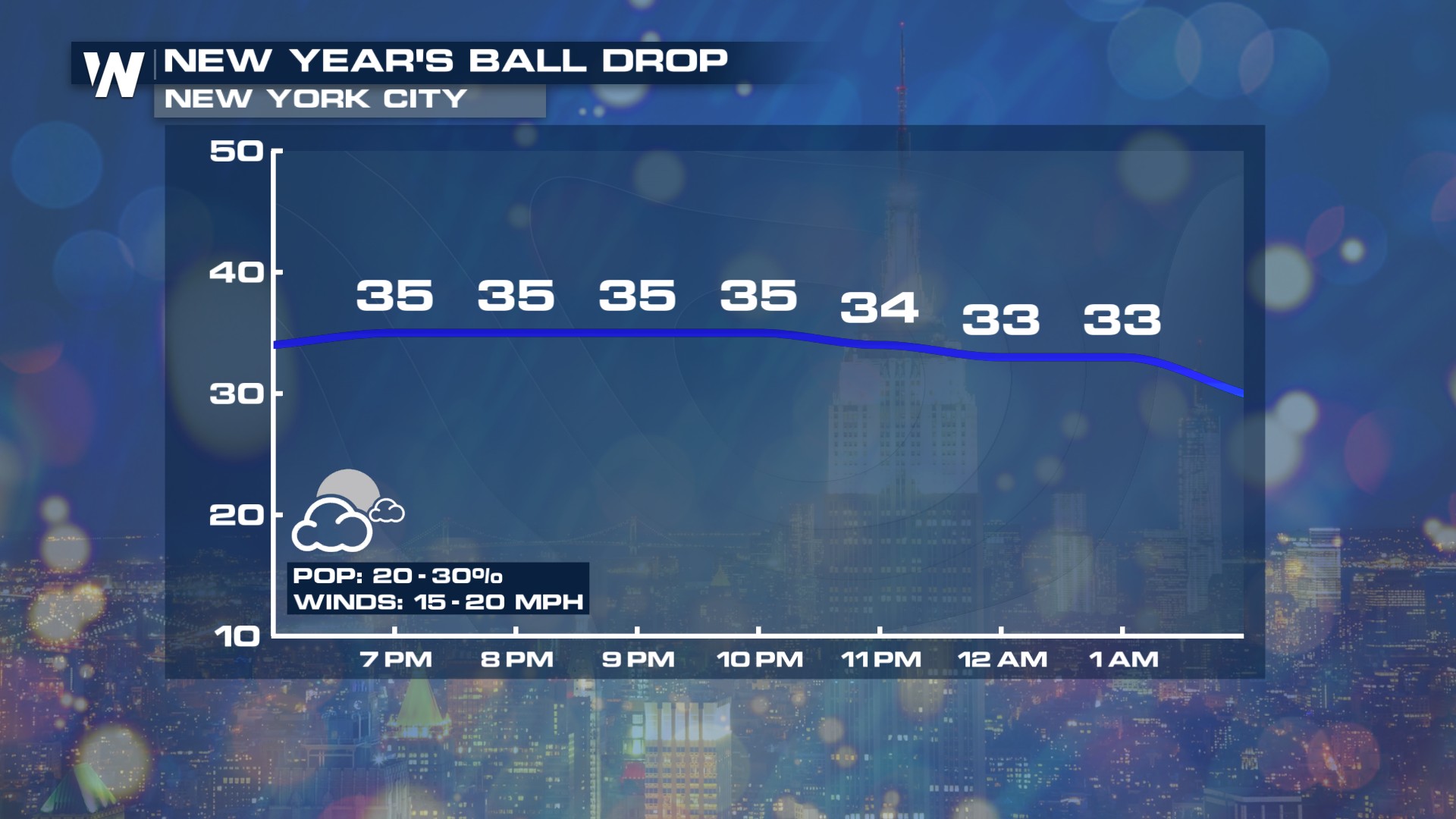
As we say goodbye to 2025 and ring in 2026, many parts of the country can expect active weather for this year’s ball drop. In New York City, home to the nation’s largest New Year’s Eve celebration, conditions will turn cool through the evening and overnight, with a low chance for a few light snowflakes around midnight. Temperatures are expected to fall below freezing, dropping into the 20s.
Here’s an early look at the forecast: a few light snow showers may be possible on New Year’s Eve across the region, but accumulations are not expected.
Did you know the first-ever ball drop originated in New York City back in 1907? Luckily for the spectators who gathered in Times Square on December 31, 1907, the weather cooperated. The day reached a high of 44°F with a low of 35°F, milder than the current normal high of 41°F and low of 30°F for December 31. Still, as the ball dropped at midnight, spectators definitely needed their winter coats, as the 35°F temperature felt colder with 20-mph west winds.
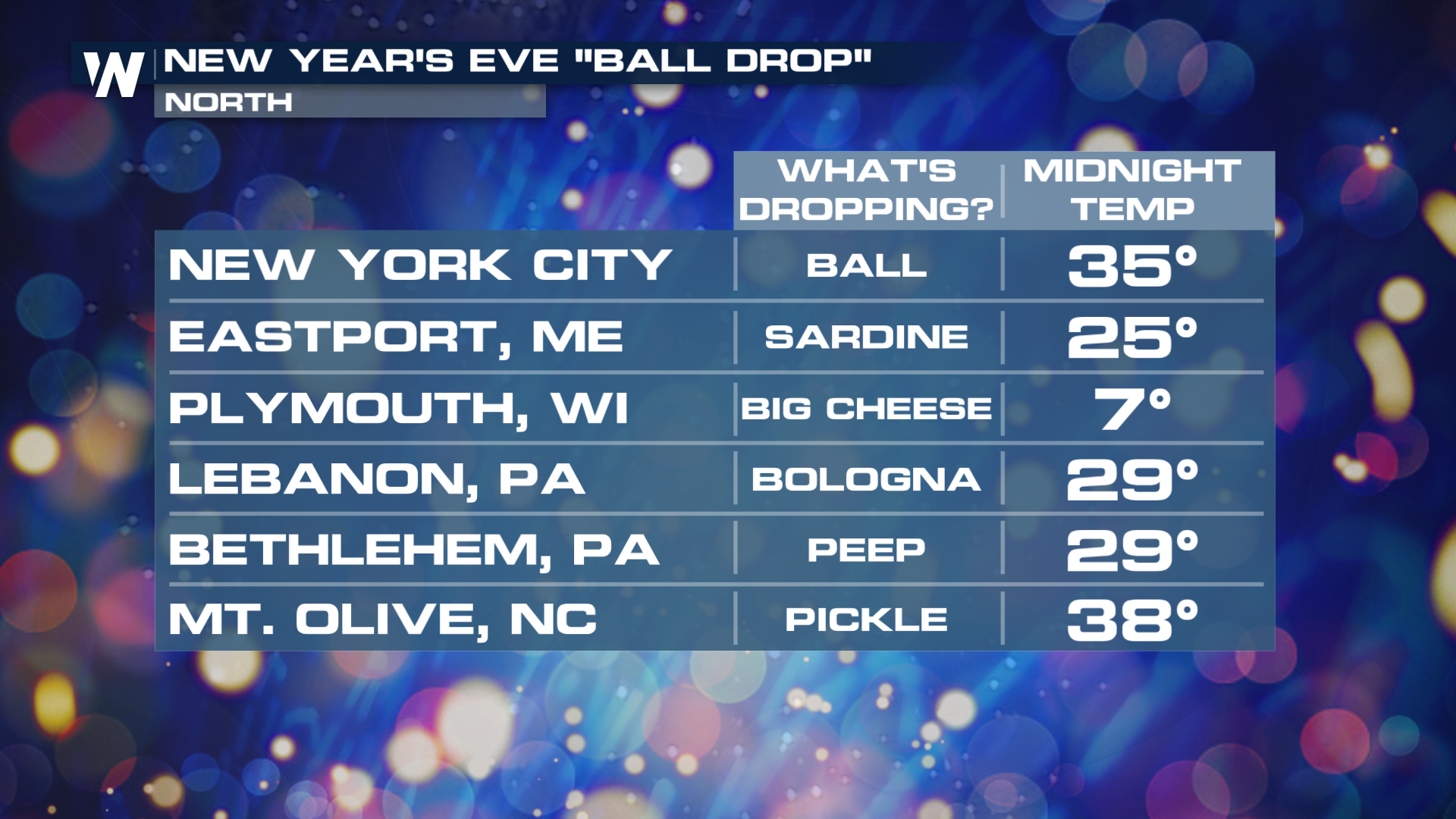
Across the rest of the country, other unique “ball drops” will be taking place, and in many spots, the weather looks chilly.
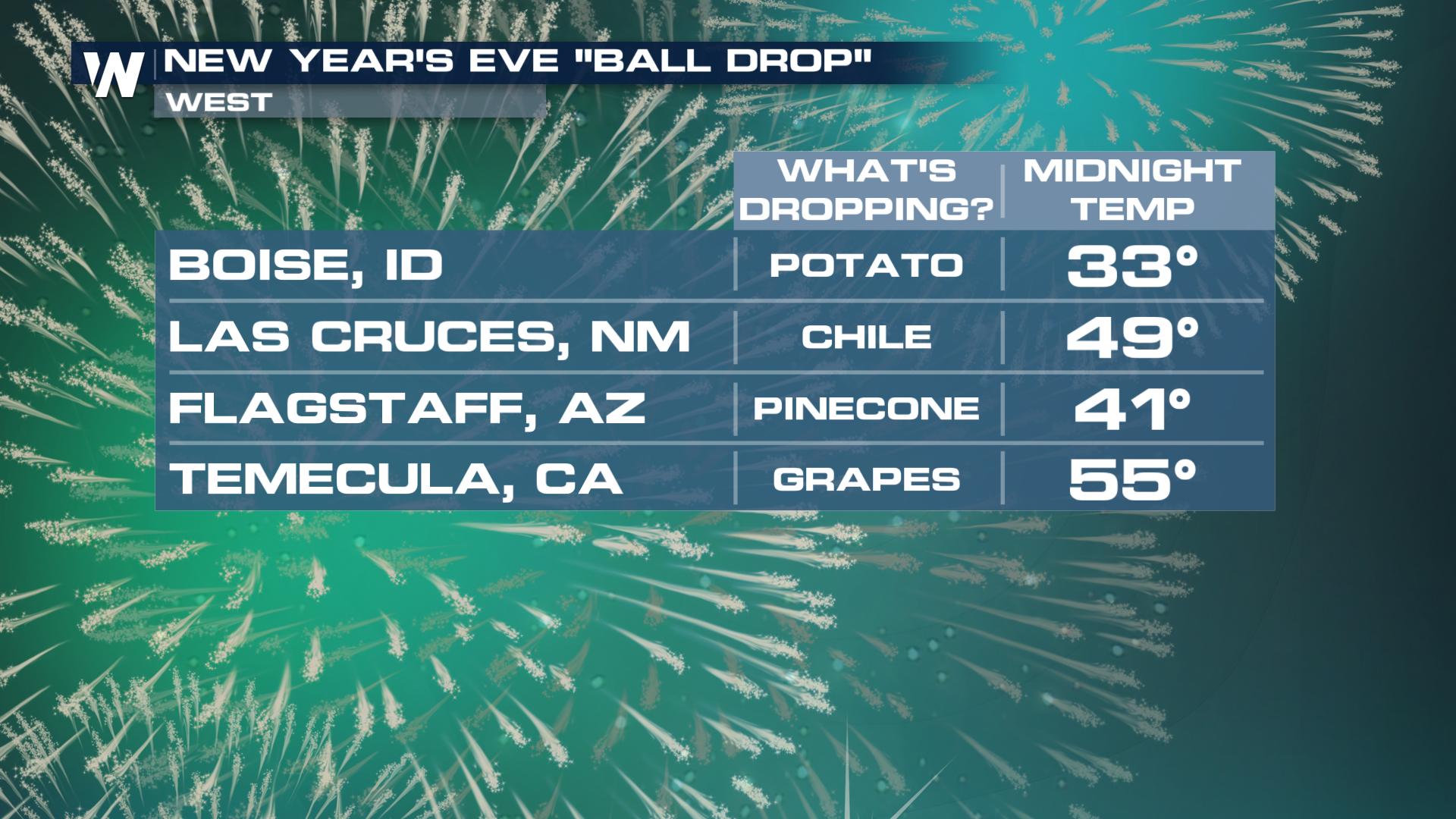
Out west, some locations will stay relatively mild. In Boise, Idaho, spectators can enjoy the famous potato drop with temperatures around 40 degrees at midnight.
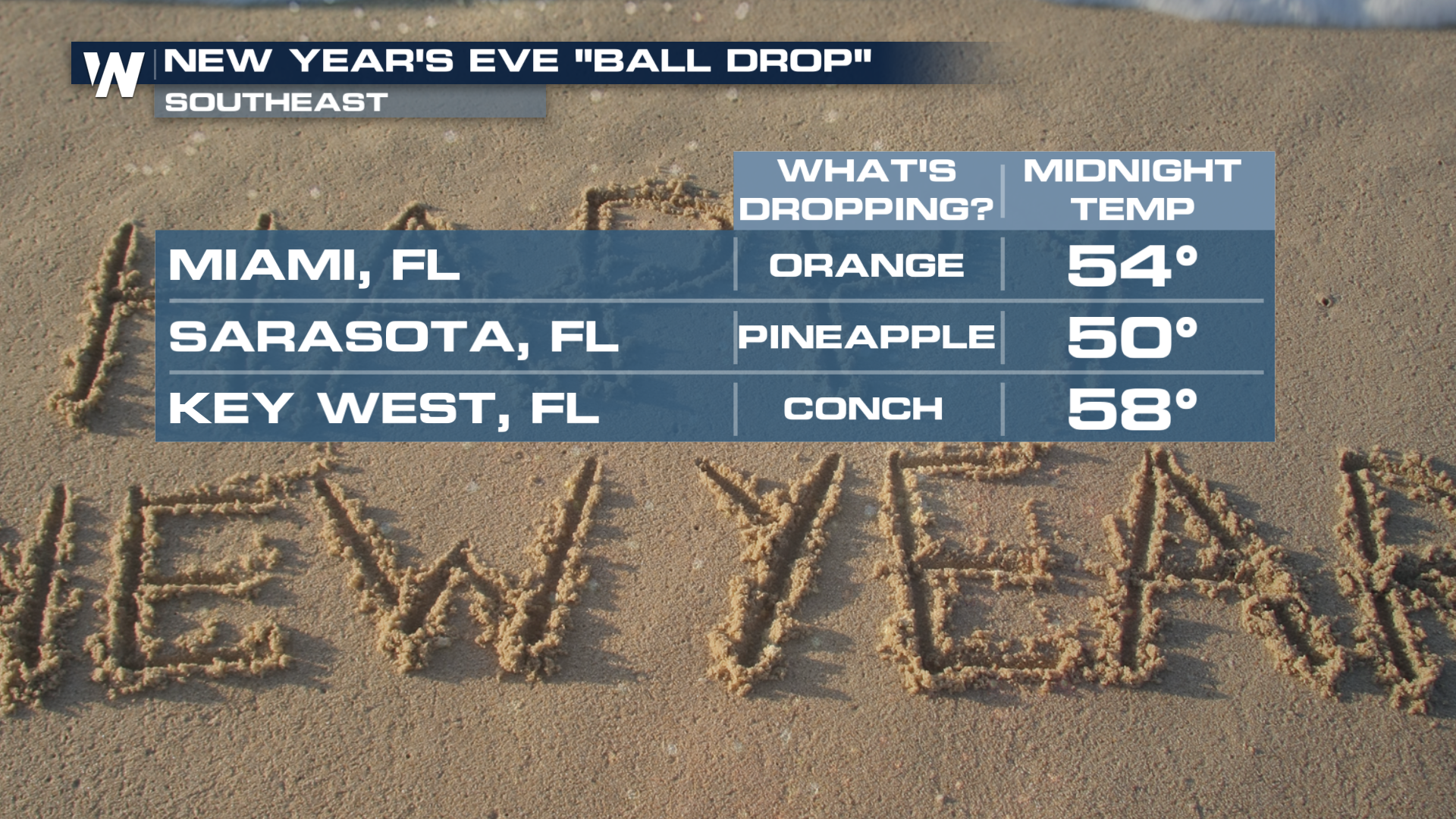
In the Southeast, a giant peach will NOT be dropping this year in Atlanta; the city is opting for a New Year's celebration called Countdown Over ATL. Temperatures will still be cool if you're participating. Still, some other spots will be dropping unusual items such as a giant orange in Miami, a giant pineapple in Sarasota, and a giant conch in Key West, where temperatures will be in the 50s.
Across the rest of the nation, some can expect a cool and rainy New Year's Eve like the southwest, and bitter cold in the northern Plains.
For a more detailed look at the days leading up to the New Year, be sure to join us on WeatherNation all week long, we’re streaming 24/7!


