Another Blast Of Cold For Midwest And Northeast
Top Stories
25 Jan 2019 9:23 AM
The northern U.S. has been dealing with some very cold temps this week. Cold air arrived behind the storm last weekend. Just when you're ready for a warming trend, along comes another blast of cold air. Another storm system pushed through the Midwest and Northeast earlier this week. Behind it, more frigid air is coming down from Canada!
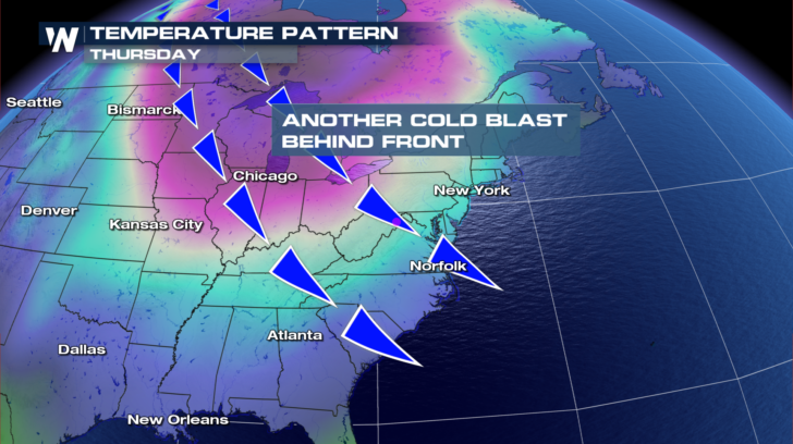
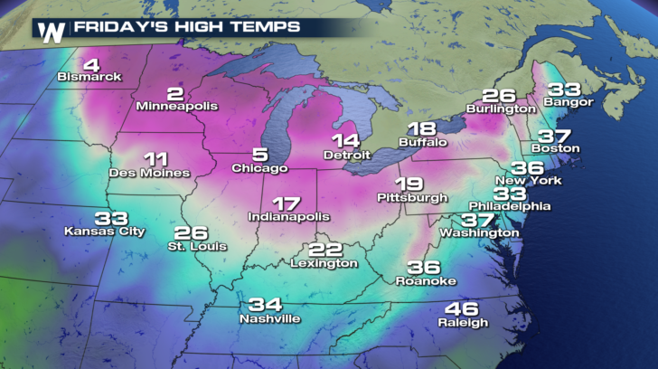
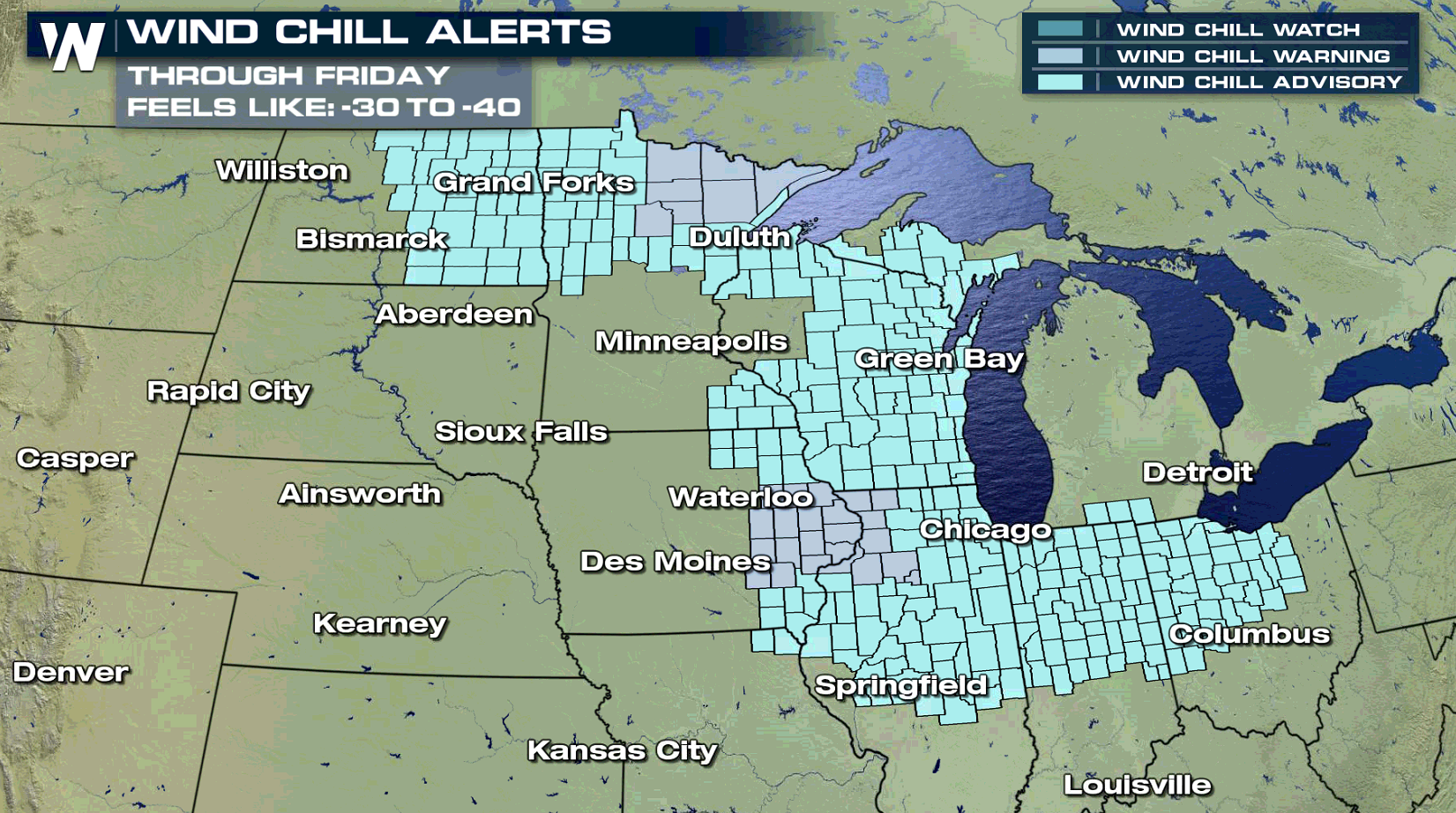 For today (Friday), the cold air will spread eastward across the Great Lakes to towns like Chicago, Indianapolis, and Detroit. Highs in Chicago will be near 5 degrees!
 By Saturday, frigid temps will be felt in Buffalo and Burlington. Teens are expected there for highs. Bangor will be cold too, with a high of 22 degrees.
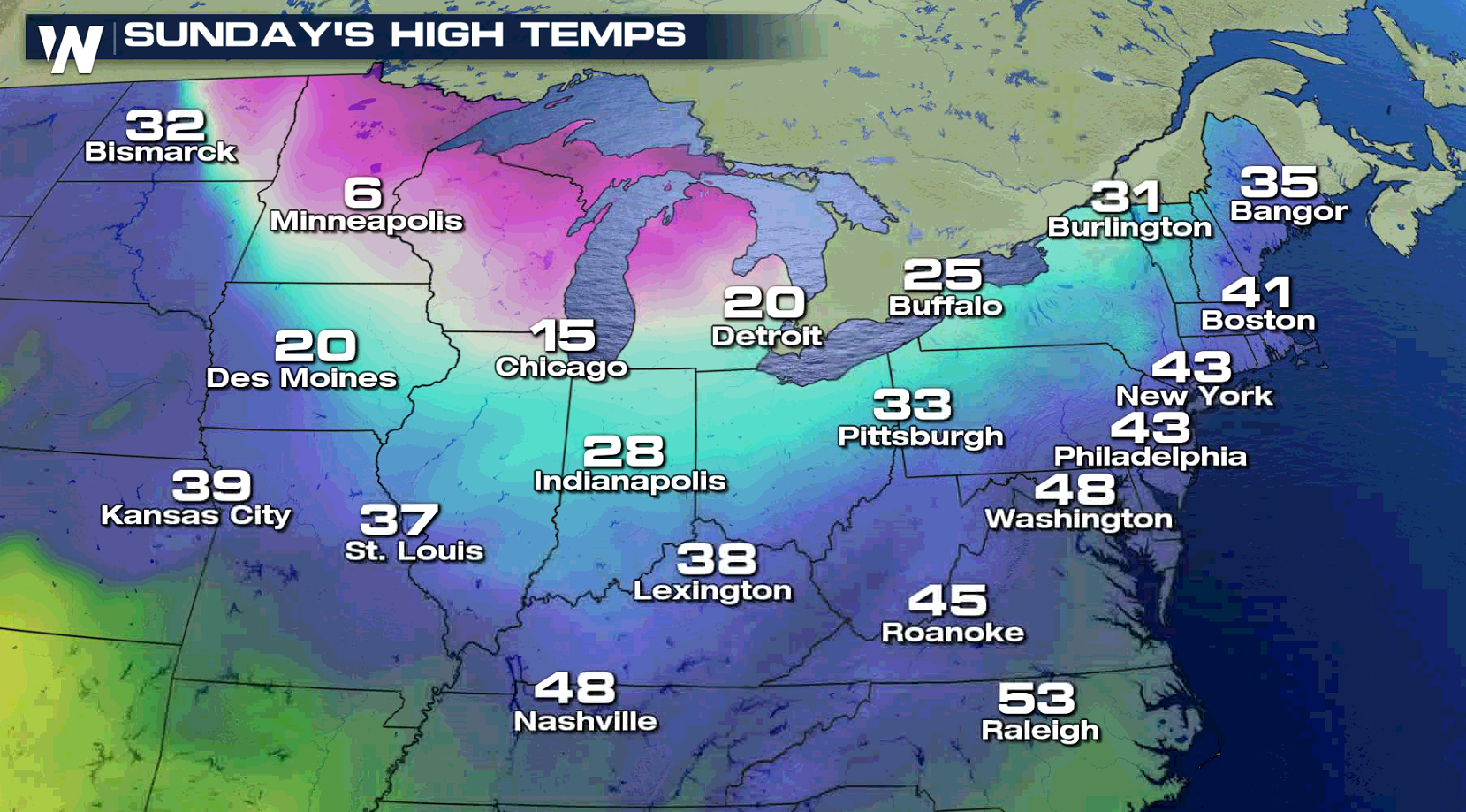
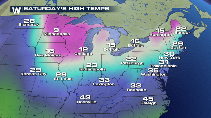 On Sunday, temperatures moderate slightly, but another blast of cold air will arrive into next week.
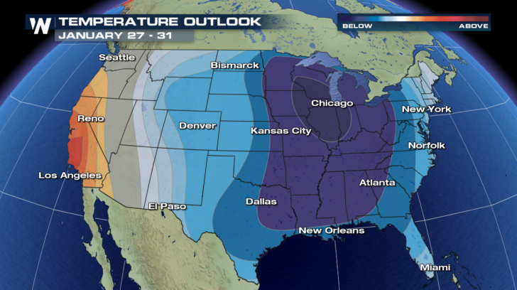
 The temperature outlook through the end of January is showing below average temps for the entire eastern U.S. right through the end of the month. Only California, and portions of Oregon and Nevada are expected to see above average temps. So get ready for a cold spell that's going to last a while.
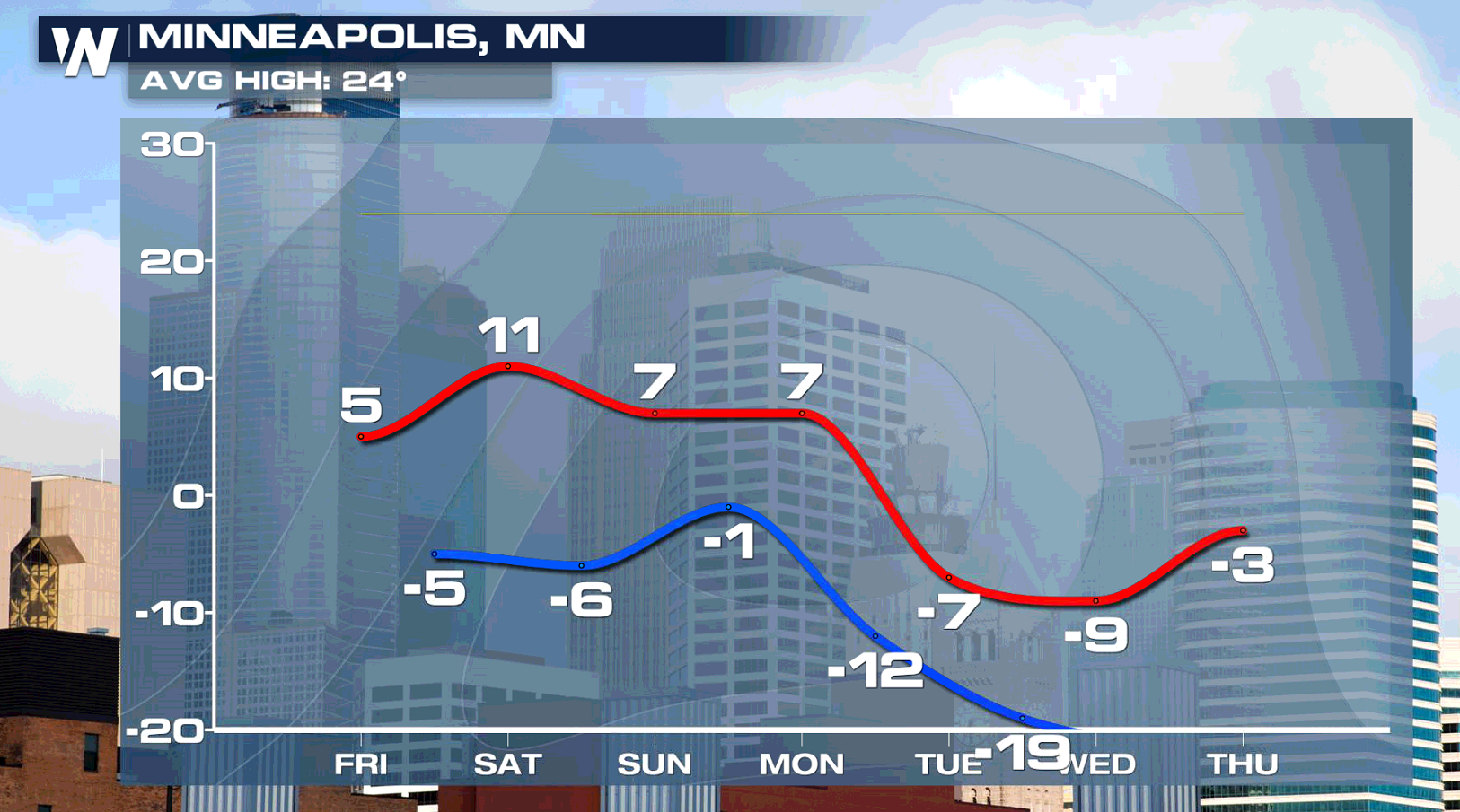
 The really cold air invaded Minneapolis on Thursday and will be around for a while. The high today will be near 5 degrees above zero and low temps well below zero right into next week.
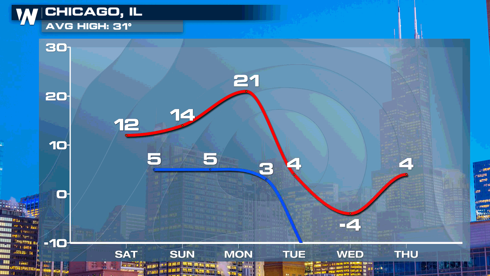
 Chicago will feel the blast of winter the most on today and again next week. The morning temps will drop to the single digits.
 For the very latest weather information, stay tuned to WeatherNation TV. You can watch on the Dish network, Apple TV, Roku, Amazon Fire TV, and Pluto TV.
For WeatherNation: Meteorologist Matt Monroe

 For today (Friday), the cold air will spread eastward across the Great Lakes to towns like Chicago, Indianapolis, and Detroit. Highs in Chicago will be near 5 degrees!
 By Saturday, frigid temps will be felt in Buffalo and Burlington. Teens are expected there for highs. Bangor will be cold too, with a high of 22 degrees.
 On Sunday, temperatures moderate slightly, but another blast of cold air will arrive into next week.
 The temperature outlook through the end of January is showing below average temps for the entire eastern U.S. right through the end of the month. Only California, and portions of Oregon and Nevada are expected to see above average temps. So get ready for a cold spell that's going to last a while.
 The really cold air invaded Minneapolis on Thursday and will be around for a while. The high today will be near 5 degrees above zero and low temps well below zero right into next week.
 Chicago will feel the blast of winter the most on today and again next week. The morning temps will drop to the single digits.
 For the very latest weather information, stay tuned to WeatherNation TV. You can watch on the Dish network, Apple TV, Roku, Amazon Fire TV, and Pluto TV.
For WeatherNation: Meteorologist Matt Monroe
For the very latest weather information, stay tuned to WeatherNation TV. You can watch on the Dish network, Apple TV, Roku, Amazon Fire TV, and Pluto TV.
For WeatherNation: Meteorologist Matt MonroeAll Weather News
More