Another Nor'easter for the East? Looks Likely

Top Stories
4 Mar 2018 10:10 PM
There's a rising likelihood of another coastal nor'easter for the mid-Atlantic and Northeast this week. Here are the latest details of what we know so far:
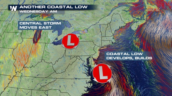 The weather setup on Wednesday morning shows a coastal low pressure area developing near the Chesapeake.
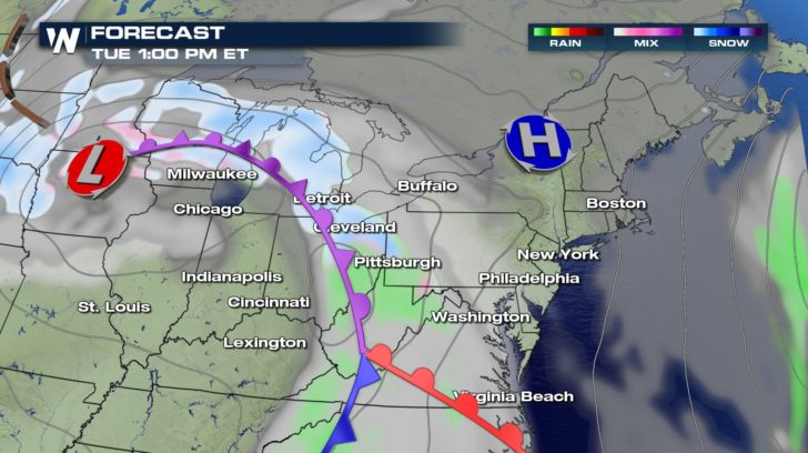 The forecast weather map for Tuesday, March 6 where green shows rain, pink shows a wintry mix, and white/blue shows snow.
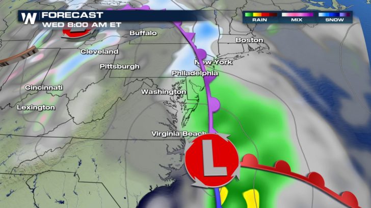 The forecast weather map for Wednesday, March 7 where green shows rain, pink shows a wintry mix, and white/blue shows snow.
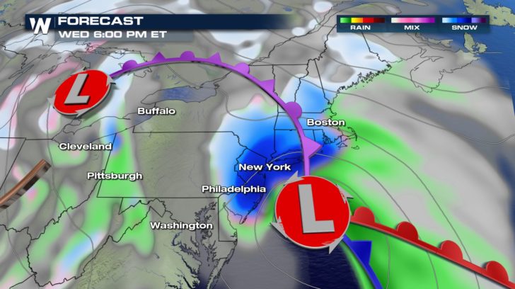 The forecast weather map for Wednesday, March 7 where green shows rain, pink shows a wintry mix, and white/blue shows snow.
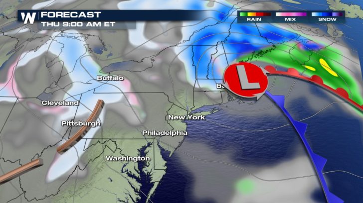 The forecast weather map for Thursday, March 8 where green shows rain, pink shows a wintry mix, and white/blue shows snow.
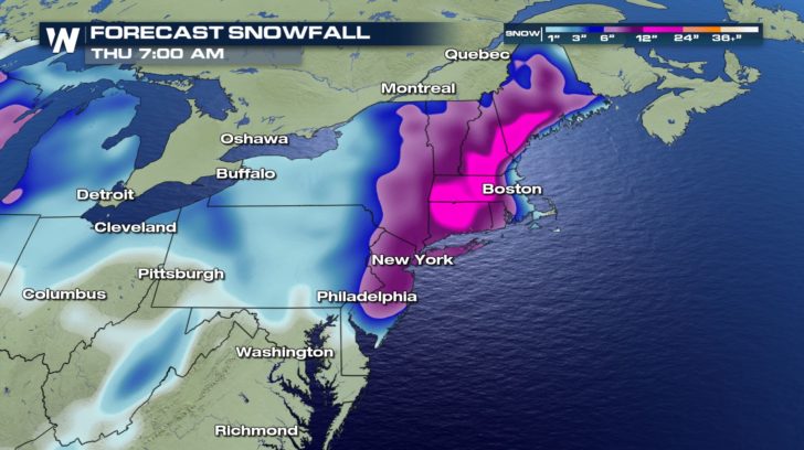 So far projections have consistently shown 6"+ of snowfall for this event. Some models have advertised up to 20 inches. However, the heaviest accumulations will likely change because the exact track and location of the low pressure area is not yet known. Also, changing the track and position of the low pressure system will change temperatures, thus precipitation type varying, and snow tallies variable. For now, plan on at least some kind of impacts on Wednesday to Thursday, with the heaviest impact felt on Wednesday night. We will keep you updated throughout the week.
-For WeatherNation, Meteorologist Steve Glazier
So far projections have consistently shown 6"+ of snowfall for this event. Some models have advertised up to 20 inches. However, the heaviest accumulations will likely change because the exact track and location of the low pressure area is not yet known. Also, changing the track and position of the low pressure system will change temperatures, thus precipitation type varying, and snow tallies variable. For now, plan on at least some kind of impacts on Wednesday to Thursday, with the heaviest impact felt on Wednesday night. We will keep you updated throughout the week.
-For WeatherNation, Meteorologist Steve Glazier
- Weather models continue to advertise a high impact coastal storm
- Rain, snow, and wind could be heavy
- Changes to the forecast will likely occur as we get closer to the event
The weather setup on Wednesday morning shows a coastal low pressure area developing near the Chesapeake.
- Weather models continue to advertise a high impact coastal storm
The forecast weather map for Tuesday, March 6 where green shows rain, pink shows a wintry mix, and white/blue shows snow.
The forecast weather map for Wednesday, March 7 where green shows rain, pink shows a wintry mix, and white/blue shows snow.
The forecast weather map for Wednesday, March 7 where green shows rain, pink shows a wintry mix, and white/blue shows snow.
The forecast weather map for Thursday, March 8 where green shows rain, pink shows a wintry mix, and white/blue shows snow.
- Rain, snow, and wind could be heavy
- Changes to the forecast will likely occur as we get closer to the event
So far projections have consistently shown 6"+ of snowfall for this event. Some models have advertised up to 20 inches. However, the heaviest accumulations will likely change because the exact track and location of the low pressure area is not yet known. Also, changing the track and position of the low pressure system will change temperatures, thus precipitation type varying, and snow tallies variable. For now, plan on at least some kind of impacts on Wednesday to Thursday, with the heaviest impact felt on Wednesday night. We will keep you updated throughout the week.
-For WeatherNation, Meteorologist Steve GlazierAll Weather News
More

Flooding, Severe Storms Target the Midwest Again
After an active week of storms across the nor
1 Aug 2026 1:40 AM


After Reaching Category 5, Genevieve Weakens in the Pacific
PacificFausto is now a post-tropical cyclone.
31 Jul 2026 1:30 AM

Flooding Risk Increases as Heavy Rain Targets the Tri-State Area
Tuesday, heavy rainfall moved across the Nort
30 Jul 2026 12:25 AM

Severe Weather: Energy From the Midwest Now in the Southeast
UPPER MIDWEST - Through Monday, dangerous tor
29 Jul 2026 10:30 PM