Another Round of Wintry Weather
Special Stories
16 Apr 2018 4:40 PM
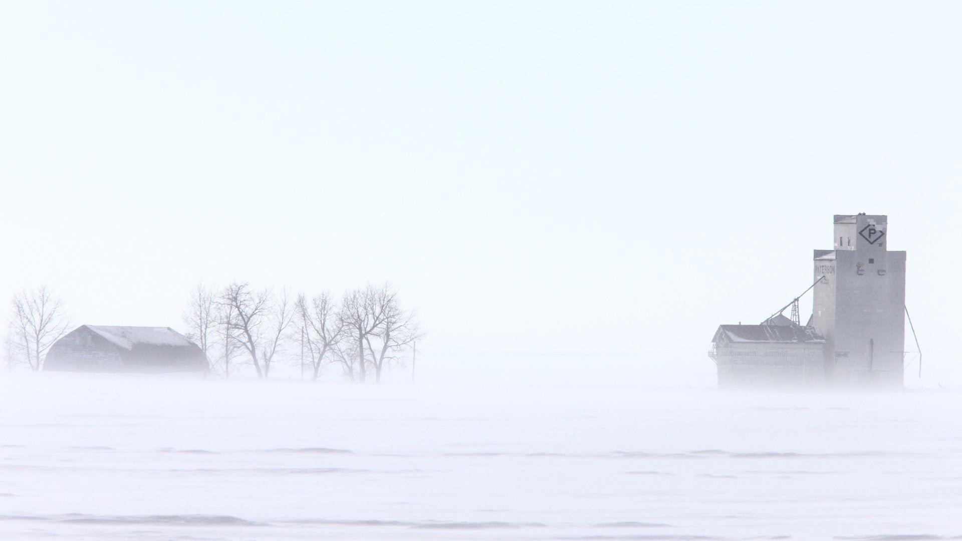
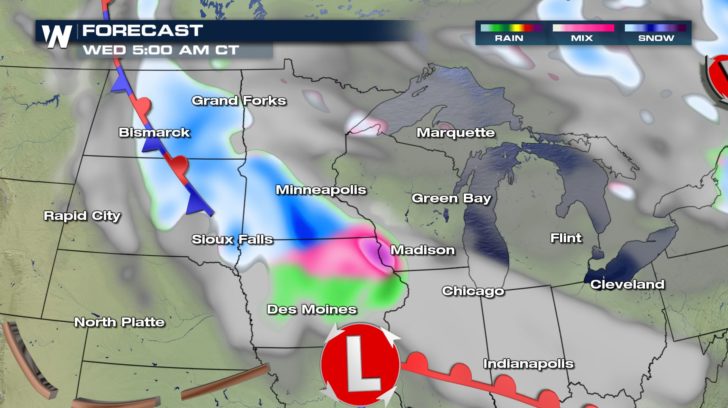
Yes. You read that title right. Another round of wintry weather is in the forecast for the Upper Midwest! After barely catching a break from the historic blizzard over the weekend, residents should brace for more snow and ice by midweek. A quick-moving disturbance moving east out of the Rockies will pass through the High Plains and Upper Midwest Tuesday into Wednesday.
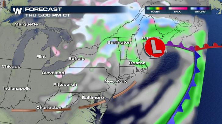
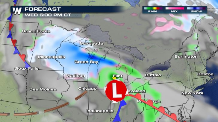 This system will also move through the Great Lakes and into New England by Thursday.
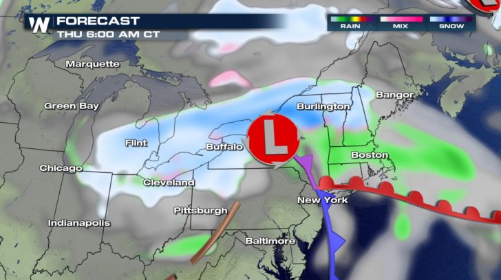
 Luckily, this system will not be as potent as the weekend blizzard. It will, however, bring several inches of snow and perhaps a tenth of an inch of freezing rain.
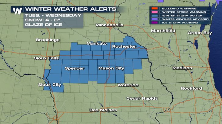 The highest snow totals are expected along the Interstate 90 corridor in southern Minnesota and the adjacent counties of northern Iowa. A general 3 to 7 inches---with possibly 8 or more---is likely in this area. This includes cities such as Mankato and Rochester, Minnesota.
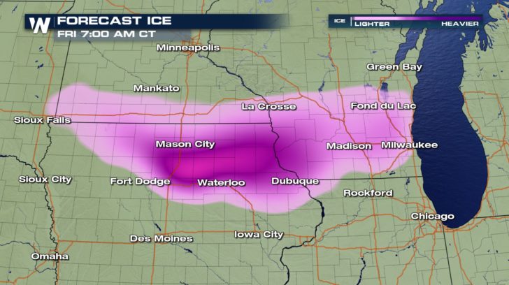
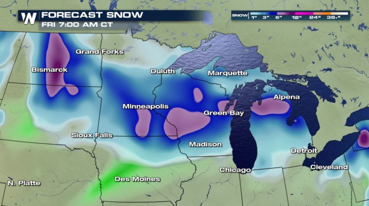 Further south into Iowa, freezing rain will be a bigger concern. Snow totals will range from 2 to 5 inches with up to one-tenth of an inch of ice. Freezing rain and snow will also be a concern in Wisconsin and points east. Additional weather watches and advisories will likely be posted by the National Weather Service.
 Be sure to follow WeatherNation on Facebook and Twitter to keep an eye on the exact track of this next winter storm.
-Meteorologist Joe Astolfi
Be sure to follow WeatherNation on Facebook and Twitter to keep an eye on the exact track of this next winter storm.
-Meteorologist Joe Astolfi
This system will also move through the Great Lakes and into New England by Thursday.
Luckily, this system will not be as potent as the weekend blizzard. It will, however, bring several inches of snow and perhaps a tenth of an inch of freezing rain.
The highest snow totals are expected along the Interstate 90 corridor in southern Minnesota and the adjacent counties of northern Iowa. A general 3 to 7 inches---with possibly 8 or more---is likely in this area. This includes cities such as Mankato and Rochester, Minnesota.
Further south into Iowa, freezing rain will be a bigger concern. Snow totals will range from 2 to 5 inches with up to one-tenth of an inch of ice. Freezing rain and snow will also be a concern in Wisconsin and points east. Additional weather watches and advisories will likely be posted by the National Weather Service.
Be sure to follow WeatherNation on Facebook and Twitter to keep an eye on the exact track of this next winter storm.
-Meteorologist Joe AstolfiAll Weather News
More
Texas Facing Major Flood Threat This week
A moisture-rich weather pattern is expected t
15 Jul 2026 2:45 PM

Historic Heatwave Hits the Northern Rockies, California Heat Expands
Dangerous heat and record high temperatures c
15 Jul 2026 9:45 AM

Canadian Wildfires to Send Thick Dense Smoke Across The Northern U.S.
As temperatures have soared across the Northe
15 Jul 2026 9:40 AM

Monsoon Moisture Returns to the Southwest, Increasing Storm and Flash Flood Potential
After weeks of hot and mostly dry weather, th
15 Jul 2026 9:15 AM

Rare Enhanced Severe Threat For New England
WHAT TO EXPECT The SPC has issued a severe ou
15 Jul 2026 1:35 AM

Saharan Dust and Excessive Heat Impact the Southeast
Hazy skies will be hovering over portions of
14 Jul 2026 10:05 AM

Another Day of Storms for the Plains & Front Range
Several rounds of severe weather have been ro
11 Jul 2026 1:50 AM