Another Severe Set-Up for the South
Special Stories
13 Mar 2019 5:38 AM
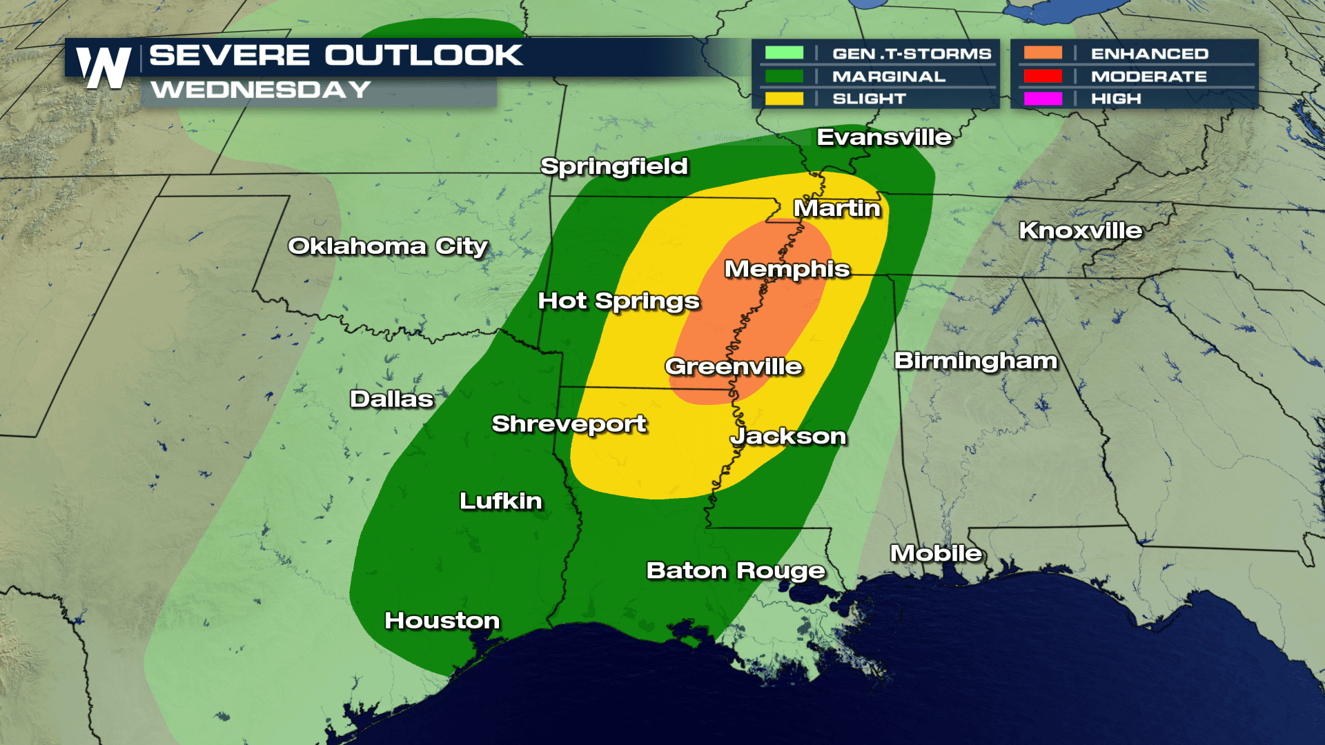
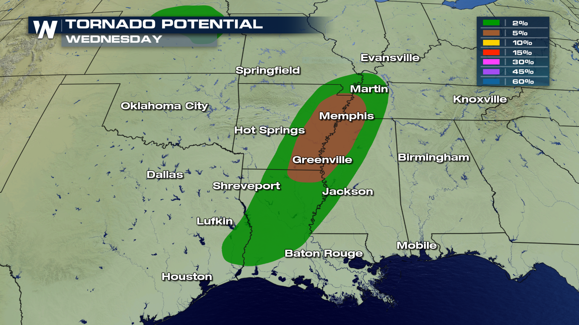
Another strong storm will swirl into the south today, likely producing severe weather with hail, wind, flooding and isolated tornadoes. Here are the areas for the highest probability of tornadic development on Wednesday afternoon. Per the SPC, cities from Greenville north to Memphis have the greatest threat of tornadoes Wednesday afternoon.
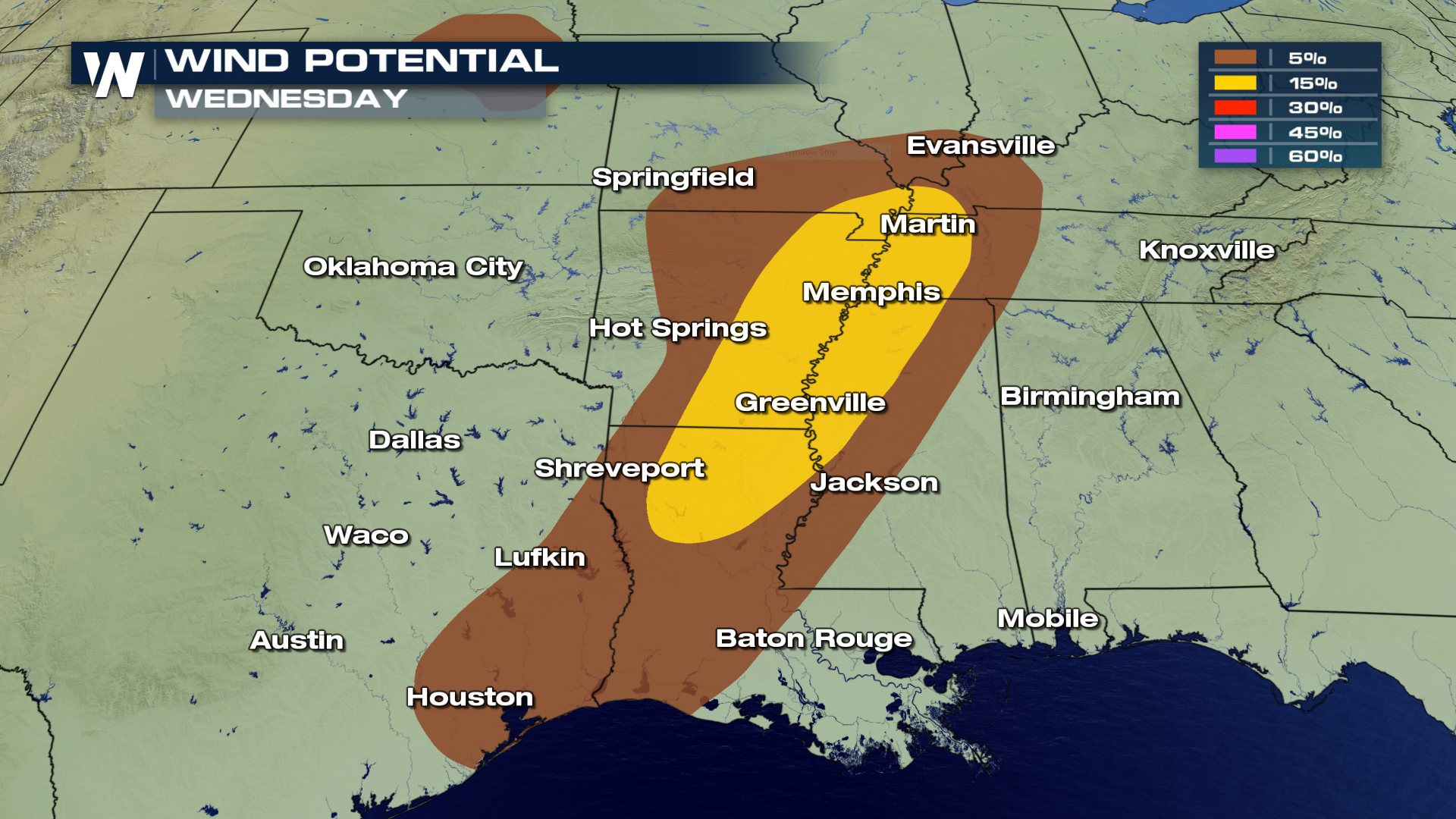
 The winds will also be an issue Wednesday afternoon as severe storms may generate gusts in excess of 50-60 MPH.
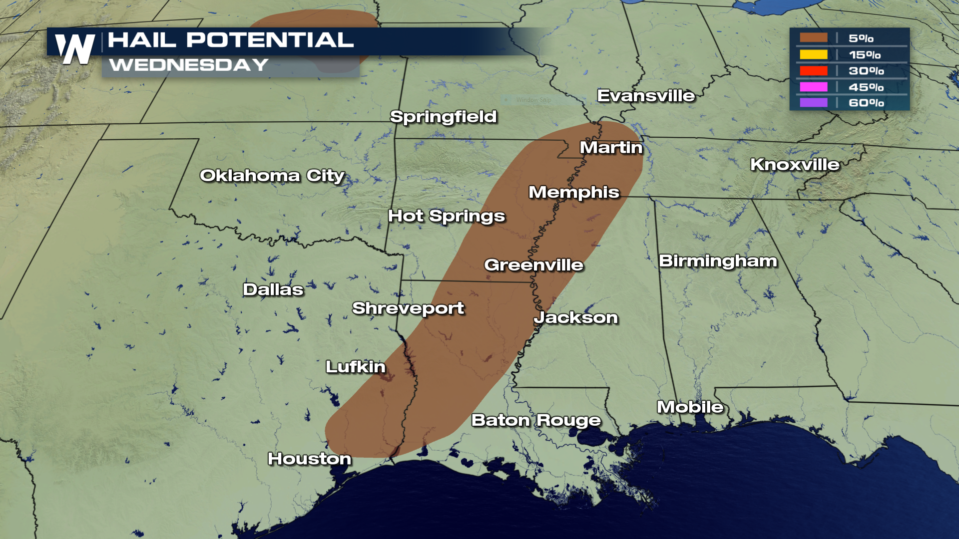
 Hail, possibly up to 1-2" in diameter is also in the forecast for Wednesday.
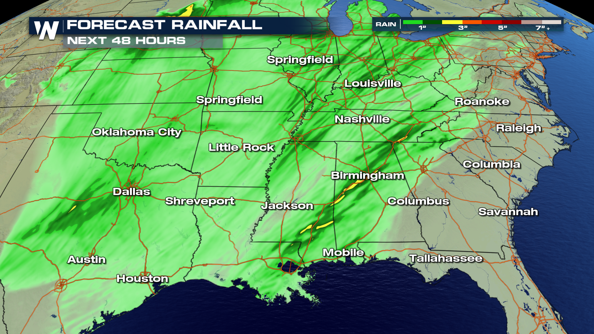
 As the storm moves through the area, expected rain totals will produce anywhere from 1 - 3"+ by Thursday. Areas shaded in yellow will likely see the largest accumulations.
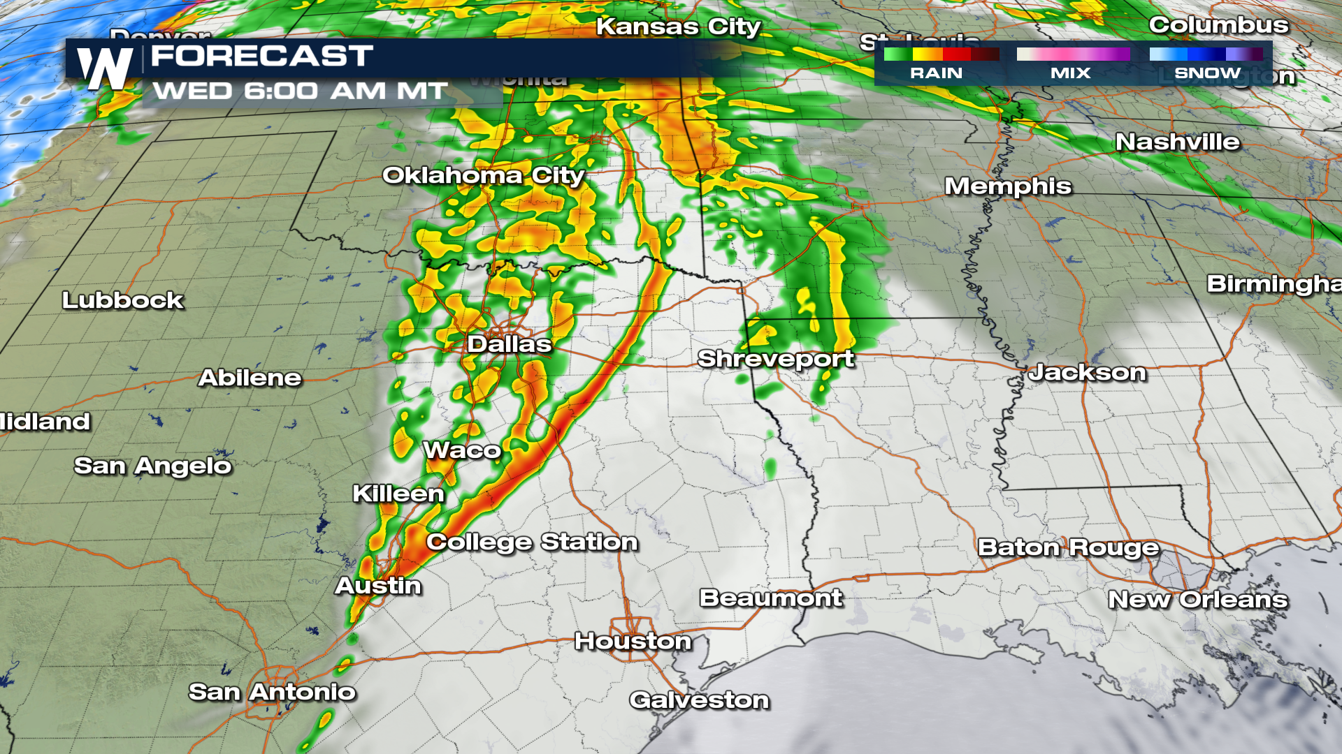
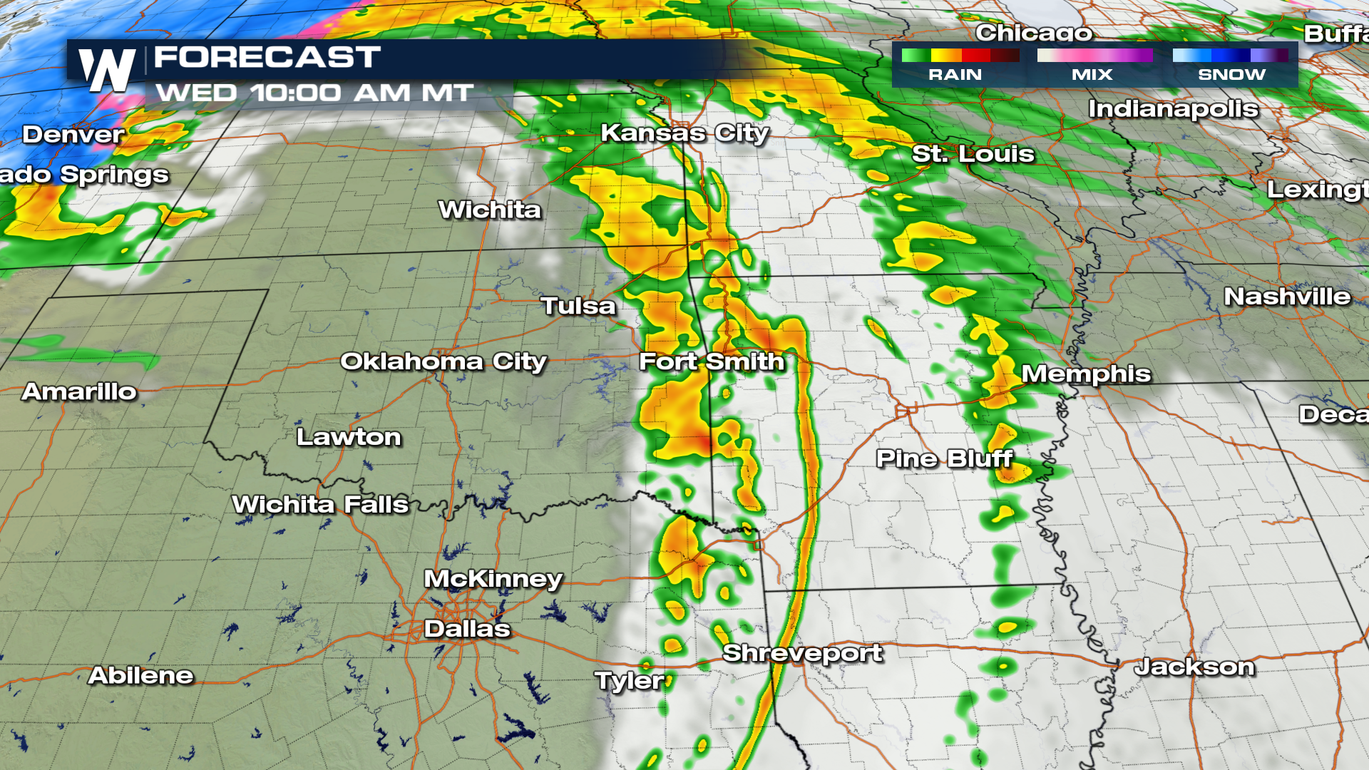
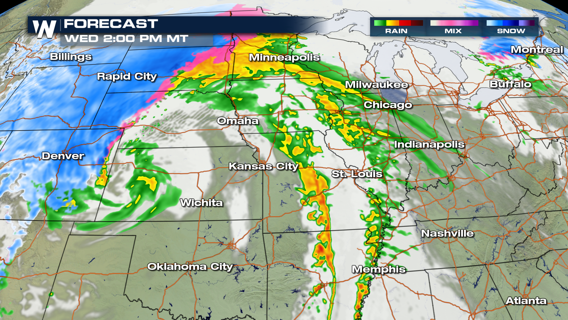
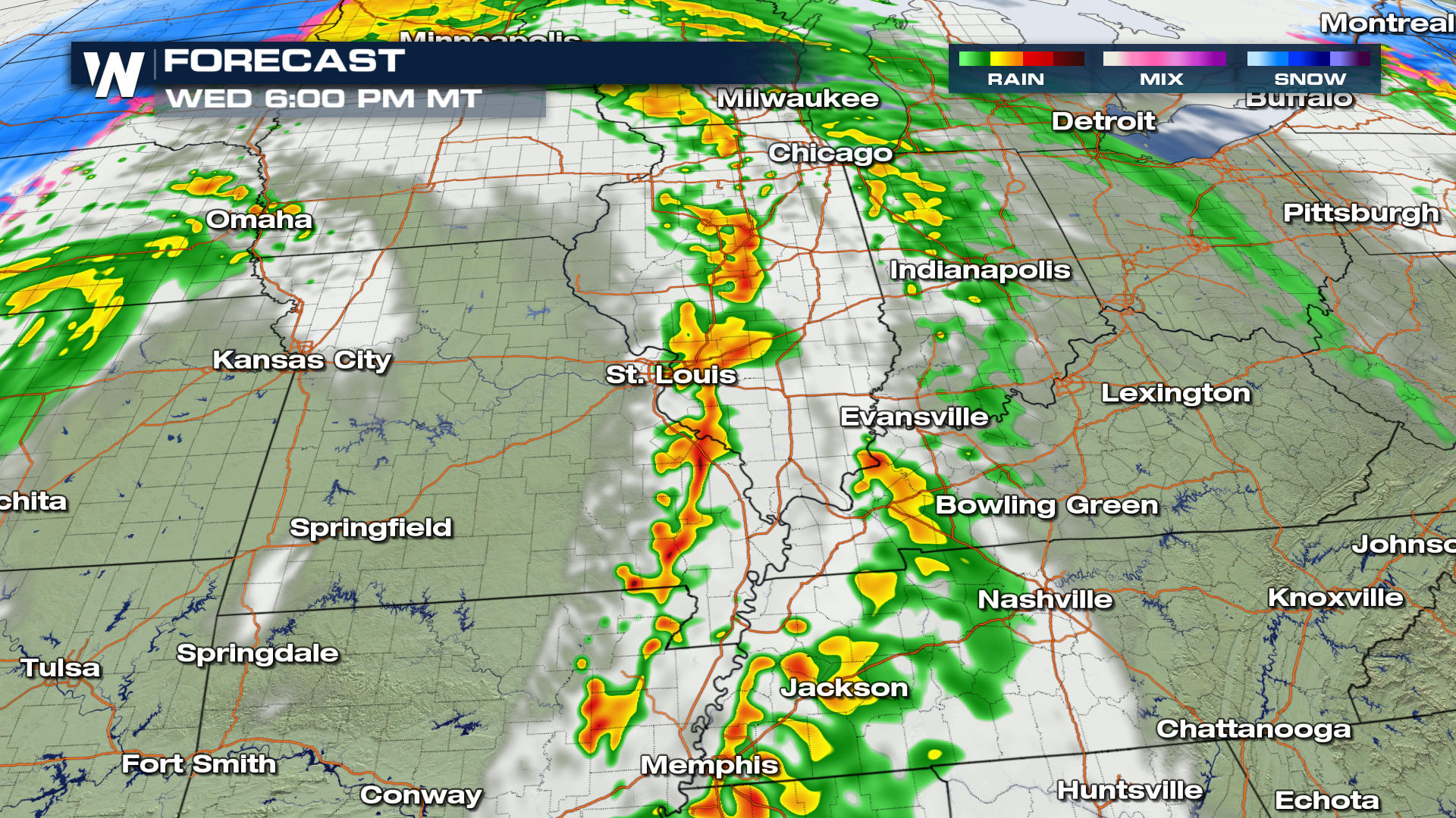
 Here is the expected movement throughout Wednesday afternoon and evening from 6 AM - 6 PM MST.
 For WeatherNation, I'm Meteorologist Greg Rule
The winds will also be an issue Wednesday afternoon as severe storms may generate gusts in excess of 50-60 MPH.
Hail, possibly up to 1-2" in diameter is also in the forecast for Wednesday.
As the storm moves through the area, expected rain totals will produce anywhere from 1 - 3"+ by Thursday. Areas shaded in yellow will likely see the largest accumulations.
Here is the expected movement throughout Wednesday afternoon and evening from 6 AM - 6 PM MST.
For WeatherNation, I'm Meteorologist Greg RuleAll Weather News
More
Pacific Northwest Fires Bringing Down the Air Quality
Conditions have been real dry out west. We've
21 Jul 2026 11:05 AM

Flash Flooding and Severe Weather for the Carolinas This Week
Another stalled front in the Carolinas is for
21 Jul 2026 10:40 AM

Another Round of Storms Targets the Northeast
Another cold front is dropping east and will
21 Jul 2026 10:25 AM

Tropics: Tropical Storm Bertha Forms In the Atlantic, Eastern Pacific Active
In the Atlantic basin, we are keeping a very
21 Jul 2026 10:00 AM

Another Round of Severe Weather for the Upper Midwest and Great Lakes
The upper-level low train continues to keep t
21 Jul 2026 1:45 AM

Air Quality Improvements in the Forecast
Wildfires burning in Northwestern Ontario, Ca
20 Jul 2026 7:20 PM

Monsoon Moisture Brings Weekend Flood Threat
The monsoon has returned to the southwestern
19 Jul 2026 1:30 AM