Another Week, More Severe Weather
Top Stories
19 May 2019 12:39 PM
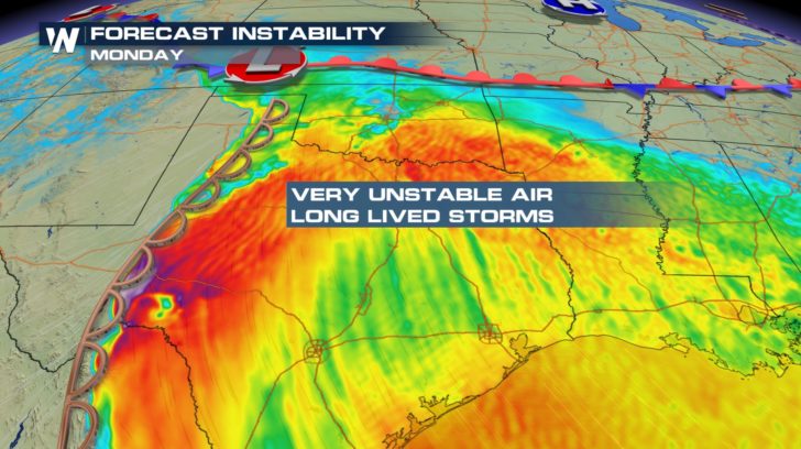
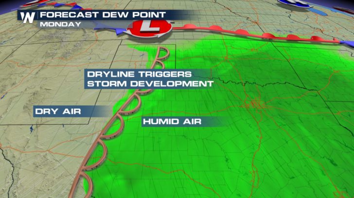
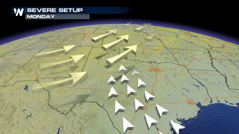
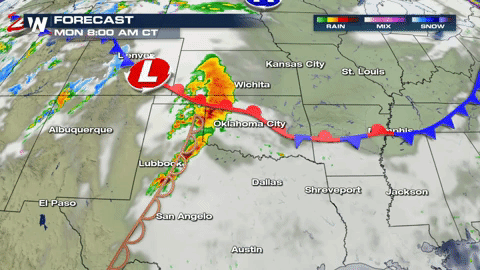
The time to prepare is now. A very volatile storm system will take shape Monday and Tuesday in the Great Plains. In fact, a few isolated severe thunderstorms will be possible during the overnight hours Sunday into Monday in the Texas Panhandle.
All eyes then turn to Monday afternoon and evening when the dynamics for a severe weather outbreak will come together.
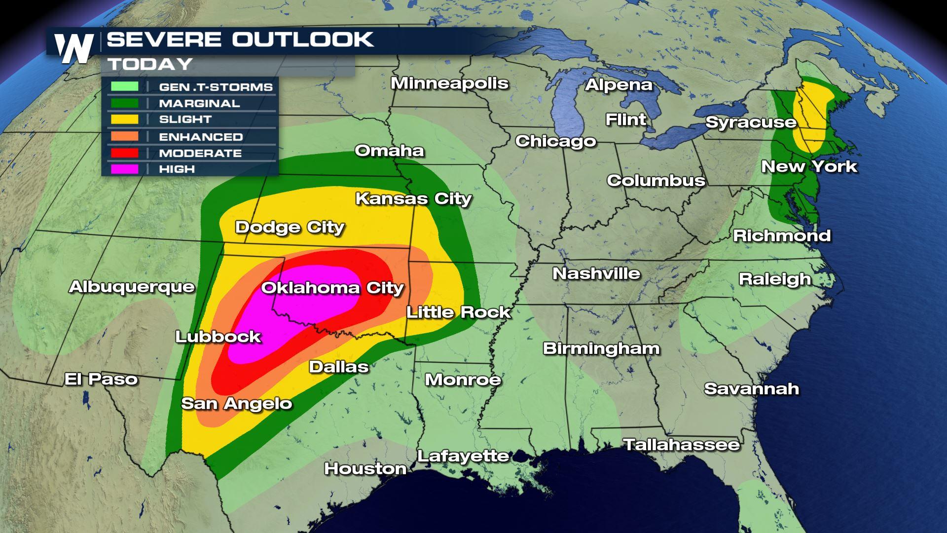
 The Storm Prediction Center (SPC) has already highlighted portions of Texas and Oklahoma for a significant severe weather risk.
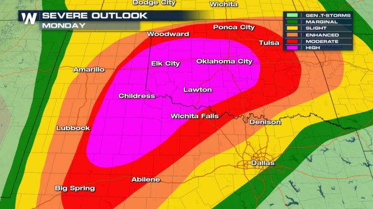 A high risk is defined by the SPC as an area where a severe weather outbreak is expected from either numerous intense and long-tracked tornadoes or a long-lived derecho-producing thunderstorm complex that produces hurricane-force wind gusts and widespread damage. This risk is reserved for when high confidence exists in widespread coverage of severe weather with embedded instances of extreme severe (i.e., violent tornadoes or very damaging convective wind events).
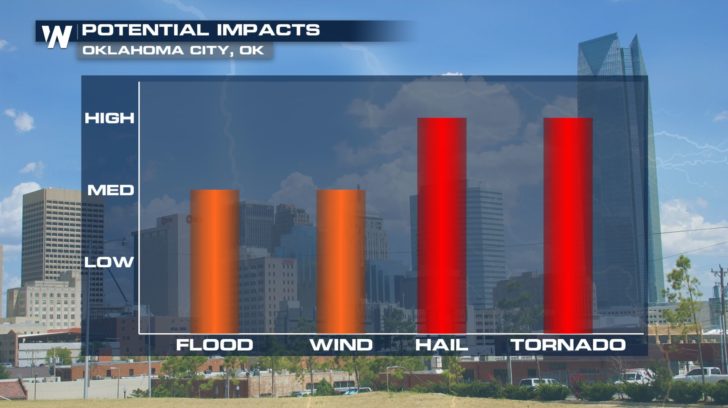
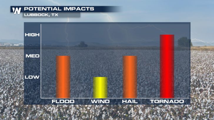
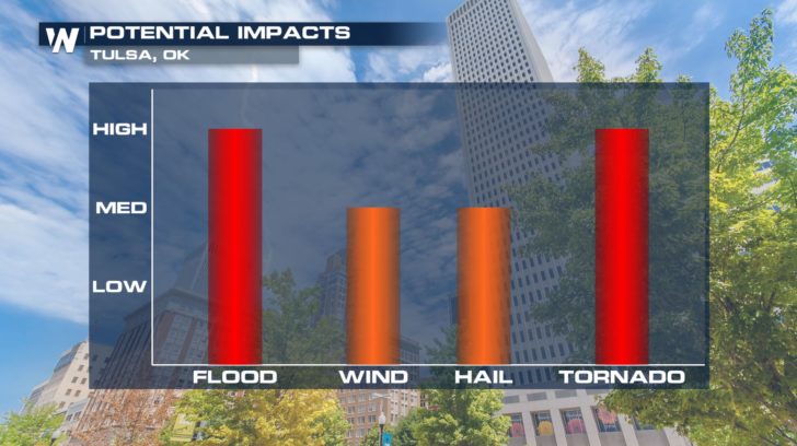
 Sizable cities such as Lubbock, Wichita Falls, Oklahoma City, Tulsa, and many others need to stay alert and attuned to the latest forecast.
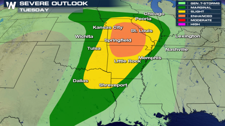
 The threat for severe thunderstorms and flooding rain will continue into Tuesday as this storm system moves east. A corridor from roughly Dallas to St. Louis should prepare for another round of active weather.
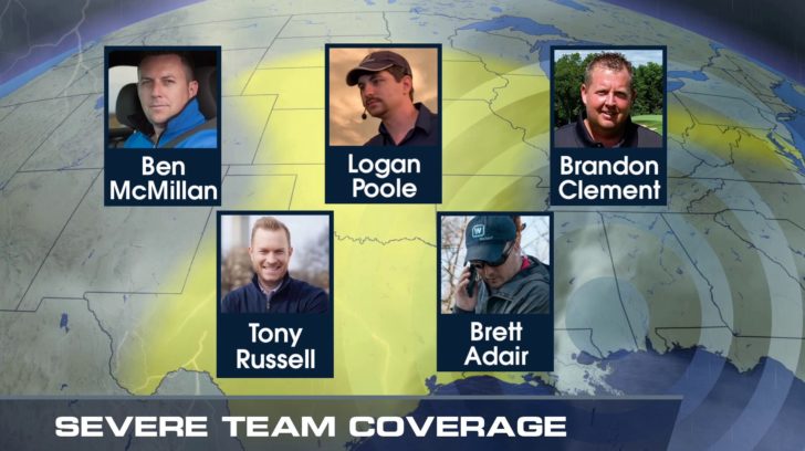
 In addition to our team of meteorologists in the studio, WeatherNation will have crews in the field, safely bringing you the latest images and storms develop.
 Be sure to "Stay Weather Aware" and follow WeatherNation on social media---Twitter, Facebook, Instagram---for the latest forecast updates in the days ahead.
The Storm Prediction Center (SPC) has already highlighted portions of Texas and Oklahoma for a significant severe weather risk.
A high risk is defined by the SPC as an area where a severe weather outbreak is expected from either numerous intense and long-tracked tornadoes or a long-lived derecho-producing thunderstorm complex that produces hurricane-force wind gusts and widespread damage. This risk is reserved for when high confidence exists in widespread coverage of severe weather with embedded instances of extreme severe (i.e., violent tornadoes or very damaging convective wind events).
Sizable cities such as Lubbock, Wichita Falls, Oklahoma City, Tulsa, and many others need to stay alert and attuned to the latest forecast.
The threat for severe thunderstorms and flooding rain will continue into Tuesday as this storm system moves east. A corridor from roughly Dallas to St. Louis should prepare for another round of active weather.
In addition to our team of meteorologists in the studio, WeatherNation will have crews in the field, safely bringing you the latest images and storms develop.
Be sure to "Stay Weather Aware" and follow WeatherNation on social media---Twitter, Facebook, Instagram---for the latest forecast updates in the days ahead.
All Weather News
More
Severe Storms Target the Midwest to the Northeast
UPPER MIDWEST - Dangerous tornadoes have alre
28 Jul 2026 1:45 AM

Tropics: Fausto Heads towards Hawaii; Genevieve Cat 4 Hurricane
PacificHurricane Fausto continues to track we
28 Jul 2026 1:45 AM


Southeast Flood Risk Lingers Near Stalled Front
A stalled boundary over the Southeast will ke
25 Jul 2026 10:55 AM

Another Round of Storms Targets the Northeast
Tuesday brought severe weather again across p
23 Jul 2026 1:15 AM

Another Round of Severe Weather for the Upper Midwest and Great Lakes
The upper-level low train continues to keep t
21 Jul 2026 1:45 AM