Another Winter Wallop for the West
Top Stories
6 Dec 2019 9:30 AM
Several rounds of rain and snow are headed across the West. Climatologically speaking, the West is entering into their wet season. Like many storms this time of year, this system will tap into an atmospheric river. A mid-level trough will not only provide a tropical source of moisture, it will also help provide energy and lift.
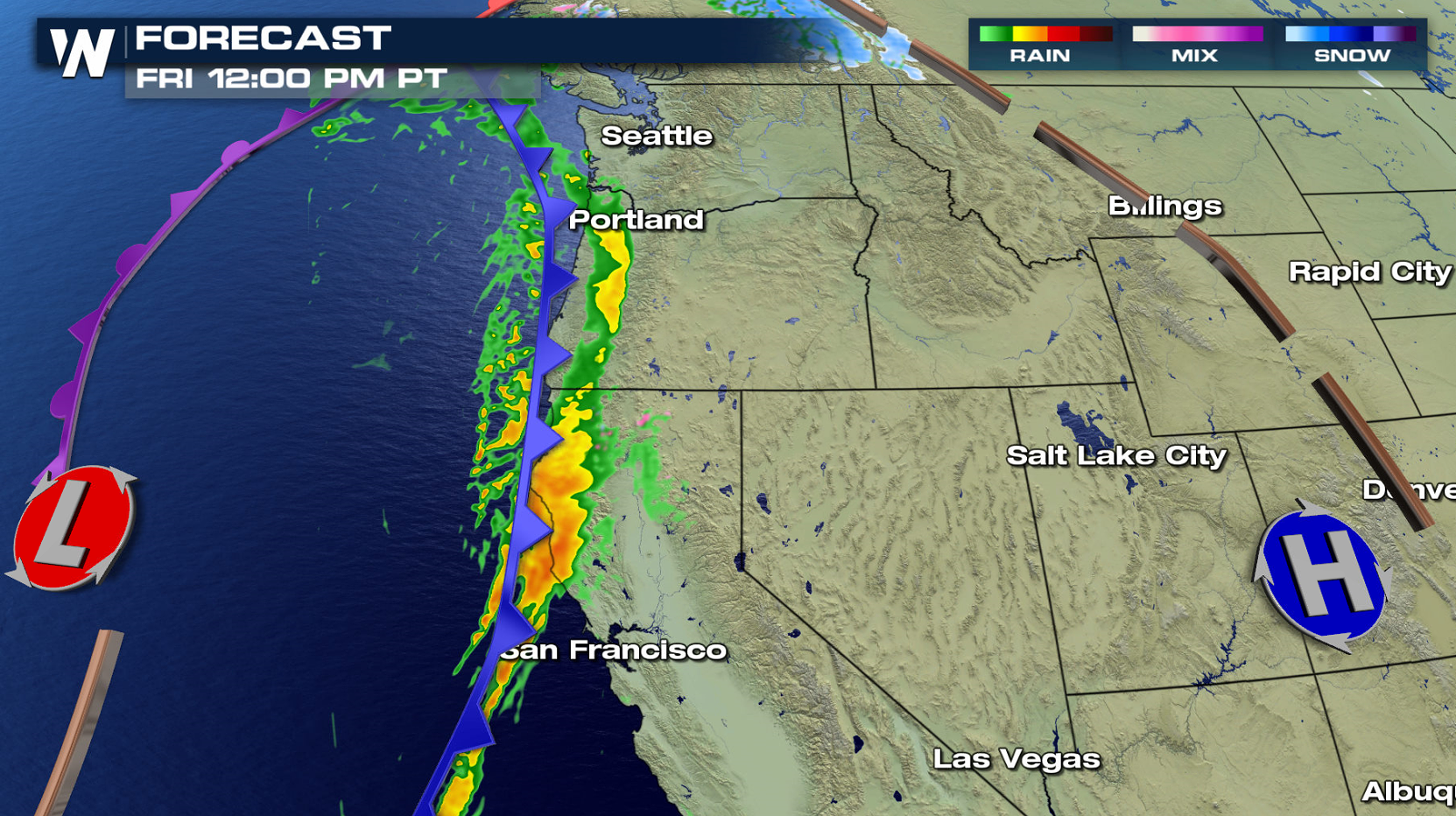
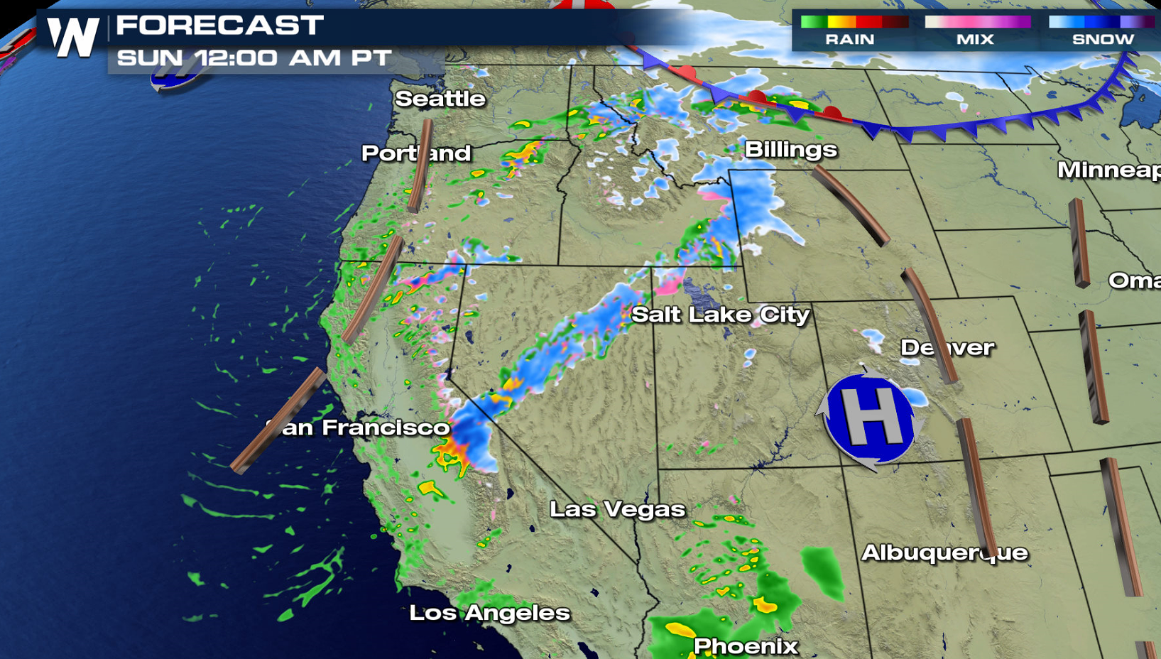
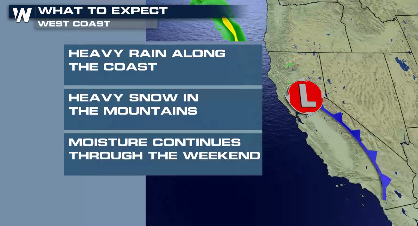 The initial push of energy has arrived with a cold front. Rain will be widespread along the coast and snow will push through the higher elevations.
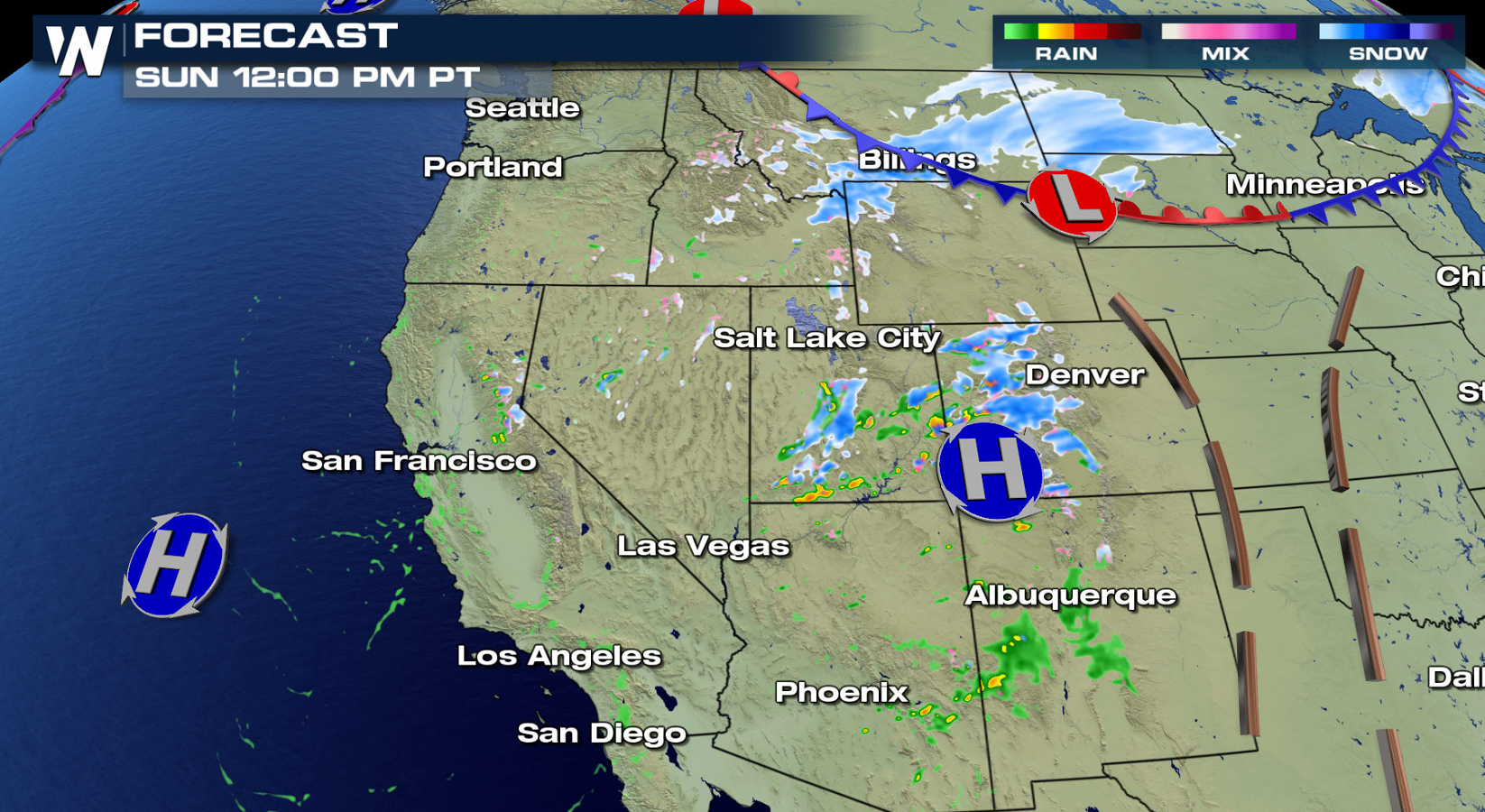
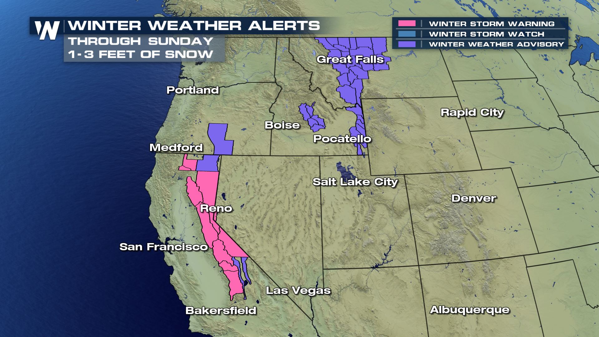
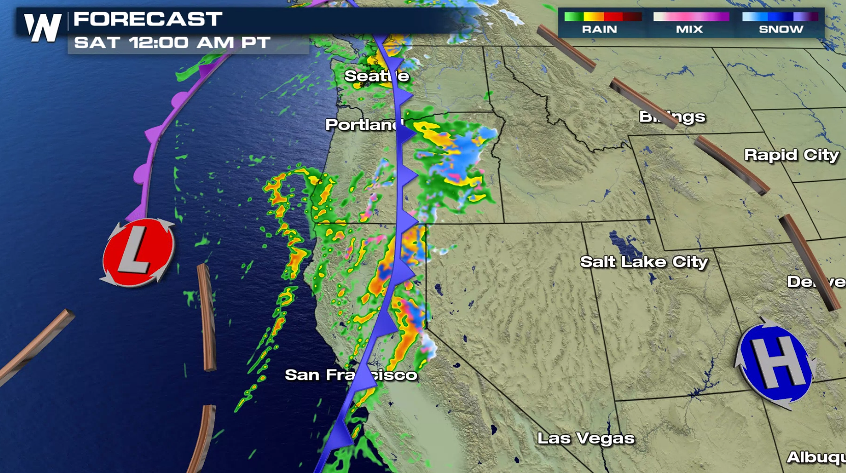 The front will weaken on Saturday, but rain and snow will continue as upper level energy arrives aloft. Snow will push eastward into the Rockies on Sunday.
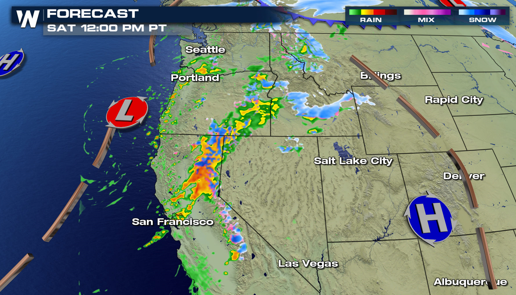
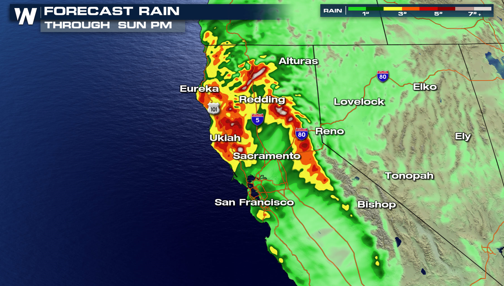
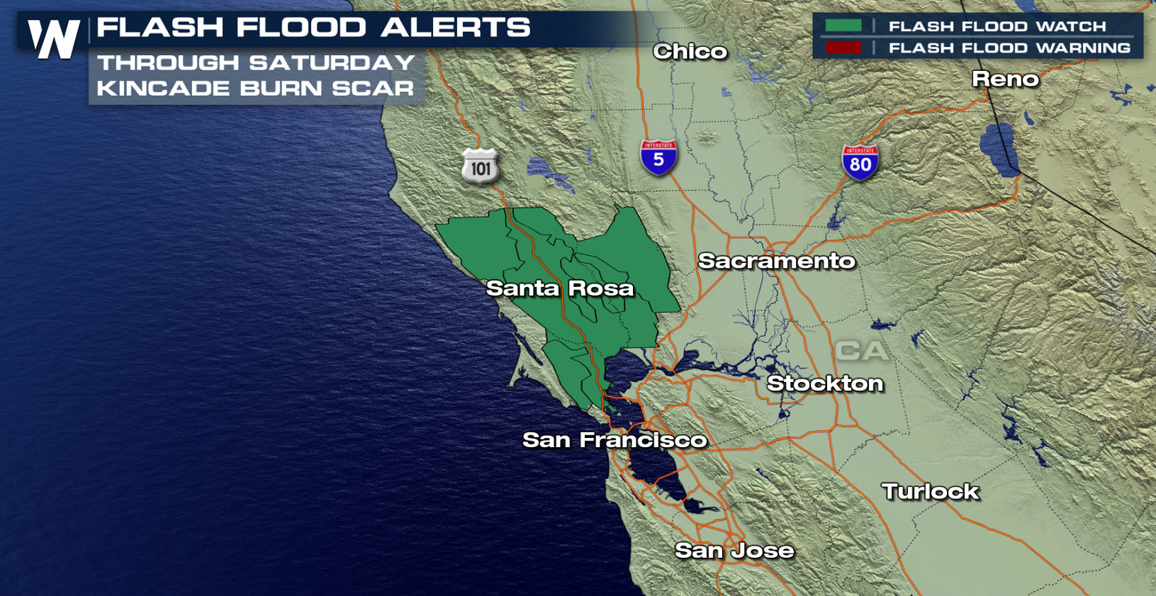
 Rainfall totals look heavy in Northern California, but not extreme. Any threat for flooding will be localized, possibly enhanced by burn scars and drier landscape.
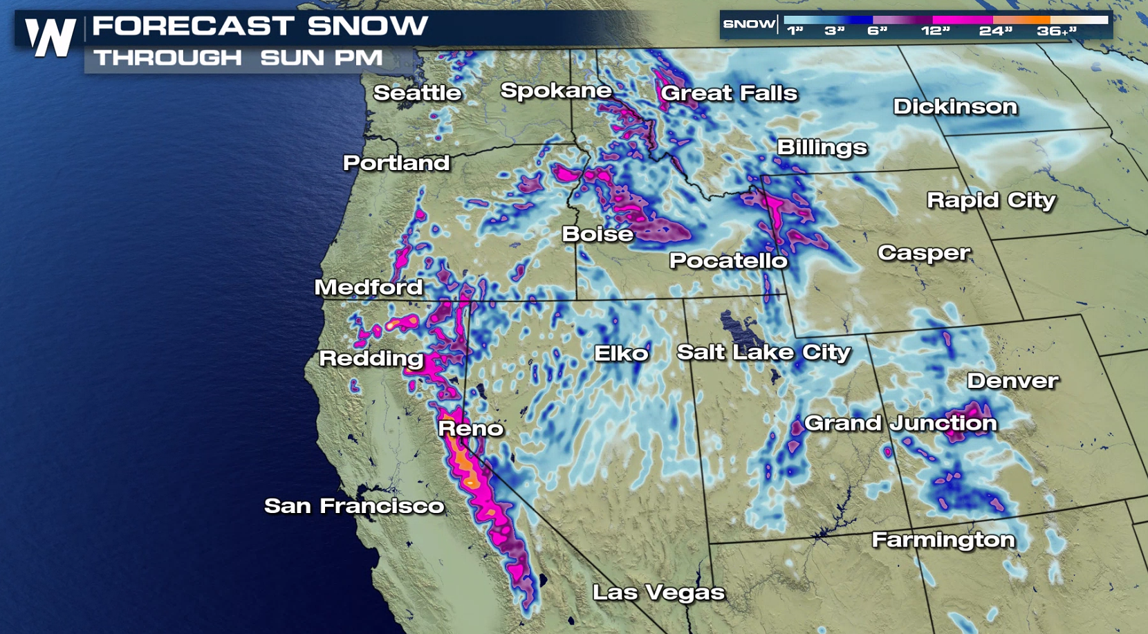 Snowfall may bring dangerous driving conditions to the Sierra Nevada. Winter Weather Alerts has been issued from California to Idaho. Flood watches are in effect north of San Francisco with the threat for flooding increased from burn scars.
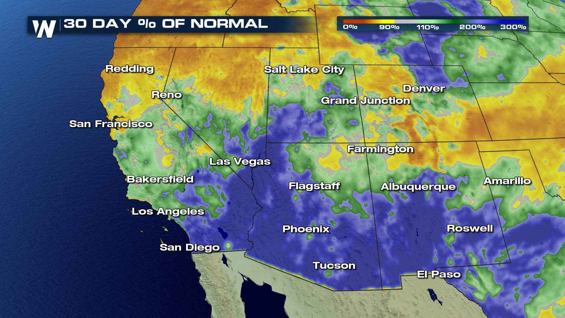
 After a dry monsoon season and a quiet meteorological fall, frequent storms beginning the week of Thanksgiving have transformed the pattern for the southwest. The recent rains have pushed many locations to above normal precipitation for the last month, or even the last year.
 Stay with WeatherNation for the latest on the potential for heavy rain and snow.
 The initial push of energy has arrived with a cold front. Rain will be widespread along the coast and snow will push through the higher elevations.

 The front will weaken on Saturday, but rain and snow will continue as upper level energy arrives aloft. Snow will push eastward into the Rockies on Sunday.


 Rainfall totals look heavy in Northern California, but not extreme. Any threat for flooding will be localized, possibly enhanced by burn scars and drier landscape.

 Snowfall may bring dangerous driving conditions to the Sierra Nevada. Winter Weather Alerts has been issued from California to Idaho. Flood watches are in effect north of San Francisco with the threat for flooding increased from burn scars.

 After a dry monsoon season and a quiet meteorological fall, frequent storms beginning the week of Thanksgiving have transformed the pattern for the southwest. The recent rains have pushed many locations to above normal precipitation for the last month, or even the last year.
 Stay with WeatherNation for the latest on the potential for heavy rain and snow.
All Weather News
More