Area of Interest In the Atlantic
Top Stories
3 Jul 2018 4:27 PM
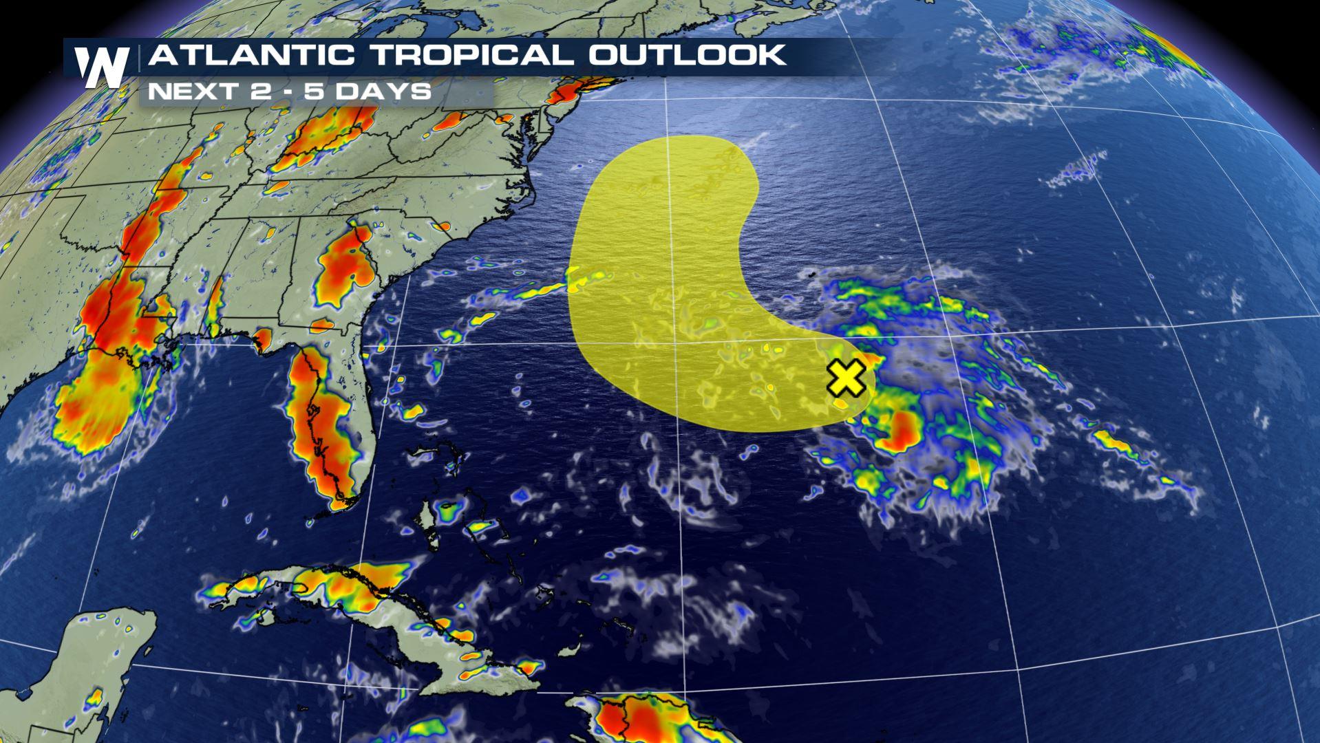
There is another area of interest in the Atlantic we will be monitoring very carefully through the Holiday week. It is churning a few hundred miles southwest of Bermuda.
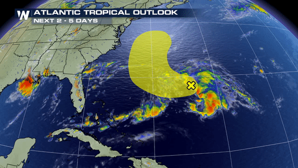
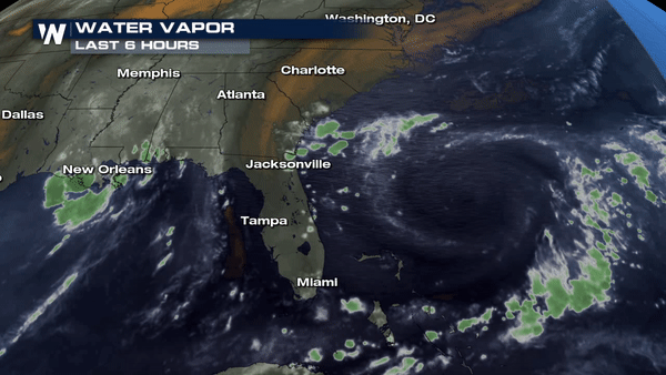 Right now- The National Hurricane Center is forecasting a low end chance of further development over the next 5 days. It is expected to drift northward by late week and interact with a frontal boundary hence the reason it is not anticipated to continue strengthening. Regardless of further formation, this area of disturbed weather will continue to keep onshore flow prominent for the east coast of Florida all the way up the Georgia and Carolina coast through Wednesday and Thursday.
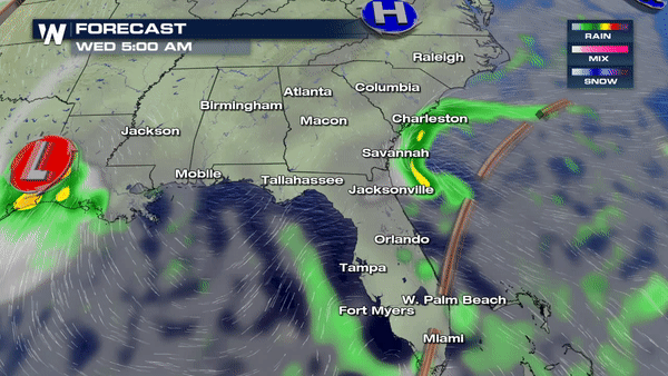 The rain will come in waves so do not expect a washout for the 4th of July but an indoor contingency plan should be made in the event you need to moves things inside for a brief period of time.
Meteorologist Merry Matthews
The rain will come in waves so do not expect a washout for the 4th of July but an indoor contingency plan should be made in the event you need to moves things inside for a brief period of time.
Meteorologist Merry Matthews
Right now- The National Hurricane Center is forecasting a low end chance of further development over the next 5 days. It is expected to drift northward by late week and interact with a frontal boundary hence the reason it is not anticipated to continue strengthening. Regardless of further formation, this area of disturbed weather will continue to keep onshore flow prominent for the east coast of Florida all the way up the Georgia and Carolina coast through Wednesday and Thursday.
The rain will come in waves so do not expect a washout for the 4th of July but an indoor contingency plan should be made in the event you need to moves things inside for a brief period of time.
Meteorologist Merry Matthews
All Weather News
More

More Storms for the East Through Monday
A low-pressure system that moved through the
3 Aug 2026 12:20 PM


After Reaching Category 5, Genevieve Weakens in the Pacific
PacificGenevieve formed last Friday south of
3 Aug 2026 12:30 AM

Flooding, Severe Storms Target the Midwest Again
After an active week of storms across the nor
1 Aug 2026 1:40 AM

Flooding Risk Increases as Heavy Rain Targets the Tri-State Area
Tuesday, heavy rainfall moved across the Nort
30 Jul 2026 12:25 AM