Areas of Severe Weather Through the Weekend
Special Stories
7 Sep 2019 9:52 AM
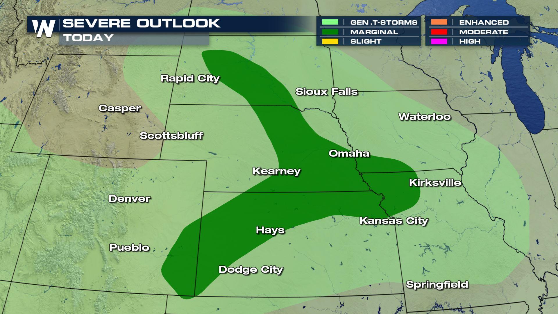
A few disturbances will move through the central and northern plains through the weekend, possibly producing areas of severe on Saturday, Sunday and into early next week. The marginal risk locations will include portions of SE Colorado through Kansas, Nebraska, Missouri, Iowa and into South Dakota.
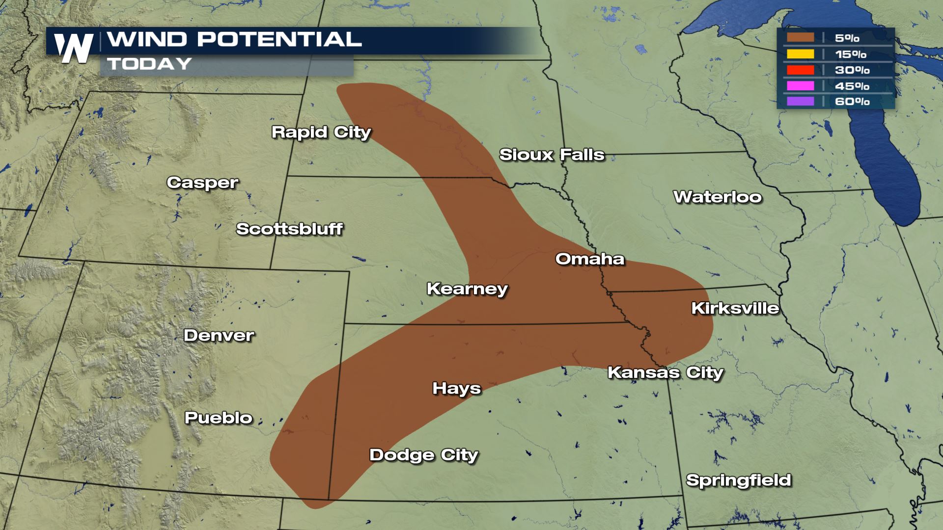
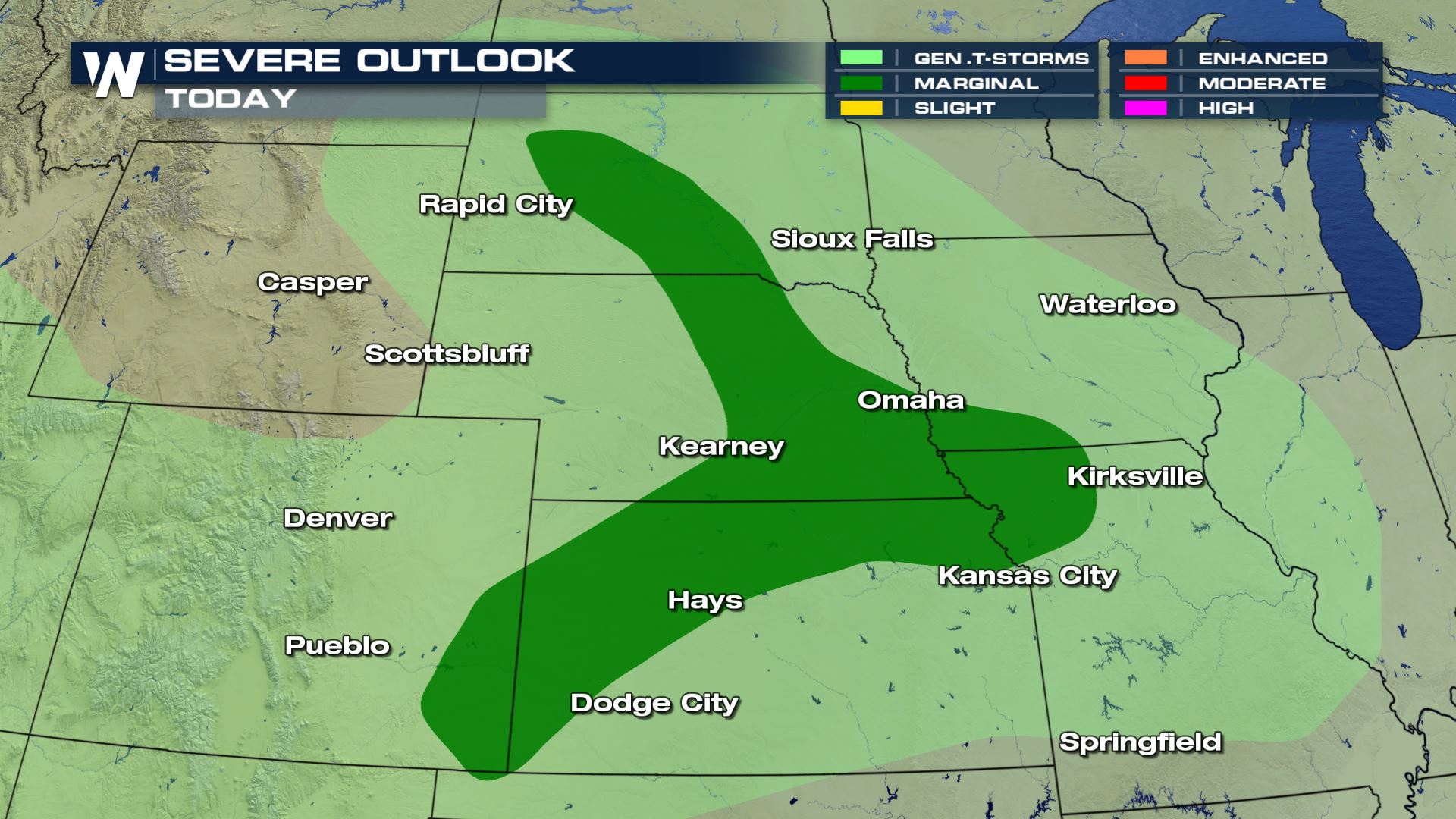 The main threat with Saturday's severe weather will likely be gusty outflow winds reaching 40-50 MPH and the slight chance of small pea-sized hail.
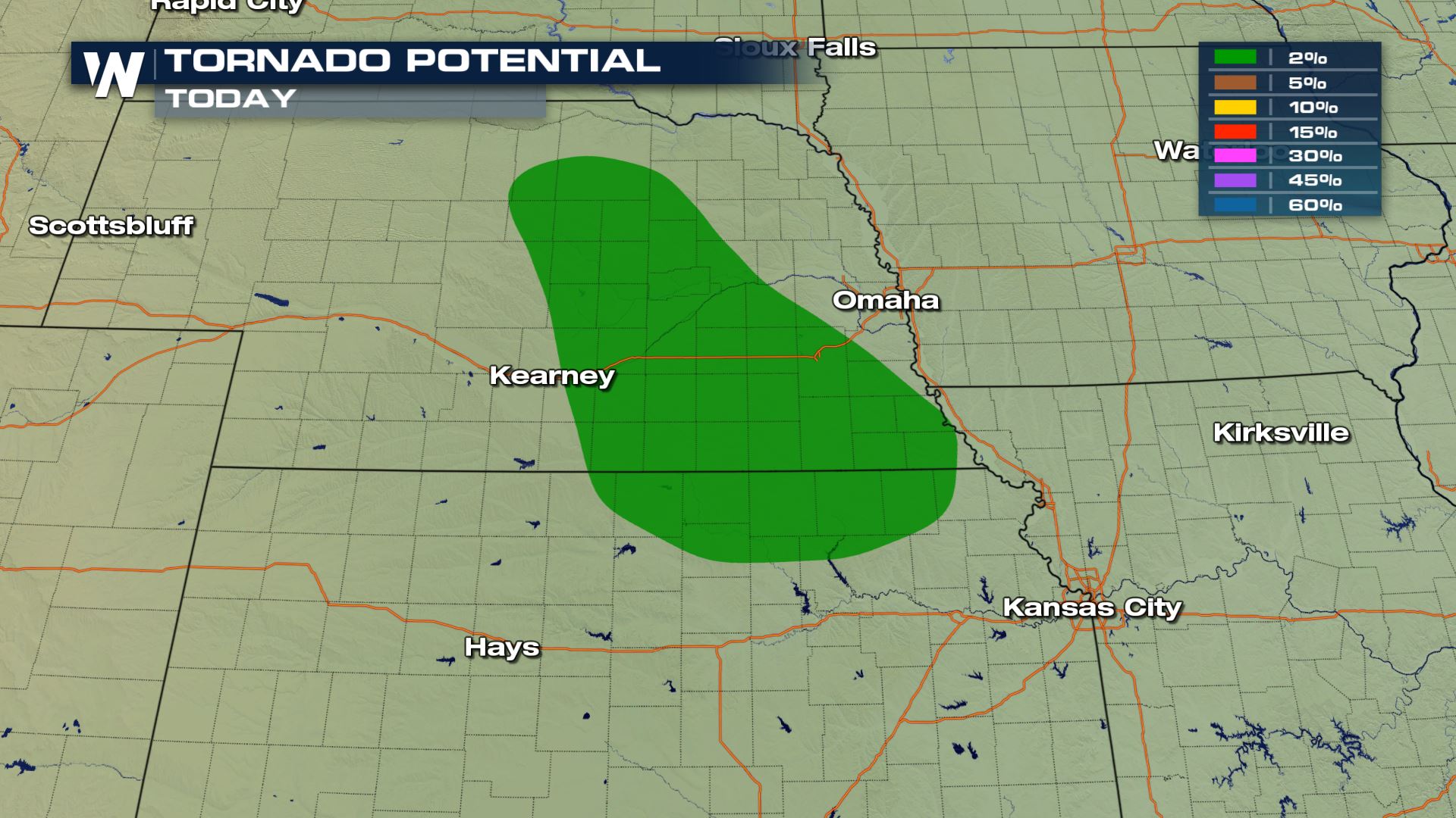
 As always, we can never rule out the risk of an isolated tornado or two to develop later in the afternoon and evening hours.
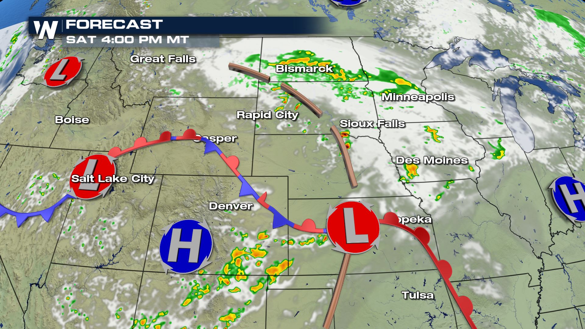
 As the forecast shows, showers and thunderstorms will develop by 4 PM through SE Colorado and into the Dakotas as a strong wave of energy moves into the region.
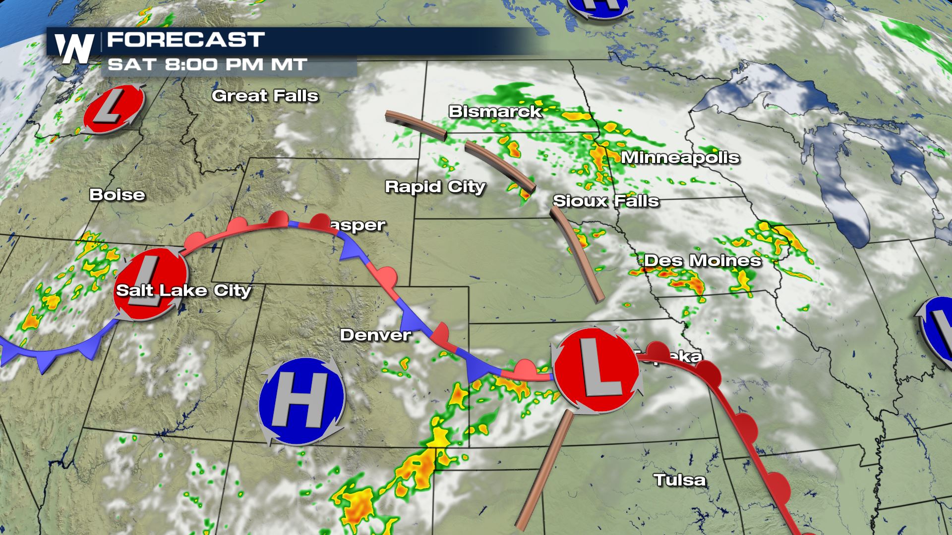
 By 8 PM, scattered storms will move east through the evening, affecting areas in Kansas, Iowa and into the Dakotas.
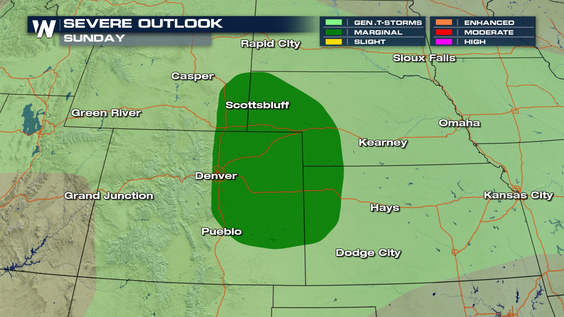
 As the same frontal boundary slowly moves east, so will the threat of severe weather. This is the severe outlook for Sunday, as a marginal risk of storms will exist from the Front Range of Colorado and into areas of Wyoming, Nebraska and Kansas. Once again, the largest threats on Sunday will be gusty outflow winds, small hail and the possibility of an isolated tornado.
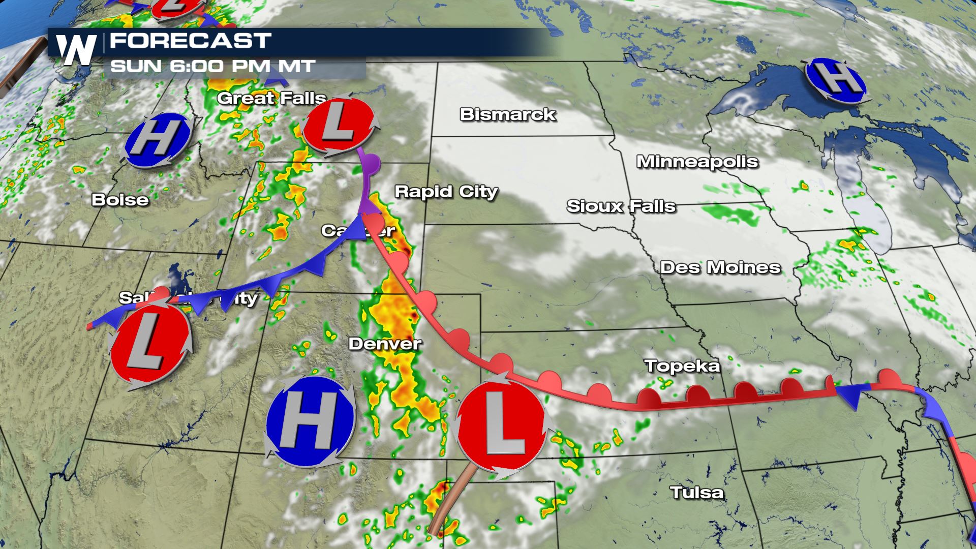
 Check out the forecast models showing a strong line of storms along the Front Range by late tomorrow afternoon. These will move east into the plains through the evening and possibly hold together overnight and into early Monday morning.
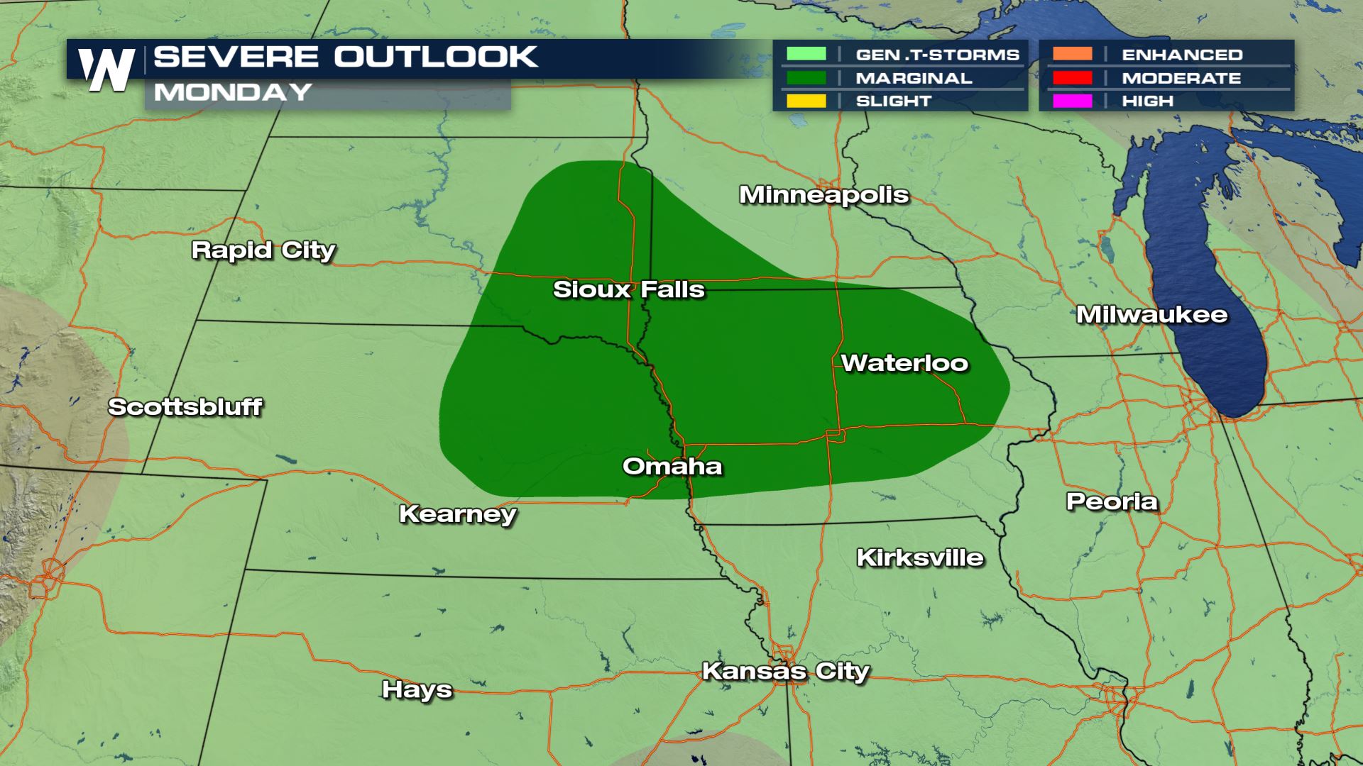
 As the frontal boundary moves northeast into Monday, the threat of severe weather will have moved into the central and northern plains with a marginal risk of severe thunderstorms.
 Forecasts are subject to change, so make sure to follow WeatherNation throughout the weekend for all the latest updates.
I'm Meteorologist Greg Rule.
Forecasts are subject to change, so make sure to follow WeatherNation throughout the weekend for all the latest updates.
I'm Meteorologist Greg Rule.
The main threat with Saturday's severe weather will likely be gusty outflow winds reaching 40-50 MPH and the slight chance of small pea-sized hail.
As always, we can never rule out the risk of an isolated tornado or two to develop later in the afternoon and evening hours.
As the forecast shows, showers and thunderstorms will develop by 4 PM through SE Colorado and into the Dakotas as a strong wave of energy moves into the region.
By 8 PM, scattered storms will move east through the evening, affecting areas in Kansas, Iowa and into the Dakotas.
As the same frontal boundary slowly moves east, so will the threat of severe weather. This is the severe outlook for Sunday, as a marginal risk of storms will exist from the Front Range of Colorado and into areas of Wyoming, Nebraska and Kansas. Once again, the largest threats on Sunday will be gusty outflow winds, small hail and the possibility of an isolated tornado.
Check out the forecast models showing a strong line of storms along the Front Range by late tomorrow afternoon. These will move east into the plains through the evening and possibly hold together overnight and into early Monday morning.
As the frontal boundary moves northeast into Monday, the threat of severe weather will have moved into the central and northern plains with a marginal risk of severe thunderstorms.
Forecasts are subject to change, so make sure to follow WeatherNation throughout the weekend for all the latest updates.
I'm Meteorologist Greg Rule.All Weather News
More
Fronts Continue To Spark Severe Weather Across the Plains
A cold front that brought record lows to the
18 Jul 2025 10:40 PM

Extreme Heat Impacts for the East Coast & South
Extreme heat continues to impact several area
18 Jul 2025 10:05 PM

Flooding Threat Remains Elevated in the East
A cold front pushing through the Eastern Seab
18 Jul 2025 9:10 PM

EF-2 Firenado from the Deer Creek Fire in Utah
A fire tornado was spotted near La Sal, Utah
18 Jul 2025 7:30 AM

Tropical System Brings Flood Risk to the Central Gulf
Time has run out for notable tropical develop
18 Jul 2025 3:05 AM

Heavy Rain, Flooding Threat Returns to Florida
Keep the rain boots handy in Florida - heavy
13 Jul 2025 12:50 PM

Severe Storm Risk Pushes into the Great Lakes, Ohio Valley
Friday was another busy day with severe weath
12 Jul 2025 8:00 PM