Atlantic Has a High Chance of the Next Tropical System

Top Stories
29 Aug 2018 8:52 PM
The National Hurricane Center is getting more confident that we will see our next tropical depression or named storm in the Atlantic Ocean. The good news is that we have plenty of time to watch this unfold.
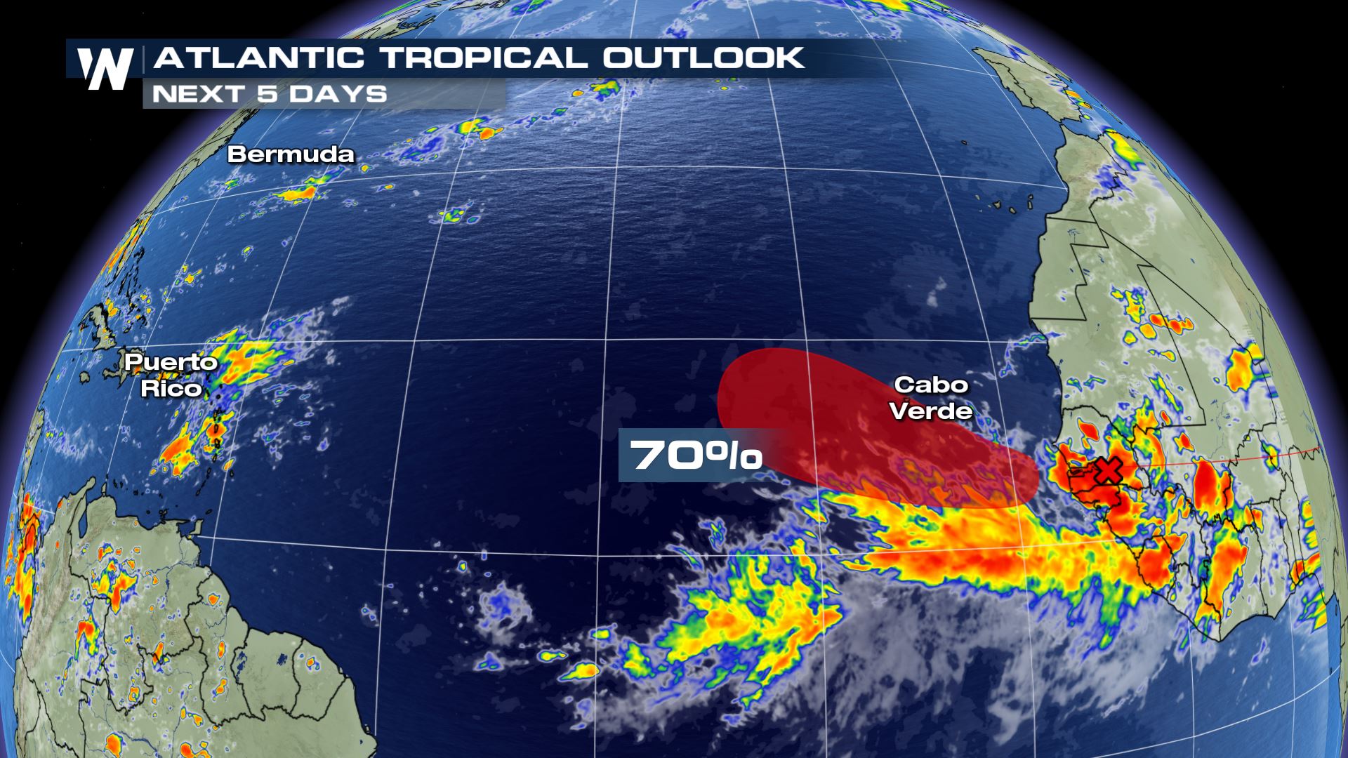 The Atlantic Tropical Outlook through Sunday, September 2 shows a 70% chance of a tropical depression (or stronger) developing.
Thunderstorms exiting the west coast of Africa are expected to strengthen near the Cabo (Cape) Verde Islands Friday. Showers and thunderstorms will be likely for those islands by Friday and into the weekend. As of late Wednesday, reliable weather models show this low pressure area heading through the central Atlantic Ocean by Wednesday, September 5. Take heed, weather models can be quite inaccurate beyond five days. Thus, keep an eye on this tropical wave as it moves across the Atlantic Basin.
The Atlantic Tropical Outlook through Sunday, September 2 shows a 70% chance of a tropical depression (or stronger) developing.
Thunderstorms exiting the west coast of Africa are expected to strengthen near the Cabo (Cape) Verde Islands Friday. Showers and thunderstorms will be likely for those islands by Friday and into the weekend. As of late Wednesday, reliable weather models show this low pressure area heading through the central Atlantic Ocean by Wednesday, September 5. Take heed, weather models can be quite inaccurate beyond five days. Thus, keep an eye on this tropical wave as it moves across the Atlantic Basin.
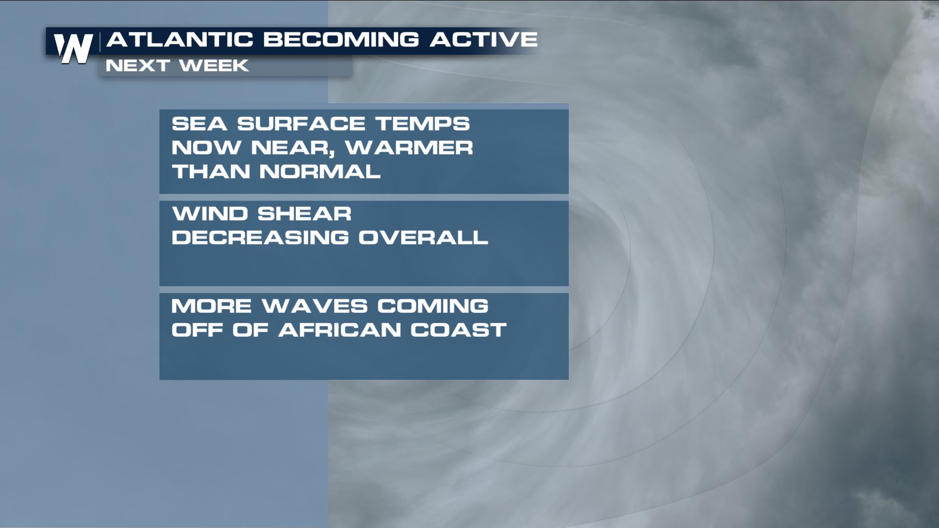
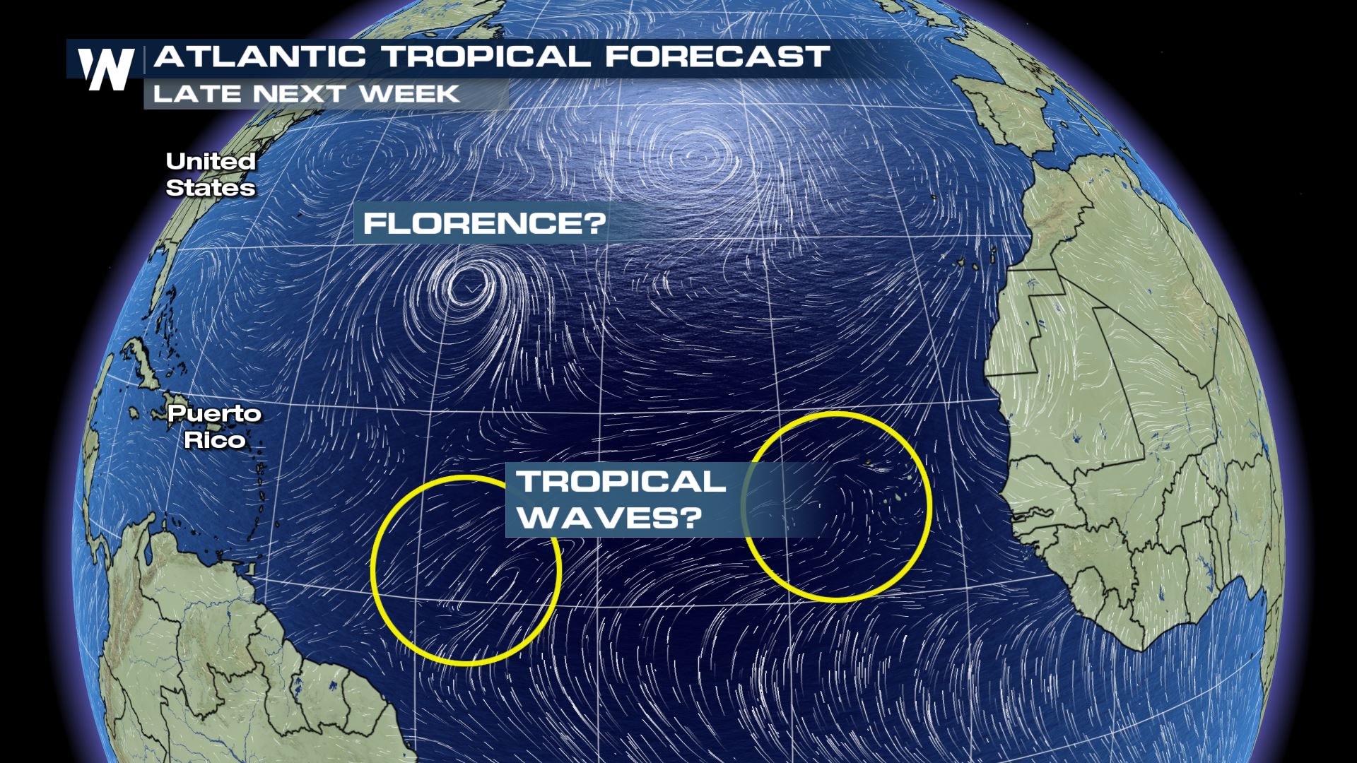 This is a reminder to keep an eye on the tropics daily, because it appears we are shifting into a more active pattern. The tropical waves exiting Africa are showing more intensity, the sea surface temperatures have warmed, and disruptive winds - known as wind shear - are beginning to relax.
 We have passed notable hurricane anniversaries such as Andrew (1992) Katrina (2005) and Irene (2011). This is the time of year you want to make sure you're hurricane ready! It only takes one storm to alter a lifetime!
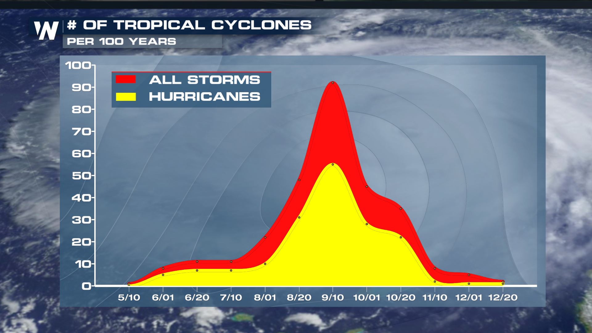 As we approach September, we approach the peak of hurricane season. History tells us that the most active time for tropical cyclones in the Atlantic is around September 10th. We will update you with any new information regarding the tropics and outlooks!
For WeatherNation, Meteorologist Steve Glazier
As we approach September, we approach the peak of hurricane season. History tells us that the most active time for tropical cyclones in the Atlantic is around September 10th. We will update you with any new information regarding the tropics and outlooks!
For WeatherNation, Meteorologist Steve Glazier
The Atlantic Tropical Outlook through Sunday, September 2 shows a 70% chance of a tropical depression (or stronger) developing.
Thunderstorms exiting the west coast of Africa are expected to strengthen near the Cabo (Cape) Verde Islands Friday. Showers and thunderstorms will be likely for those islands by Friday and into the weekend. As of late Wednesday, reliable weather models show this low pressure area heading through the central Atlantic Ocean by Wednesday, September 5. Take heed, weather models can be quite inaccurate beyond five days. Thus, keep an eye on this tropical wave as it moves across the Atlantic Basin.
This is a reminder to keep an eye on the tropics daily, because it appears we are shifting into a more active pattern. The tropical waves exiting Africa are showing more intensity, the sea surface temperatures have warmed, and disruptive winds - known as wind shear - are beginning to relax.
We have passed notable hurricane anniversaries such as Andrew (1992) Katrina (2005) and Irene (2011). This is the time of year you want to make sure you're hurricane ready! It only takes one storm to alter a lifetime!
As we approach September, we approach the peak of hurricane season. History tells us that the most active time for tropical cyclones in the Atlantic is around September 10th. We will update you with any new information regarding the tropics and outlooks!
For WeatherNation, Meteorologist Steve GlazierAll Weather News
More

East Gears Up for Stormy, Wet Weekend
A low pressure system crashing through the Mi
1 Aug 2026 9:15 PM


Flooding, Severe Storms Target the Midwest Again
After an active week of storms across the nor
1 Aug 2026 1:40 AM

After Reaching Category 5, Genevieve Weakens in the Pacific
PacificFausto is now a post-tropical cyclone.
31 Jul 2026 1:30 AM

Flooding Risk Increases as Heavy Rain Targets the Tri-State Area
Tuesday, heavy rainfall moved across the Nort
30 Jul 2026 12:25 AM

Severe Weather: Energy From the Midwest Now in the Southeast
UPPER MIDWEST - Through Monday, dangerous tor
29 Jul 2026 10:30 PM