Tropical Atlantic Waves to Watch
Special Stories
19 Aug 2020 6:00 AM
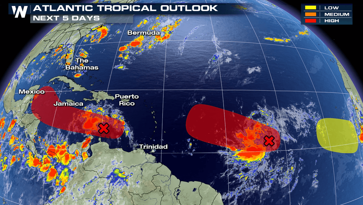
We are monitoring three tropical disturbances in the Atlantic Basin. Two of them are likely to further develop over the next five days. The first tropical wave passed through the Windward Islands recently and is now moving through the eastern Caribbean Sea. It's moving at around 20 mph and is currently a large area of disorganized showers and thunderstorms.
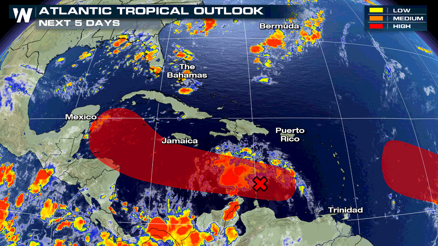
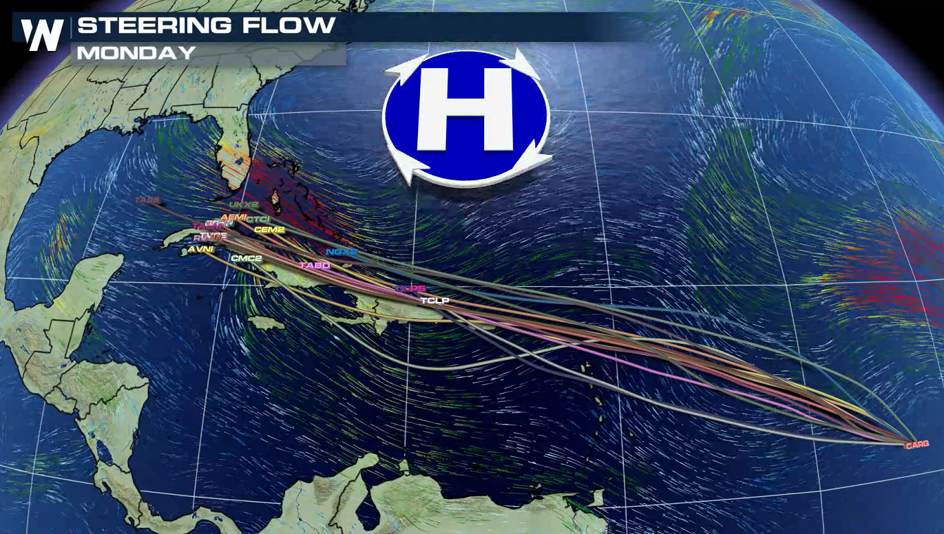
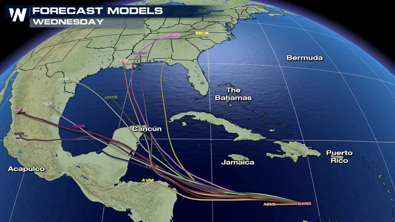 The system, named Invest 97L (for now), is expected to organize further as it continues to move westward. In terms of the forecast models, our spaghetti plots are in good agreement with the storm moving through to the western Caribbean Sea. Longer term, solutions begin to vary, as the models take the storm into the Gulf of Mexico. The National Hurricane Center (NHC) gives this storm a 40% chance to become a tropical system within the next couple of days, but 80% chance by 5 days.
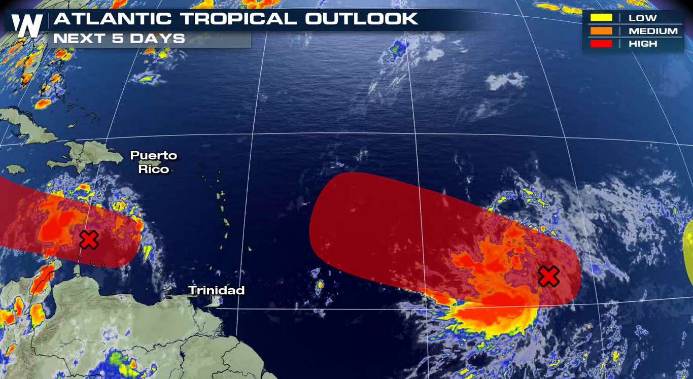
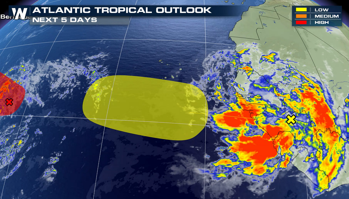
 The second tropical wave is still over the eastern Atlantic and is forecast to interact with another disturbance. This wave has a high chance (90%) of tropical development in 2 to 5 days and will be the next system to watch. The National Hurricane Center says "Environmental conditions are conducive for further development, and a tropical depression is expected to form during the next day or two while the system moves generally west-northwestward at 15 to 20 mph across the central and western portions of the tropical Atlantic."
 A large area of showers and thunderstorms is associated with a third tropical wave set to emerge off the coast of Africa. Development is not expected in the near term.
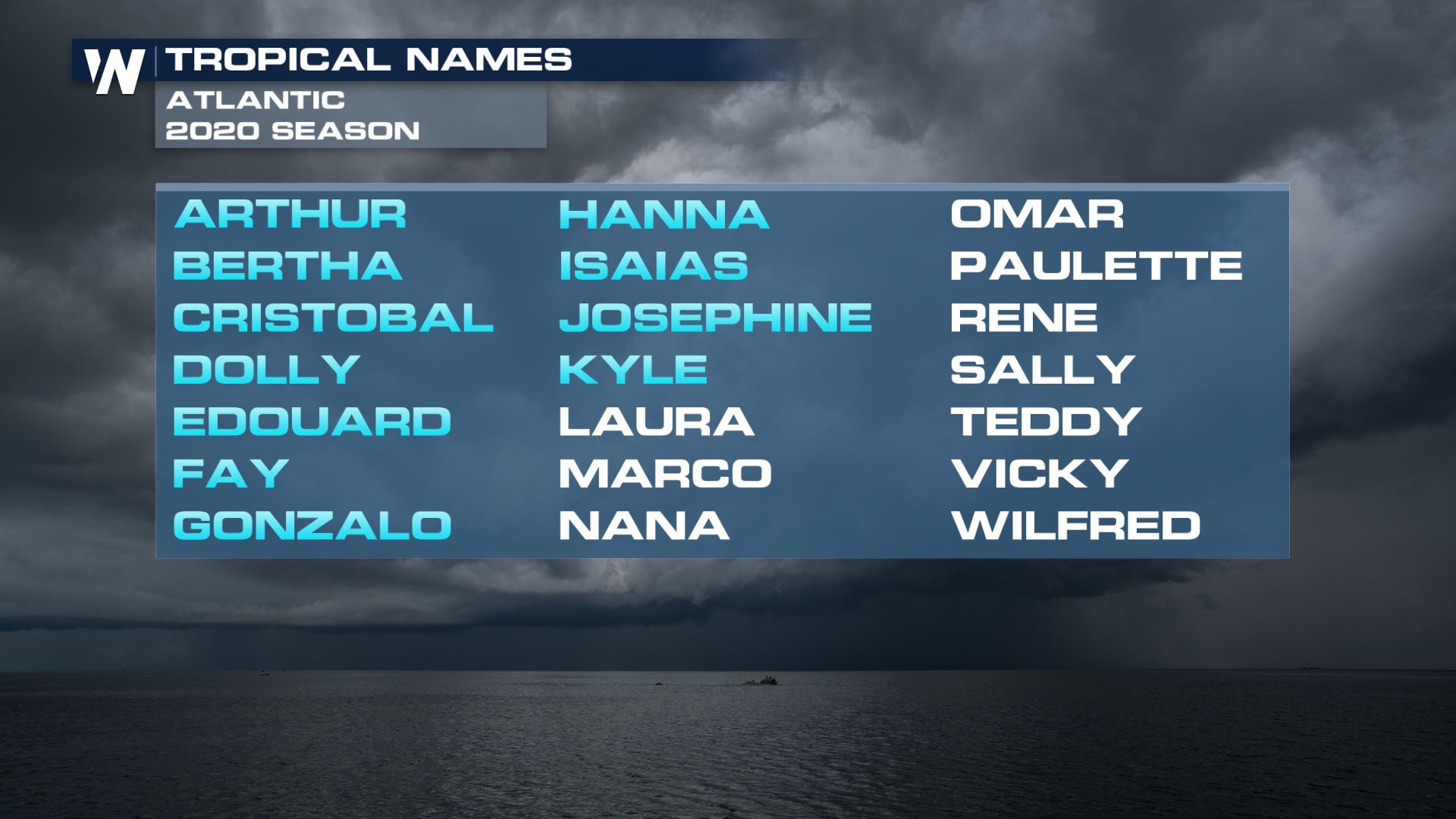
The next name to listen for if any of these disturbances get named will be "Laura".
A large area of showers and thunderstorms is associated with a third tropical wave set to emerge off the coast of Africa. Development is not expected in the near term.
The next name to listen for if any of these disturbances get named will be "Laura".
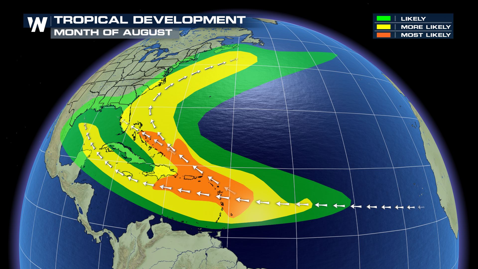
 Usually in the month of August there are three paths that storms typically follow as seen below. And as our models have forecast they are likely to follow suit as well.
 For more information on the Atlantic follow us on twitter, @WeatherNation!
https://twitter.com/WeatherNation/status/1295782707696414720
For more information on the Atlantic follow us on twitter, @WeatherNation!
https://twitter.com/WeatherNation/status/1295782707696414720
The system, named Invest 97L (for now), is expected to organize further as it continues to move westward. In terms of the forecast models, our spaghetti plots are in good agreement with the storm moving through to the western Caribbean Sea. Longer term, solutions begin to vary, as the models take the storm into the Gulf of Mexico. The National Hurricane Center (NHC) gives this storm a 40% chance to become a tropical system within the next couple of days, but 80% chance by 5 days.
The second tropical wave is still over the eastern Atlantic and is forecast to interact with another disturbance. This wave has a high chance (90%) of tropical development in 2 to 5 days and will be the next system to watch. The National Hurricane Center says "Environmental conditions are conducive for further development, and a tropical depression is expected to form during the next day or two while the system moves generally west-northwestward at 15 to 20 mph across the central and western portions of the tropical Atlantic."
A large area of showers and thunderstorms is associated with a third tropical wave set to emerge off the coast of Africa. Development is not expected in the near term.
The next name to listen for if any of these disturbances get named will be "Laura".
Usually in the month of August there are three paths that storms typically follow as seen below. And as our models have forecast they are likely to follow suit as well.
For more information on the Atlantic follow us on twitter, @WeatherNation!
https://twitter.com/WeatherNation/status/1295782707696414720
All Weather News
More
Fronts Continue To Spark Severe Weather Across the Plains
A cold front that brought record lows to the
18 Jul 2025 10:40 PM

Extreme Heat Impacts for the East Coast & South
Extreme heat continues to impact several area
18 Jul 2025 10:05 PM

Flooding Threat Remains Elevated in the East
A cold front pushing through the Eastern Seab
18 Jul 2025 9:10 PM

EF-2 Firenado from the Deer Creek Fire in Utah
A fire tornado was spotted near La Sal, Utah
18 Jul 2025 7:30 AM

Tropical System Brings Flood Risk to the Central Gulf
Time has run out for notable tropical develop
18 Jul 2025 3:05 AM

Heavy Rain, Flooding Threat Returns to Florida
Keep the rain boots handy in Florida - heavy
13 Jul 2025 12:50 PM

Severe Storm Risk Pushes into the Great Lakes, Ohio Valley
Friday was another busy day with severe weath
12 Jul 2025 8:00 PM