Unsettled Pattern Continues Across the Northwest
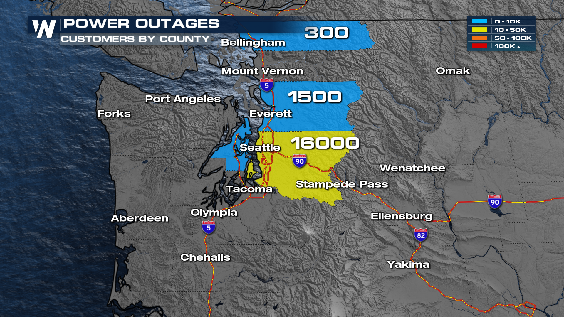
Winds in the Pacific Northwest have been howling thanks to a bomb cyclone that brought hurricane-force winds to the area last week. Although that system has moved out, very gusty winds have been a concern, with gusts to 60-70 mph recorded in the last 24 hours. (above) As far as power outages, in Washington, there are still over 15,000 folks without power as of Sunday night.
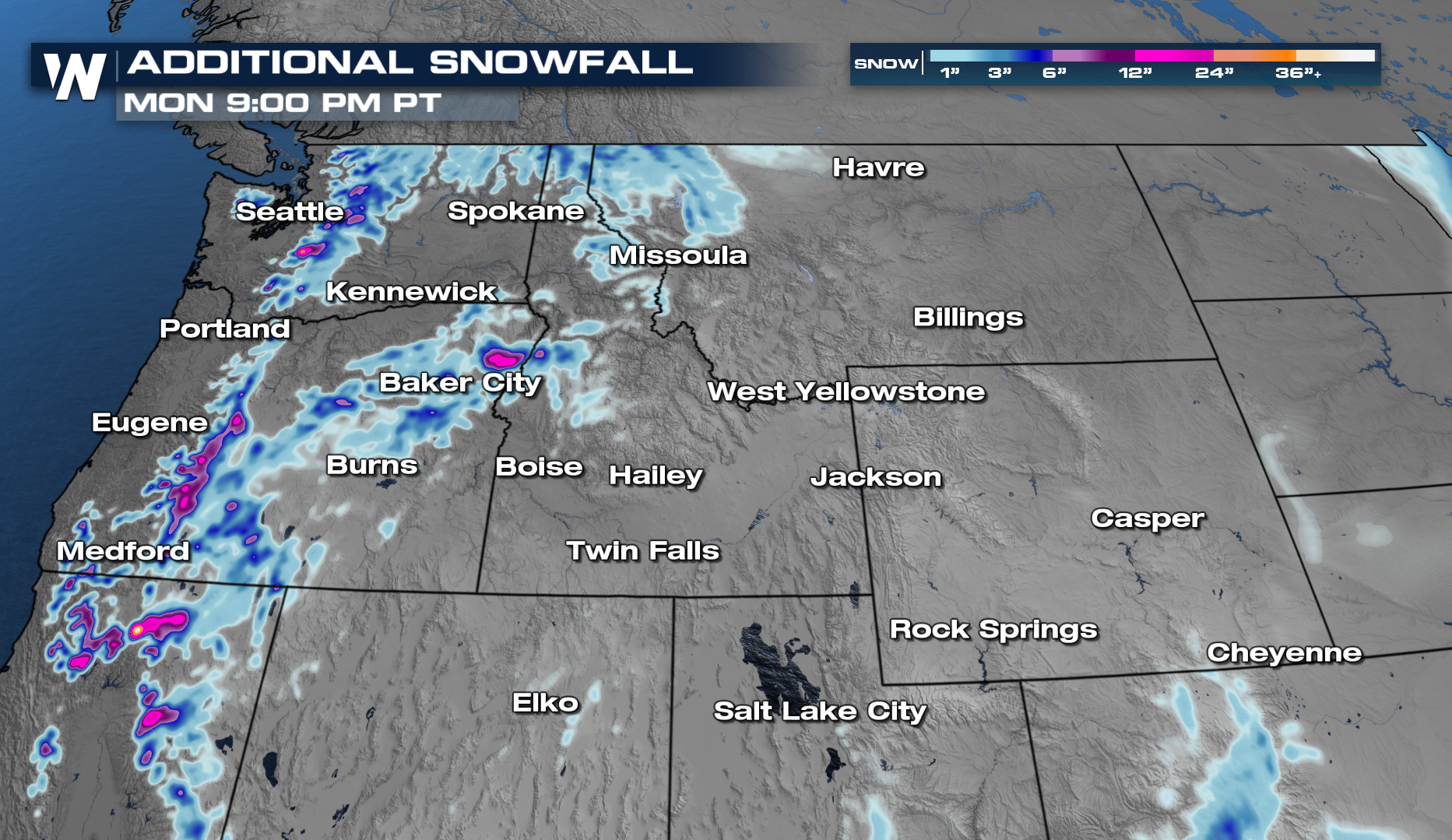
 Another round of moisture moves in along with an area of low pressure. This means more rain and snow to start off your week. Some of the snowfall totals in the higher elevations can reach over a foot of snow through Tuesday. Travel can be impacted, so make sure to check any impacts on roads and the passes.
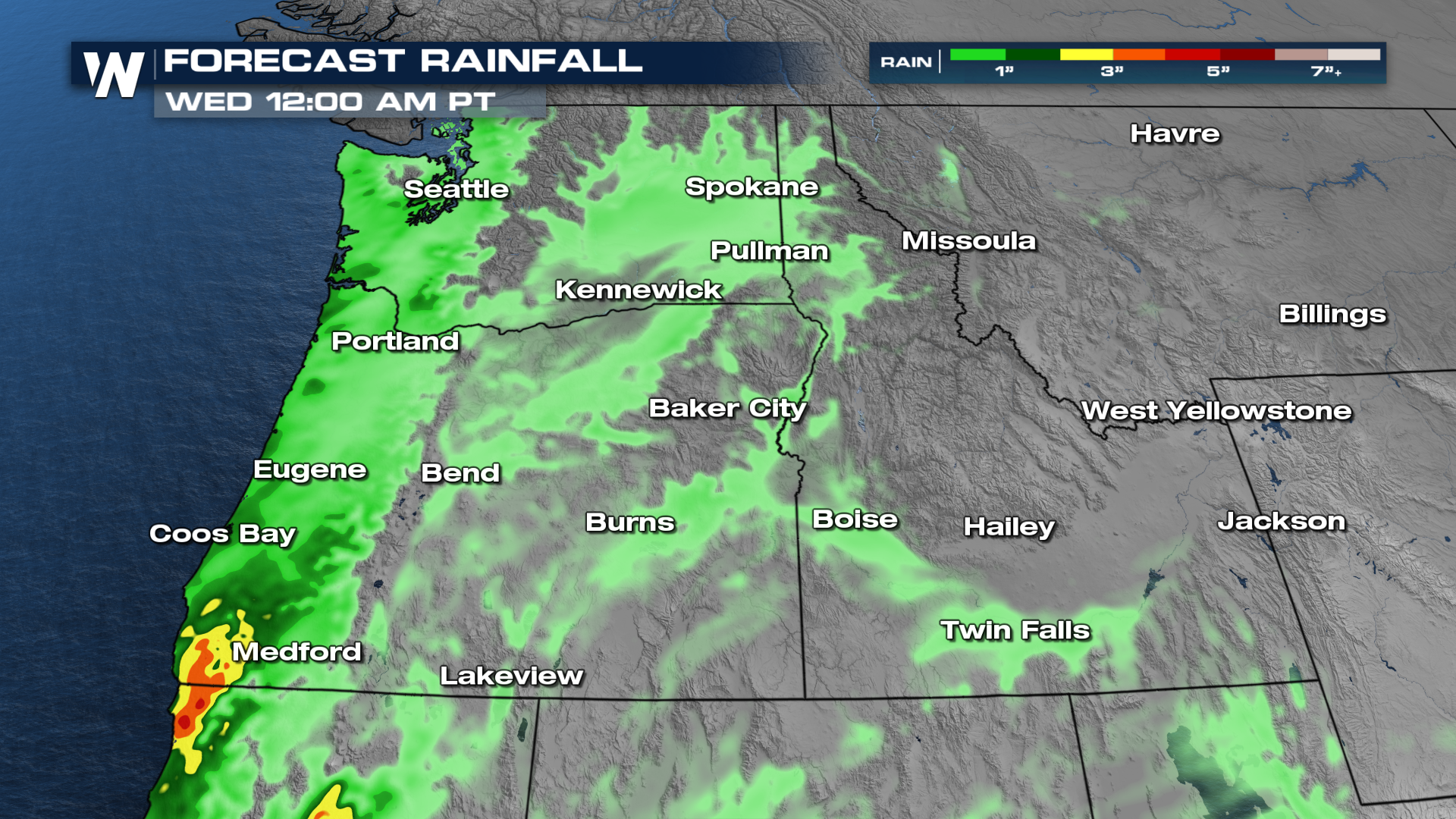
 Rainfall totals will be around a quarter of an inch to localized 3-4 inches possible. The heaviest rainfall will be along the coast.
 You can always check your West Regional Forecast at :50 past the hour.