August Outlook Favors Another Warm Month
Special Stories
20 Jul 2020 2:00 AM
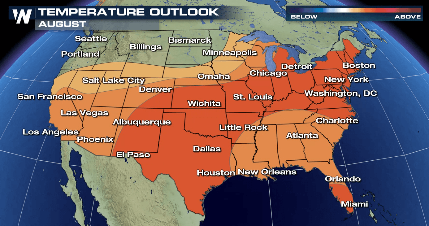
Much of the nation is expected to see warmer than normal temperatures for the upcoming month of August. That's according to the latest monthly outlook from NOAA's Climate Prediction Center (CPC). The Northwest is the exception, with equal chances for above or below average temperatures in the forecast.
Odds favor a wetter than normal August in the Tennessee Valley, Southeast, and Northern Plains. Below average precipitation is forecast in the Southern Plains, which may worsen drought conditions.
https://twitter.com/NWSCPC/status/1283761184684957696
The CPC noted that "the main factors influencing the August 2020 outlooks for temperature and precipitation are trends , soil moisture, potential impacts from tropical cyclone activity, and dynamical model output." Long range computer model forecasts are heavily favoring warmer than normal weather over much of the nation.
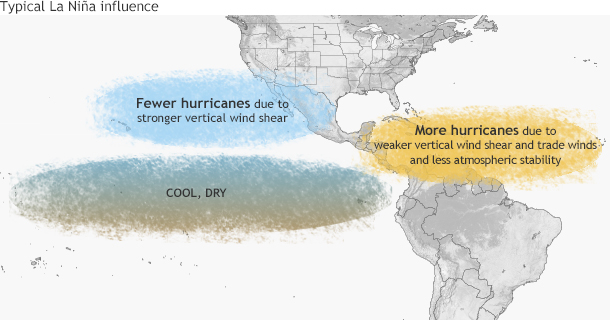 Earlier this month, a La Nina watch was issued. The CPC stated "La Nina conditions are factored into the monthly outlook, though impacts are likely to be minimal." A La Nina is observed when colder than average water temperatures are recorded in the equatorial Pacific Ocean. This could influence tropical activity in the Atlantic Basin, which lead to the above average rainfall forecast for the Southeast.
Earlier this month, a La Nina watch was issued. The CPC stated "La Nina conditions are factored into the monthly outlook, though impacts are likely to be minimal." A La Nina is observed when colder than average water temperatures are recorded in the equatorial Pacific Ocean. This could influence tropical activity in the Atlantic Basin, which lead to the above average rainfall forecast for the Southeast.
All Weather News
More
East Gears Up for Stormy, Wet Weekend
A low pressure system crashing through the Mi
1 Aug 2026 11:35 PM


Flooding, Severe Storms Target the Midwest Again
After an active week of storms across the nor
1 Aug 2026 1:40 AM

After Reaching Category 5, Genevieve Weakens in the Pacific
PacificFausto is now a post-tropical cyclone.
31 Jul 2026 1:30 AM

Flooding Risk Increases as Heavy Rain Targets the Tri-State Area
Tuesday, heavy rainfall moved across the Nort
30 Jul 2026 12:25 AM

Severe Weather: Energy From the Midwest Now in the Southeast
UPPER MIDWEST - Through Monday, dangerous tor
29 Jul 2026 10:30 PM