Automation Improves Access to Cooperative Rainfall Data

Special Stories
3 Nov 2019 1:07 AM
[Photo of water covered road on a rainy day. From pexels.com via NOAA]
[NOAA] Availability of precipitation data speeds up with new improvements to a set of widely used observations. Hourly Precipitation Data (C-HPD) from the National Weather Service (NWS) Cooperative Observer Program (COOP) network is now available more quickly to traditional users and the public due to new automation combined with digitization.
C-HPD consists of precipitation amounts, which are measurements of hourly accumulation of precipitation, including rain and snow, for approximately 1900 observing stations around the country, and several U.S. territories in the Caribbean and Pacific.
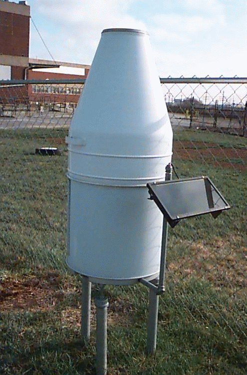 [Fischer-Porter Recording Rain Gauge with real time measurements. From NOAA]
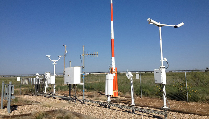 [ASOS at the Childress Municipal Airport in Childress, Texas. From NOAA]
Beginning in the mid-2000s, the NWS, which provides the C-HPD observations, began converting its network of precipitation gauges from punched paper recording to digital recording. Along with this upgrade, NCEI has also completed a transition from a processing system largely reliant on manual digitization and quality assurance to a fully automated ingest and quality control system. Previously, data values took six months or more to prepare for official release. Working in coordination with the NWS Weather Forecast offices, NCEI now provides the data to the user community shortly after they arrive.
[Fischer-Porter Recording Rain Gauge with real time measurements. From NOAA]
Precipitation Data Origins
C-HPD provides observations of hourly precipitation amounts from as early as the 1940s to the present, although the earliest dates vary considerably by state and region. These data, which are mainly collected in rural and suburban areas of the country, complement precipitation observations collected by other observing systems such as the Automated Surface Observing System (ASOS) that are located primarily at major airports, and the U.S. Climate Reference Network stations, which are located in many of the most ecologically pristine locations in the country such as National and State Parks.
[ASOS at the Childress Municipal Airport in Childress, Texas. From NOAA]
Uses of Hourly Precipitation Data
NOAA’s products and services support planning, resilience, and economic vitality, impacting more than one-third of America’s gross domestic product. Uses of C-HPD range from climate monitoring to engineering and construction. The C-HPD dataset helps ensure the spatial coverage necessary for conducting hydrological studies for engineering, design, and construction, and for aiding the understanding of climate variability and change in the United States.All Weather News
More


Tropics: Fausto Heads towards Hawaii; Genevieve a Major Hurricane
PacificTropical Depression Fausto continues t
29 Jul 2026 10:15 AM

Flooding Risk Increases as Heavy Rain Targets the Tri-State Area
New England - Along with the threat of severe
29 Jul 2026 10:10 AM


Southeast Flood Risk Lingers Near Stalled Front
A stalled boundary over the Southeast will ke
25 Jul 2026 10:55 AM

Another Round of Storms Targets the Northeast
Tuesday brought severe weather again across p
23 Jul 2026 1:15 AM