Band of Heavy Snow from the Ohio Valley to the Northeast
Special Stories
13 Feb 2020 7:00 AM
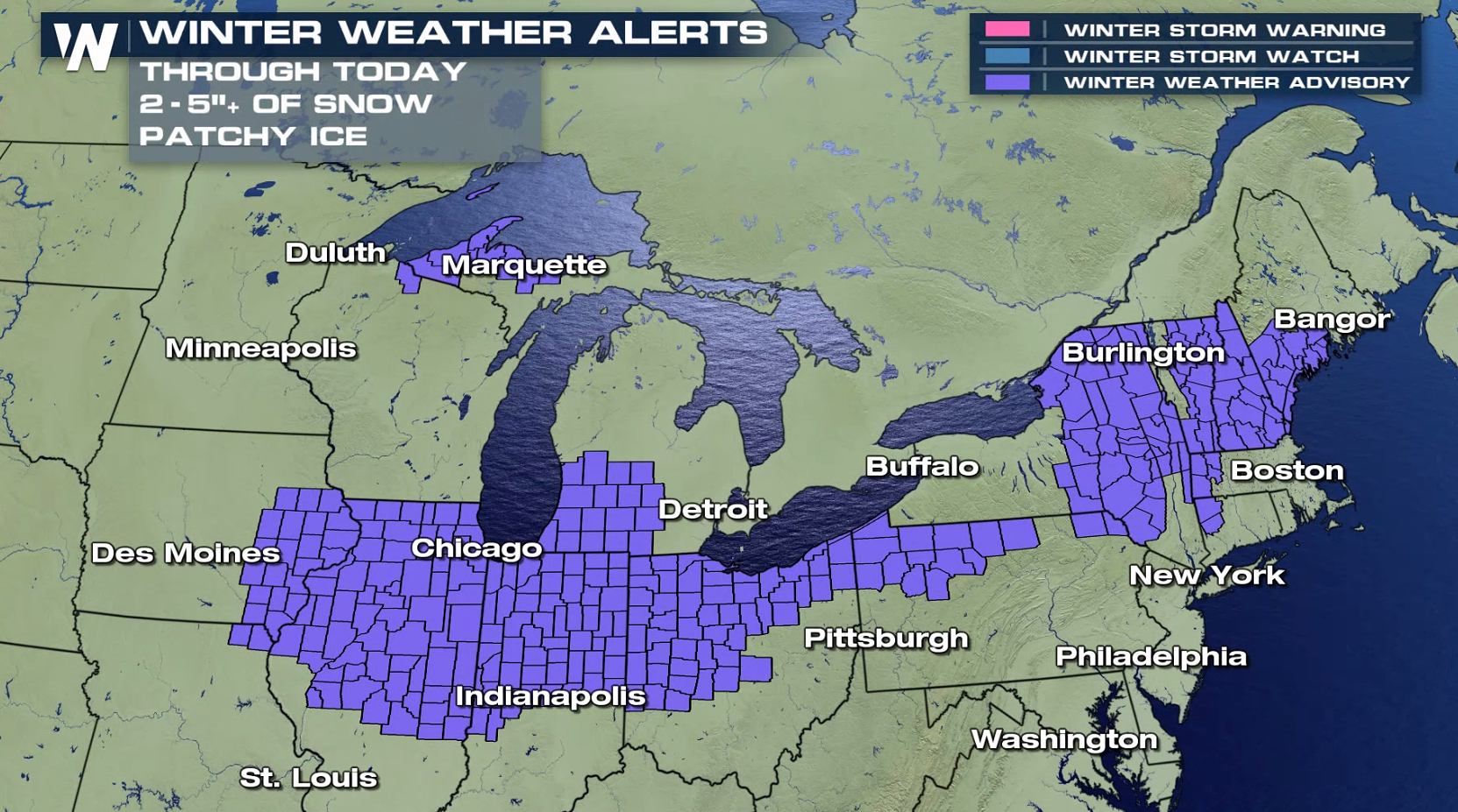
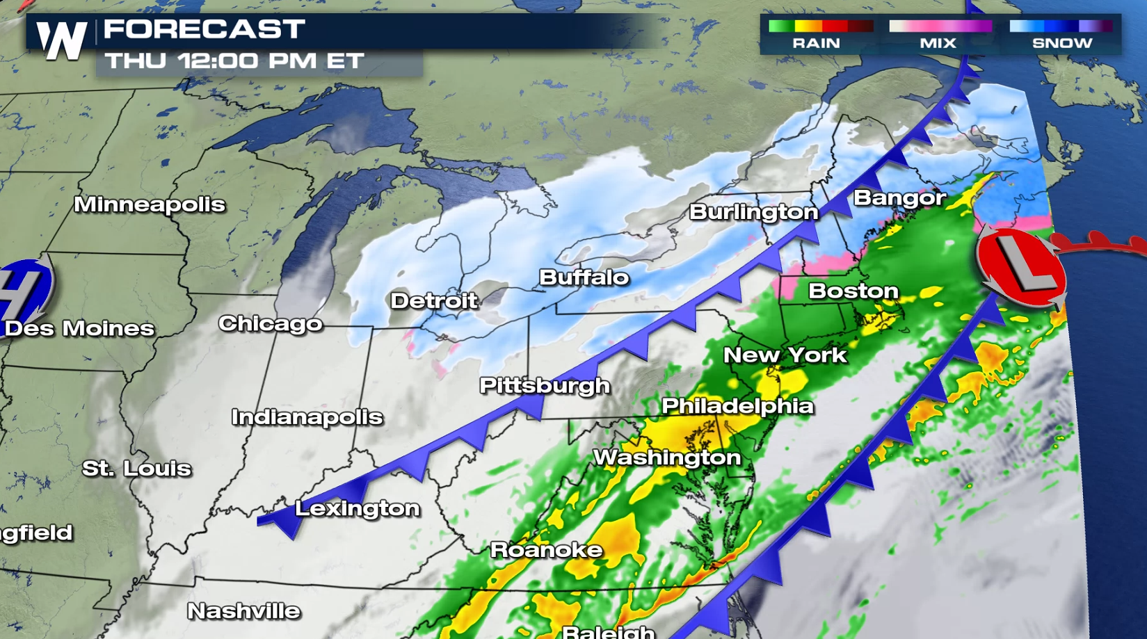
A storm system sweeping from the Ohio Valley into the Northeast will produce a swath of heavy snowfall. Cold air plunging southward coupled with moisture moving north will create significant accumulations. Winter weather alerts extend from New England to the Southern Plains.
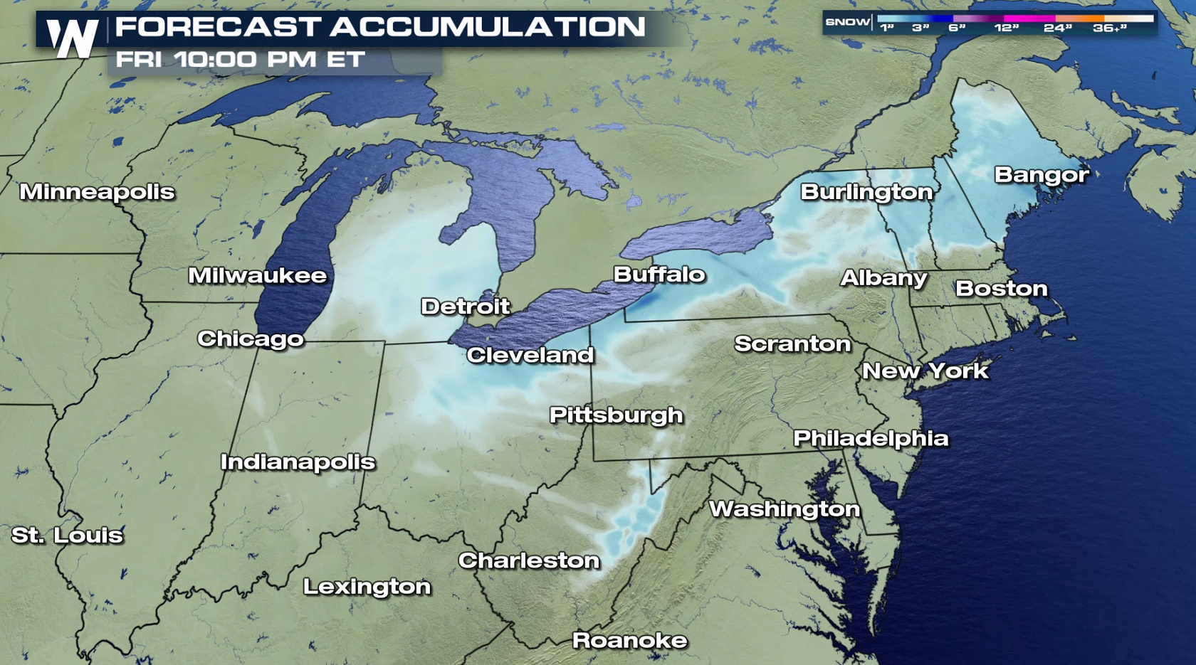
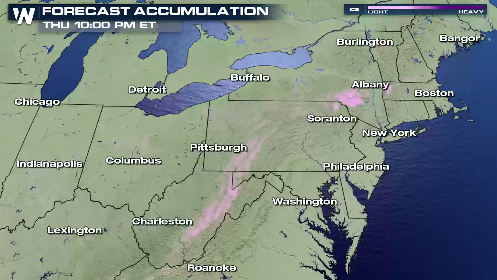
 A band of heavy snow behind the low pressure center will create 3" to 6" snowfall accumulations. Near the Great Lakes, totals will be enhanced and may approach a foot. Some freezing rain and sleet may produce icy areas.
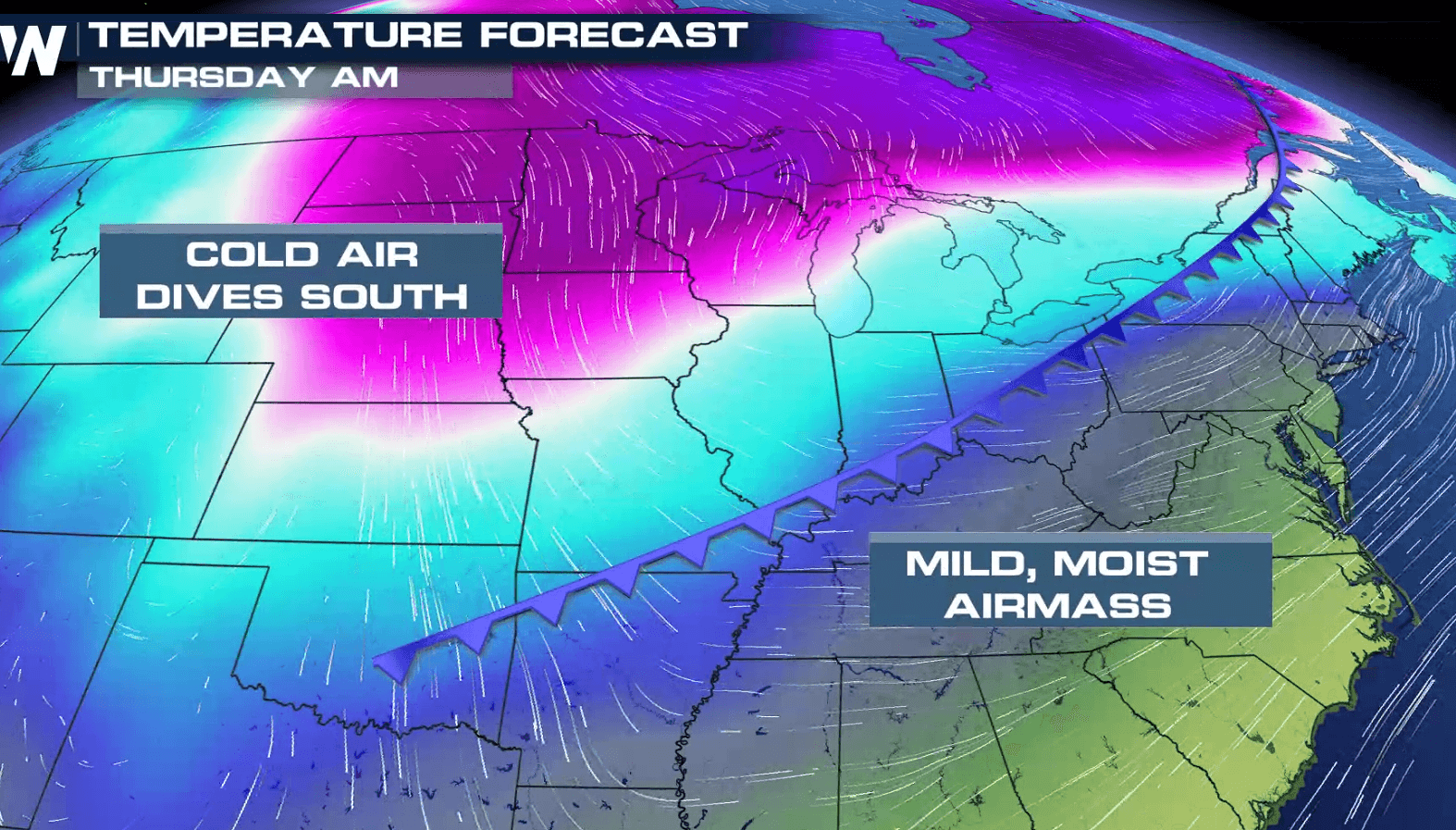
 The low pressure center will move away from the Northeast and into the Atlantic today (Thursday). Humidity is already in place from the Gulf of Mexico as an arctic cold front drops southward, bringing the cold air. This will setup the band of heavy snow.
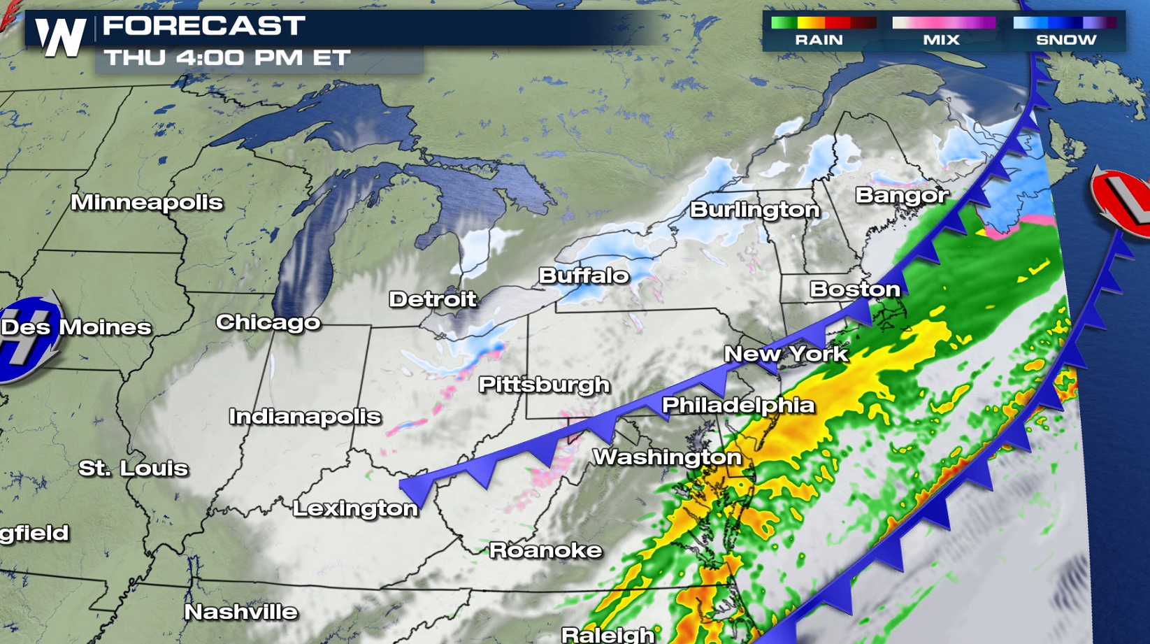
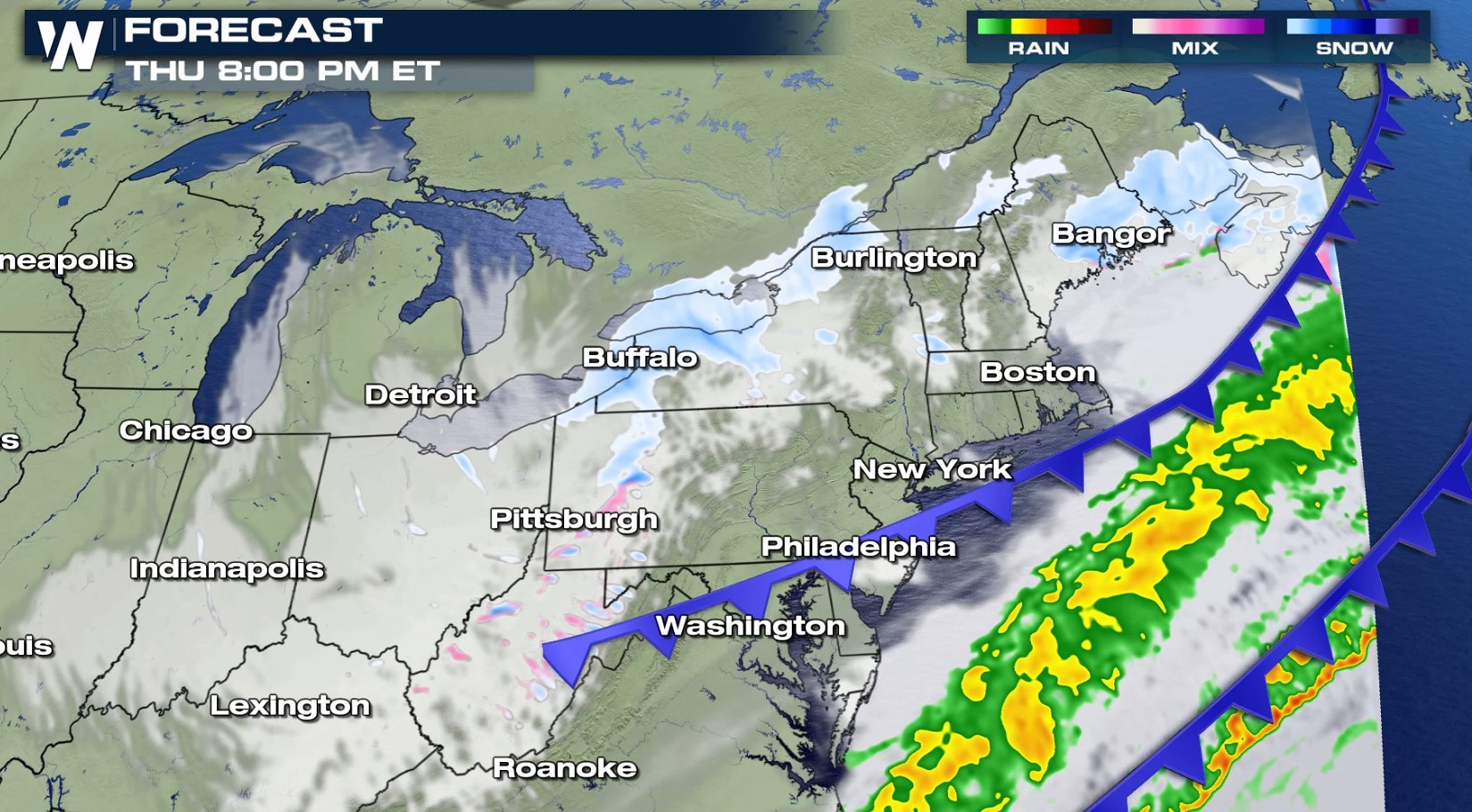 Be prepared for slow travel conditions and keep up-to-date on the latest information with WeatherNation.
A band of heavy snow behind the low pressure center will create 3" to 6" snowfall accumulations. Near the Great Lakes, totals will be enhanced and may approach a foot. Some freezing rain and sleet may produce icy areas.
The low pressure center will move away from the Northeast and into the Atlantic today (Thursday). Humidity is already in place from the Gulf of Mexico as an arctic cold front drops southward, bringing the cold air. This will setup the band of heavy snow.
Be prepared for slow travel conditions and keep up-to-date on the latest information with WeatherNation.All Weather News
More
Wildfire Outbreak in the Pacific Northwest
SPOKANE, WA - On Saturday, August 1st, the Ol
3 Aug 2026 1:55 AM

More Storms for the East Through Monday
A low-pressure system that moved through the
3 Aug 2026 1:50 AM


After Reaching Category 5, Genevieve Weakens in the Pacific
PacificGenevieve formed last Friday south of
3 Aug 2026 12:30 AM

Flooding, Severe Storms Target the Midwest Again
After an active week of storms across the nor
1 Aug 2026 1:40 AM

Flooding Risk Increases as Heavy Rain Targets the Tri-State Area
Tuesday, heavy rainfall moved across the Nort
30 Jul 2026 12:25 AM

Severe Weather: Energy From the Midwest Now in the Southeast
UPPER MIDWEST - Through Monday, dangerous tor
29 Jul 2026 10:30 PM