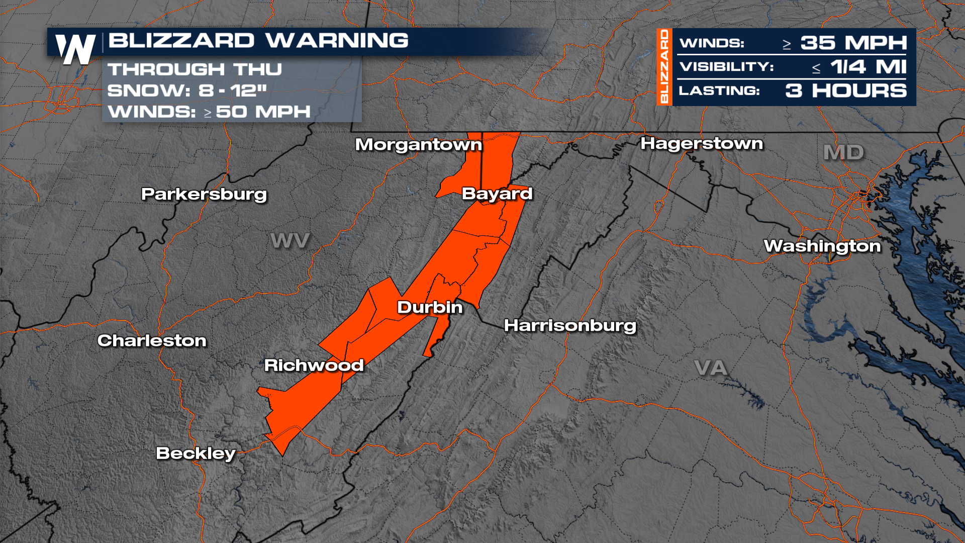
Blizzard Alerts Issued In West Virginia

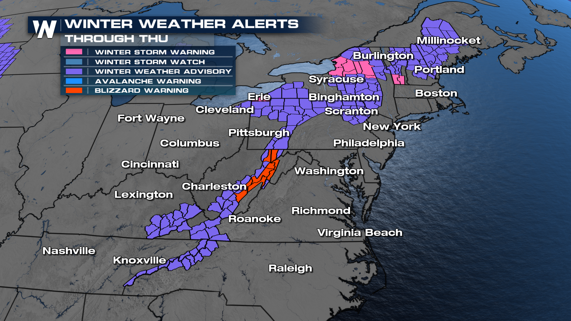
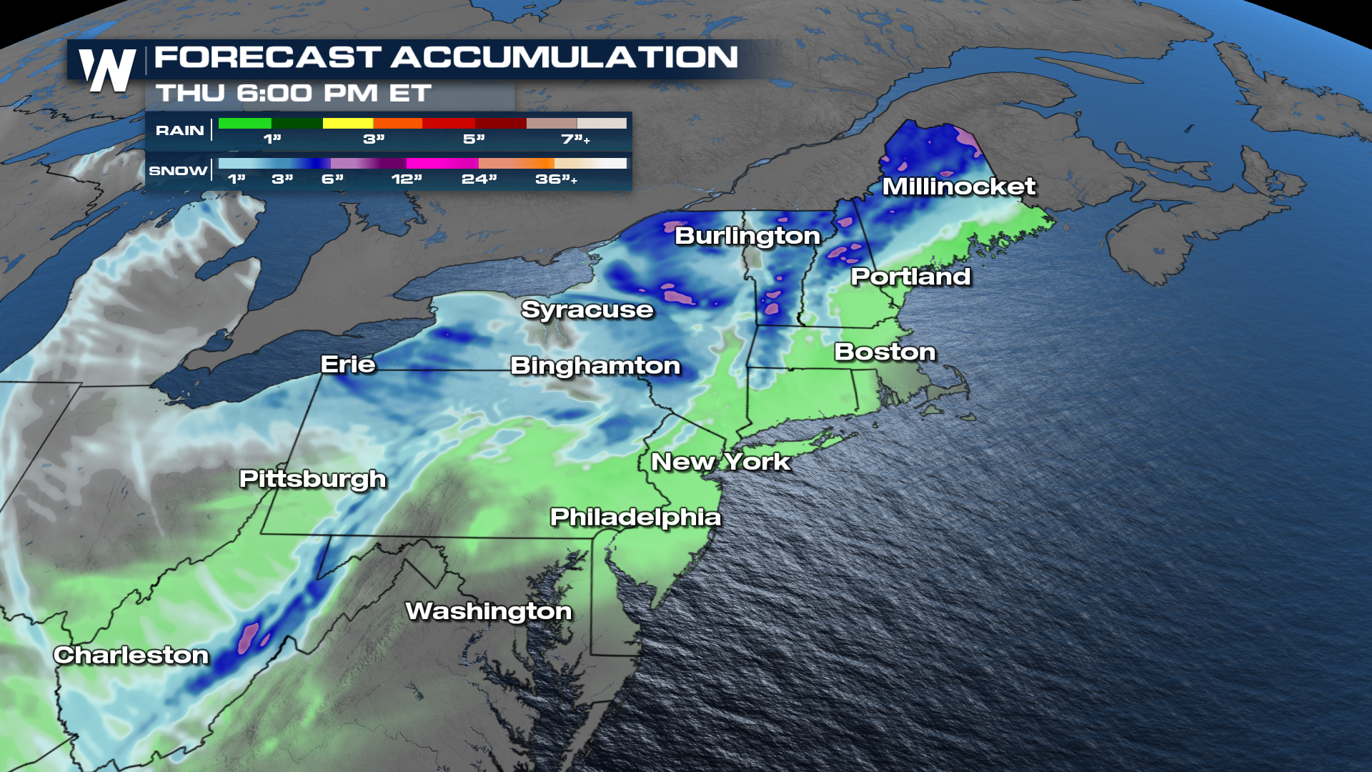
NORTHEAST - The northeastern U.S. is in for some wintry weather over the course of the week, with a couple of clipper systems dropping down from the northern Plains. The clippers continue with a fast-moving clipper system that will move out of the Upper Midwest and into the interior of the Northeast on Wednesday. This system will bring a brief but disruptive round of winter weather to several states. As the system pushes east, a wide swath of Winter Weather Advisories and Warnings is issued across the Interior Northeast and the higher elevations of the Appalachians. Snowfall totals across this region will range from 4 to 6 inches.
One of the most significant impacts will come from a corridor of Blizzard Warnings in the Central Appalachians. In this region, snow accumulations of three to six inches combined with wind gusts up to 50 miles per hour will create dangerous whiteout conditions and severely reduced visibility. Travel will be extremely difficult to nearly impossible at times, as blowing snow-coated roads and obscured sight lines will be possible.
Farther north, Snowfall totals will be even heavier in the snowbelts, where lake effect snowfall is expected to pick up throughout the week. Communities across the Tug Hill Plateau and the western Adirondacks can pick up up between 8 and 16 inches of snow, continuing an active stretch of winter weather for upstate New York.
 Winds will be a problem for visibility late Wednesday into Thursday as the front moves through. Widespread 30-40 mph gusts are expected.
Another clipper is forecast to track quickly behind it on Thursday, threatening parts of the Northern High Plains and the Ohio Valley with a mix of heavy snow and pockets of freezing rain. In anticipation, Winter Storm Watches are already issued in eastern Montana, signaling the potential for another round of hazardous travel and wintry disruptions.
Be cautious because the air will turn cold later this week in places that receive rain from these clippers, while the roads remain wet, black ice could be a problem at the end of the week.


