Blizzard Conditions Through Tonight in the Upper Midwest
Top Stories
1 Feb 2022 7:30 AM
A fast moving clipper-type weather system is bringing strong winds to the Upper Midwest, creating blizzard conditions today. Travel will be difficult, if not impossible at times in the Red River Valley of North Dakota and Minnesota.
https://twitter.com/MSPPIO_NW/status/1488508454306201605
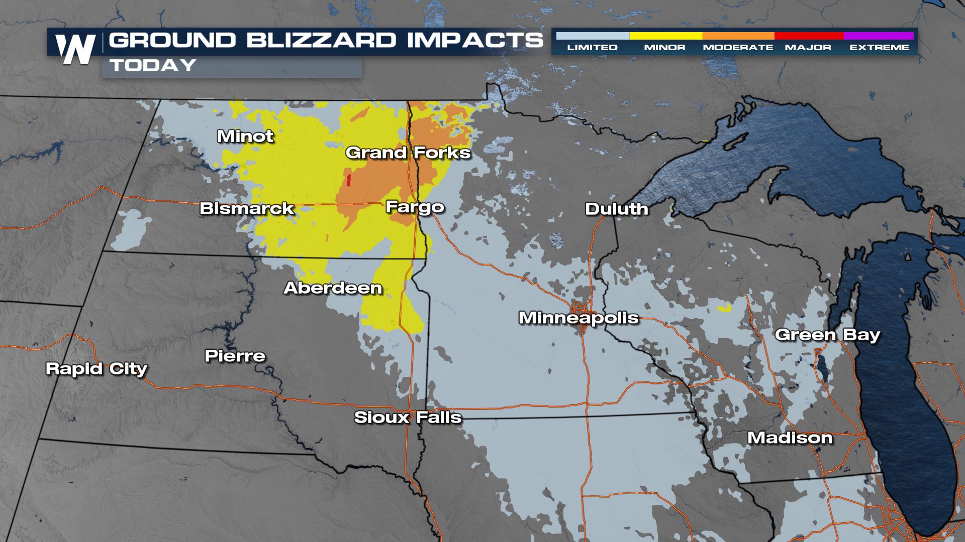
 The Winter Storm Severity Index is highlighting some spots in North Dakota and northwest Minnesota for moderate ground blizzard impacts for Tuesday. Low visibility, white out conditions, plus finger and pillow drifts are possible across roadways. Some road closures may occur. Conditions will be improving through the evening hours and into Wednesday.
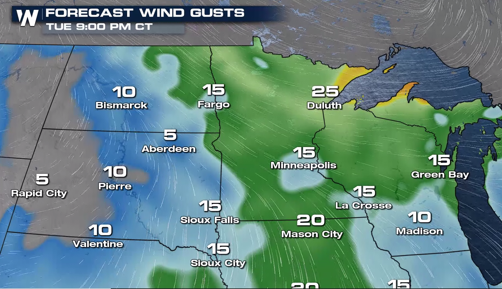
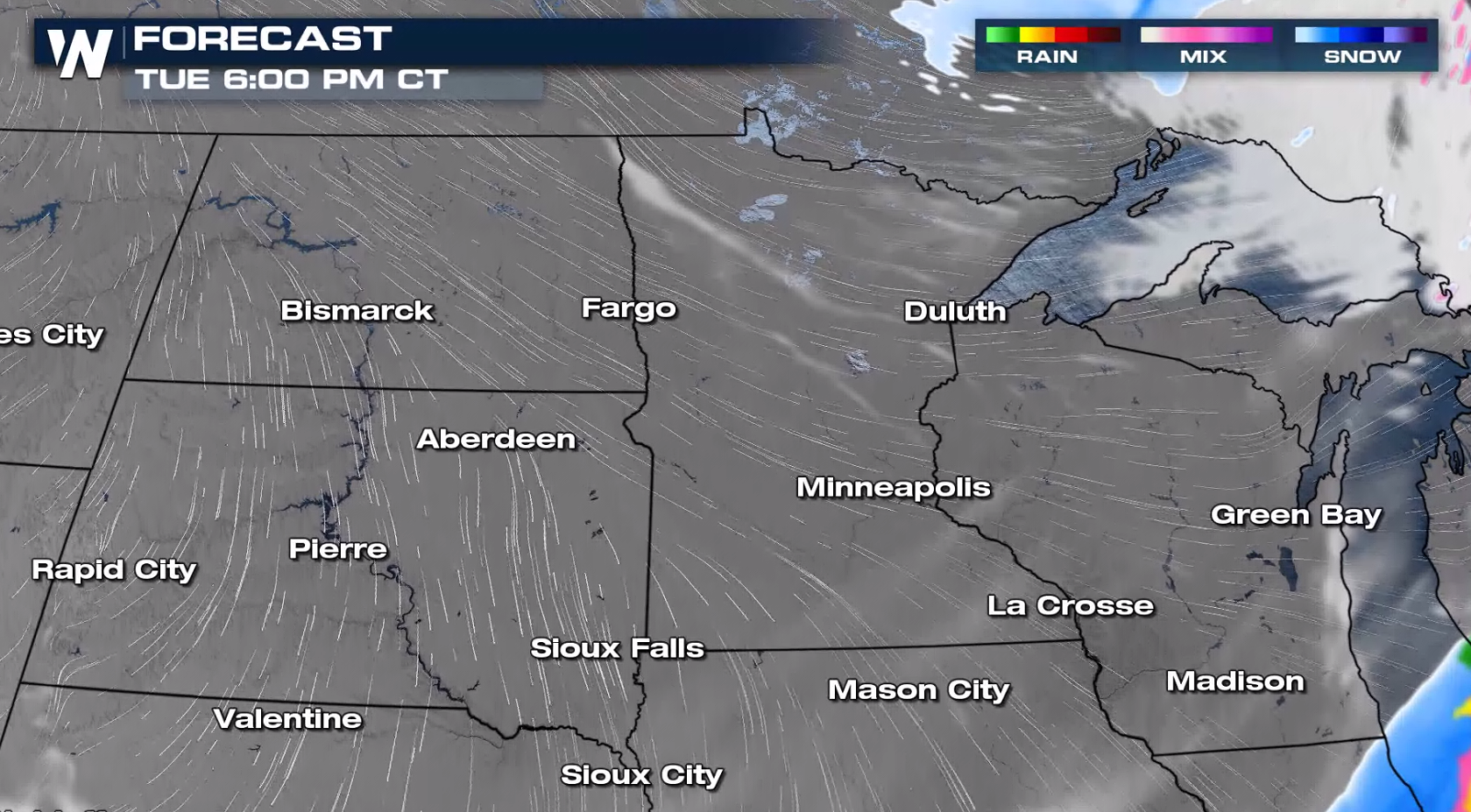 Low visibility and near white-out conditions will be possible as the wind remains strong across the Red River Valley of the North.
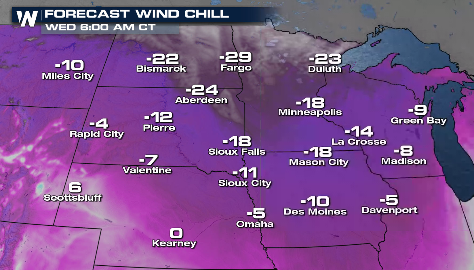
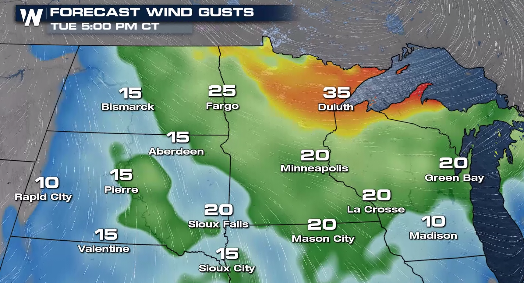 The wind will start to diminish this evening, but still remain brisk, creating bitter wind chills.
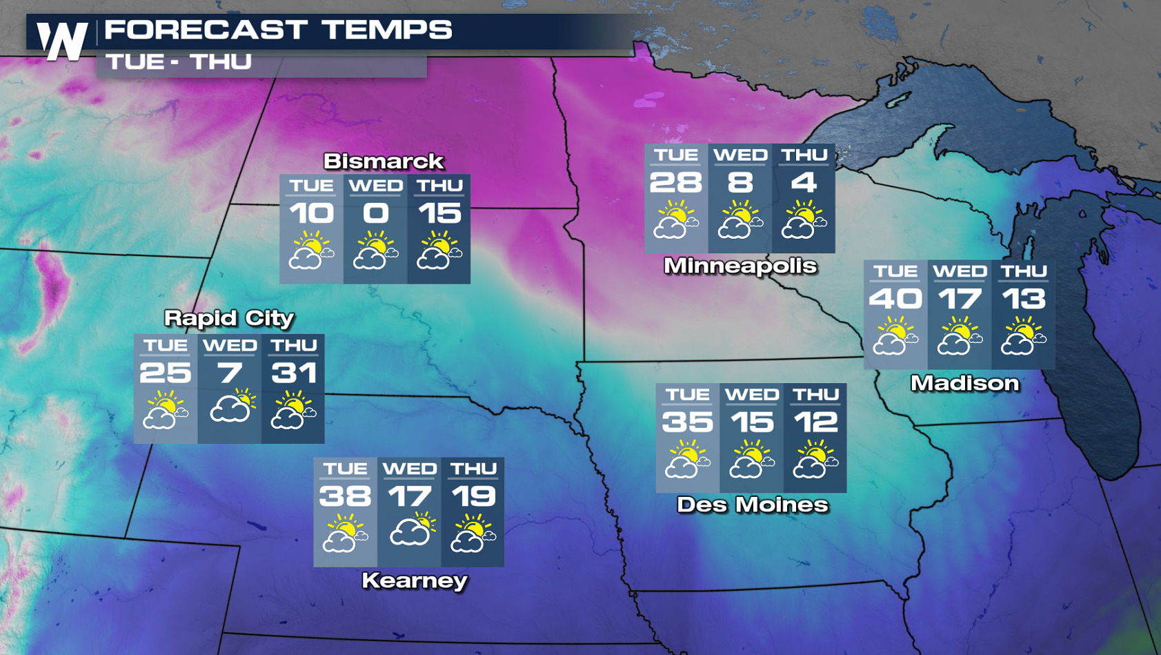 Behind the cold front, temperatures will tumble for the middle of the week. With a persistent breeze Wednesday morning, the wind chills will become subzero across the Upper Midwest, dropping to 20 to 30 below in parts of the Dakotas and Minnesota.
 WeatherNation will keep you up-to-date on-air and online on the potential of blizzard conditions in the Upper Midwest.
Alerts
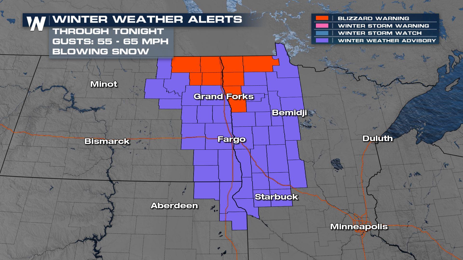
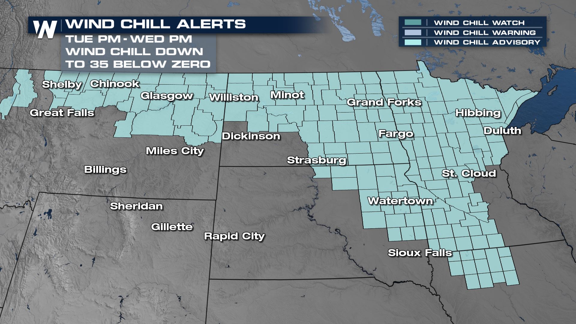
Blizzard warnings and winter weather advisories continue through tonight for the blowing snow. Winds up to 50 mph may produce blizzard-like conditions with near zero visibility.
The Winter Storm Severity Index is highlighting some spots in North Dakota and northwest Minnesota for moderate ground blizzard impacts for Tuesday. Low visibility, white out conditions, plus finger and pillow drifts are possible across roadways. Some road closures may occur. Conditions will be improving through the evening hours and into Wednesday.
Forecast
The low pressure center has moved into Ontario, dragging a cold front eastward across Lake Superior. Strong wind gusts will continue with snowfall amounts remaining minimal.
Low visibility and near white-out conditions will be possible as the wind remains strong across the Red River Valley of the North.
The wind will start to diminish this evening, but still remain brisk, creating bitter wind chills.
Cold
Behind the cold front, temperatures will tumble for the middle of the week. With a persistent breeze Wednesday morning, the wind chills will become subzero across the Upper Midwest, dropping to 20 to 30 below in parts of the Dakotas and Minnesota.
WeatherNation will keep you up-to-date on-air and online on the potential of blizzard conditions in the Upper Midwest.All Weather News
More
More Storms for the East Through Monday
A low-pressure system that moved through the
2 Aug 2026 10:40 PM

Wildfire Outbreak in the Pacific Northwest
SPOKANE, WA - On Saturday, August 1st, the Ol
2 Aug 2026 10:35 PM


After Reaching Category 5, Genevieve Weakens in the Pacific
PacificGenevieve formed on last Friday south
2 Aug 2026 6:25 PM

Flooding, Severe Storms Target the Midwest Again
After an active week of storms across the nor
1 Aug 2026 1:40 AM

Flooding Risk Increases as Heavy Rain Targets the Tri-State Area
Tuesday, heavy rainfall moved across the Nort
30 Jul 2026 12:25 AM

Severe Weather: Energy From the Midwest Now in the Southeast
UPPER MIDWEST - Through Monday, dangerous tor
29 Jul 2026 10:30 PM