Rounds of Snow Returning to the Midwest

If you were tired of dusting off the old snow shovel up north, you might want to avert your eyes. We have several waves impacting the Central U.S., with snow expected in the Plains and Midwest!
Temperature Drop
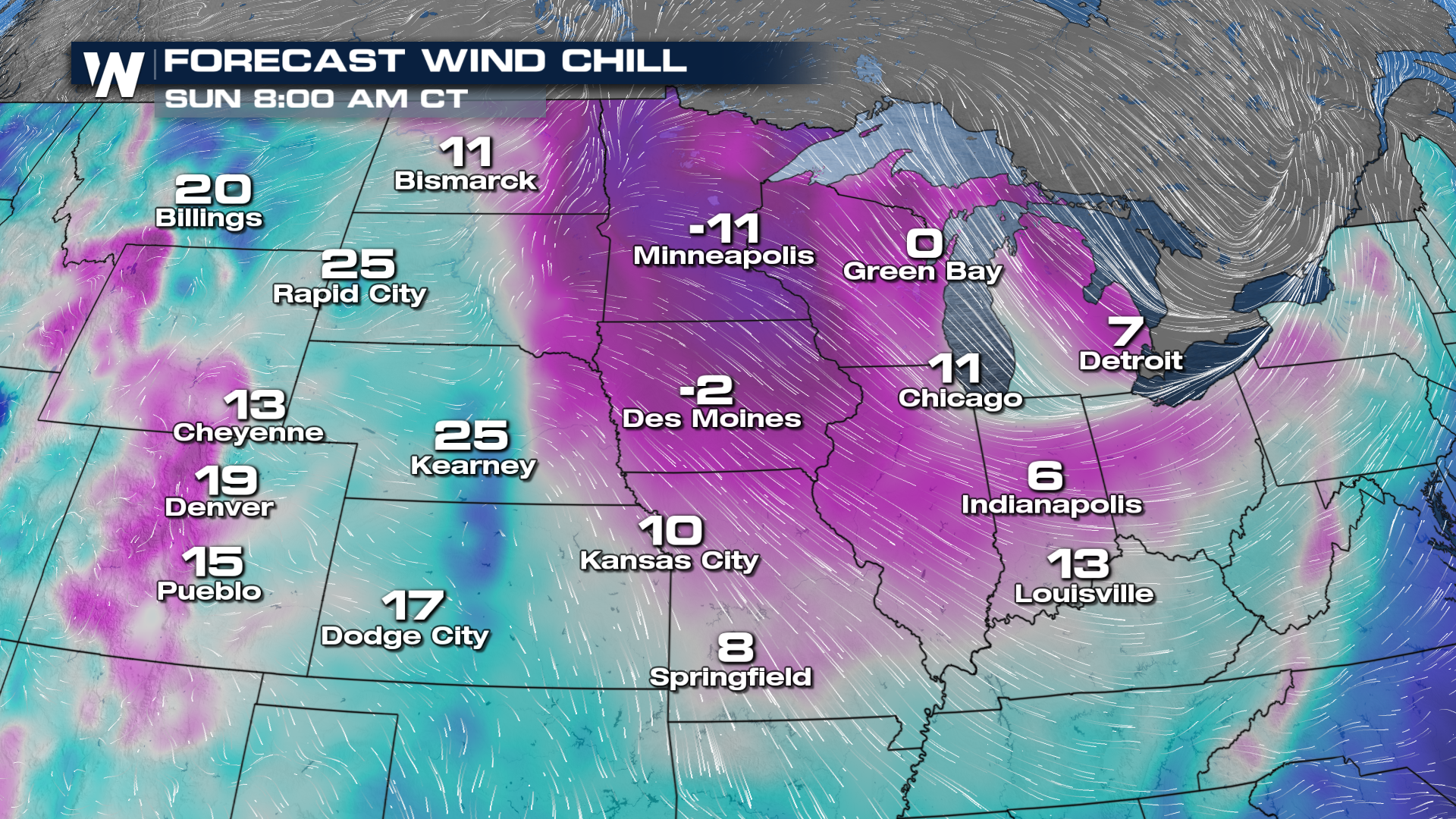
After the first low moves through on Thursday, temperatures are going to drop dramatically! This will set the stage for the second wave, where it'll have far cooler temperatures to work with, meaning ideal conditions for snow.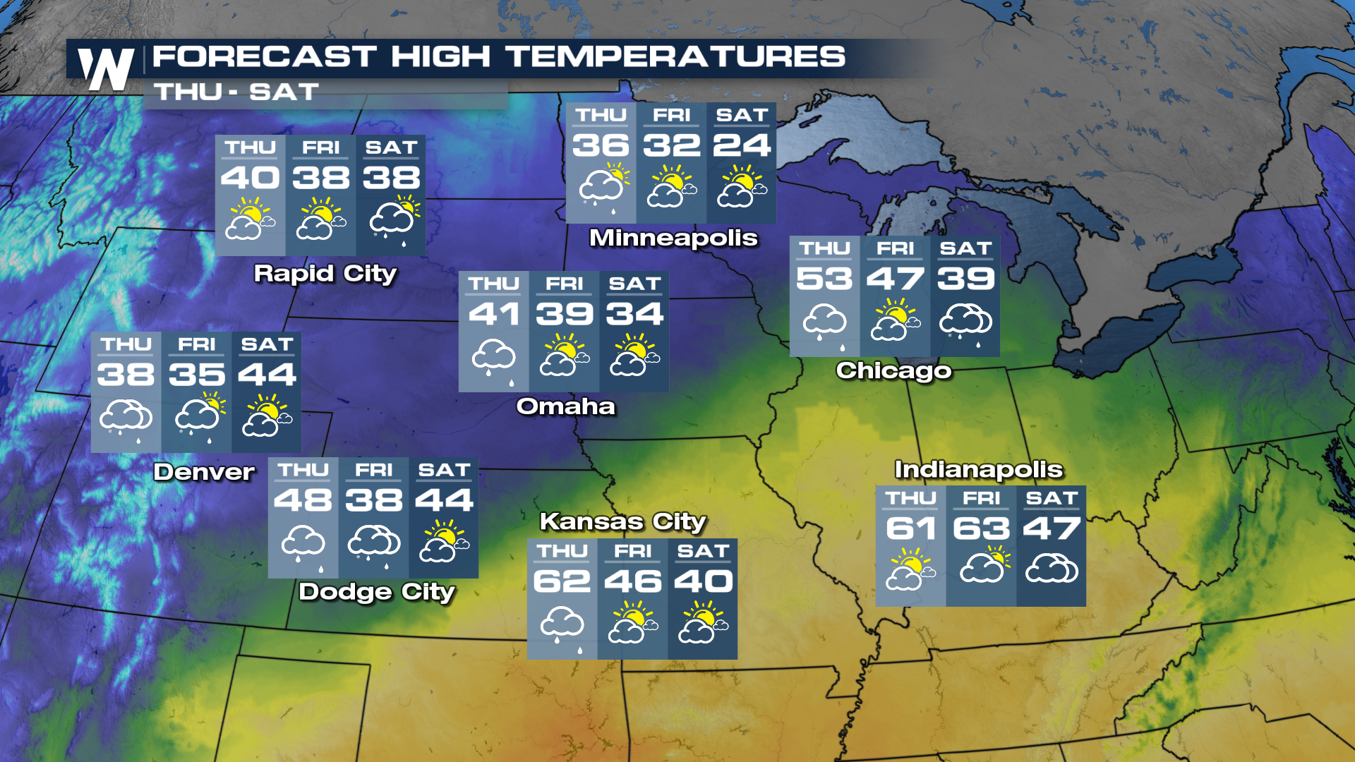 Wind chill values will also be impacted by these two waves, dropping some of these temperatures to well below zero.
Forecast & Timing
With relatively warmer temperatures ahead of the first wave, whether or not you get snow, rain, or even freezing rain will depend on how far north and west you are. Rain will likely start to change to sleet and snow around I-35 in Minnesota Thursday evening, with this band of wintry weather pushing across Northern Wisconsin and the U.P. of Michigan overnight. As that first low clears to the east, the next round of snow will begin to develop Friday afternoon in the Upper-Midwest along the base of a trough. As gulf moisture meets this trough, widespread snow is expected to develop around the Great Lakes and Upper-Midwest. Snow will wrap around the low as it gradually moves across the Great Lakes through Sunday morning.
Areas east of the Dakotas are expecting 1-3 inches of snow, with some areas expected 3-6 inches (dark blue into purple color). Heaviest snow is expected around the Great Lakes in northern Michigan and eastern Wisconsin. 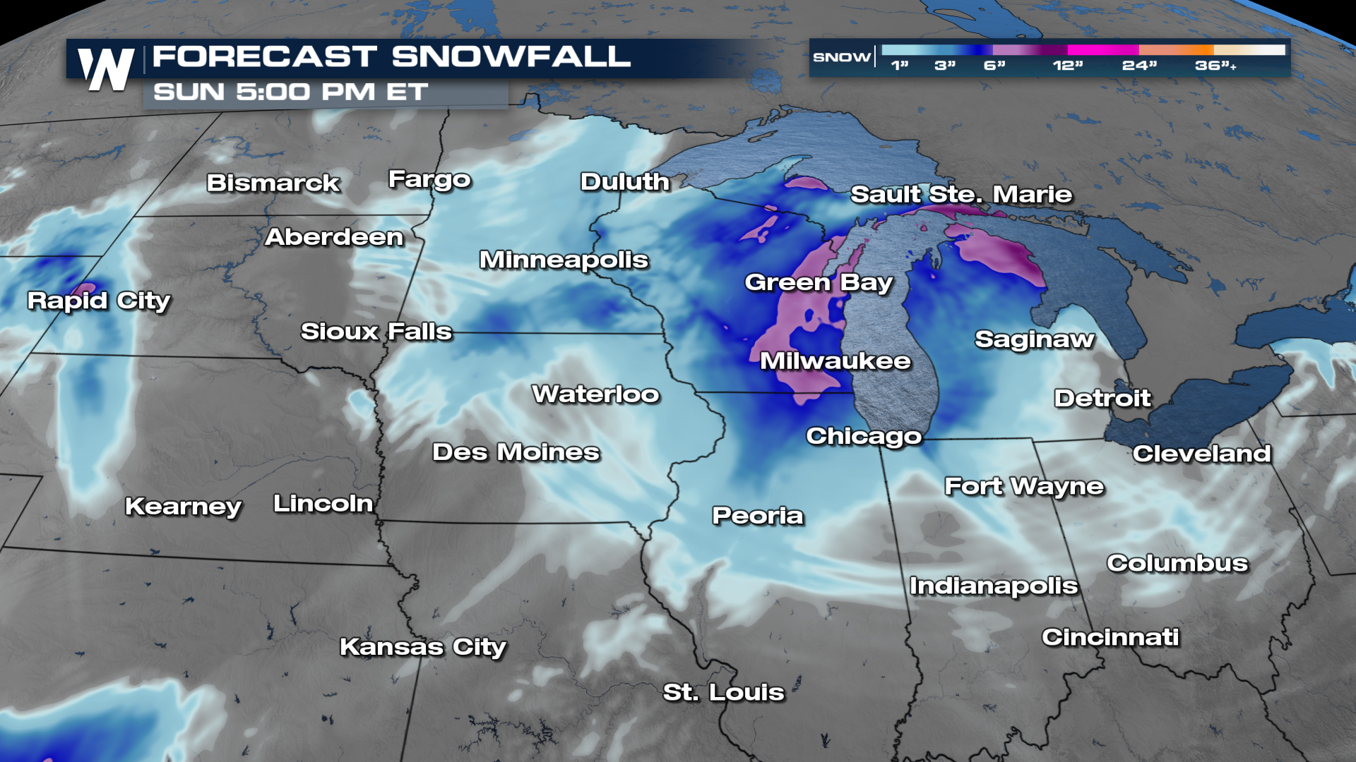 For the latest in the Central Region, tune in live at :30 past the hour or get it on demand anytime with the WeatherNation app!


