Snow Squalls In The Northeast

The Northeastern U.S. has been one of the more active regions of the country so far this winter in terms of ice and snow, with plenty piling up around the Great Lakes and into New England. A warmer system brought rain and gusty winds to the Northeast on Friday, but another wet and colder system keeps some snow around through tonight. Winter Weather Alerts (above) have been issued for parts of New England.
Looking Ahead This Week
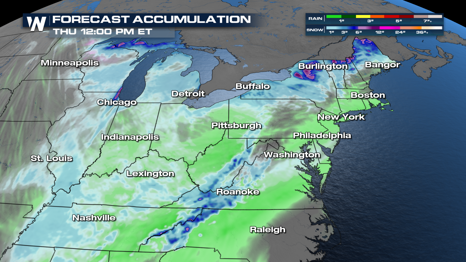
Another wave of rain, snow, and cool air will keep the Northeast active this week.
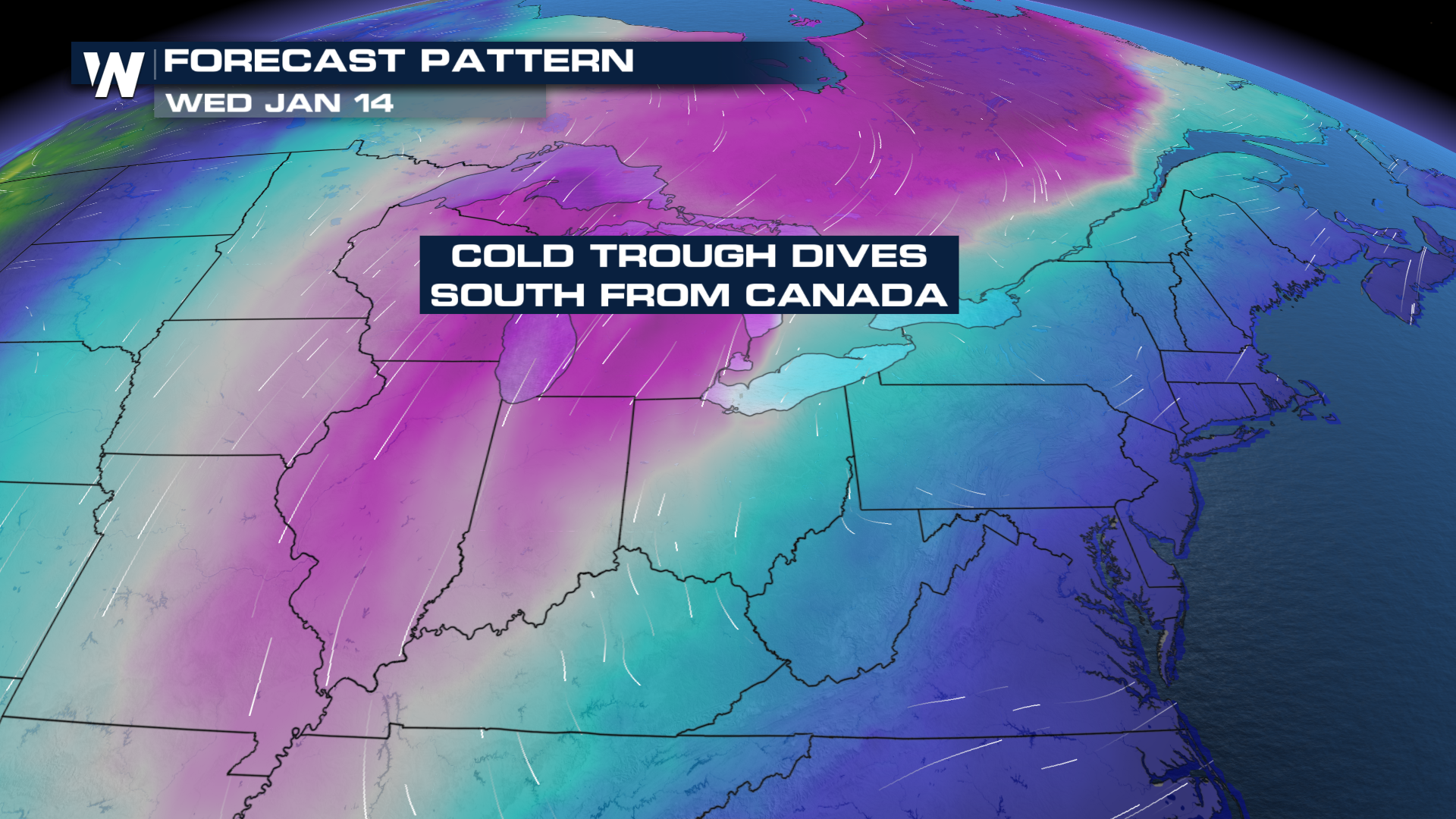 Moisture will start out over the Great Lakes and move into the Northeast. Areas across the Mid-Atlantic and Ohio Valley will also see some rain and snow out of this next wave midweek.
Accumulations will not be impactful, but this is still something to be on the lookout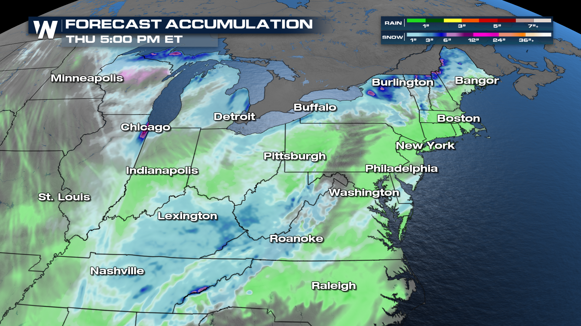 for this week.
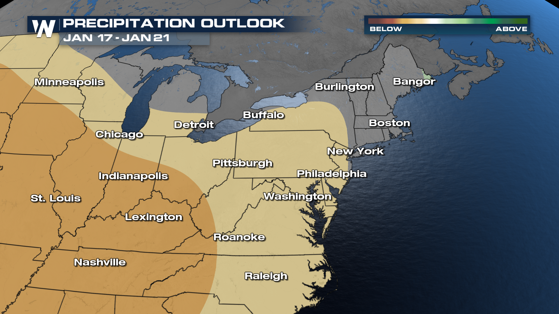
Longer-range, the precipitation outlook for the Northeast has a drier than normal pattern.
Get the latest in the Northeast in the East Regional Forecast anytime with the WeatherNation app - or tune in live at :10 past the hour!


