Severe Chances Ride Along Front Tonight

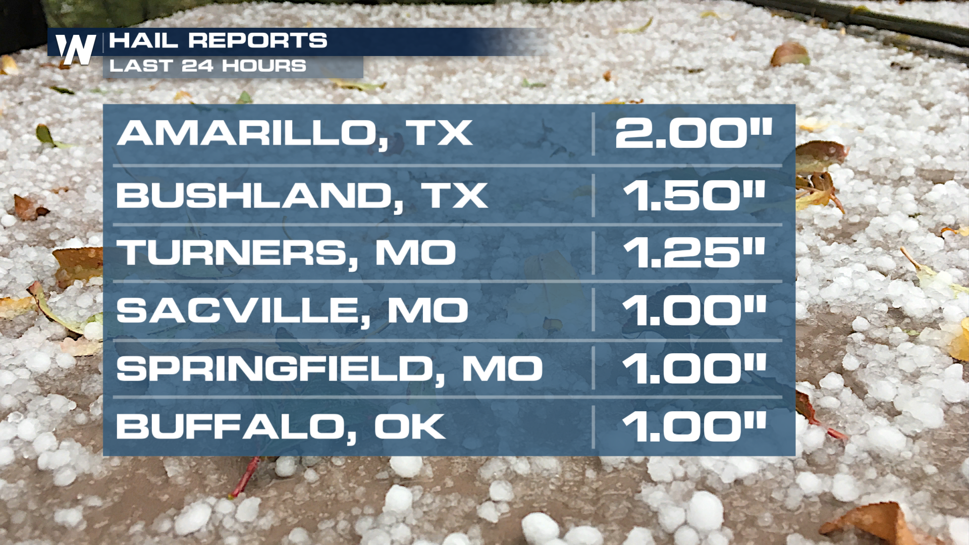
Storms rumbled through the Plains early Wednesday. The strongest storms kicked out hailstones 1-2 inches in diameter on Wednesday morning! That will be an appetizer for the severe threat unfolding for the rest of the week!
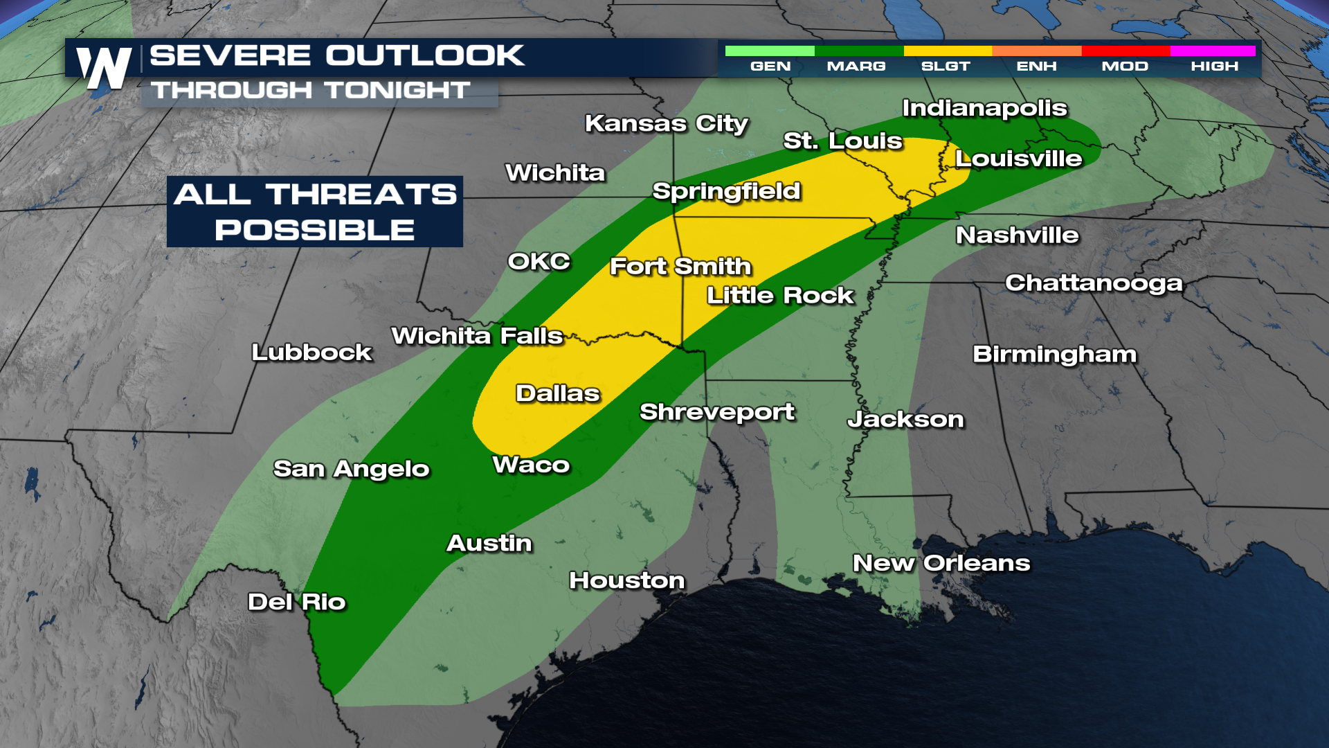
Outlooks
The Storm Prediction Center has issued a SLIGHT risk for severe storms overnight with a threat for some tornadoes. This risk extends from Texas to the Ozarks to the Ohio River Valley. The threat of isolated to scattered severe thunderstorms with large hail, damaging winds, and a tornado or two is possible.
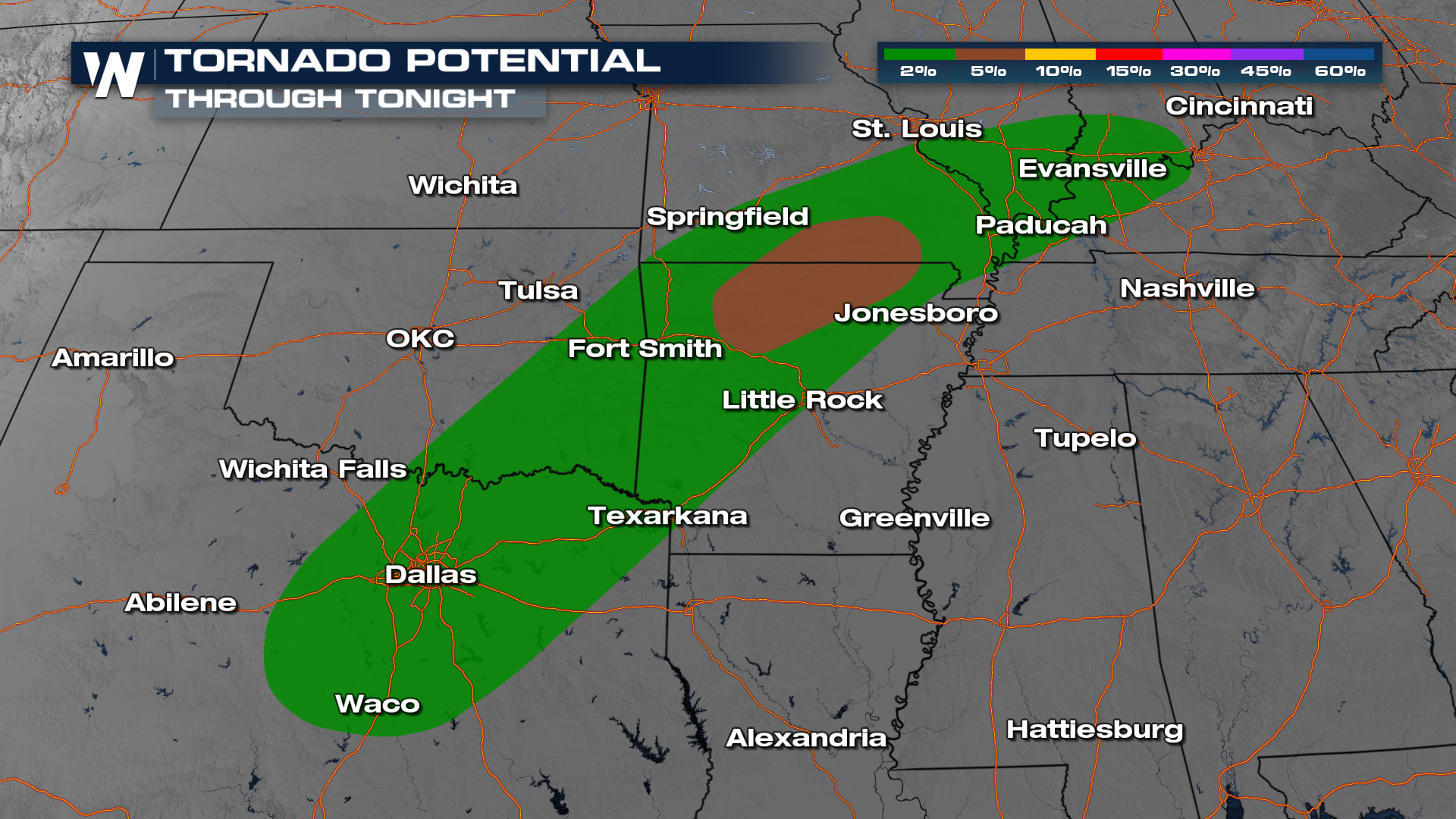
 Through tonight, the tornado threat is a little higher in northern Arkansas and into Missouri through the Ozarks.
Timing
Overnight, we still see storms around. Please have multiple ways to get alerts, as all threats, including tornadoes. As we head into Thursday, spots like Oklahoma and Arkansas will have storms around to start your day.


