Northeast: Snow & Ice Winds Down, Heavy Rain Ahead

Another round of wintry weather is taking aim at the Northeast once again. This time the impacts will be primarily from sleet and freezing rain, with some snow mixing in as well.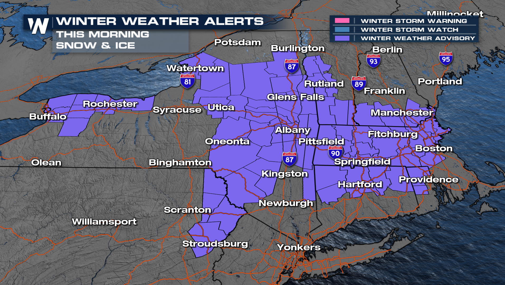
Winter weather alerts have been issued through Friday morning for a mix of sleet, freezing rain, and snow. Freezing rain could top three tenths of an inch in some areas, leading to power outages.
Sleet will be the more widespread freezing precipitation type, but freezing rai could target a few areas as well, notably higher elevation locations like the Worcester Hills, Berkshires, and Catskills.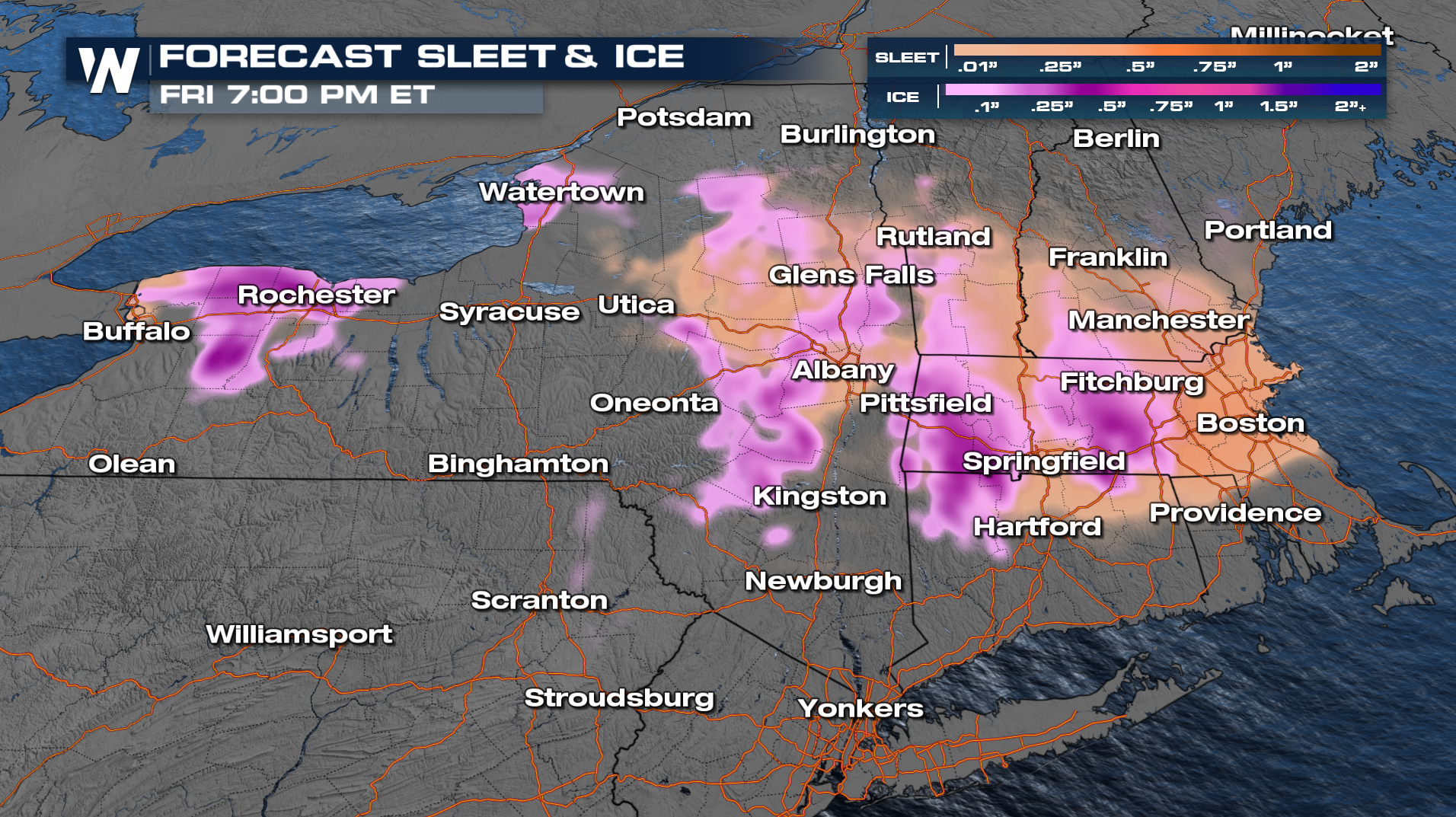
Snow should be on the lighter side, but a quick burst of Northeast winds Friday morning could lead to an hour or two of heavy snowfall rates. While the snow falls, expect roads to get slick very quickly.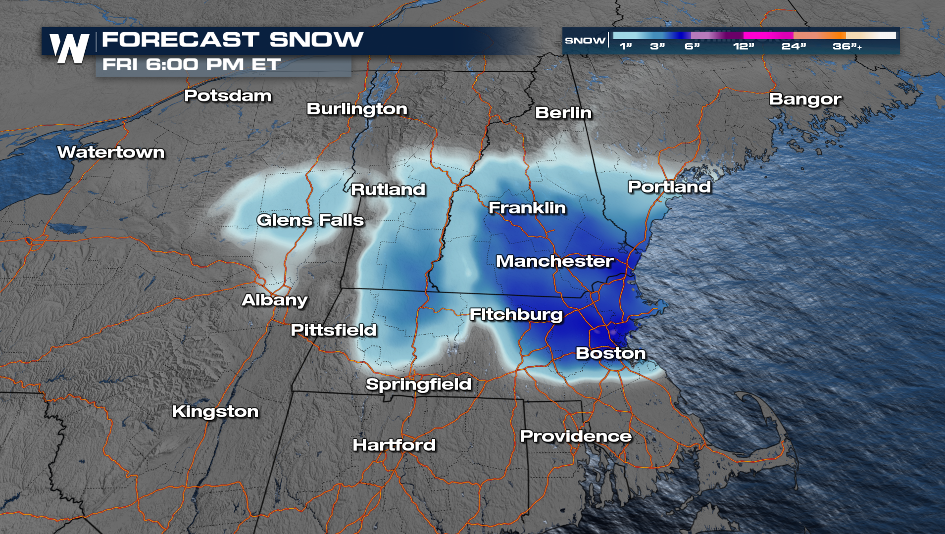
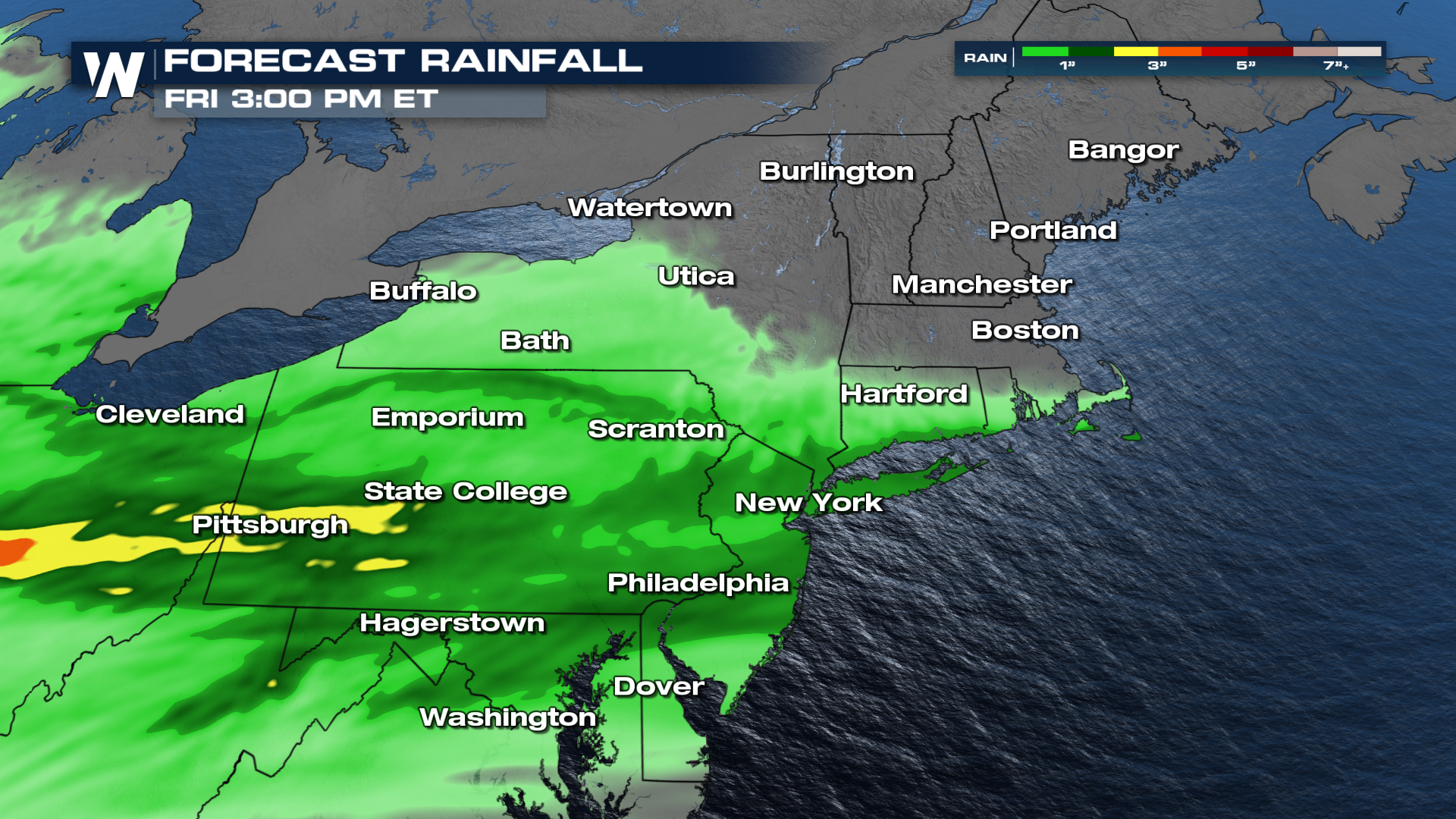
Across most of the Northeast, however, heavy rainfall is expected with our next system. Warmer temperatures will favor some of these high rainfall totals by the end of the work week. The heaviest totals we're seeing will likely reside across the Ohio Valley and the Mid-Atlantic region.
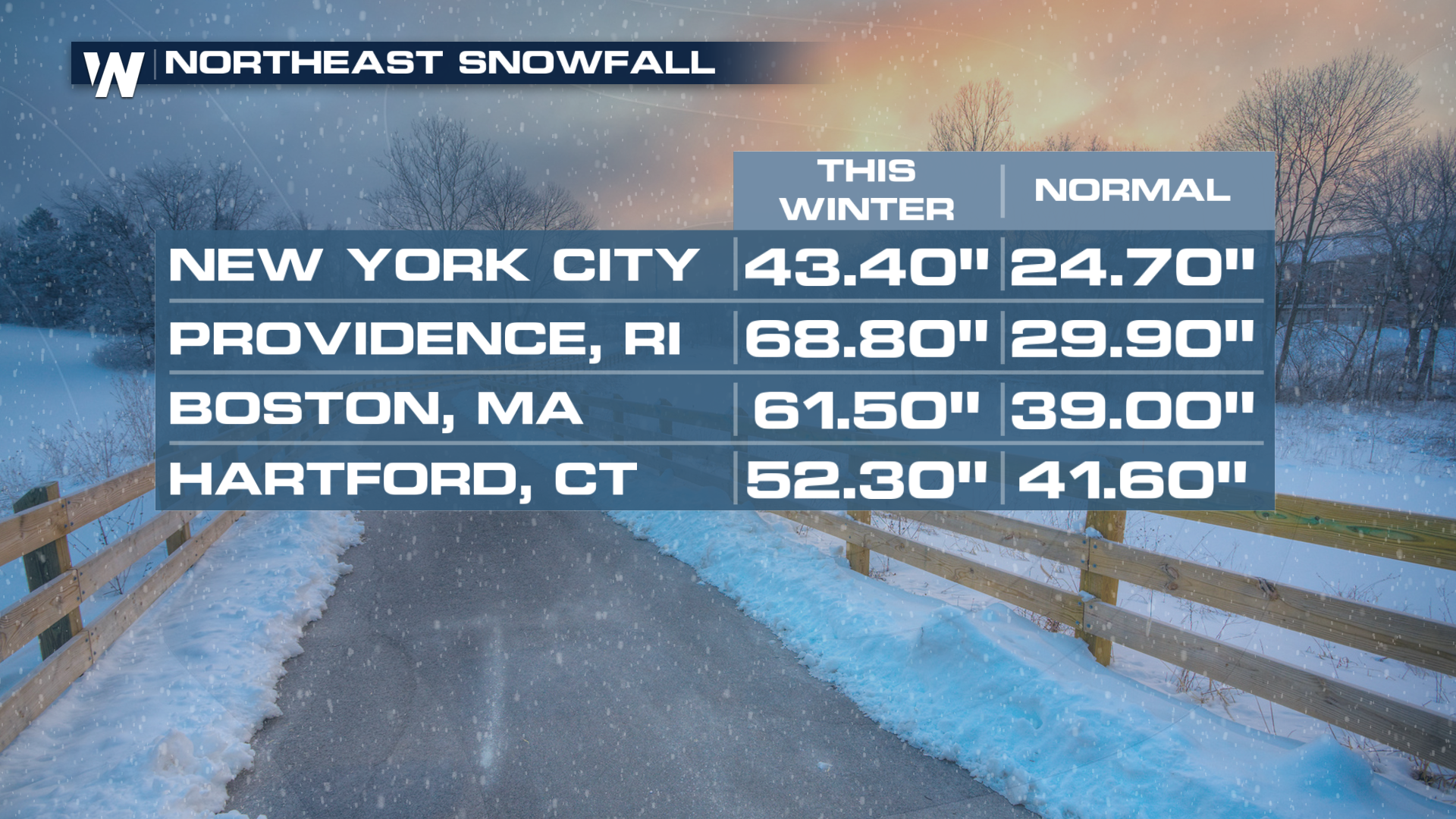
 It has been a snowy and cold winter across the Northeast. Check out some of the current snow totals for the season in comparison to what is normal for the season!
 More details can be found during your Eastern Regional Forecast, :10 past the hour on WeatherNation.


