Flooding, Severe Storms Target the Midwest Again

After an active week of storms across the northern U.S., another round of severe storms is expected in parts of the Midwest to end the week. A cold front will drop across the region, tapping into warm temperatures and abundant moisture to fuel storms.
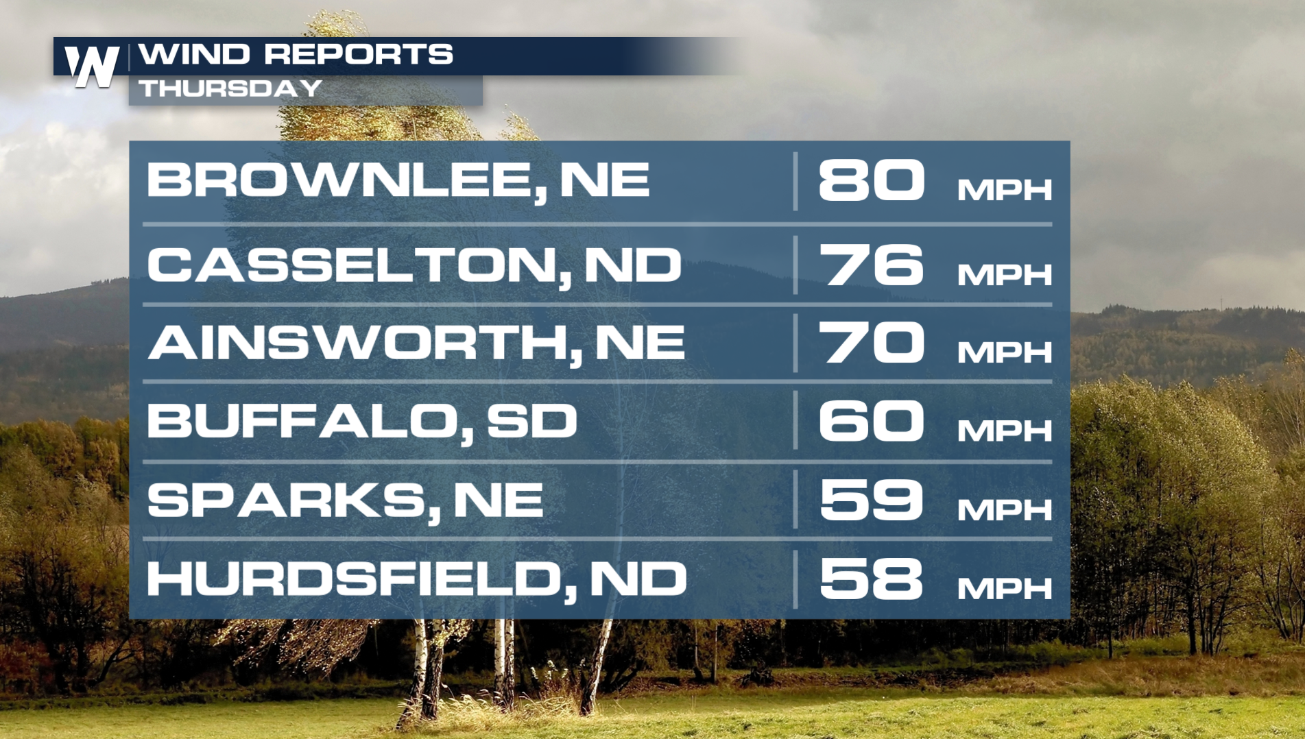
On Thursday, winds downed trees and heavy rain caused a few flash flooding issues. Gusts topped 80 mph in the strongest storms!
Severe Weather Outlooks
Tonight, a severe weather risk remains across parts of Missouri and Mississippi River Valley. However, the severe threat has looked minimal so far but don't let your guard down tonight.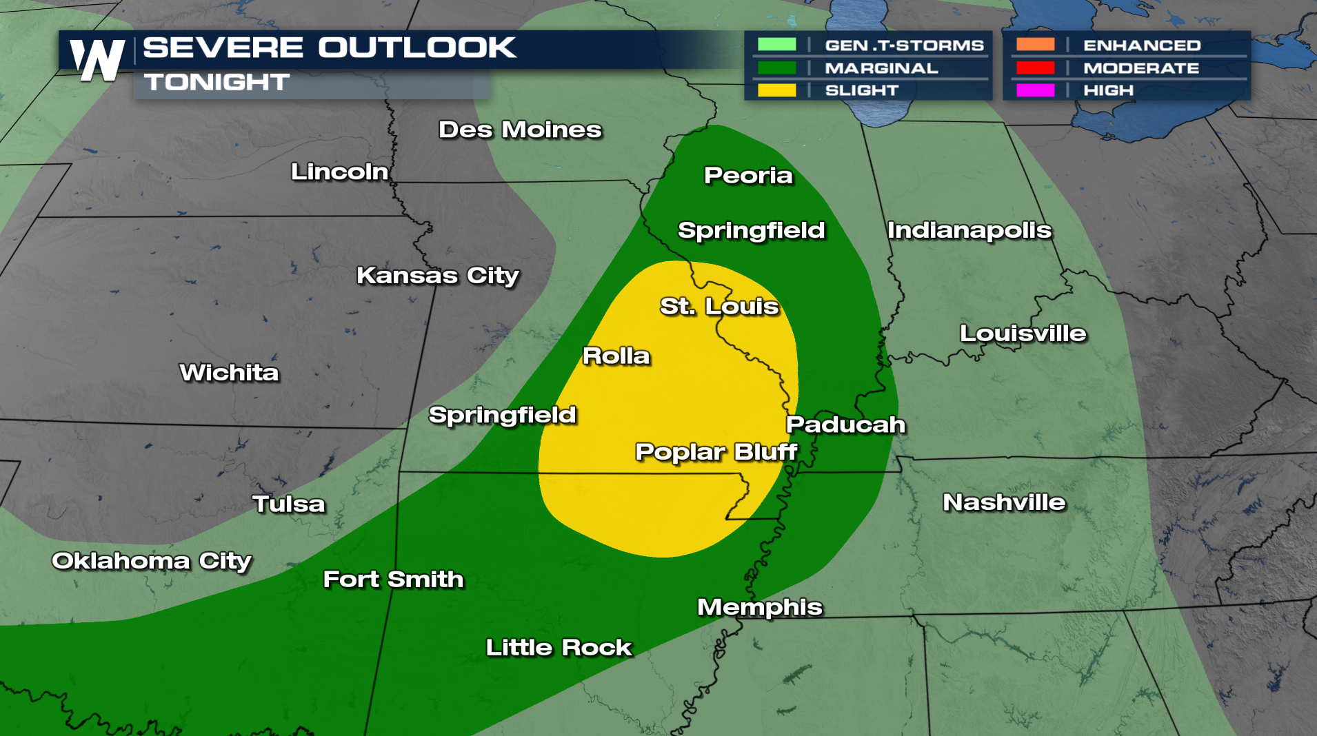
Forecast
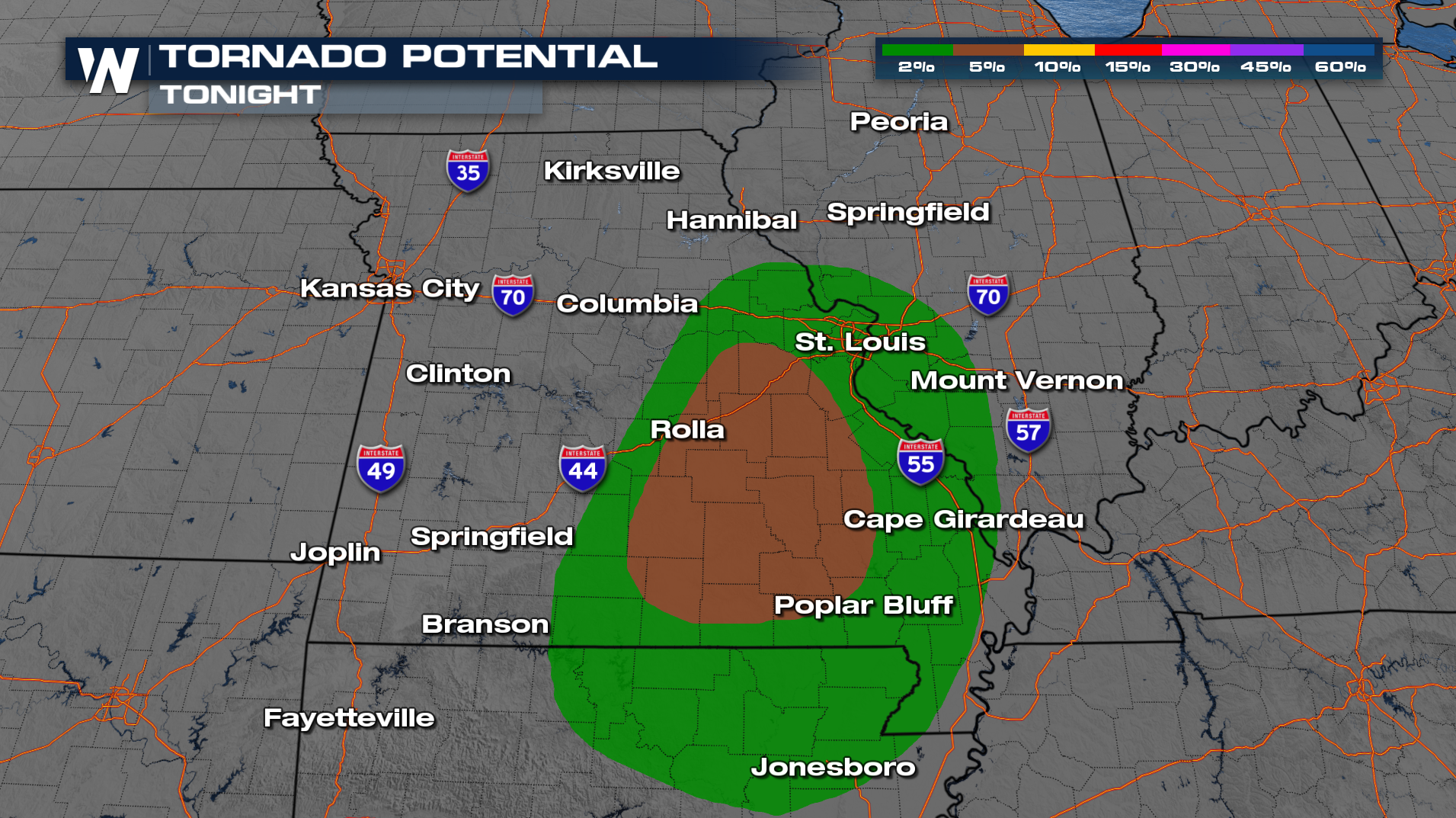
For the overnight, the highest severe threat will be across SE Missouri, Western Kentucky, and Southern Illinois. Storms should start to weaken after midnight across the Ohio Valley. People attending Lollapalooza in Chicago should stay aware of the weather and have a place to shelter in mind. North of the center of low pressure, moisture will continue to wrap counter-clockwise into Michigan, Wisconsin and Minnesota.
Heavy downpours also posing a threat for flash flooding. Rainfall totals could surpass 2-4 inches in some areas. Get the latest forecast for the Central Region on demand anytime with the WeatherNation app, or tune in to our feed at :30 past the hour!


