More Flooding Concerns Out East

Top Stories
22 Sep 2026 1:45 PM
WHAT TO EXPECT
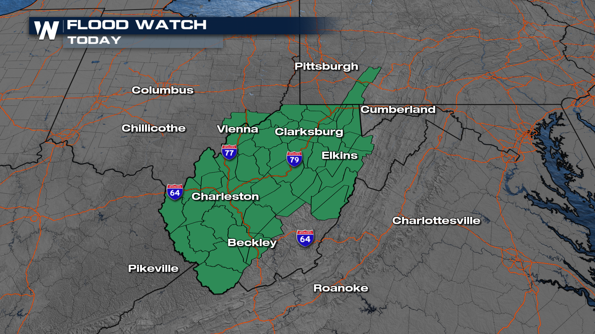
Record rainfall fell this weekend across the Ohio River Valley and the Mid-Atlantic. On Monday, Ohio tacked on almost 4 more inches in spots. More rainfall is on the way, continuing the risk of flooding. Because of this risk, flood watches remain in place over the next few days across OH, PA, and WV for additional rainfall.
 Storms & Timing
A frontal boundary will continue to linger, bringing more rain, with heavy rain embedded in some of the storms that develop. Rounds of rain will continue to develop through Wednesday.
RAINFALL TOTALS
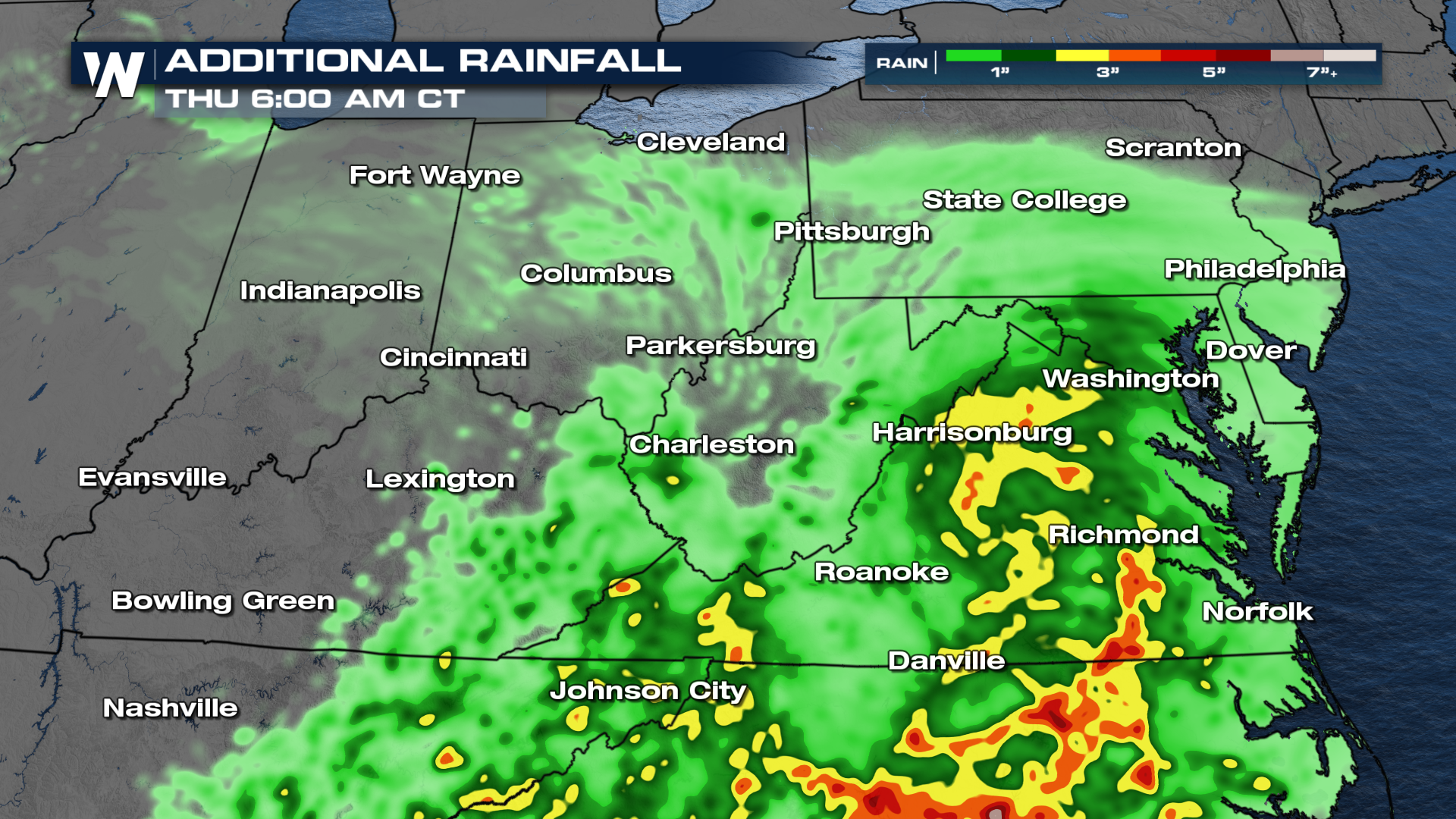
While heavy rain will be possible in some spots the next few days, at least the bulls eye is moving. The heftiest totals look to come down in Virginia down to parts of the Carolinas through Wednesday.
All Weather News
More
Stalled Front Heightens Flood Risk Today
Heavy rain continues across parts of Central
4 Oct 2026 5:30 PM


Tropical Update: EPAC Active; Atlantic clears September with no Hurricanes
Pacific BasinThe Pacific Ocean has been incre
4 Oct 2026 2:10 PM

Heavy Rain and Flood Threat Along For The Gulf Coast
Deep tropical moisture streaming north from t
4 Oct 2026 10:15 AM

Plains & Midwest: Slow Moving Storms Increase Flood Threat
WHAT TO EXPECTTropical moisture from the remn
2 Oct 2026 1:25 AM

Another Round of Flooding Possible for the Southwest
In the last month, the southwestern states of
1 Oct 2026 1:35 AM