Plains & Midwest: Slow Moving Storms Increase Flood Threat

WHAT TO EXPECT
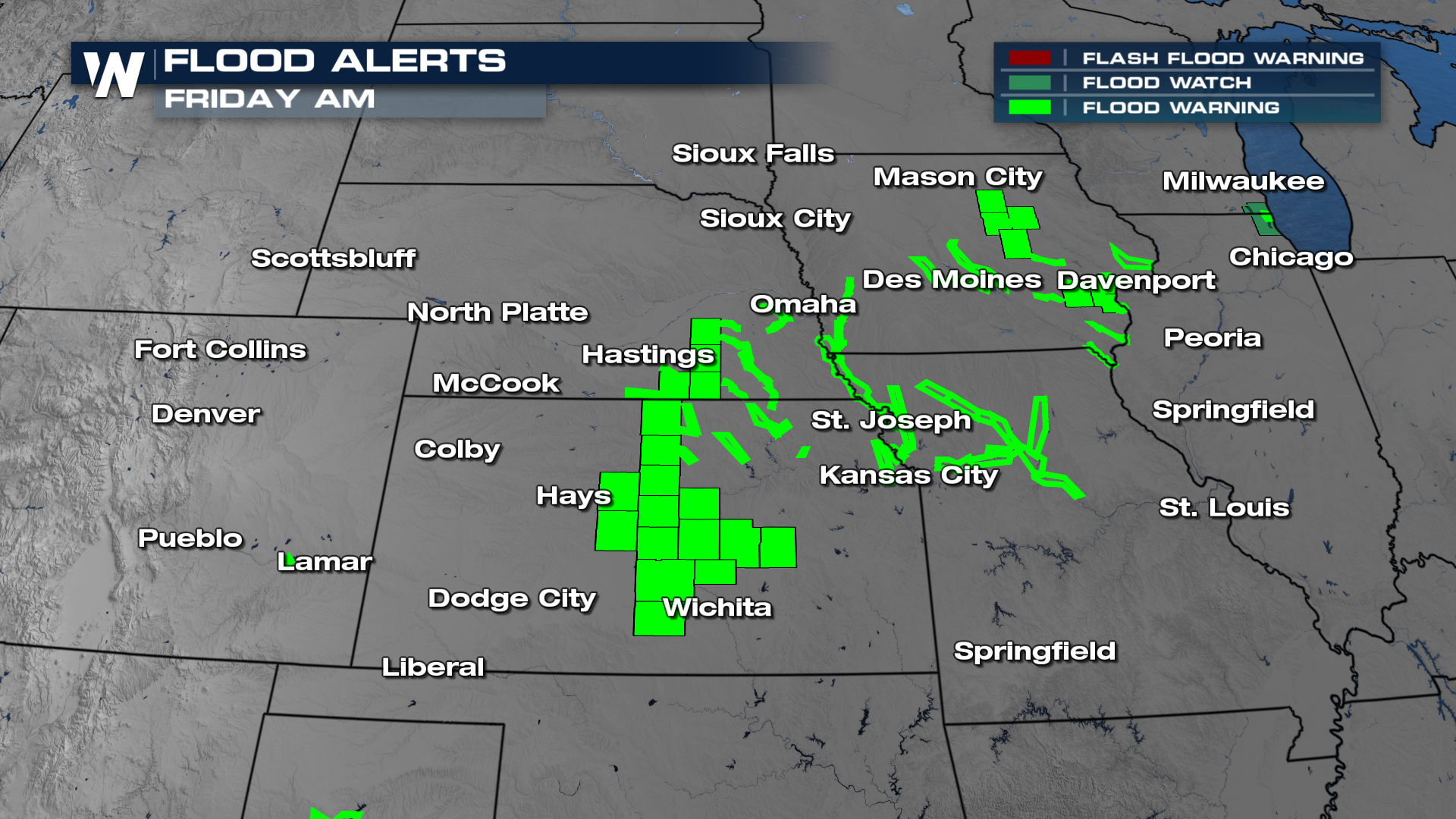
Tropical moisture from the remnants of Polo and the Gulf have surged north and met a frontal boundary. This has equaled a formula of very heavy rainfall. Flood alerts are in place through Thursday across portions of the plains and Midwest. The soils for this part of the country are already very saturated for many. This means adding more rainfall can lead to flooding of rivers, creeks, and streams, and flash flooding is not out of the question.
TIMING
Rounds of heavy rain will continue on and off. Isolated areas of flooding will be possible. Friday, this low will move east, and we will see drier conditions by the end of the week.
TOTALS
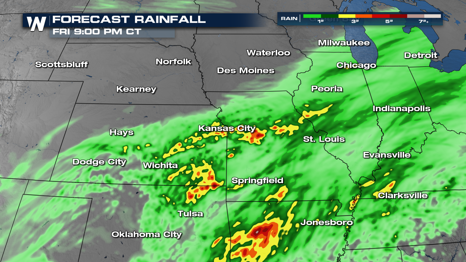
Folks can expect very heavy rainfall, with most seeing around 2"- 4". Some localized areas of a half foot will be possible! Never try to drive through floodwaters, and make sure to take any flood alerts and warnings seriously. If you live in an area prone to flooding, make sure to have an action plan in place if flooding develops!
Make sure to tune into WeatherNation for the latest forecast!


