Cold Front Brings Storms and Cool Down

Temperatures are feeling cooler across the plains today! Enjoy it...because it won't last long. Temperatures will begin to warm up again, and a few storms remain possible today.
The Storm Prediction Center has issued a MARGINAL (level 1 out of 5) risk for severe thunderstorms along the front across Missouri, central Illinois and southern Iowa (above). All threats look possible, including Isolated tornadoes will be for portions of Illinois and Missouri.
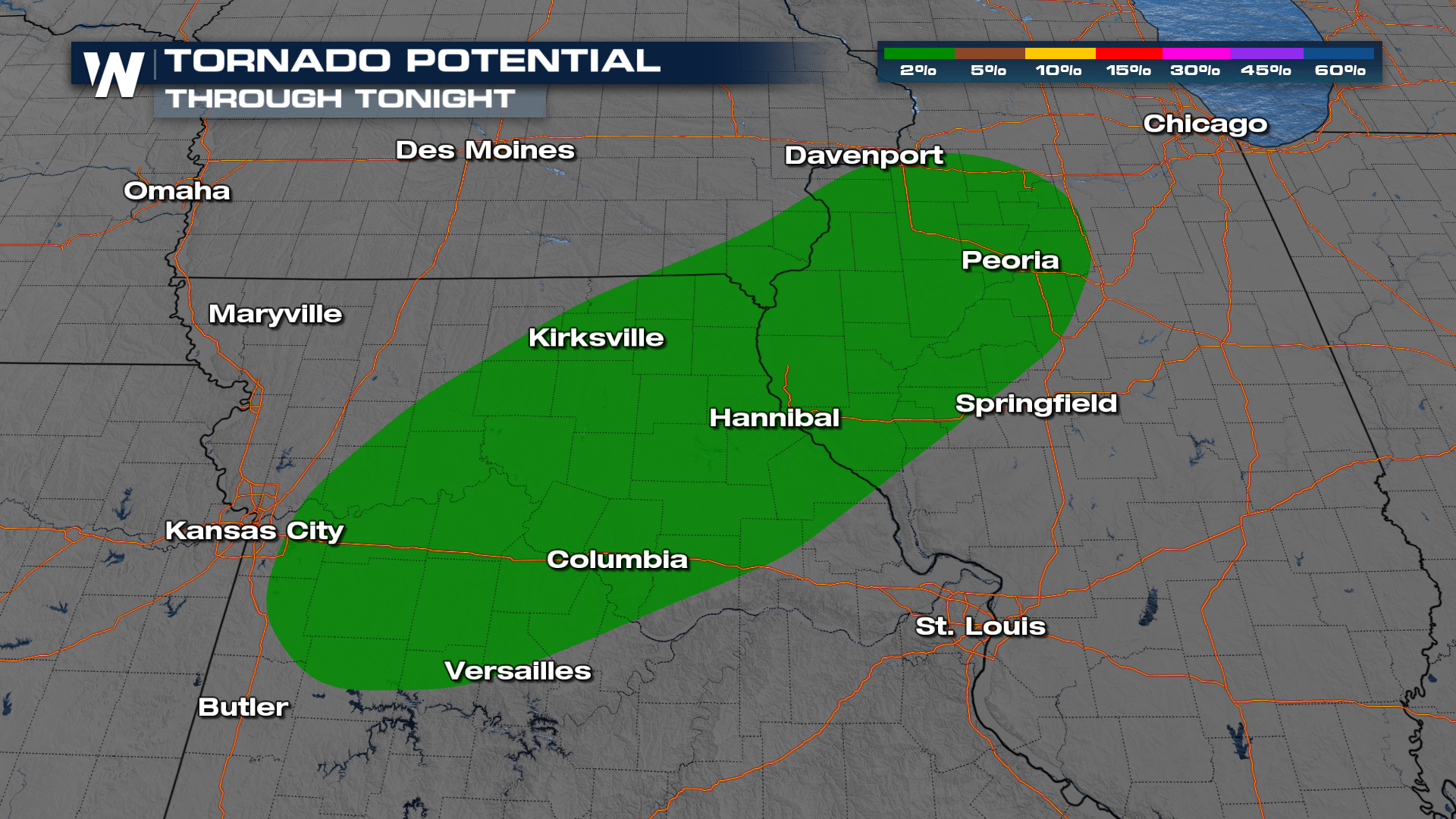
Through tonight and into the overnight hours the frontal boundary moving through these areas will be supporting the risk for strong to severe thunderstorms. Our models also show some of the activity actually picking up overnight so be prepared to receive severe weather alerts as you head to sleep tonight.
Another threat to keep an eye on is the flooding threat. This front isn't going to be in a hurry, so as it walks southward, it will focus a few rounds of storms somewhere. Right now, that looks to take aim at Iowa and northern Missouri.
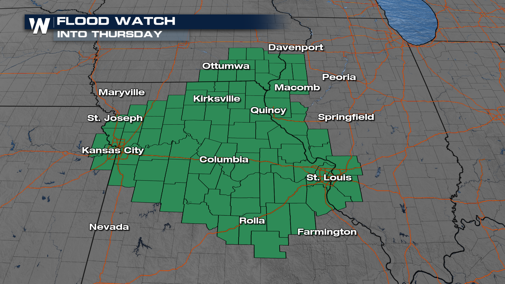
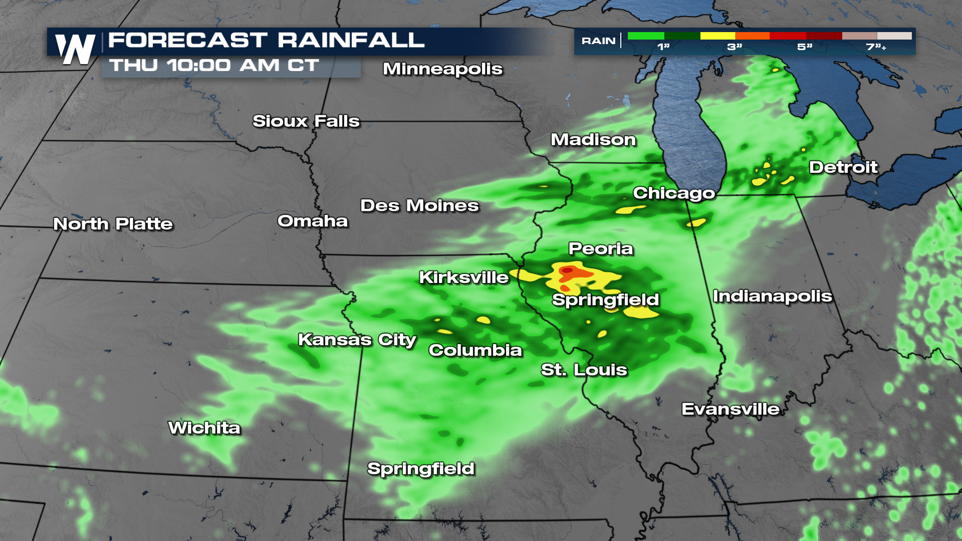 Flood Watches are in effect for the potential of heavy rain and flooding.
More details on your Central Regional Forecast can always be found :30 past the hour on WeatherNation.


