Blizzard Warnings Continue in the High Plains
Special Stories
6 Mar 2018 9:11 AM
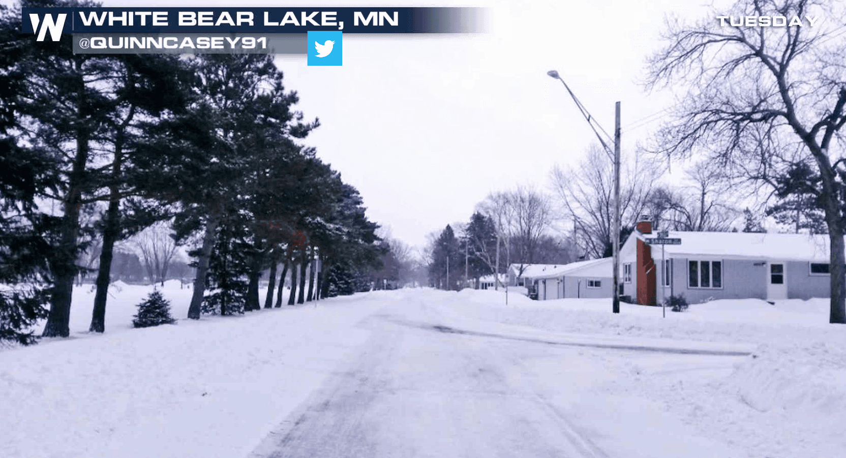
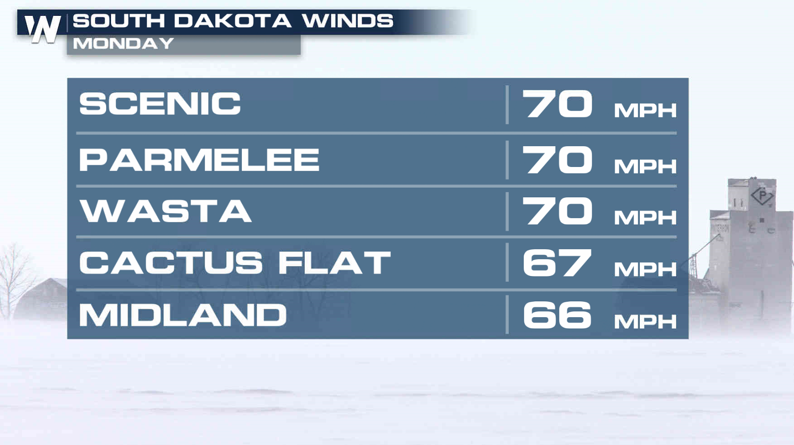
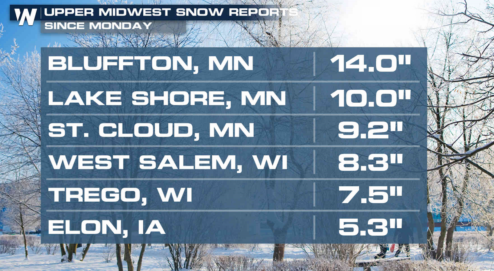
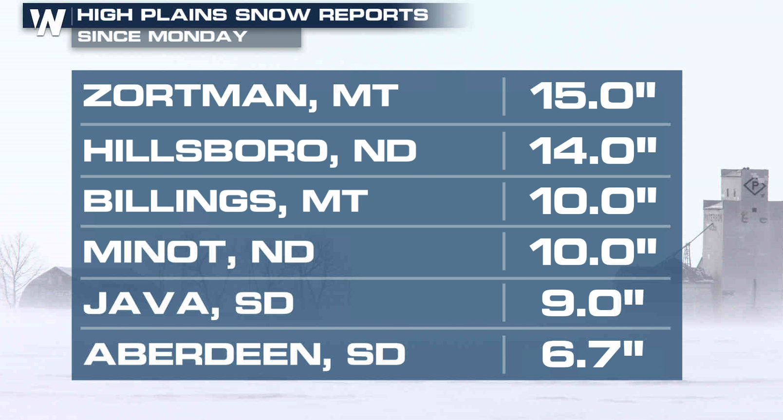
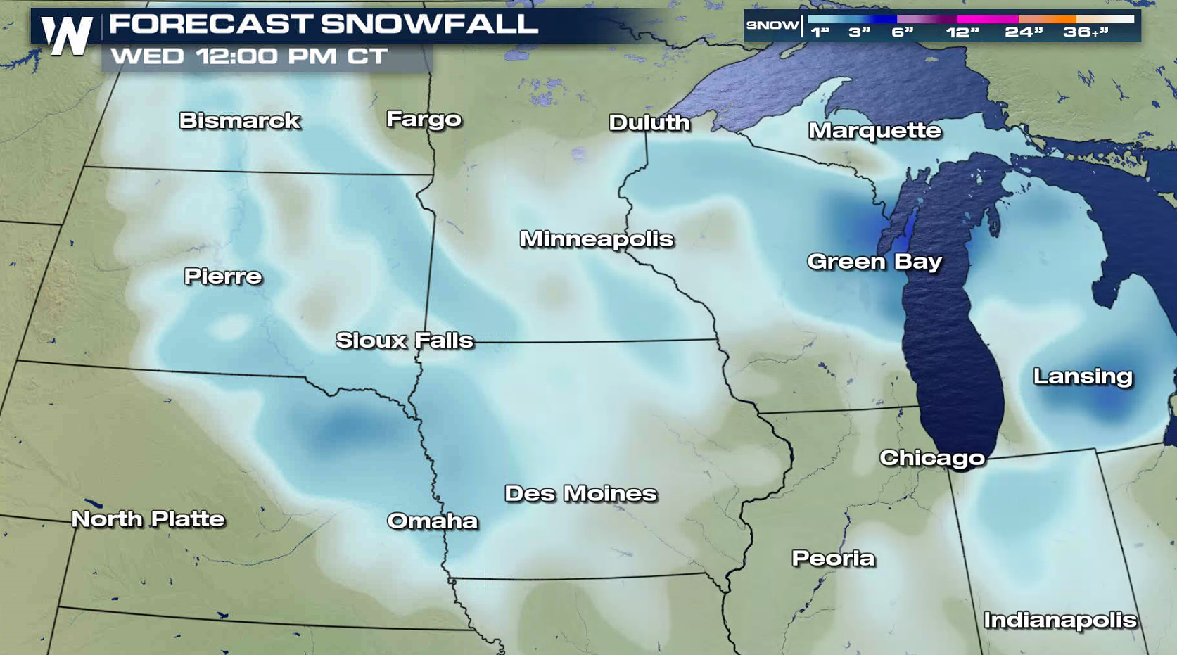
Strong winds and heavy snow have been moving through the Midwest to start this week. Gusts to 70 mph were clocked in South Dakota. Snowfall accumulations reached to over a foot in Montana, North Dakota, and Minnesota.
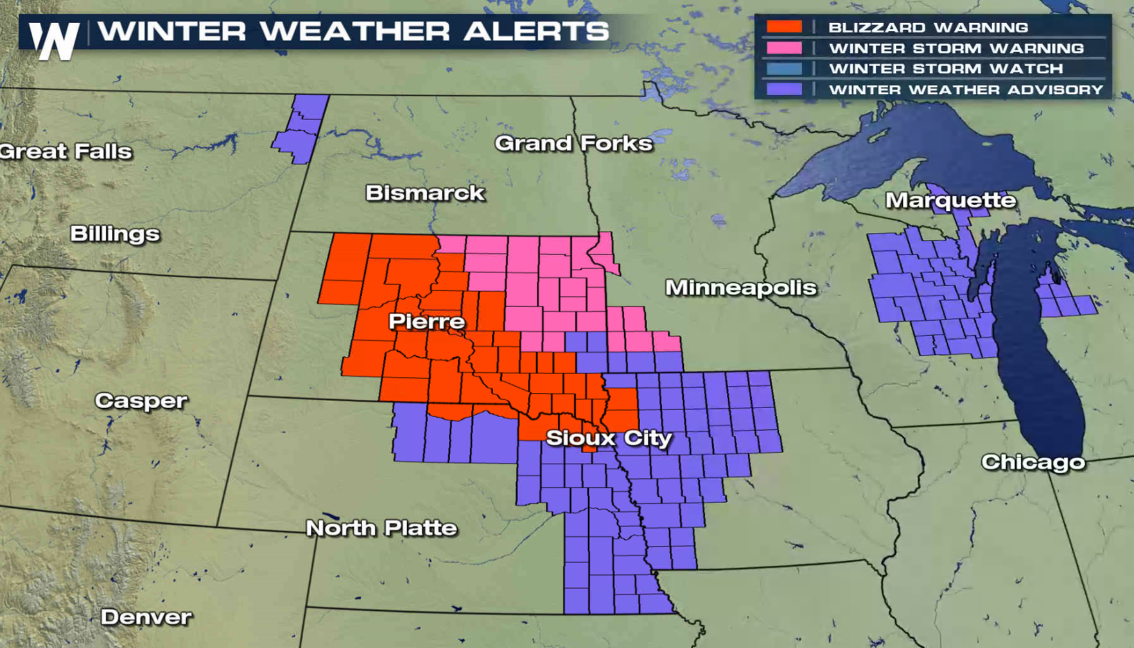
 Blizzard Warnings remain in effect through midday from central South Dakota into northeastern Nebraska and northwestern Iowa. A few inches of additional accumulation is likely, with occasional wind gusts above 30 mph.
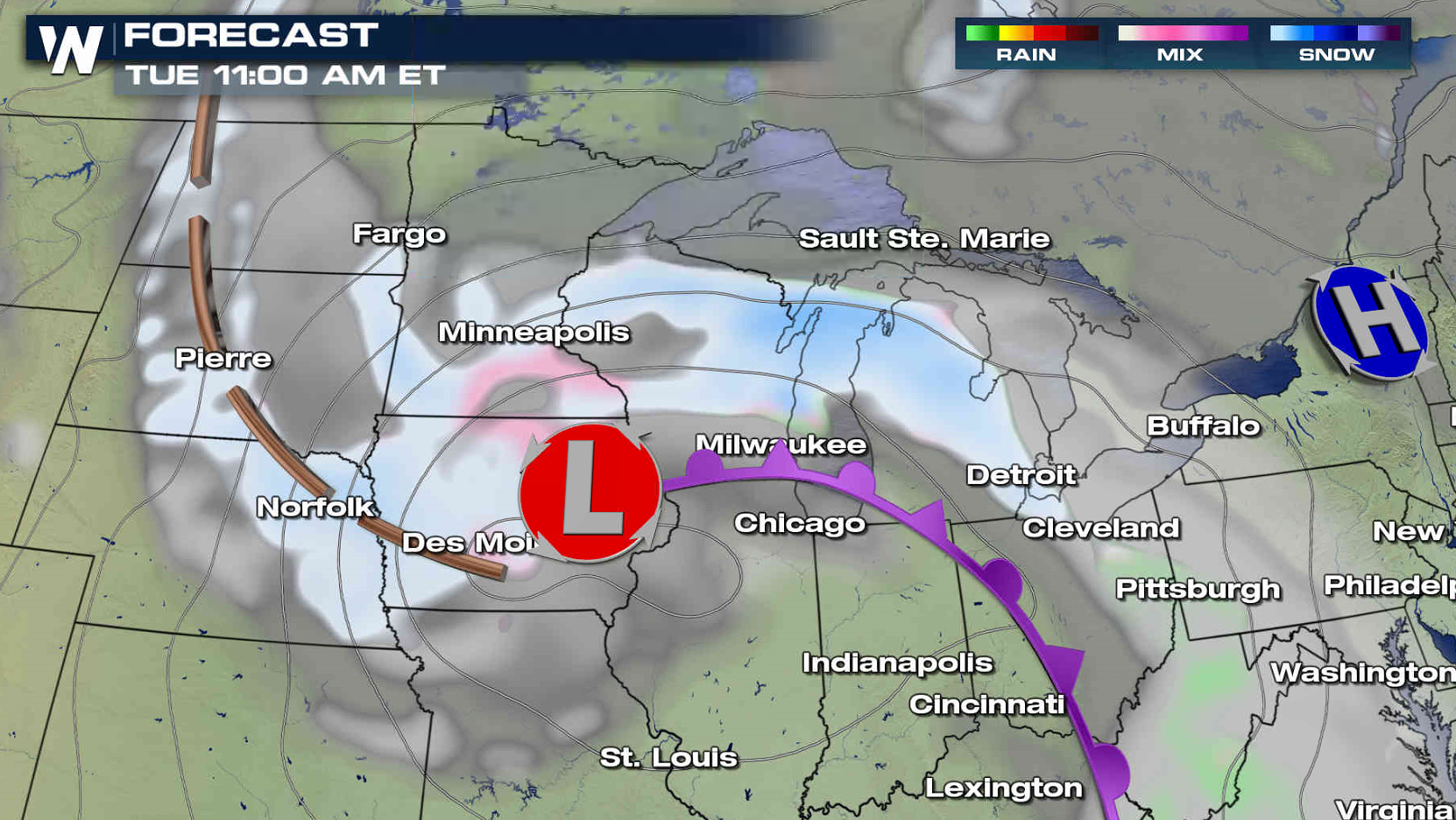
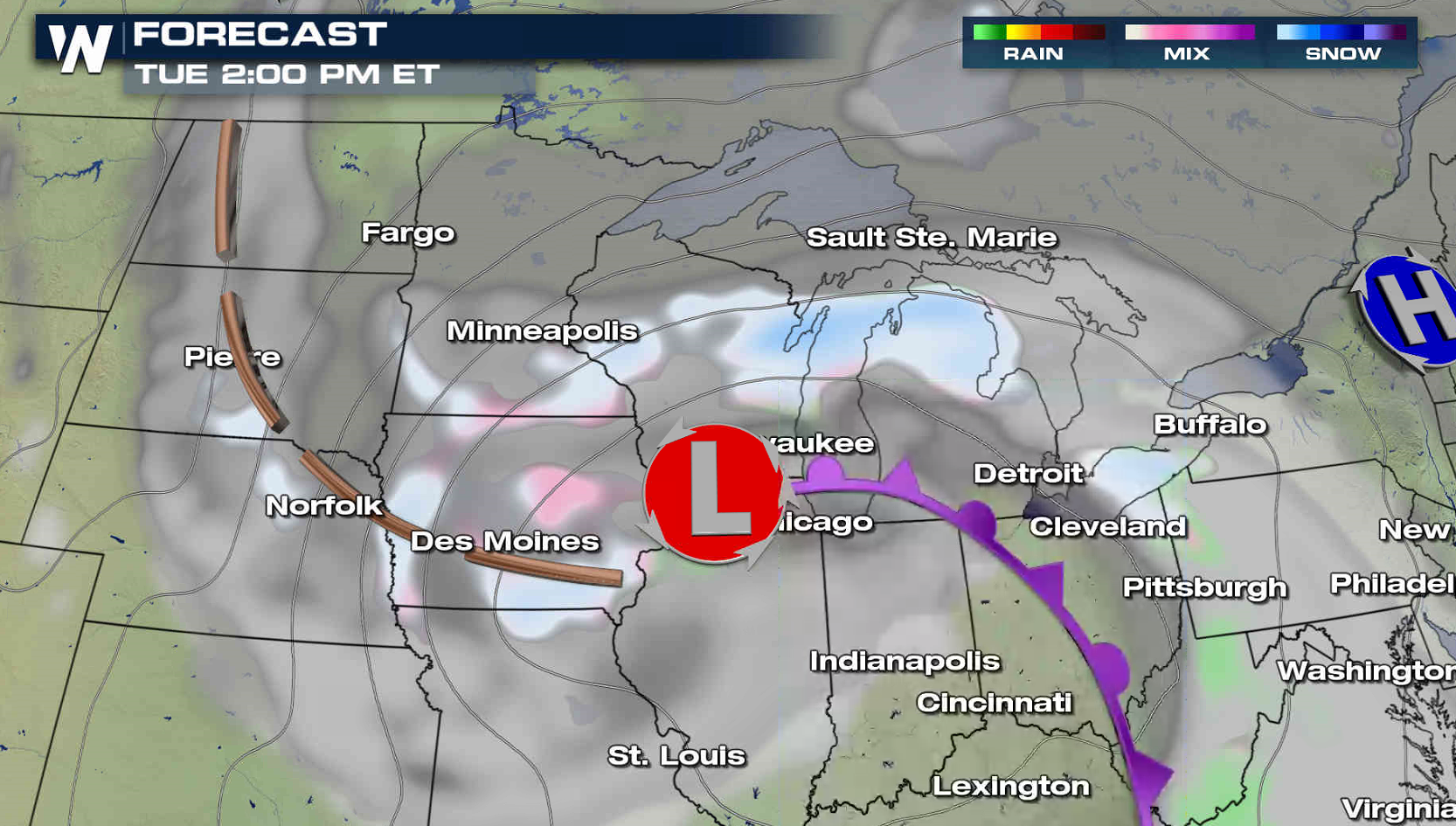
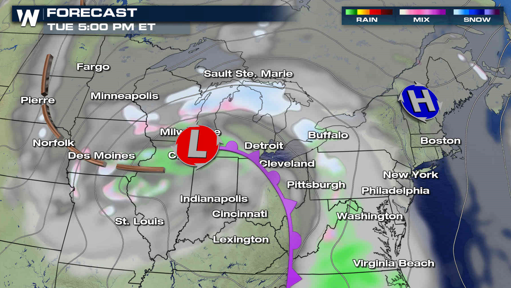
 The low pressure center will gradually weaken throughout the day as it slowly moves from Iowa to Lake Michigan. The wind will continue to decrease and snow showers will become more scattered.
 For WeatherNation: Meteorologist Mace Michaels
Blizzard Warnings remain in effect through midday from central South Dakota into northeastern Nebraska and northwestern Iowa. A few inches of additional accumulation is likely, with occasional wind gusts above 30 mph.
The low pressure center will gradually weaken throughout the day as it slowly moves from Iowa to Lake Michigan. The wind will continue to decrease and snow showers will become more scattered.
For WeatherNation: Meteorologist Mace MichaelsAll Weather News
More


More Storms for the East Sunday and Monday
A low-pressure system crashing through the Mi
2 Aug 2026 2:20 AM

After Reaching Category 5, Genevieve Weakens in the Pacific
PacificGenevieve formed on last Friday south
2 Aug 2026 1:30 AM

Flooding, Severe Storms Target the Midwest Again
After an active week of storms across the nor
1 Aug 2026 1:40 AM

Flooding Risk Increases as Heavy Rain Targets the Tri-State Area
Tuesday, heavy rainfall moved across the Nort
30 Jul 2026 12:25 AM

Severe Weather: Energy From the Midwest Now in the Southeast
UPPER MIDWEST - Through Monday, dangerous tor
29 Jul 2026 10:30 PM