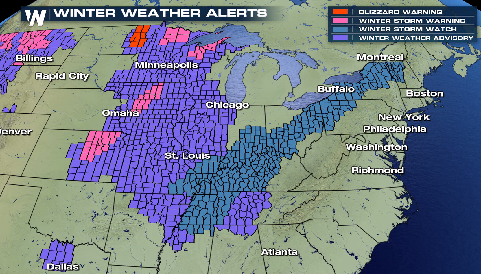
Blizzard Warnings in the Upper Midwest, Ice and Snow Headed East
Special Stories
11 Jan 2018 11:13 AM
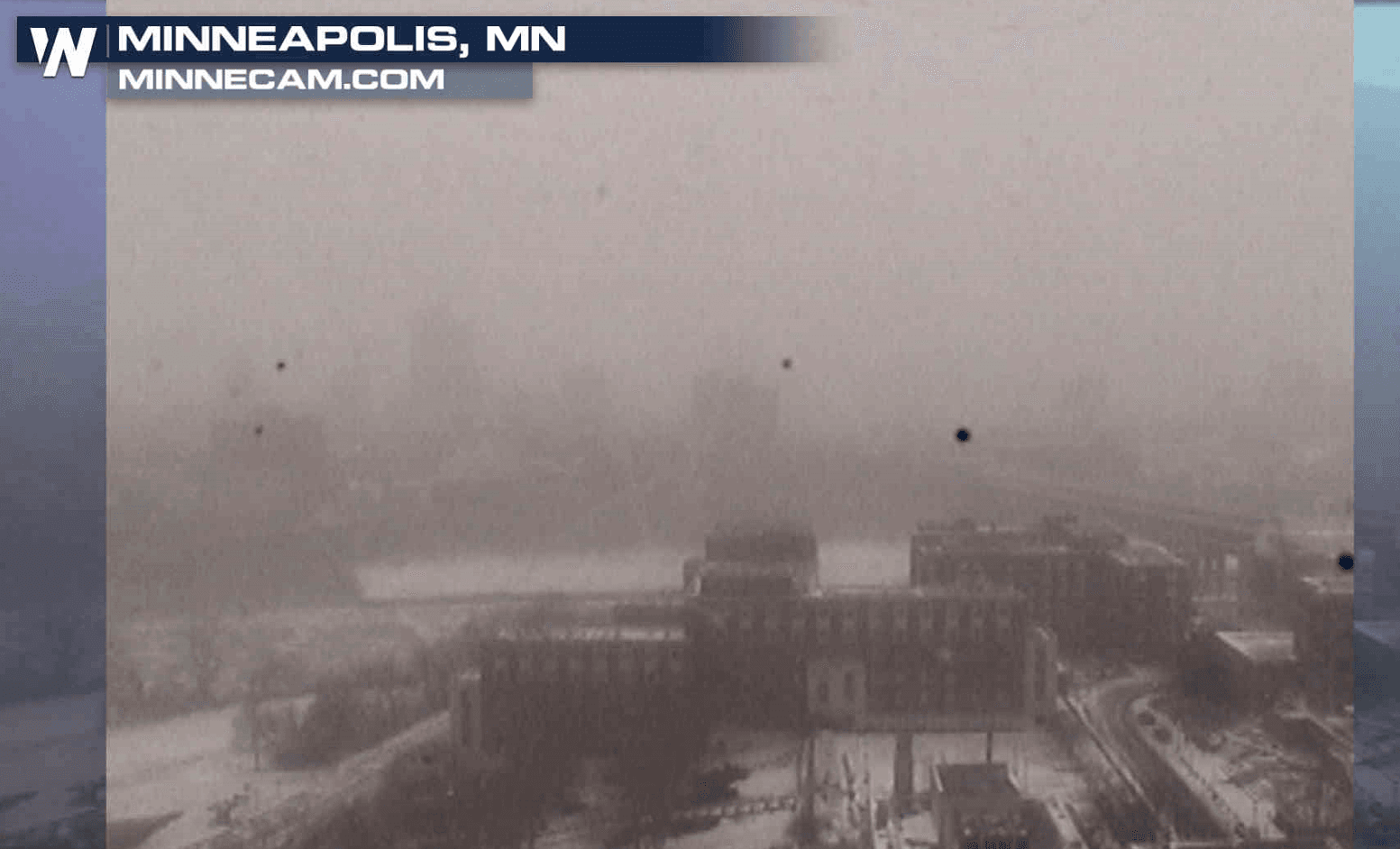
Even though snow has quit falling, white out conditions continue in the Red River Valley of North Dakota and Minnesota as winds howl with gusts to 40 mph. Some roads have been closed due to the significant blowing and drifting snow. Blizzard Warnings remain in effect for the area, with Winter Storm Watches now expanding into the Northeast.
https://twitter.com/MSPPIO_NW/status/951493780984786944
https://twitter.com/G_Hjelmstad/status/951489557643620352
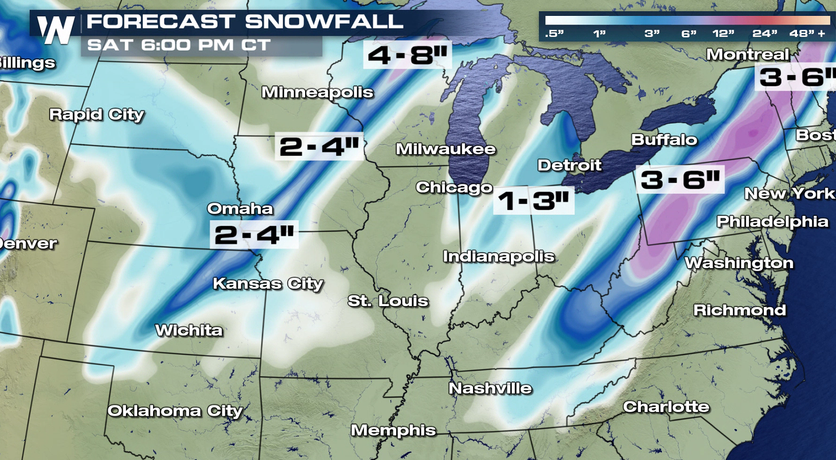
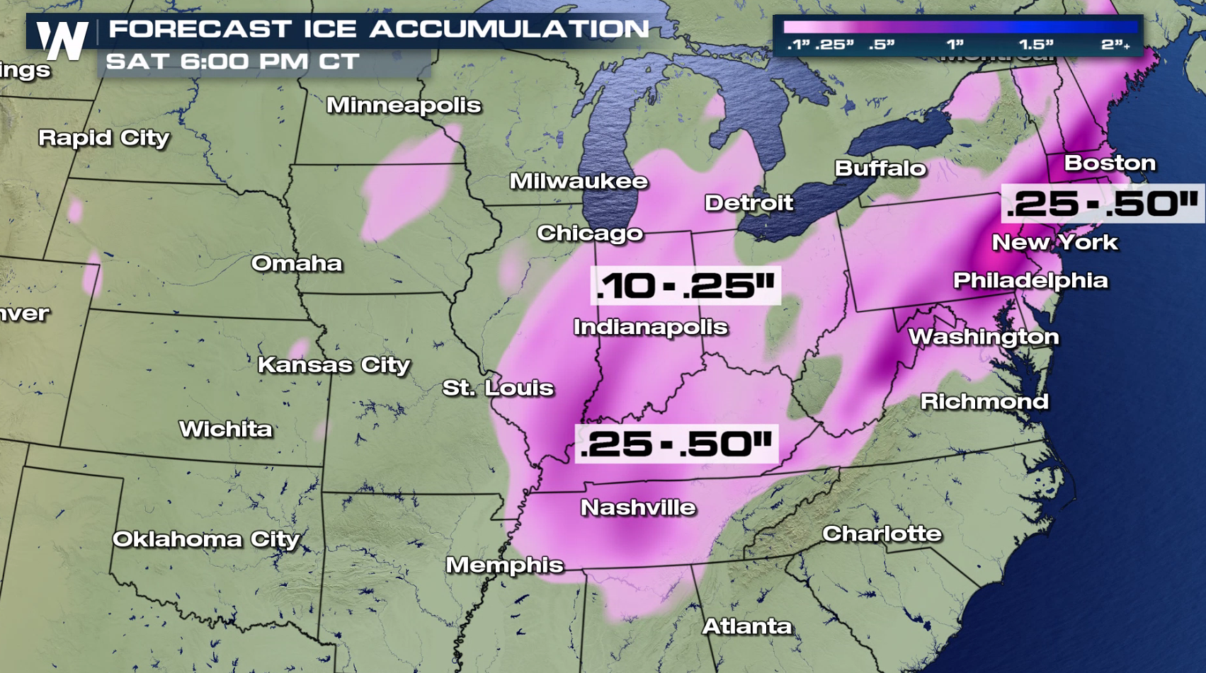
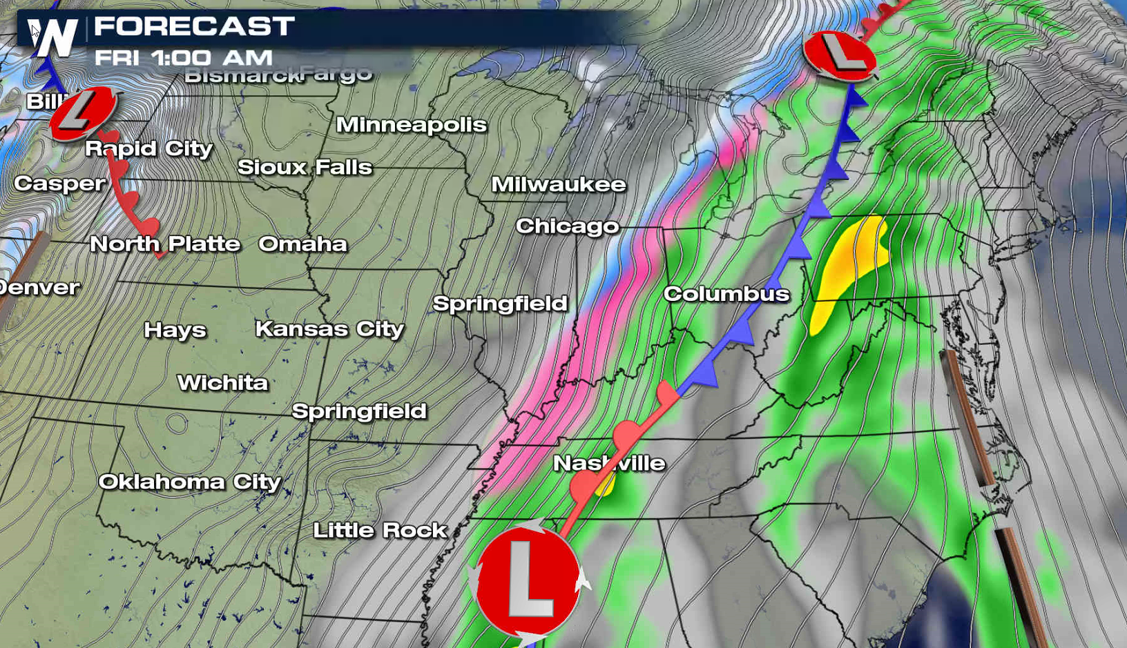
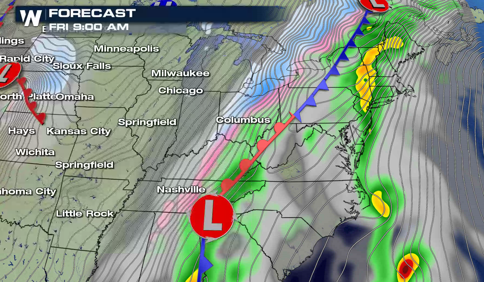
 In the heaviest snow bands, totals may reach to 6" to 8". Ice is also a concern, as freezing rain and sleet may accumulate up to .50" in the Ohio Valley and Northeast into Friday.
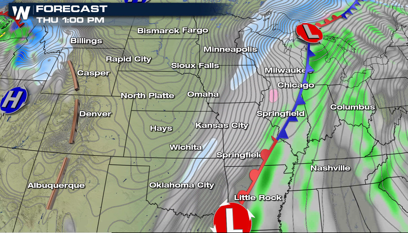
 The lead low pressure center is now moving through the Great Lakes and will push into Canada this afternoon. A second low will move up from the Mississippi Valley into the Tennessee Valley, pulling up humidity from the Gulf of Mexico. As the moisture runs into the cold air dropping southward behind a cold front, freezing rain, sleet, and snow will develop into this weekend.
 For WeatherNation: Meteorologist Mace Michaels
In the heaviest snow bands, totals may reach to 6" to 8". Ice is also a concern, as freezing rain and sleet may accumulate up to .50" in the Ohio Valley and Northeast into Friday.
The lead low pressure center is now moving through the Great Lakes and will push into Canada this afternoon. A second low will move up from the Mississippi Valley into the Tennessee Valley, pulling up humidity from the Gulf of Mexico. As the moisture runs into the cold air dropping southward behind a cold front, freezing rain, sleet, and snow will develop into this weekend.
For WeatherNation: Meteorologist Mace MichaelsAll Weather News
More
Fronts Continue To Spark Severe Weather Across the Plains
A cold front that brought record lows to the
18 Jul 2025 10:40 PM

Extreme Heat Impacts for the East Coast & South
Extreme heat continues to impact several area
18 Jul 2025 10:05 PM

Flooding Threat Remains Elevated in the East
A cold front pushing through the Eastern Seab
18 Jul 2025 9:10 PM

EF-2 Firenado from the Deer Creek Fire in Utah
A fire tornado was spotted near La Sal, Utah
18 Jul 2025 7:30 AM

Tropical System Brings Flood Risk to the Central Gulf
Time has run out for notable tropical develop
18 Jul 2025 3:05 AM

Heavy Rain, Flooding Threat Returns to Florida
Keep the rain boots handy in Florida - heavy
13 Jul 2025 12:50 PM

Severe Storm Risk Pushes into the Great Lakes, Ohio Valley
Friday was another busy day with severe weath
12 Jul 2025 8:00 PM