Building a Weather-Ready Nation: Spring Flooding
Special Stories
8 Mar 2021 10:15 AM
https://www.youtube.com/watch?v=9lsJl3J-IJA
After a major early spring flooding event, John Van Pelt spoke with John Gordon from NWS Louisville about lessons we can all learn to be safe this spring.
 The National Weather Service issues many hydrology related products. Some are to warn you of potential hazards; others are information statements to keep you up to date on changing weather and river situations. Below are the most commonly issued products along with a brief explanation of what they mean to you:
The National Weather Service issues many hydrology related products. Some are to warn you of potential hazards; others are information statements to keep you up to date on changing weather and river situations. Below are the most commonly issued products along with a brief explanation of what they mean to you:
"Take Action!" when these products are issued
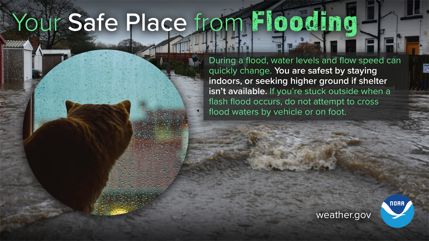
Warnings or Advisories are issued when confidence is greater than 80% that an event will occur. Depending on the type of event, these may be issued anywhere from hours before an event to days in advance of an event. +Flash Flood Warning +Flood Warning +Flood Advisory +Coastal/Lakeshore Hazardous Message +Special Weather Statement"Be Prepared" when these products are issued
Watch products associated with flooding are typically issued within a day or more of the event. The confidence level for an event to occur when a Watch is issued is 50-80%. When a Watch is issued, you should begin to gather more information about the situation and determine what actions you will need to take should a warning be issued. +Flash Flood Watch +Flood Watch"Be Aware" when these products are issued
Outlook products are issued days, weeks or even months in advance of the event. The confidence level for an event highlighted in an outlook to occur is less than 50%. When an Outlook is issued, you should take note. This serves as a "heads-up" that you may be impacted and gives you a general timeline of when the event could occur. +Hydrologic Outlook +Hazardous Weather OutlookProducts to keep you informed
The products listed below are produced to keep the public and NWS partners up to date on the latest forecast information. +Area Forecast Discussion +Hydrometeorological Discussion +River Forecast +Flash Flood Statement +Flood Statement +Hydrologic Statement +River Recreation Statement +Quantitative Precipitation Forecast +Public Information Statements CREDIT: National Weather Service Flood Safety CampaignAll Weather News
More
Fronts Continue To Spark Severe Weather Across the Plains
A cold front that brought record lows to the
18 Jul 2025 10:40 PM

Extreme Heat Impacts for the East Coast & South
Extreme heat continues to impact several area
18 Jul 2025 10:05 PM

Flooding Threat Remains Elevated in the East
A cold front pushing through the Eastern Seab
18 Jul 2025 9:10 PM

EF-2 Firenado from the Deer Creek Fire in Utah
A fire tornado was spotted near La Sal, Utah
18 Jul 2025 7:30 AM

Tropical System Brings Flood Risk to the Central Gulf
Time has run out for notable tropical develop
18 Jul 2025 3:05 AM

Heavy Rain, Flooding Threat Returns to Florida
Keep the rain boots handy in Florida - heavy
13 Jul 2025 12:50 PM

Severe Storm Risk Pushes into the Great Lakes, Ohio Valley
Friday was another busy day with severe weath
12 Jul 2025 8:00 PM