Building Central Storms Through Midweek
Special Stories
3 Jun 2020 11:30 AM
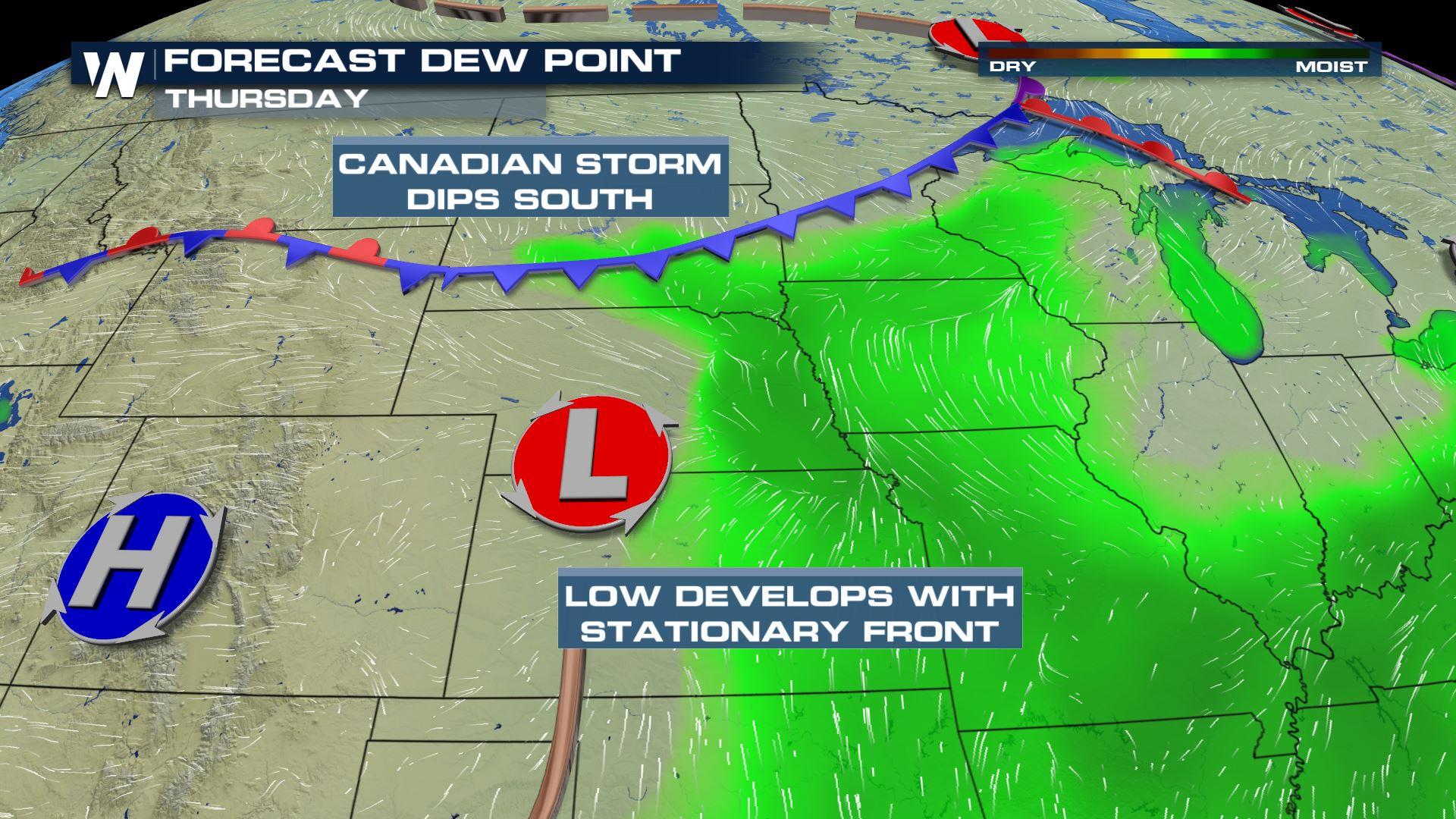
A mid-upper level ridge of high pressure stubbornly draped across the southern U.S. is dominating the pattern into the second half of the week. Bursts of energy will ride around the ridge to set the stage for an active pattern in the northern states. Severe storms are possible with this energy and a stalling surface cold front from the Upper Midwest to the Ohio Valley and Northeast today (Wednesday) and Thursday. Several other surface features will begin building in the High Plains to enhance severe chances for the middle and the end of the week. An area of low pressure is expected to develop on the western edge of the stalled front, on the lee side of the Rocky Mountains. At the same time, a cold front will push in from Canada. Winds at the surface will build in deep Gulf Moisture, setting the stage for an unstable atmosphere.
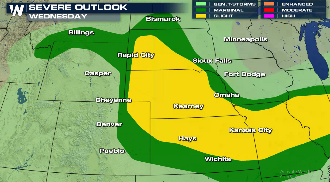
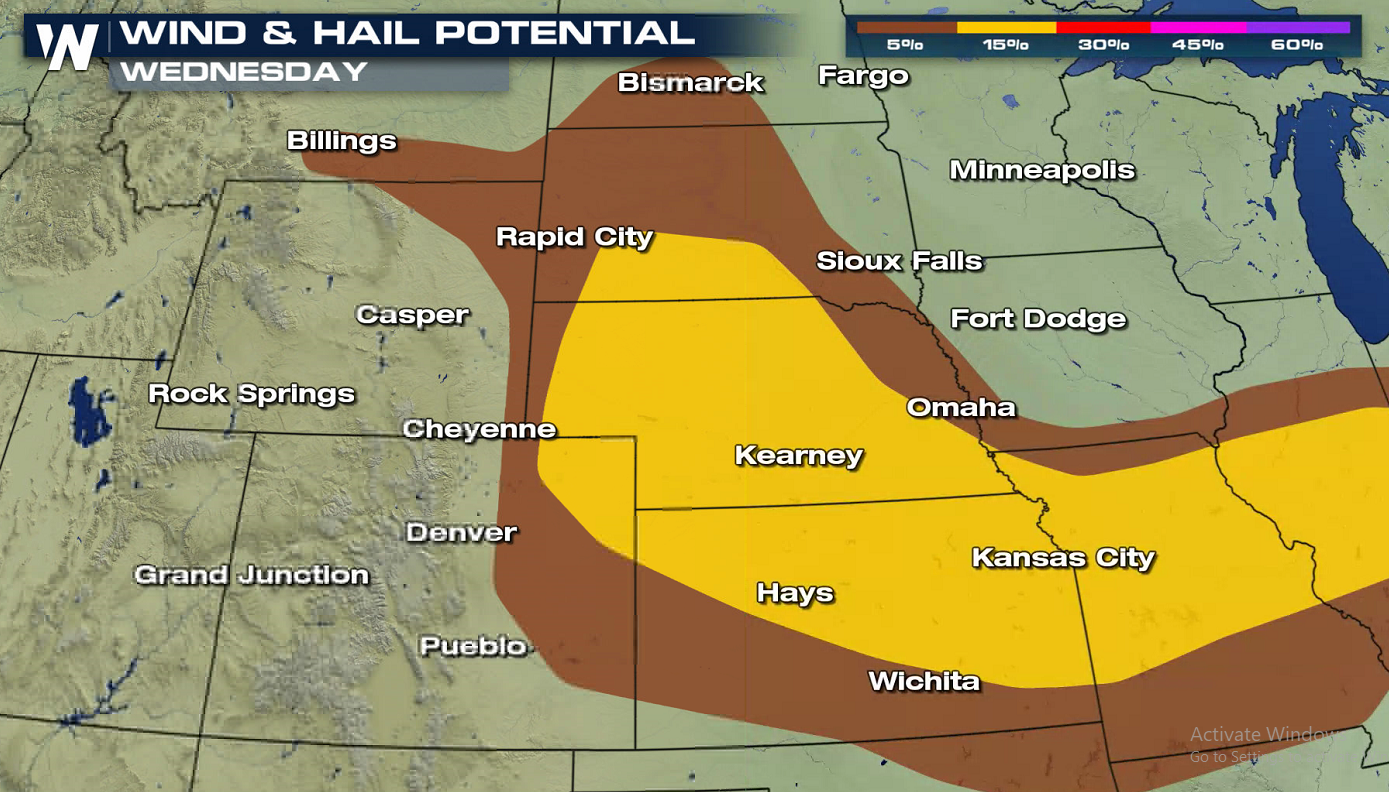
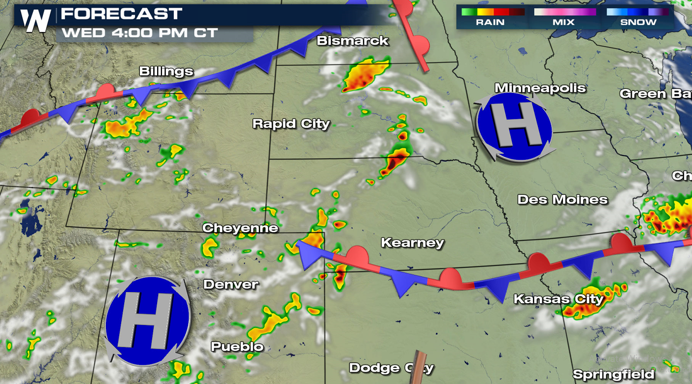
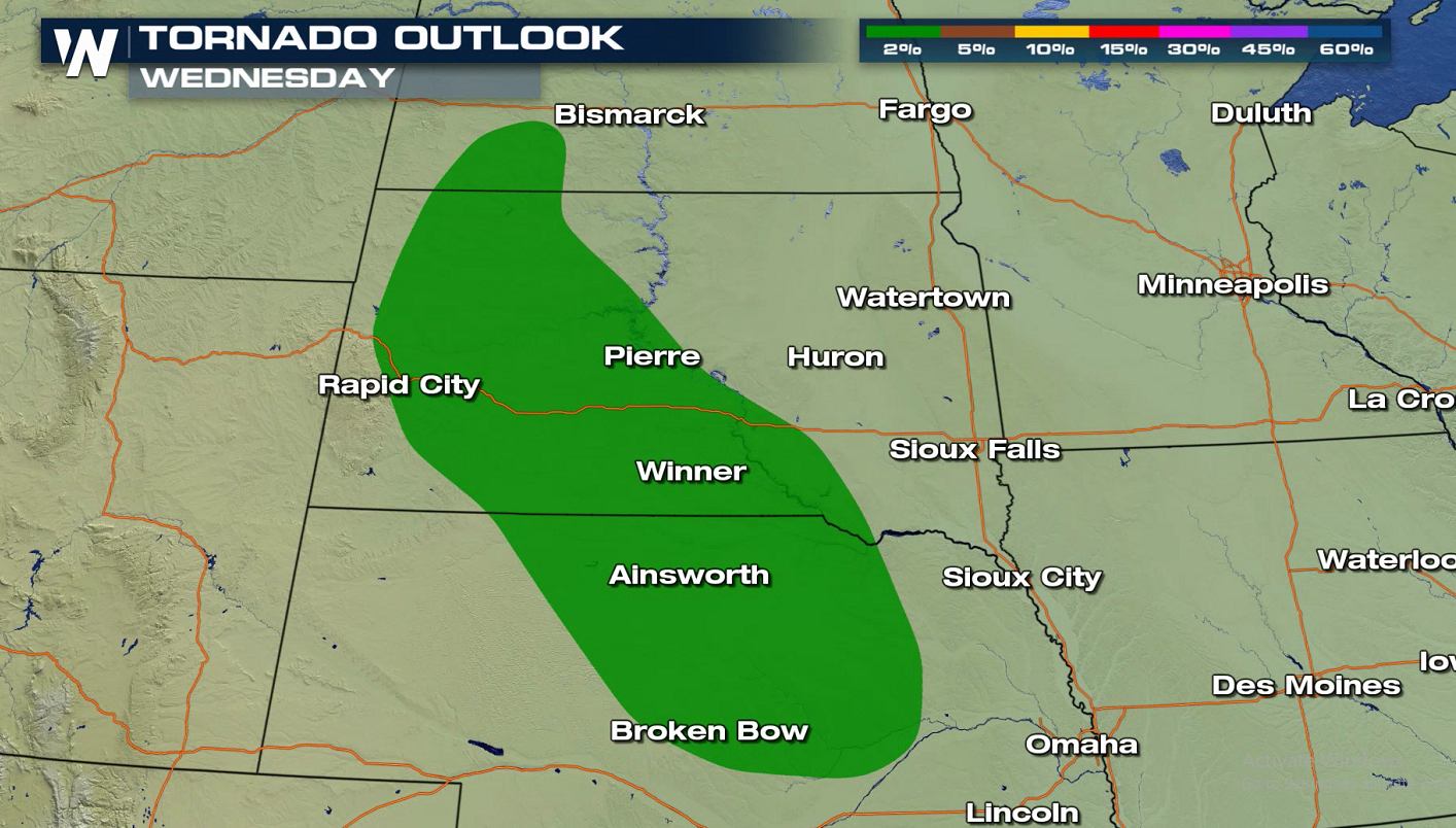 This afternoon (Wednesday), enough moisture and instability from daytime heating will be present to pop up afternoon thunderstorms. Scattered supercell thunderstorms will bring a chance at large hail and damaging winds. Though the threat of tornadoes is minimal, we can never rule out an isolated spin up.
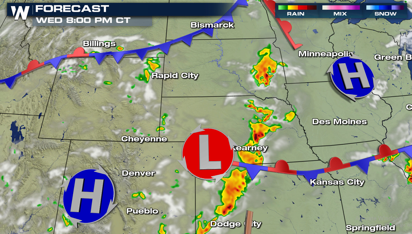
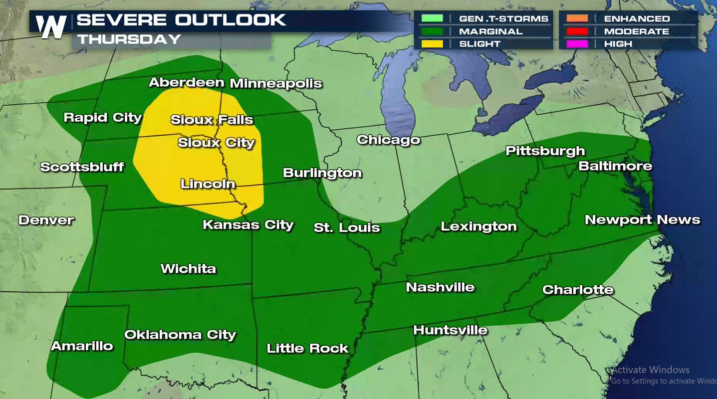
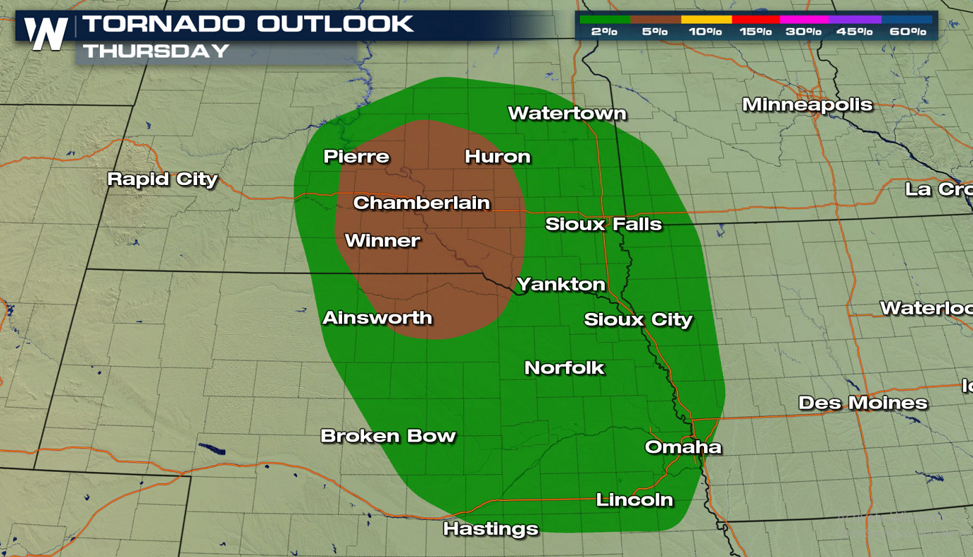
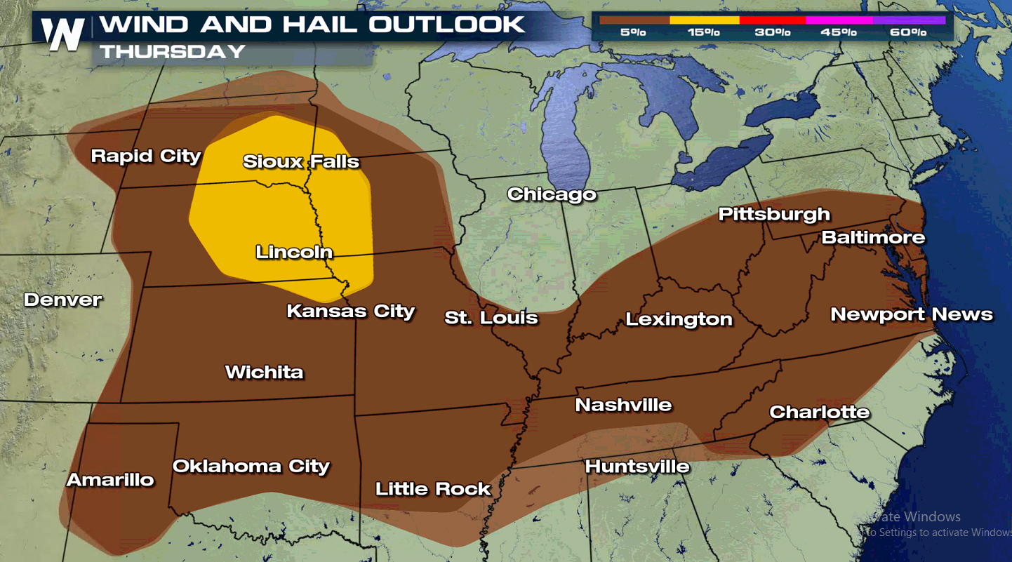
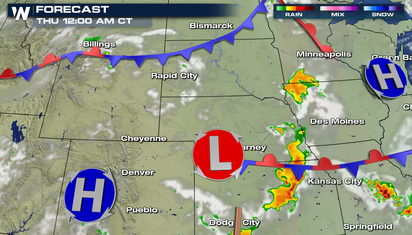 On Thursday, the Storm Prediction Center is also highlighting a Slight Risk area from Siouxland down to Kansas City. The jet stream will remain active in the northern U.S. with additional shots of mid-level energy coming through. Surface moisture and instability will only grow as the surface systems begin to merge and stall. The stationary front will act as an initiation point for storms. We'll watch for storms to congeal into clusters/lines into the overnight hours, continuing the gust wind and heavy rain threat into early Friday.
This afternoon (Wednesday), enough moisture and instability from daytime heating will be present to pop up afternoon thunderstorms. Scattered supercell thunderstorms will bring a chance at large hail and damaging winds. Though the threat of tornadoes is minimal, we can never rule out an isolated spin up.
On Thursday, the Storm Prediction Center is also highlighting a Slight Risk area from Siouxland down to Kansas City. The jet stream will remain active in the northern U.S. with additional shots of mid-level energy coming through. Surface moisture and instability will only grow as the surface systems begin to merge and stall. The stationary front will act as an initiation point for storms. We'll watch for storms to congeal into clusters/lines into the overnight hours, continuing the gust wind and heavy rain threat into early Friday.
All Weather News
More
Fronts Continue To Spark Severe Weather Across the Plains
A cold front that brought record lows to the
18 Jul 2025 10:40 PM

Extreme Heat Impacts for the East Coast & South
Extreme heat continues to impact several area
18 Jul 2025 10:05 PM

Flooding Threat Remains Elevated in the East
A cold front pushing through the Eastern Seab
18 Jul 2025 9:10 PM

EF-2 Firenado from the Deer Creek Fire in Utah
A fire tornado was spotted near La Sal, Utah
18 Jul 2025 7:30 AM

Tropical System Brings Flood Risk to the Central Gulf
Time has run out for notable tropical develop
18 Jul 2025 3:05 AM

Heavy Rain, Flooding Threat Returns to Florida
Keep the rain boots handy in Florida - heavy
13 Jul 2025 12:50 PM

Severe Storm Risk Pushes into the Great Lakes, Ohio Valley
Friday was another busy day with severe weath
12 Jul 2025 8:00 PM