Bursts of Lake Effect Snow Expected This Weekend

Top Stories
13 Nov 2021 4:15 PM
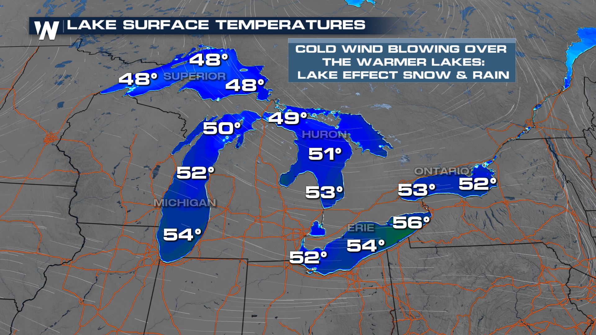
Bands of lake effect snow are expected this weekend across the Great Lakes region as favorable surface wind direction moves over the warmer waters and onto the colder land. Bands will be narrow, but if they're slow moving or stationary could put down high snow totals in isolated areas.
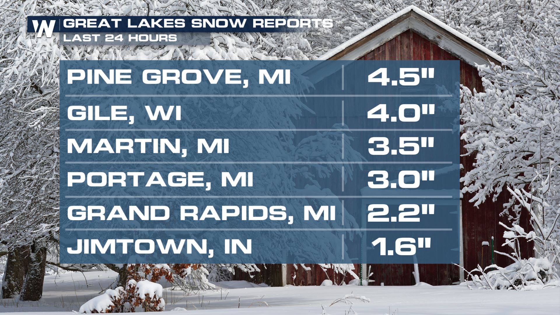
 Check out some of the higher totals from the last 24 hours:
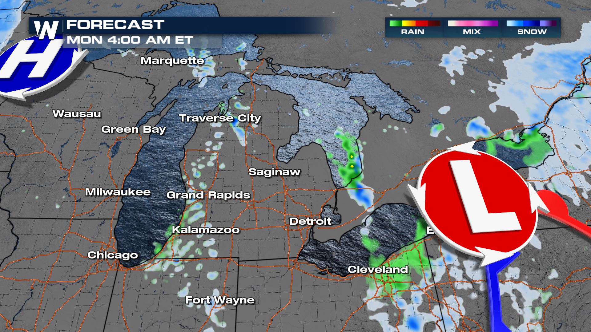
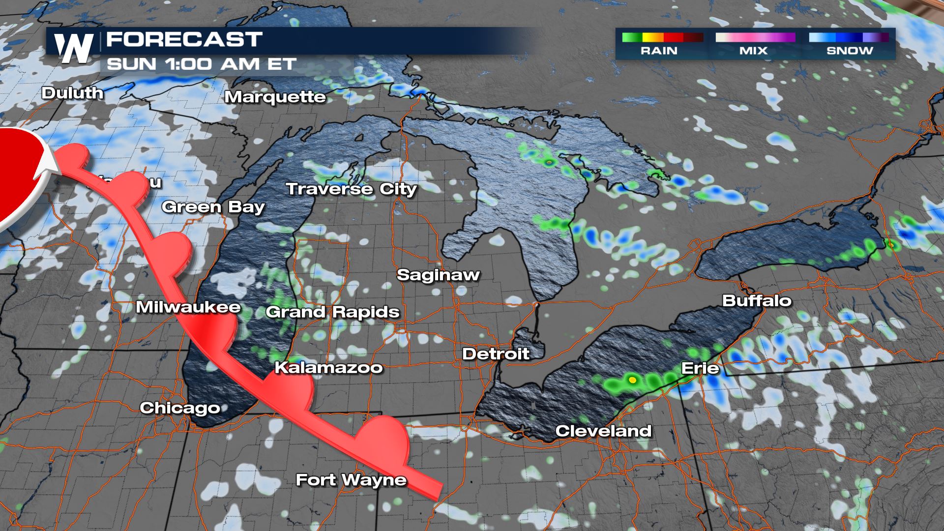 Wrap around moisture on the back side of the Alberta clipper surface low. and winds from the west-northwest will aid in more lake effect snow bands across the Midwest and Great Lakes Sunday afternoon. Meanwhile more light but widespread system snow will be happening in the Ohio Valley and western New York.
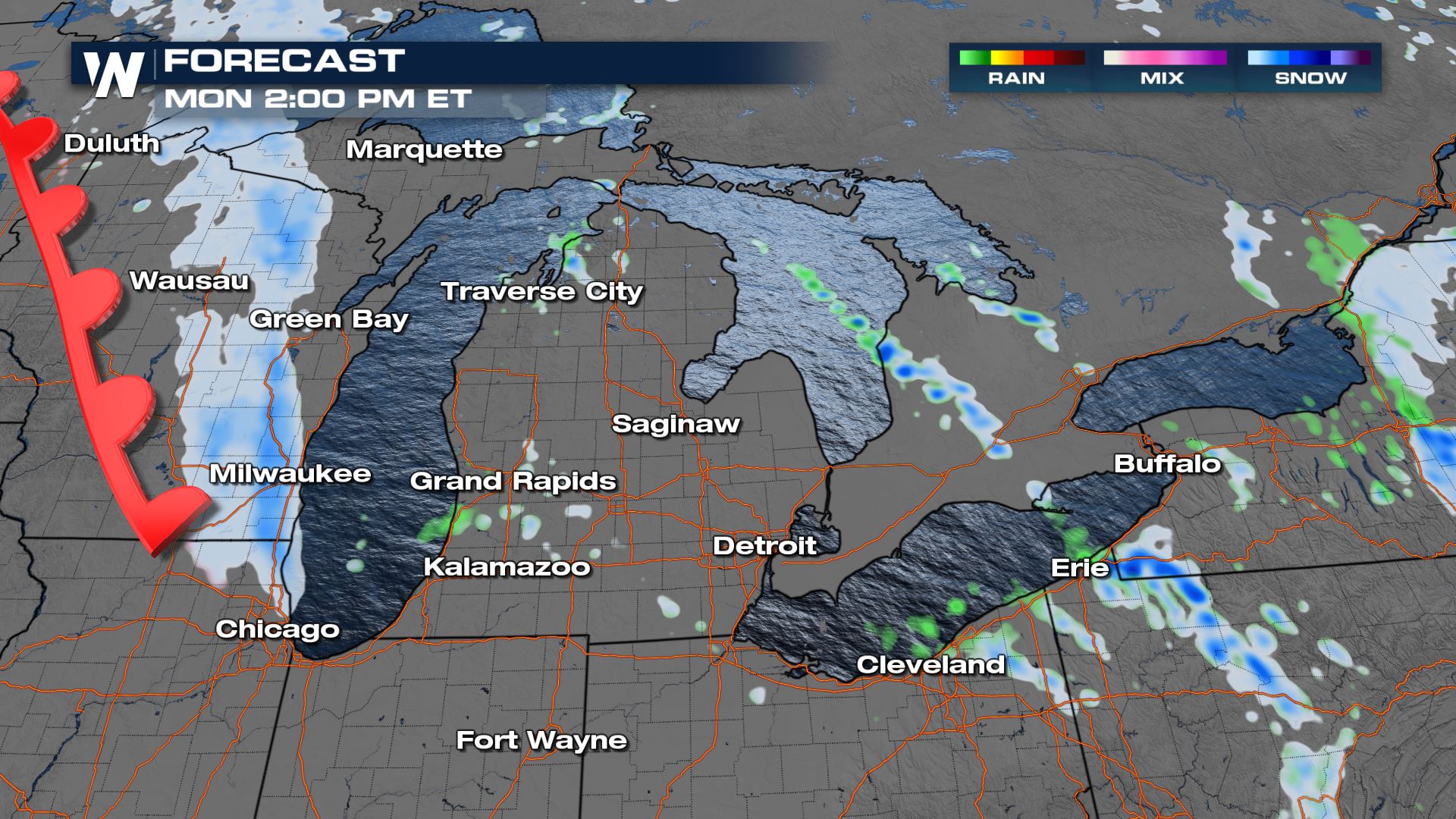
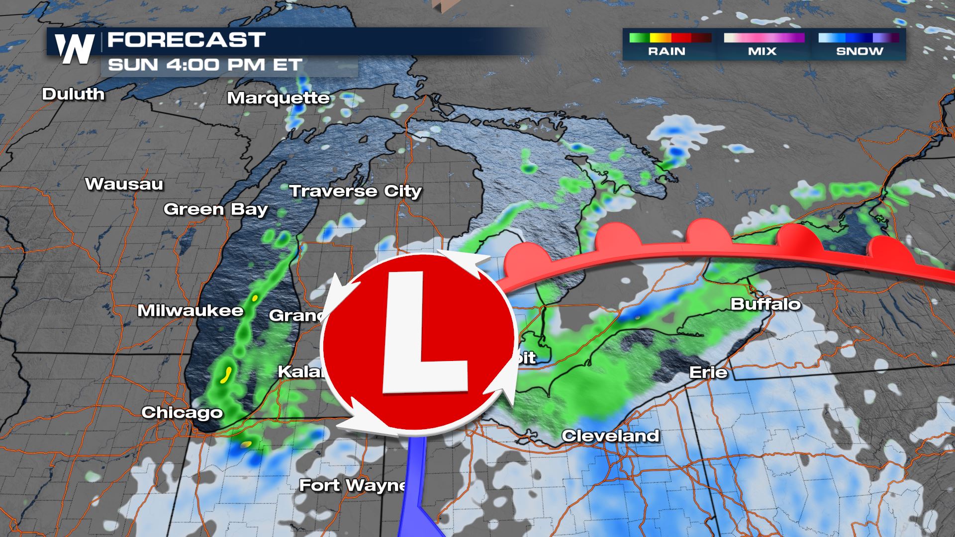 As the low moves away Monday, a few more bursts of snow are possible along the eastern shores of the lakes throughout the day.
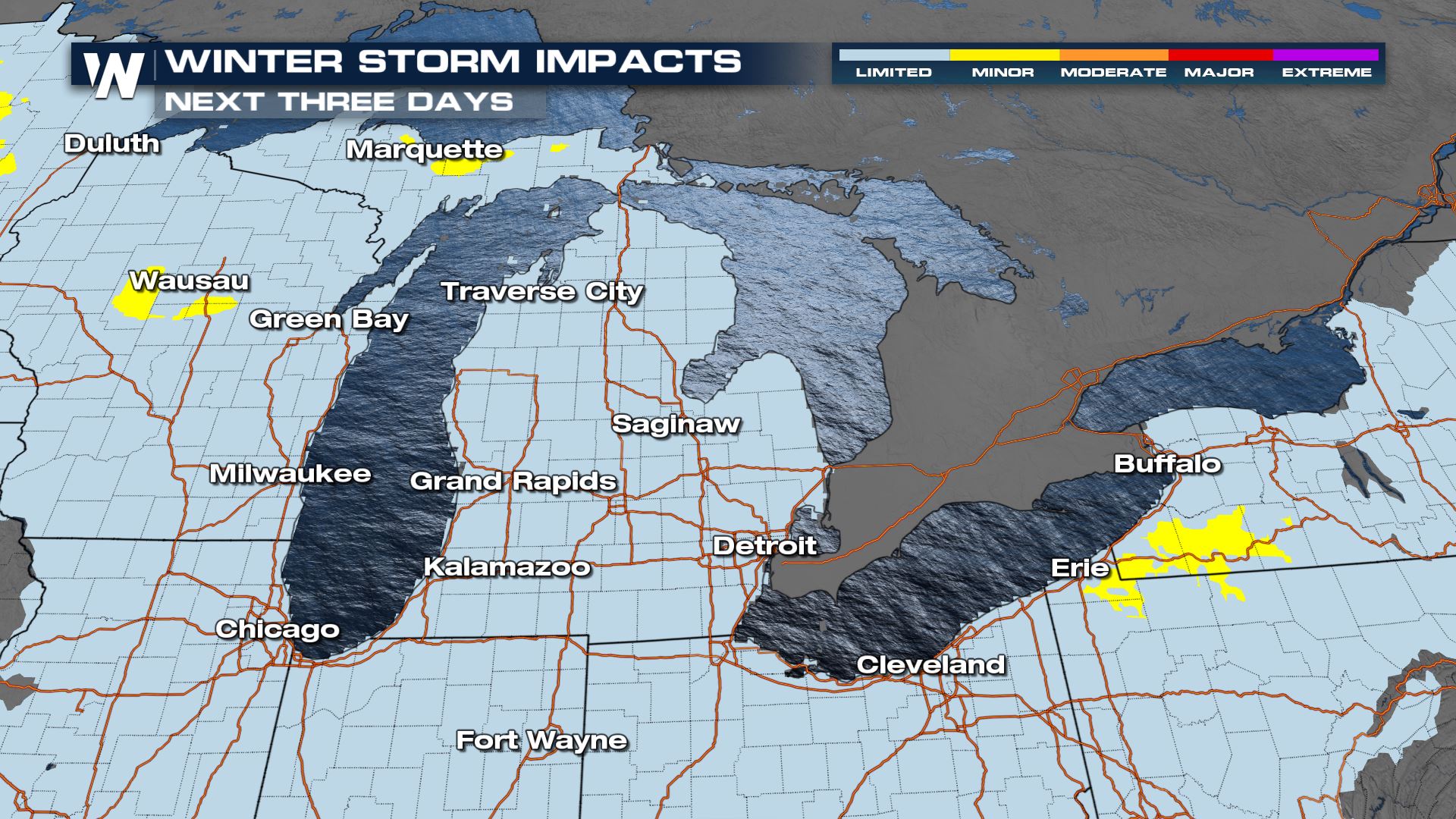
 Impacts will be relatively minor, but spots highlighted in yellow will be affected more than surrounding areas. These more affected areas can change depending on where the heavy bands of snow set up.
 We're covering the top national weather headlines all day on WeatherNation on air and online. Stream 24/7 to get all of your forecast details!
Check out some of the higher totals from the last 24 hours:
Forecast
More snow is expected over the next 48 hours. Accumulations will generally be light, and impacts will be relatively minor. But still take care driving, roads can still be slippery without a ton of snow! Overnight snow will become more widespread in spots as the Alberta clipper system rolls through. The snow from the clipper will be on top of any lake effect snow that fell earlier Saturday.
Wrap around moisture on the back side of the Alberta clipper surface low. and winds from the west-northwest will aid in more lake effect snow bands across the Midwest and Great Lakes Sunday afternoon. Meanwhile more light but widespread system snow will be happening in the Ohio Valley and western New York.
As the low moves away Monday, a few more bursts of snow are possible along the eastern shores of the lakes throughout the day.
Impacts will be relatively minor, but spots highlighted in yellow will be affected more than surrounding areas. These more affected areas can change depending on where the heavy bands of snow set up.
We're covering the top national weather headlines all day on WeatherNation on air and online. Stream 24/7 to get all of your forecast details!All Weather News
More
Monsoon Moisture Brings Weekend Flood Threat
The monsoon has returned to the southwestern
17 Jul 2026 12:55 PM

Texas Hill Country: Life-Threatening Flooding
TEXAS HILL COUNTRY - Life-threatening floodin
17 Jul 2026 12:10 PM

Thick Wildfire Smoke Continues to Pour Across the Great Lakes, East Coast
Wildfires burning in Northwestern Ontario, Ca
17 Jul 2026 11:20 AM

Two Tropical Areas to Monitor in the Atlantic
Two areas of potential tropical development a
17 Jul 2026 11:10 AM

Heat Alerts Across the Nation End Thursday
ALL-TIME RECORD HIGHS were broken across the
16 Jul 2026 1:00 AM

Rare Enhanced Severe Threat For New England
WHAT TO EXPECT The SPC has issued a severe ou
15 Jul 2026 1:35 AM

Saharan Dust and Excessive Heat Impact the Southeast
Hazy skies will be hovering over portions of
14 Jul 2026 10:05 AM