CA Evacuations Lifted as Heavy Rain Ends
Special Stories
22 Mar 2018 8:34 PM
"We dodged a bullet when the rain didn't reach it's full potential." Those were the words of Ventura, Santa Barbara, and Los Angeles County officials at a press conference Thursday evening.
https://twitter.com/WeatherNation/status/976965034520625152
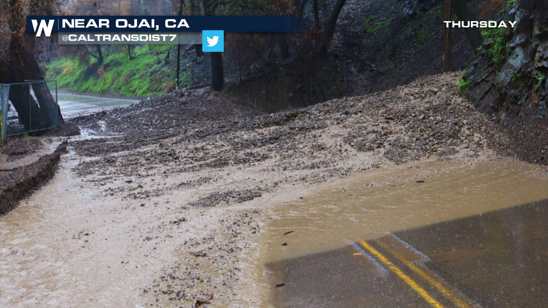
A press conference was held to update the media and public about the latest round of rain and thunderstorms to hit burn scar areas in California. One of the highlights was that people who had to evacuate, due to potential flooding, were allowed to return to their homes as of 5 p.m. Pacific Time Thursday. However they were urged to use caution as rain slowly ends overnight.
Other highlights of the press conference include:
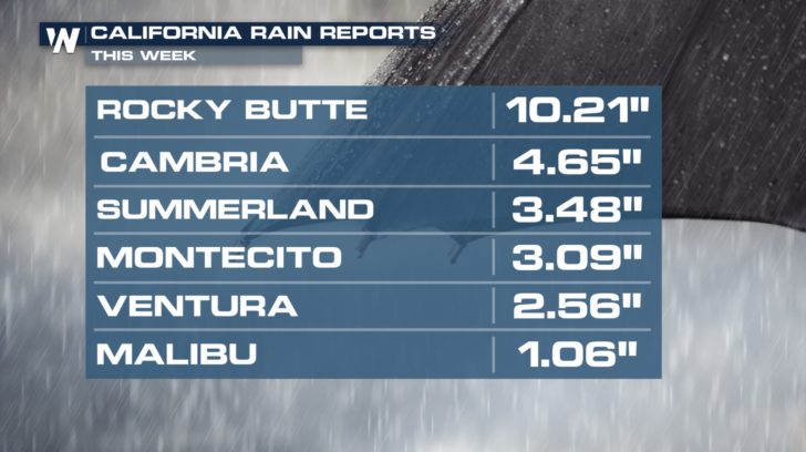 National Weather Service Meteorologists from Los Angeles say that the area didn't get as heavy rain as expected because some of the weather dynamics that cause intense lifting weren't quite there this time. The moisture was there, but the storms never reached had the "punch" forecasters expected. Some of the heavier rain missed these areas to the north, also to the south.
Still, residents below burn scar areas need to monitor the forecast for heavy rain events in the future. This is the wet season for southern California, however as we get into April and May, history tells us drier weather usually moves in.
National Weather Service Meteorologists from Los Angeles say that the area didn't get as heavy rain as expected because some of the weather dynamics that cause intense lifting weren't quite there this time. The moisture was there, but the storms never reached had the "punch" forecasters expected. Some of the heavier rain missed these areas to the north, also to the south.
Still, residents below burn scar areas need to monitor the forecast for heavy rain events in the future. This is the wet season for southern California, however as we get into April and May, history tells us drier weather usually moves in.
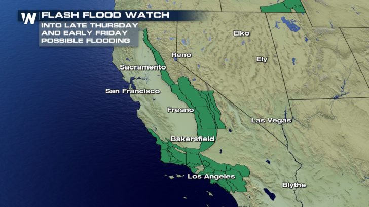 Flooding remains a possibility until early Friday morning, March 23 due to a few remaining showers and thunderstorms.
For WeatherNation, Meteorologist Steve Glazier
Flooding remains a possibility until early Friday morning, March 23 due to a few remaining showers and thunderstorms.
For WeatherNation, Meteorologist Steve Glazier
- Area fire departments, sheriff's offices, emergency managers, the National Guard, and others were deployed and on standby for this heavy rain and flooding event
- About 400 first responders were deployed in the areas most at risk for flooding
- Fortunately there were no reports of major flooding, injuries, or fatalities from the heavy rain over burn scar areas
- Officials created 'debris basins' to collect rainwater, rocks, mud, etc. and the basins performed 'perfectly.'
- Highway 101 stayed open throughout the rain event
- Schools in the areas are expected to be fully open Friday
- Heaviest of the rain comes to an end Thursday night, or at least by Friday morning's sunrise
National Weather Service Meteorologists from Los Angeles say that the area didn't get as heavy rain as expected because some of the weather dynamics that cause intense lifting weren't quite there this time. The moisture was there, but the storms never reached had the "punch" forecasters expected. Some of the heavier rain missed these areas to the north, also to the south.
Still, residents below burn scar areas need to monitor the forecast for heavy rain events in the future. This is the wet season for southern California, however as we get into April and May, history tells us drier weather usually moves in.
Flooding remains a possibility until early Friday morning, March 23 due to a few remaining showers and thunderstorms.
For WeatherNation, Meteorologist Steve GlazierAll Weather News
More
Wildfire Outbreak in the Pacific Northwest
Conditions have been incredibly dry out west.
2 Aug 2026 12:20 PM


More Storms for the East Sunday and Monday
A low-pressure system crashing through the Mi
2 Aug 2026 2:20 AM

After Reaching Category 5, Genevieve Weakens in the Pacific
PacificGenevieve formed on last Friday south
2 Aug 2026 1:30 AM

Flooding, Severe Storms Target the Midwest Again
After an active week of storms across the nor
1 Aug 2026 1:40 AM

Flooding Risk Increases as Heavy Rain Targets the Tri-State Area
Tuesday, heavy rainfall moved across the Nort
30 Jul 2026 12:25 AM

Severe Weather: Energy From the Midwest Now in the Southeast
UPPER MIDWEST - Through Monday, dangerous tor
29 Jul 2026 10:30 PM