Strong Tornadoes Possible in the Midwest, Ohio Valley on Thursday

While the Midwest has finally seen a break from a cold and snowy pattern, warmer air and increasing moisture could lead to numerous severe storms on Thursday. A Pacific low is now strengthening in the lee of the Rockies and will continue moving east, bringing lift and wind shear to the region. At the surface, moisture from the Gulf is pulled north into mild winter temperatures.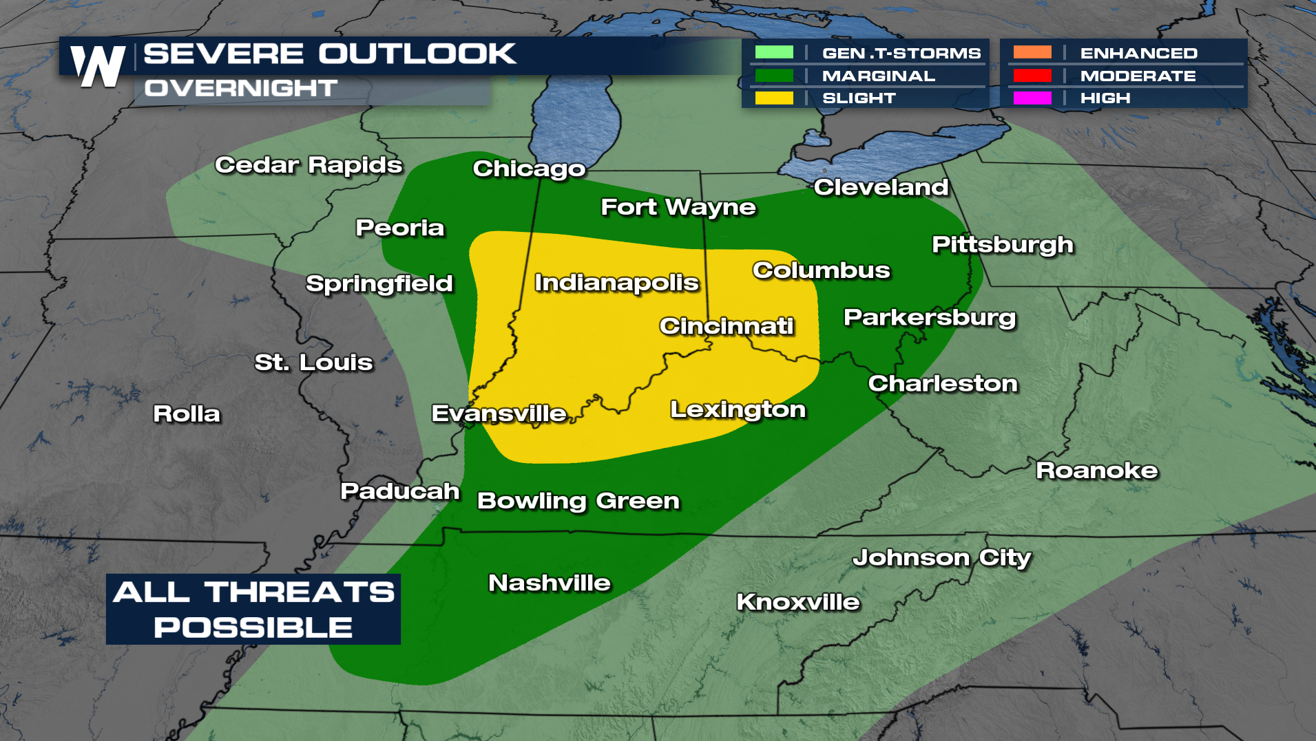
A few tornadoes have been confirmed across parts of the Illinois and the tornado threat will continue overnight into Ohio and Indiana. Please have several ways to receive weather alerts with storms in the forecast tonight.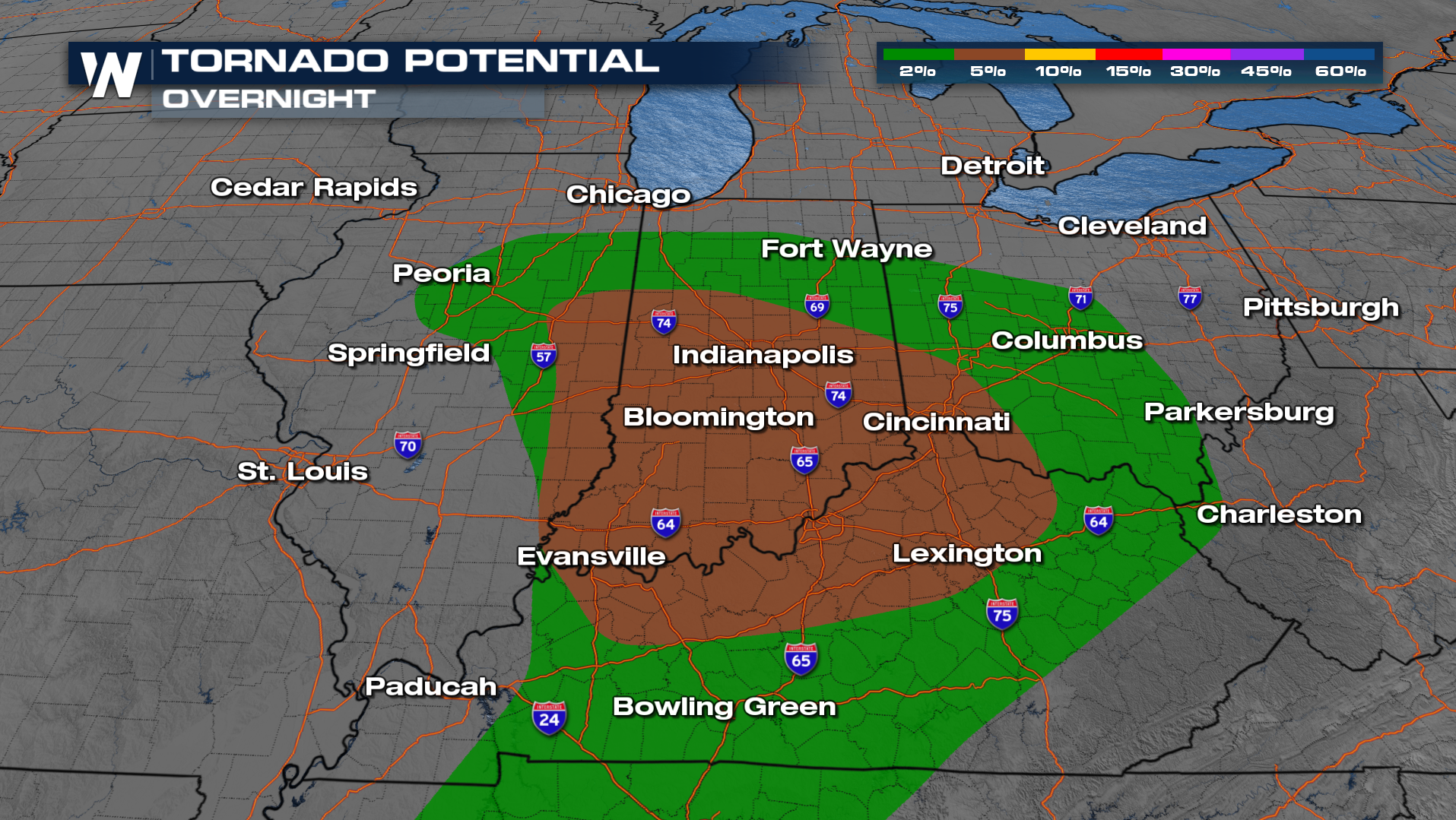
As we move further into the overnight, the severe threat will gradually end from west to east. Some heavier downpours could be possible within the stronger storms. An additional inch or two of rain could be possible.
.


