California's Kincade Fire Burn Scar Seen From Space
Special Stories
5 Nov 2019 2:35 AM
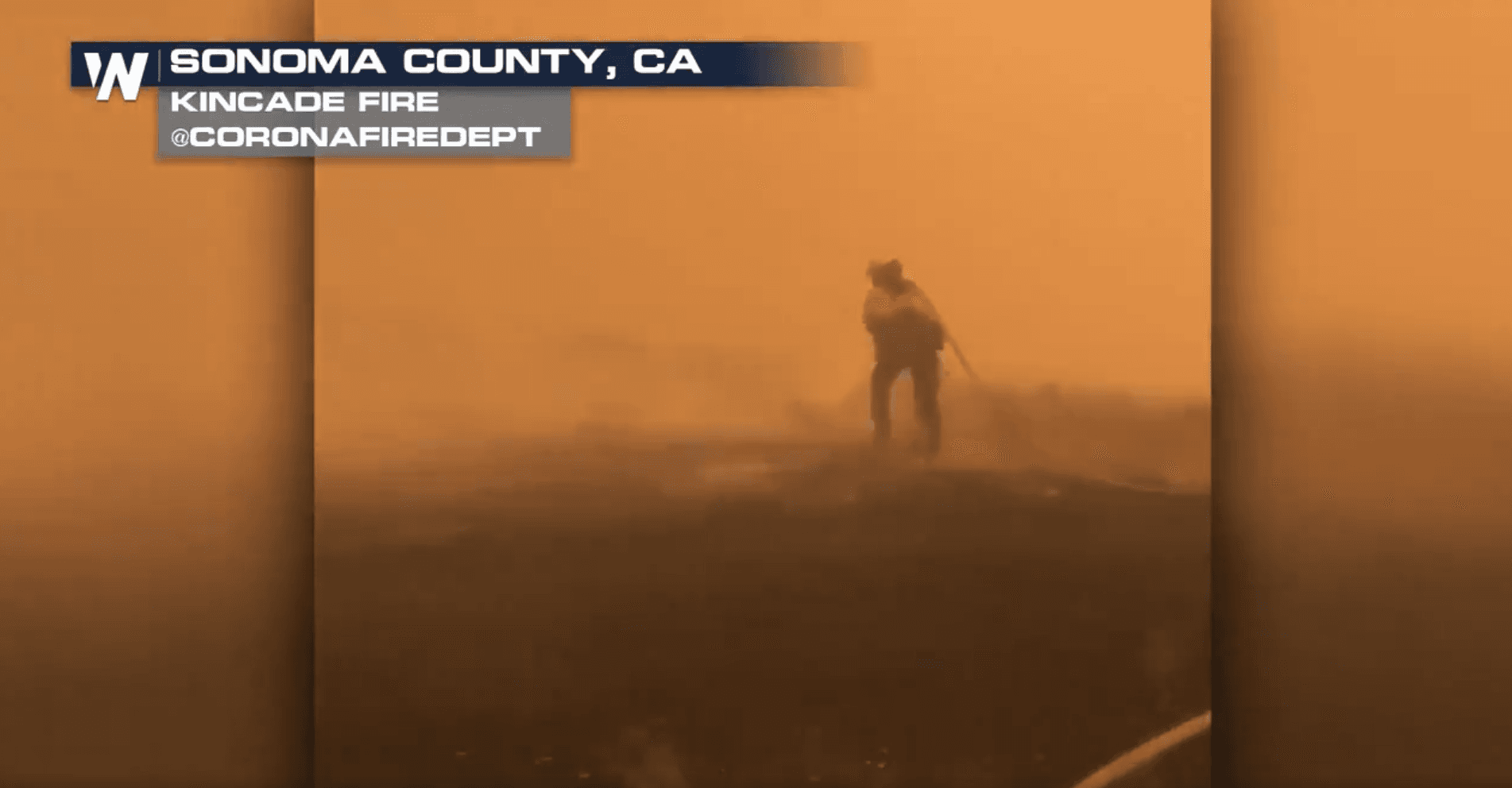
[Kincade fire in Calfornia from October 28th. From Corona Fire Department]
[NASA] Thousands of acres damaged by the ongoing Kincade Fire in Northern California's Sonoma County are visible from the Advanced Spaceborne Thermal Emission and Reflection Radiometer (ASTER) instrument aboard NASA's Terra satellite. The burned area appears dark gray in ASTER's visible channels. Hotspots, where the fire is still smoldering, appear as yellow dots in ASTER's heat-sensing, thermal infrared channels.
After starting on Oct. 23, forcing residents to evacuate, the fire had burned 77,758 acres and destroyed 372 structures by Nov. 3, according to the California Department of Forestry and Fire Protection. It is now over 80% contained. The town of Healdsburg is in the center of the image, which covers an area of about 24 by 25 miles.
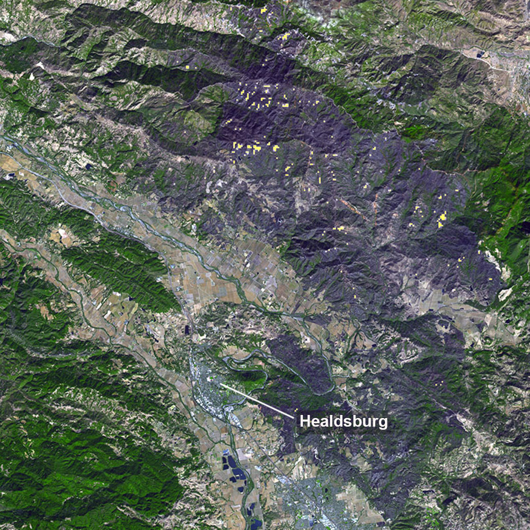 [A large burn scar can be seen from space where the Kincade Fire has burned through Sonoma County, California. The image was taken on Nov. 3, 2019, by the ASTER instrument aboard NASA’s Terra satellite. Credits: NASA/JPL-Caltech]
ASTER is one of five Earth-observing instruments launched in December 1999 on NASA's Terra satellite. With its 14 spectral bands from the visible to the thermal infrared wavelength region and its high spatial resolution of 15 to 90 meters (about 50 to 300 feet), ASTER images Earth to map and monitor the planet's changing surface. Japan's Ministry of Economy, Trade and Industry built the instrument. NASA's Jet Propulsion Laboratory in Pasadena, California, is responsible for the American portion of the joint U.S.-Japan science team that validates and calibrates the instrument and the data products associated with it.
[A large burn scar can be seen from space where the Kincade Fire has burned through Sonoma County, California. The image was taken on Nov. 3, 2019, by the ASTER instrument aboard NASA’s Terra satellite. Credits: NASA/JPL-Caltech]
ASTER is one of five Earth-observing instruments launched in December 1999 on NASA's Terra satellite. With its 14 spectral bands from the visible to the thermal infrared wavelength region and its high spatial resolution of 15 to 90 meters (about 50 to 300 feet), ASTER images Earth to map and monitor the planet's changing surface. Japan's Ministry of Economy, Trade and Industry built the instrument. NASA's Jet Propulsion Laboratory in Pasadena, California, is responsible for the American portion of the joint U.S.-Japan science team that validates and calibrates the instrument and the data products associated with it.
All Weather News
More
Heat Wave Grips Central, Western U.S.
Are you over the summer heat yet? SouthwestEx
25 Jul 2026 11:10 AM

Tropics: Fausto Heads to Hawaii; Genevieve Has Formed and Could Become a Major Hurricane
Atlantic BasinBertha has dissipated after mov
25 Jul 2026 11:00 AM

Severe Storms Target the Midwest This Weekend
Extreme heat will be a big story this week ac
25 Jul 2026 11:00 AM

Southeast Flood Risk Lingers Near Stalled Front
A stalled boundary over the Southeast will ke
25 Jul 2026 10:55 AM

Fire Weather Continues This Weekend
Conditions have been really dry out west. We'
25 Jul 2026 10:50 AM

Another Round of Storms Targets the Northeast
Tuesday brought severe weather again across p
23 Jul 2026 1:15 AM

Another Round of Severe Weather for the Upper Midwest and Great Lakes
The upper-level low train continues to keep t
21 Jul 2026 1:45 AM