Central Plains heating up through the end of the week
Special Stories
13 May 2019 5:15 PM
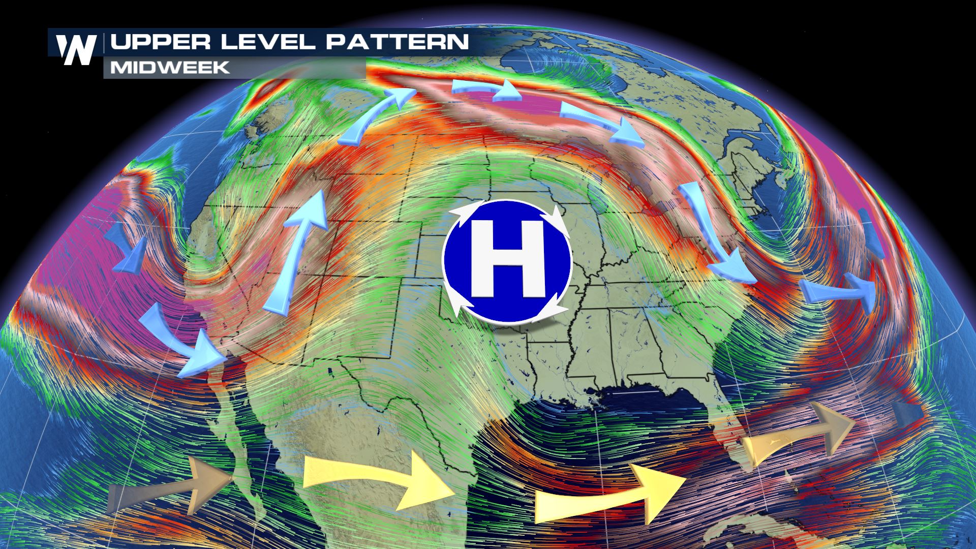
High pressure is building in the central plains over the next couple of days. This means the upper level jet streams is ridging to the north, keeping the cold air locked in Canada but allowing the cold air is diving into the North East of the United States.
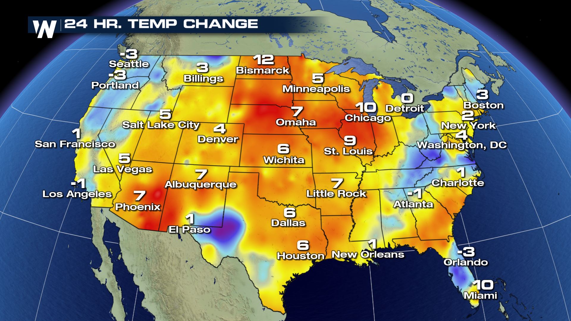
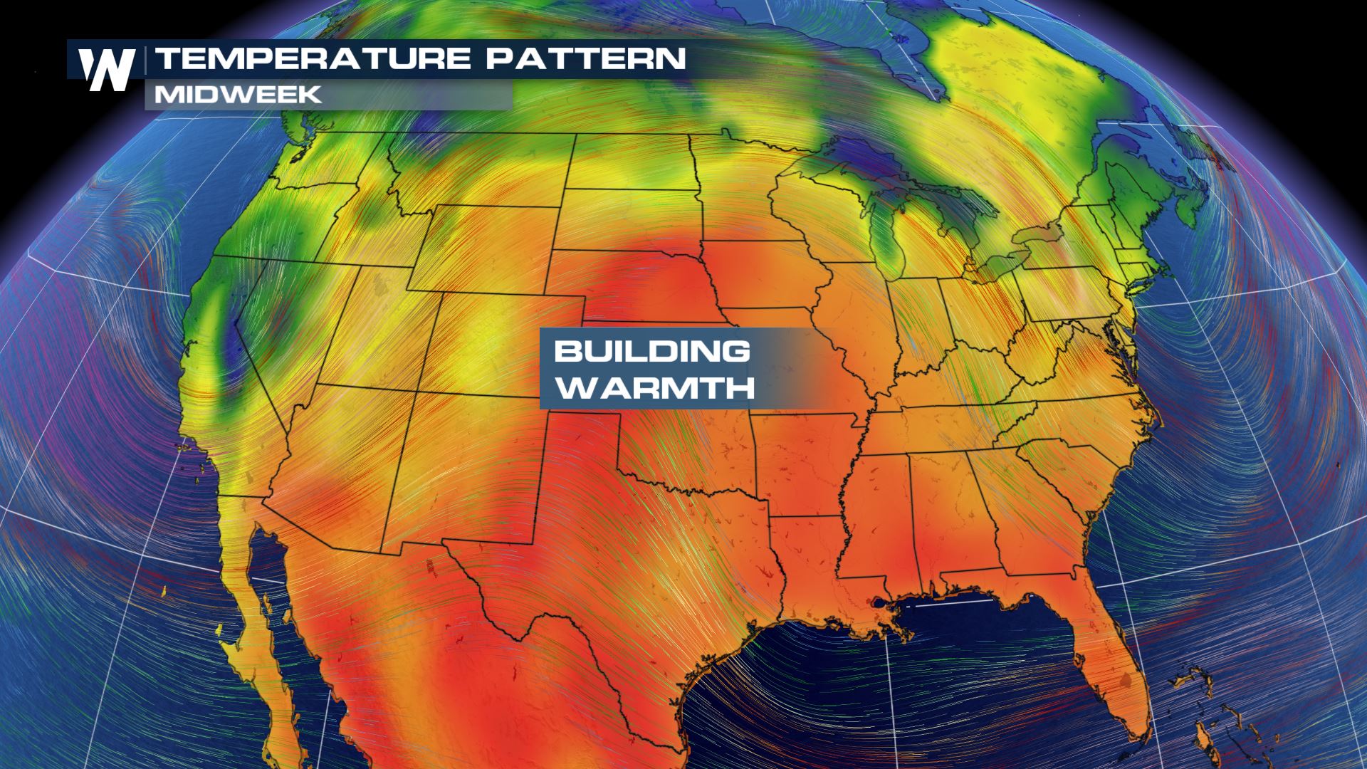 High temperatures for Monday are already reaching anywhere from 5 to 15 degrees warmer than they were on Sunday afternoon. The heat is just getting started and highs will continue to climb ever higher over the next couple of days.
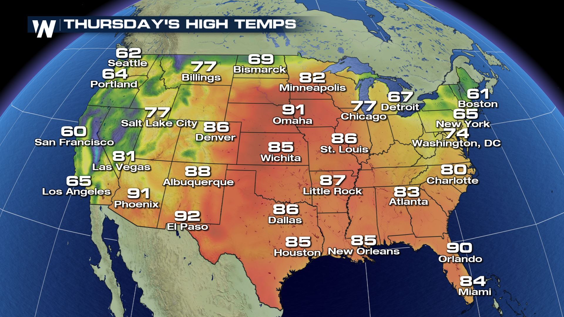
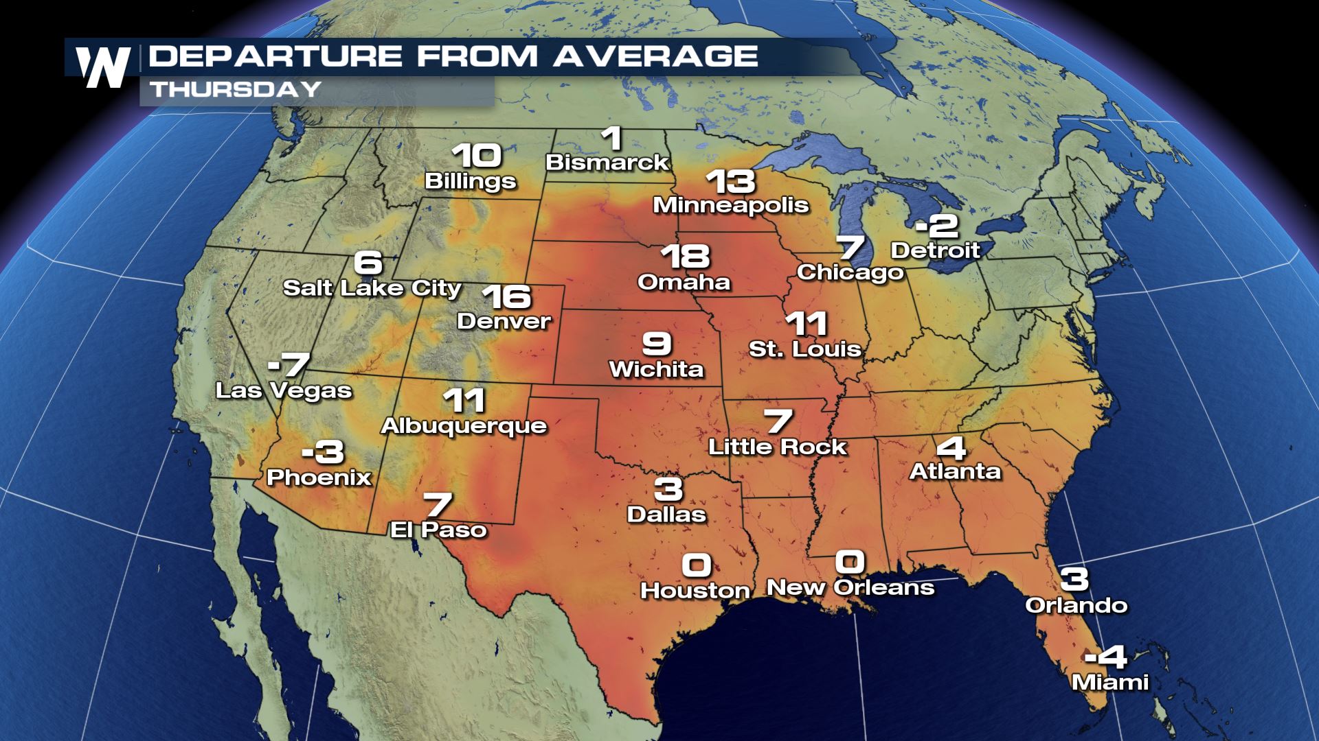
 By Thursday, high temperatures in the central United States will be the hottest they will get during the warming trend. Some areas could get some of the hottest conditions so far this year.
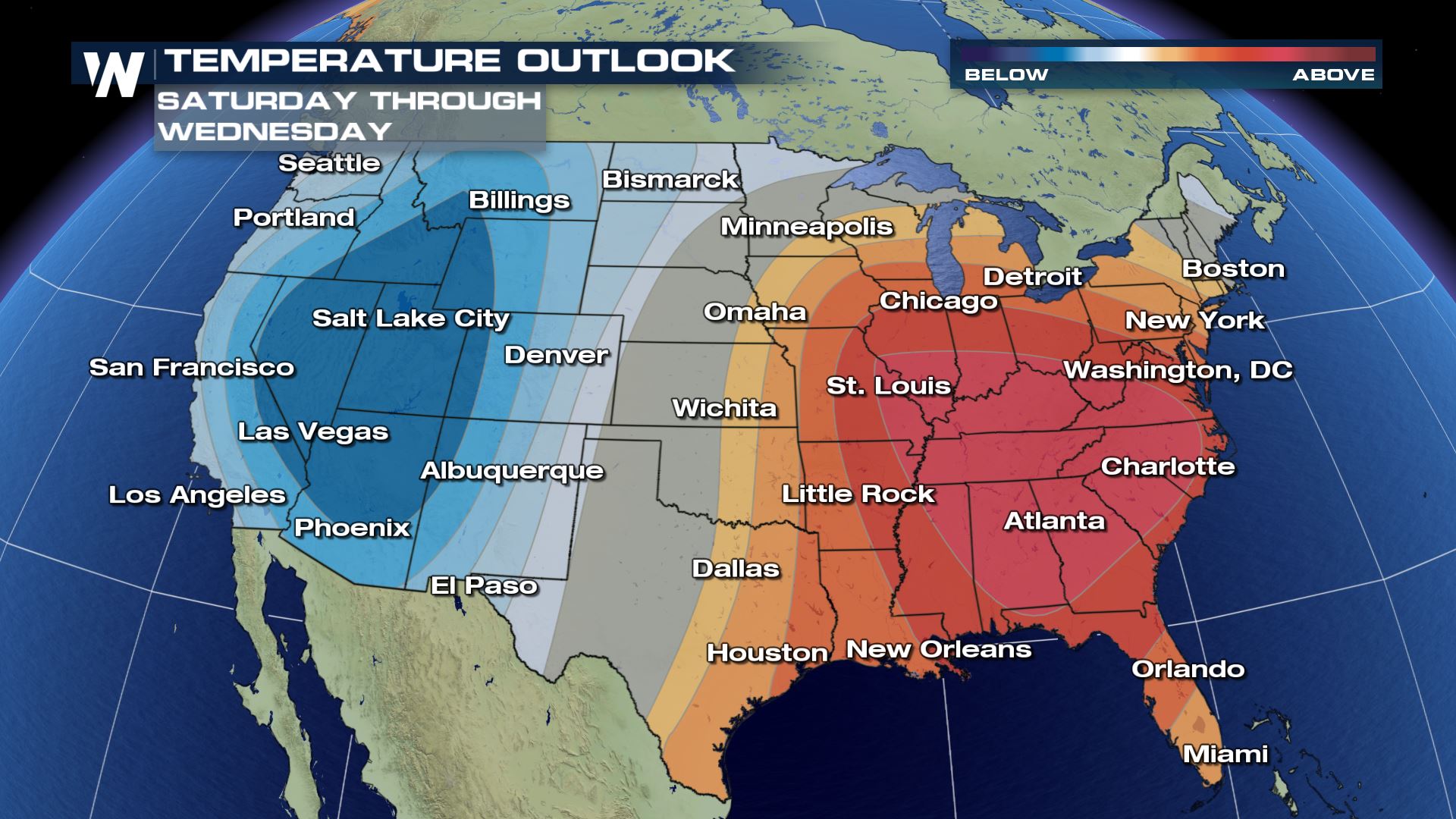
 As the center of the high pressure moves to the east, the heat will follow meaning the north east won’t stay cold past this week. The extended temperature outlook shows the eastern half of the country warming up next week.

 High temperatures for Monday are already reaching anywhere from 5 to 15 degrees warmer than they were on Sunday afternoon. The heat is just getting started and highs will continue to climb ever higher over the next couple of days.
 By Thursday, high temperatures in the central United States will be the hottest they will get during the warming trend. Some areas could get some of the hottest conditions so far this year.

 As the center of the high pressure moves to the east, the heat will follow meaning the north east won’t stay cold past this week. The extended temperature outlook shows the eastern half of the country warming up next week.

All Weather News
More