Chance of Severe Storms Returns to the Southern Plains

Top Stories
25 Apr 2021 2:00 PM
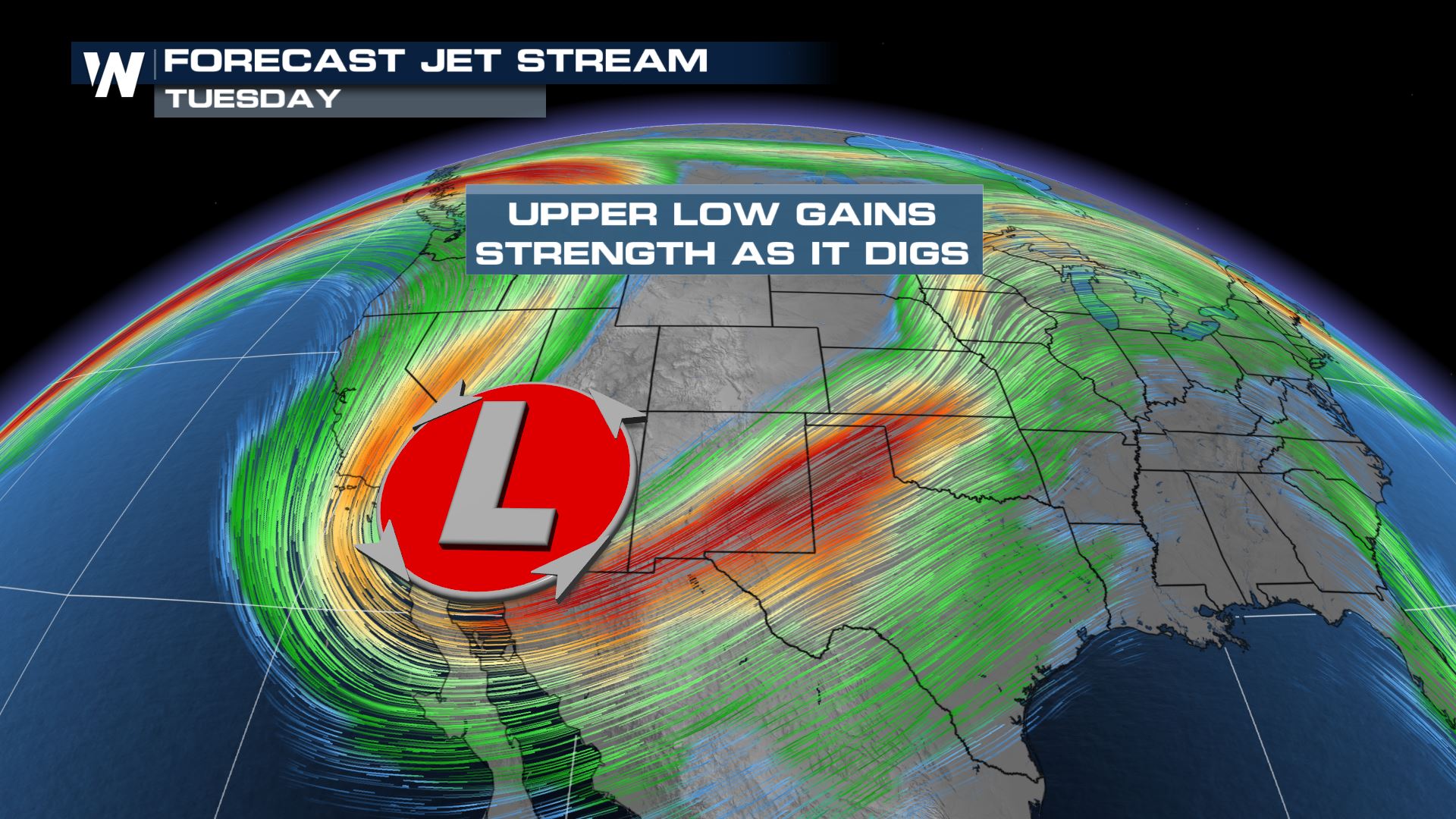
A strong storm over the Western U.S. this weekend will move east through the beginning of the work and school week, and will bring a chance of strong to severe storms from Kansas southward into Texas.
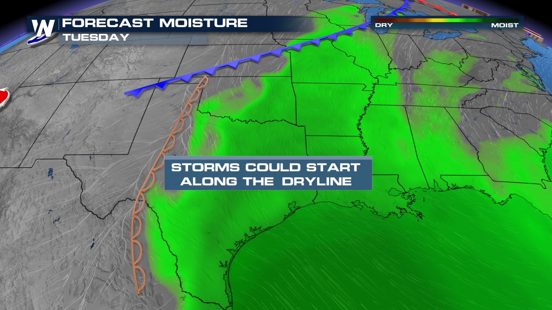
 There is expected to be plenty of warmth in place with temperatures forecast to be in the 80s. However, it's the water vapor in the air where storms garner most of their energy. South winds should funnel higher humidity northward from the Gulf of Mexico into the Southern Plains.
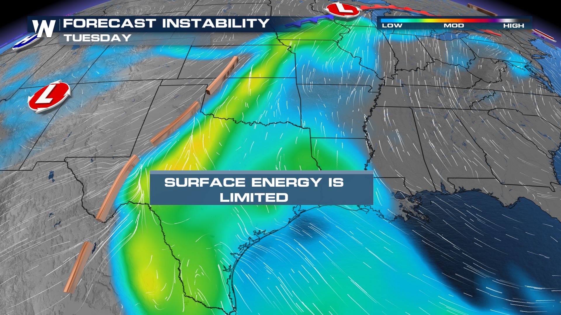
 The combination of heat and humidity will provide ample energy for these storms to be severe.
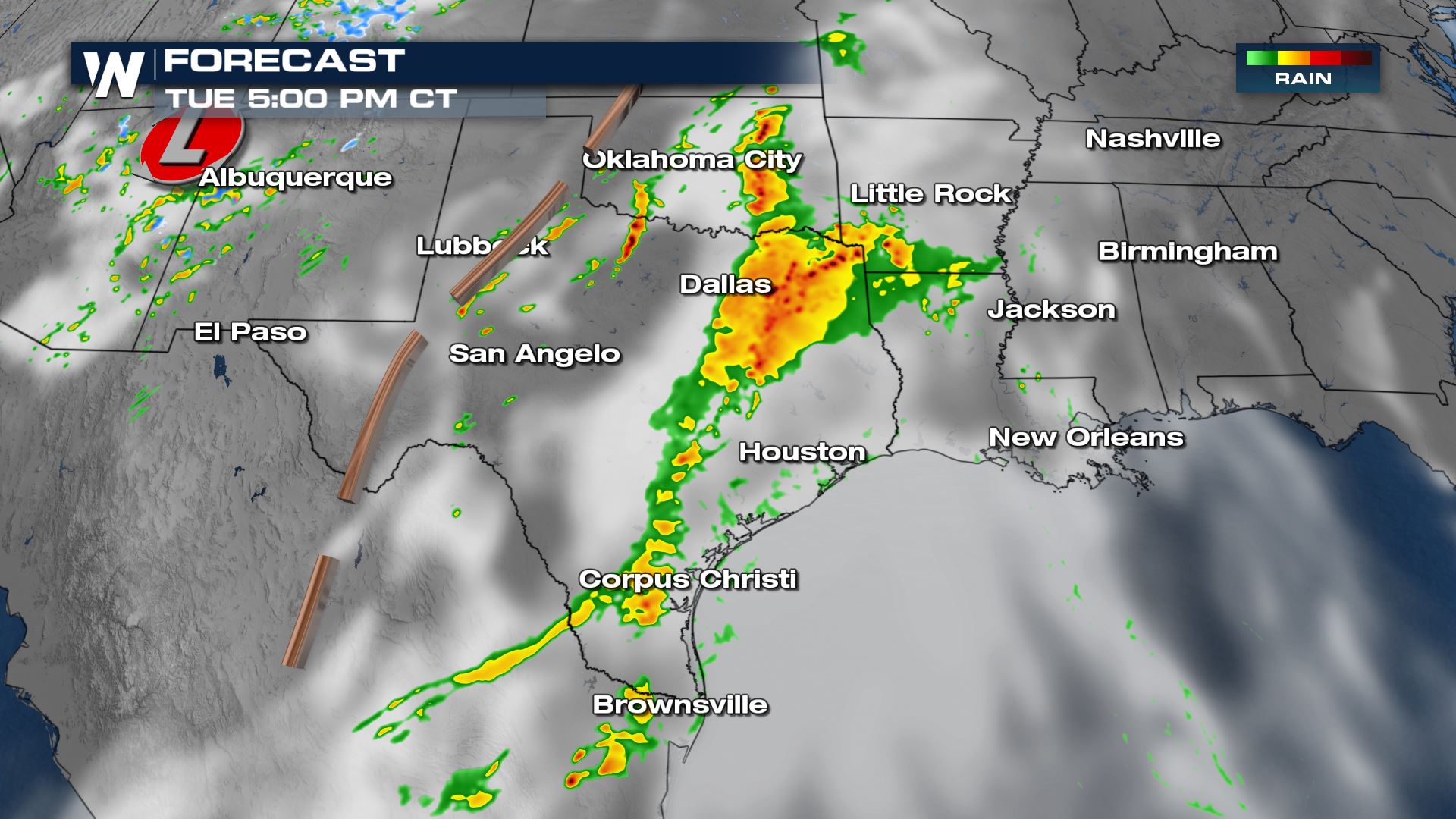
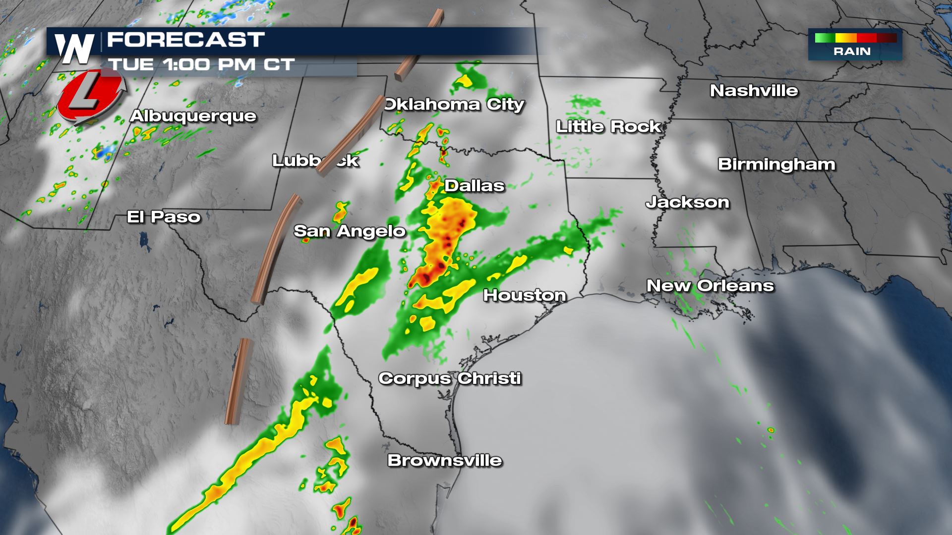 Thunderstorms are expected to gain in strength through the afternoon and also increase in coverage as they move east.
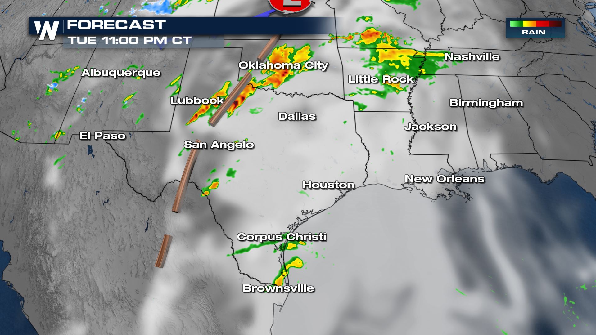
 By Tuesday night, storms should coalesce into a complex and chance from tornadoes will begin to decrease.
 Stay with WeatherNation for all the latest the closer we get to this chance of severe storms.
There is expected to be plenty of warmth in place with temperatures forecast to be in the 80s. However, it's the water vapor in the air where storms garner most of their energy. South winds should funnel higher humidity northward from the Gulf of Mexico into the Southern Plains.
The combination of heat and humidity will provide ample energy for these storms to be severe.
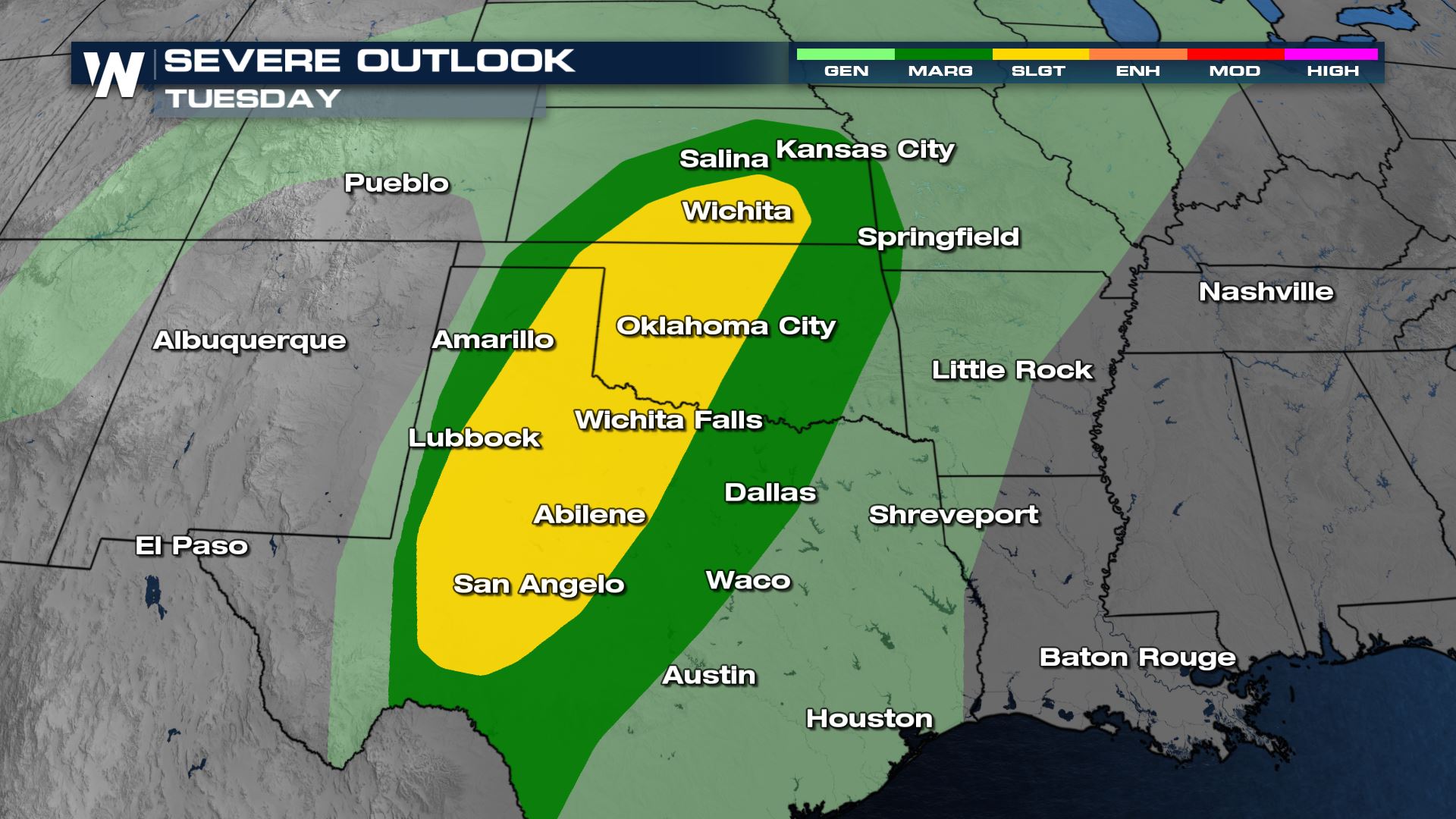
SPC Risk
As of right now, the Storm Prediction Center has a level II threat for storms being severe. This level of a threat would signal that along with large hail over 1" in diameter and strong winds over 58 mph, there could also be a risk for a few tornadoes too.
Forecast
Storms could fire as early as midday Tuesday.
Thunderstorms are expected to gain in strength through the afternoon and also increase in coverage as they move east.
By Tuesday night, storms should coalesce into a complex and chance from tornadoes will begin to decrease.
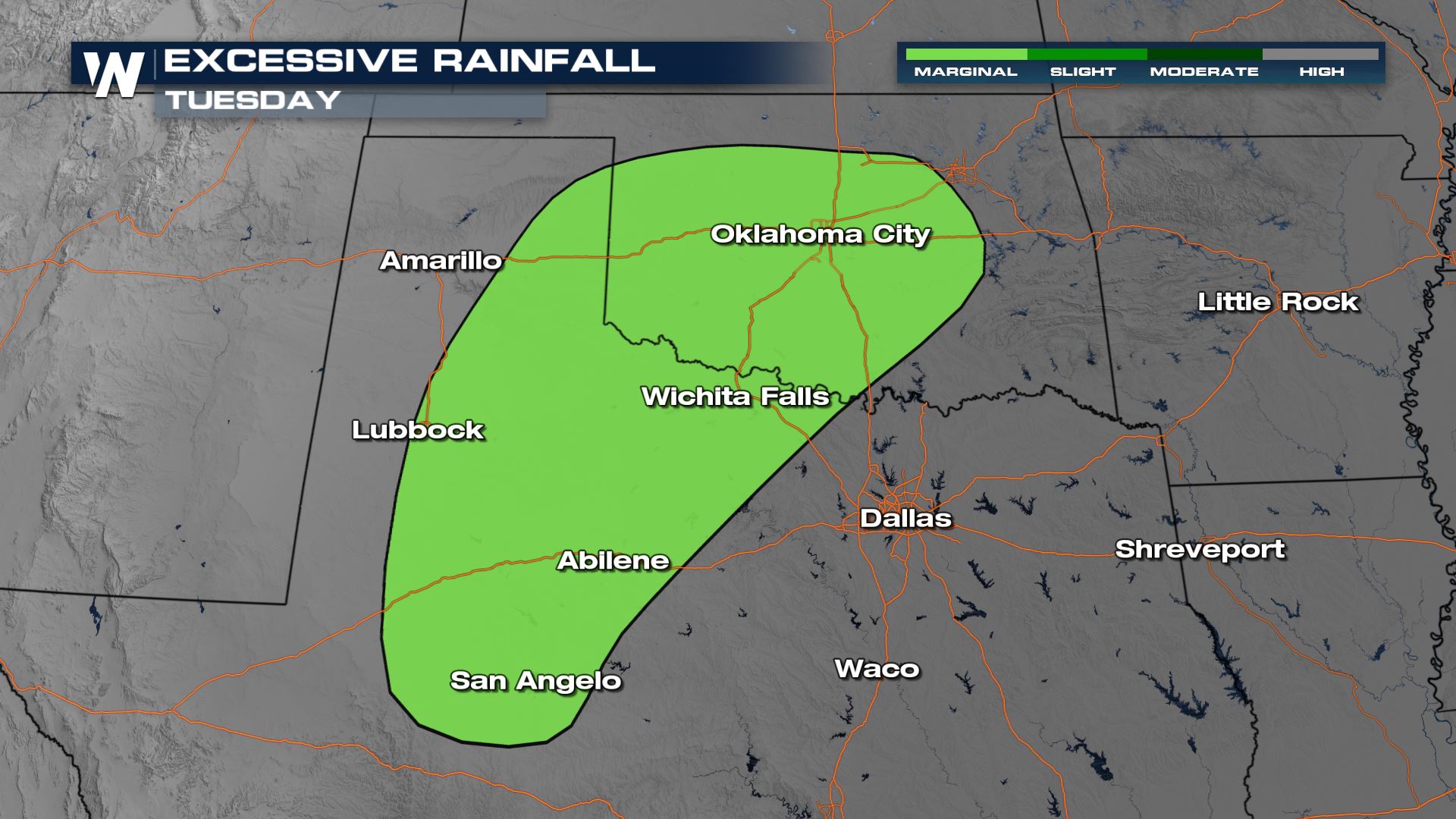
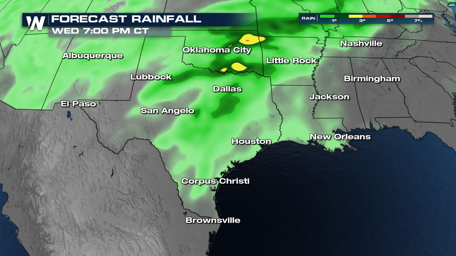
Excessive Rain Forecast
On top of strong to severe storms, there is also a risk for possible flooding. It's a lowest level risk at this time which means the chance of flash flooding would be low and isolated in nature of coverage.
Stay with WeatherNation for all the latest the closer we get to this chance of severe storms.All Weather News
More
Weekend System To Shake up Pattern Across the Country
A significant early-summer trough is expected
26 Jun 2026 8:45 PM

'MCS' Season Takes Hold with Severe Weather & Flooding Threats for the Plains & Midwest
As Summer settles in across the Central U.S.,
26 Jun 2026 8:40 PM

Massive Fires Burn in Utah, Extreme Fire Danger Develops Friday
Photo: Iron Fire getting doused with a retard
26 Jun 2026 8:30 AM

Severe Threat Tracks into the Northeast Friday
Another day, another Illinois tornado. That's
26 Jun 2026 2:25 AM


Front Range Overnight Storms, More Thursday and Friday
FRONT RANGE - Large hail and strong winds pus
25 Jun 2026 2:15 AM

Another Day of Heat For the West Before Changes
This week, an upper-level ridge has taken ove
24 Jun 2026 6:30 PM