Cleanup Underway after Tornadoes and 100 mph Winds Hit Sioux Falls
Special Stories
11 Sep 2019 12:46 PM
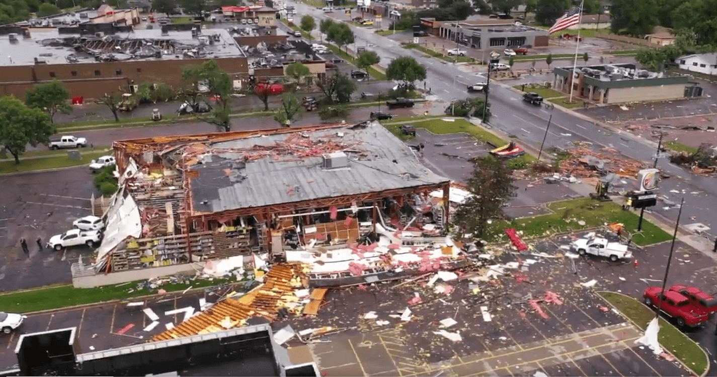
[Storm damage in Sioux Falls, SD. Drone video from the City of Sioux Falls]
Strong wind gusts and possibly multiple tornado touchdowns hit Sioux Falls, South Dakota late Tuesday night. Mayor Paul TenHaken said in a morning press conference that damage was extensive, but no major injuries or deaths have been reported.
https://twitter.com/CitySiouxFalls/status/1171799318971465728
https://twitter.com/WeatherNation/status/1171792485384740864
The National Weather Service is conducting a damage survey that so far concluded there were three EF-2 tornado touchdowns, with winds of 125 to 130 mph Paths ranged from .63 to .9 of a mile. Each touchdown was on the ground for around a minute and created a damage path of 50 to 75 yards. Todd Heitkamp, Meteorologist in Charge at the National Weather Service office in Sioux Falls, stated that wind gusts were higher than 100 mph and they will continue to survey the area to confirm if there were any other tornadoes within this line.
https://twitter.com/i/status/1171826538305556482
https://twitter.com/ToddHeitkamp/status/1171860725607936000
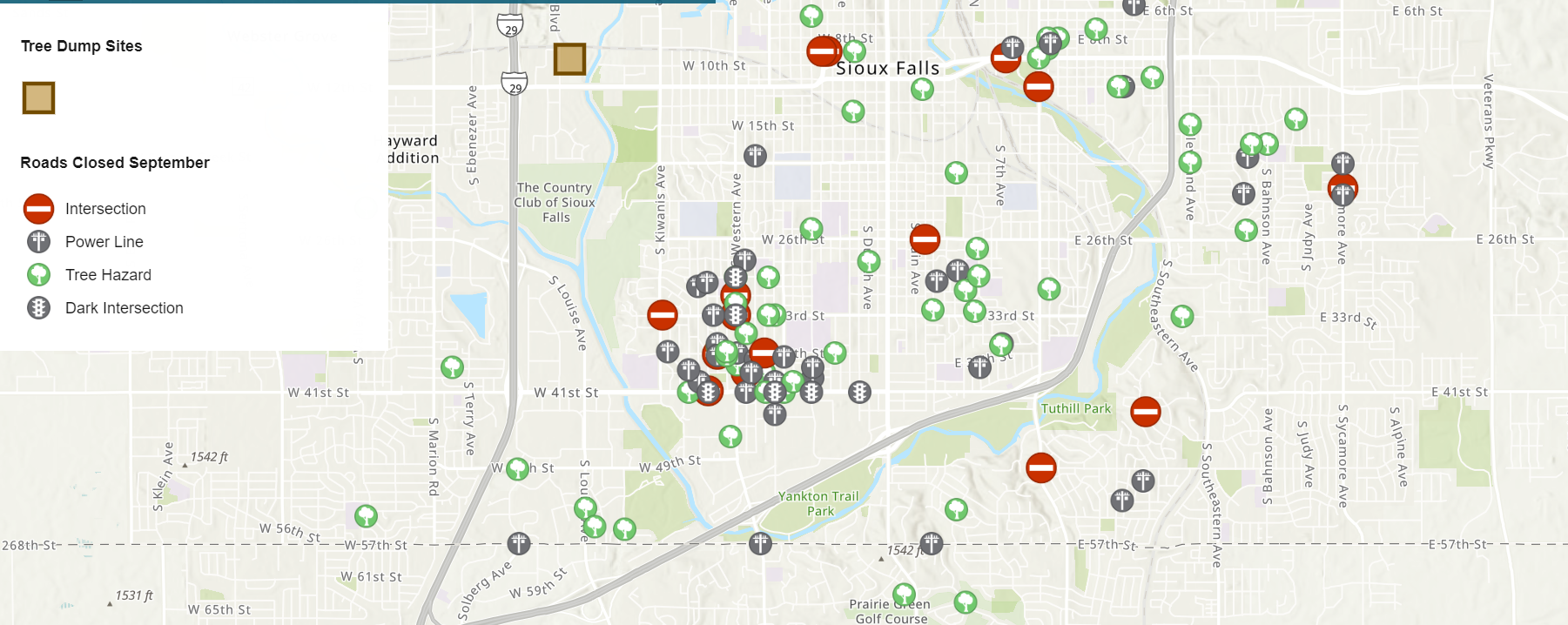 [Map of reported damage in Sioux Falls, SD. From City of Sioux Falls]
At least 37 structures reported significant structural damage or have collapsed. Xcel Energy reported a peak of 25,000 without power, with that number under 7,000 as of late Wednesday morning.
https://twitter.com/NWSSiouxFalls/status/1171864741729300480
https://twitter.com/Jill_KSFY/status/1171760737016078336
A Tornado Warning was issued for Sioux Falls at 11:27 p.m. The National Weather Service received the first confirmation of a tornado in southern areas of Sioux Falls at 11:38 p.m.
https://twitter.com/NWSSiouxFalls/status/1171641542458695686
https://twitter.com/shawncable/status/1171642309152333826
Along with damaged buildings, power lines were downed across the city and trees uprooted. The last time a tornado hit Sioux Falls was July of 1989. More specific information from city officials can be found at https://siouxfalls.org/storm
https://twitter.com/NWSSiouxFalls/status/1171865006033391616
https://twitter.com/ksfynews/status/1171781449609072640
https://twitter.com/paultenhaken/status/1171685641832280064
Stay tuned to WeatherNation on-air and online for updates.
For WeatherNation: Meteorologist Mace Michaels
[Map of reported damage in Sioux Falls, SD. From City of Sioux Falls]
At least 37 structures reported significant structural damage or have collapsed. Xcel Energy reported a peak of 25,000 without power, with that number under 7,000 as of late Wednesday morning.
https://twitter.com/NWSSiouxFalls/status/1171864741729300480
https://twitter.com/Jill_KSFY/status/1171760737016078336
A Tornado Warning was issued for Sioux Falls at 11:27 p.m. The National Weather Service received the first confirmation of a tornado in southern areas of Sioux Falls at 11:38 p.m.
https://twitter.com/NWSSiouxFalls/status/1171641542458695686
https://twitter.com/shawncable/status/1171642309152333826
Along with damaged buildings, power lines were downed across the city and trees uprooted. The last time a tornado hit Sioux Falls was July of 1989. More specific information from city officials can be found at https://siouxfalls.org/storm
https://twitter.com/NWSSiouxFalls/status/1171865006033391616
https://twitter.com/ksfynews/status/1171781449609072640
https://twitter.com/paultenhaken/status/1171685641832280064
Stay tuned to WeatherNation on-air and online for updates.
For WeatherNation: Meteorologist Mace MichaelsAll Weather News
More
Flooding, Severe Storms Target the Midwest Again
After an active week of storms across the nor
31 Jul 2026 4:15 PM


After Reaching Category 5, Genevieve Weakens in the Pacific
PacificFausto is now a post-tropical cyclone.
31 Jul 2026 1:30 AM

Flooding Risk Increases as Heavy Rain Targets the Tri-State Area
Tuesday, heavy rainfall moved across the Nort
30 Jul 2026 12:25 AM

Severe Weather: Energy From the Midwest Now in the Southeast
UPPER MIDWEST - Through Monday, dangerous tor
29 Jul 2026 10:30 PM