Clipper to Bring Snow to the Great Lakes and Northeast
Top Stories
21 Dec 2020 7:45 AM
A low pressure system sweeping out of Canada (referred to as an Alberta Clipper) will bring snow chances across the Great Lakes Monday. The term 'clipper' means this will be a quick moving system, so in terms of accumulative snow, we only really expect a couple inches of snow for these areas.
https://twitter.com/NWSduluth/status/1340971676926808065
 Snow has been falling this morning across parts of Minnesota and Wisconsin. We will continue to track this system as moves across the Great Lake States.
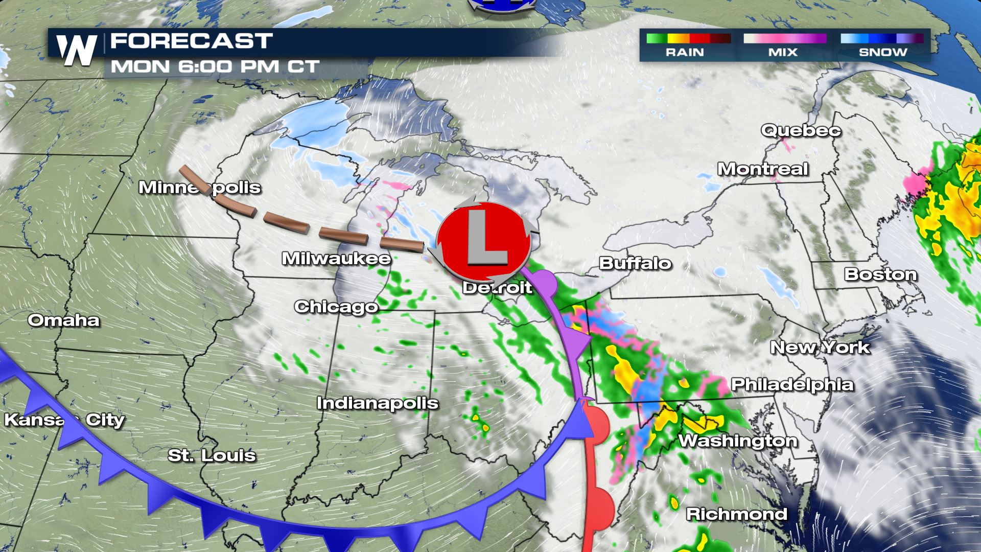
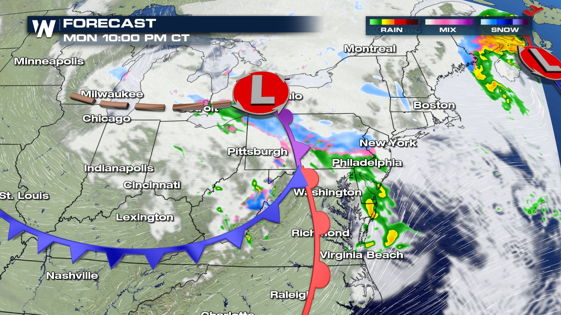
 Check out how quickly this low pressure system sweeps across the Great Lakes. The fast movement of this system means extreme snowfall is not in the forecast, but a few inches of accumulation will be possible.

 For more information as we track this system, be sure to tune into WeatherNation!
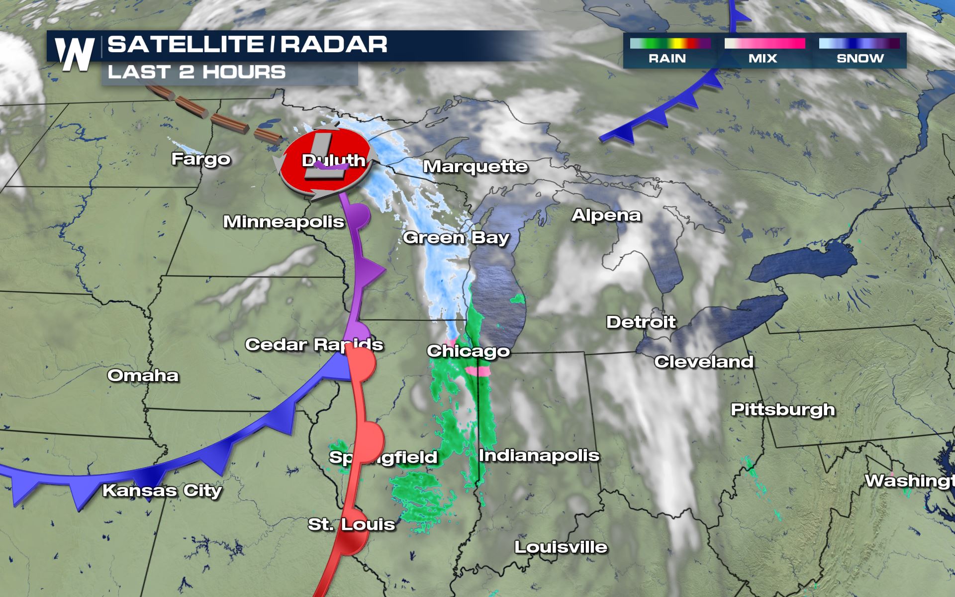
Morning Radar
Snow has been falling this morning across parts of Minnesota and Wisconsin. We will continue to track this system as moves across the Great Lake States.
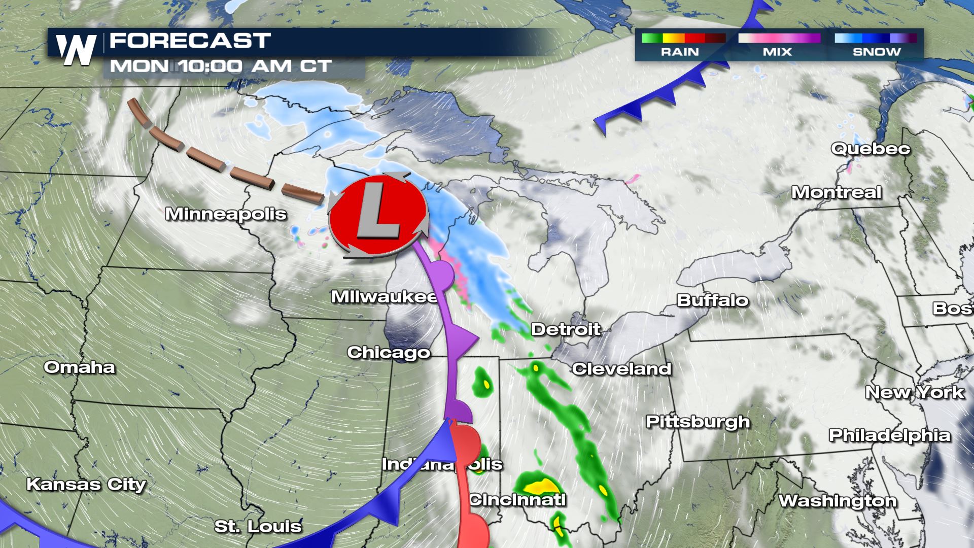
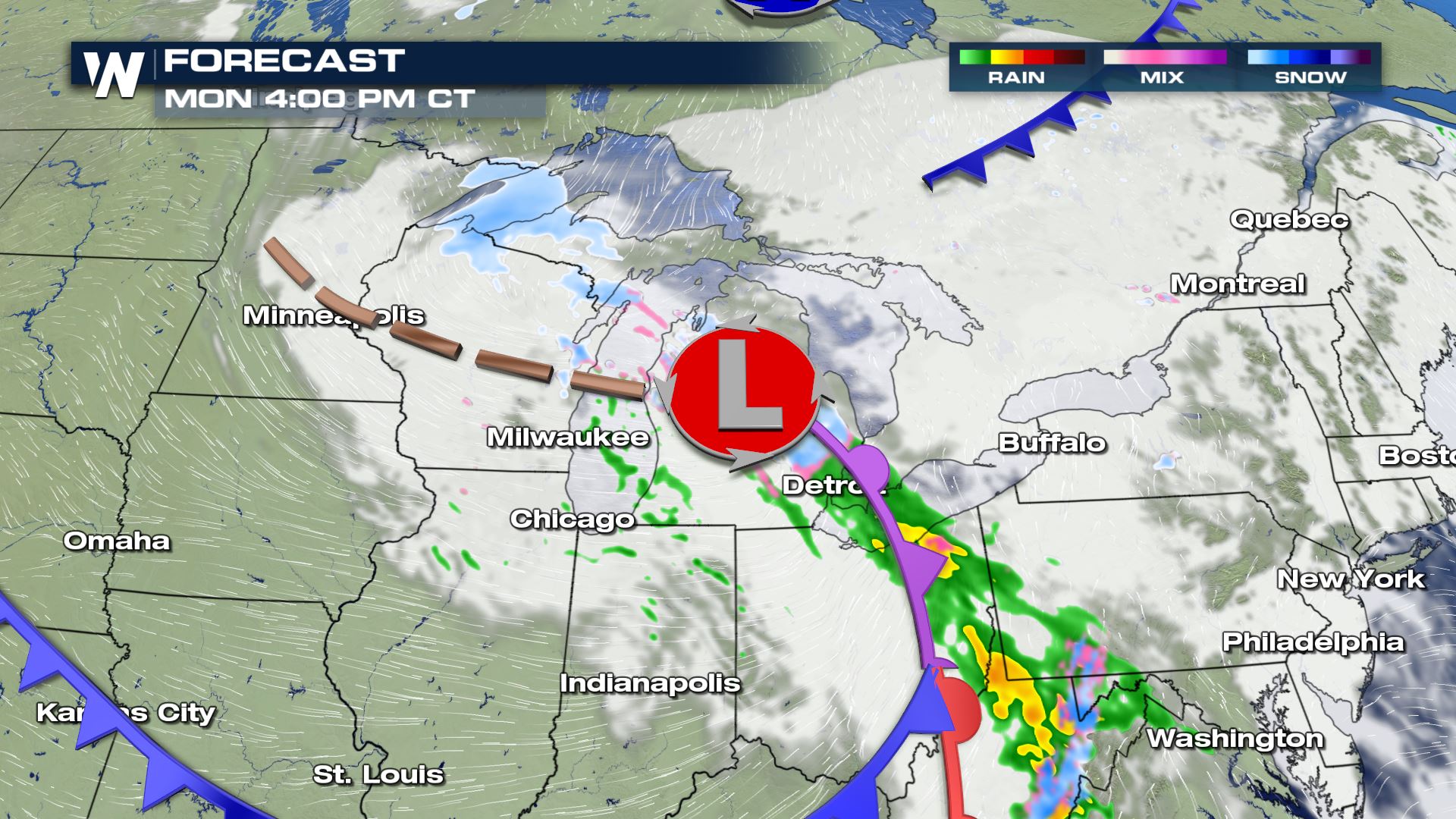
Forecast
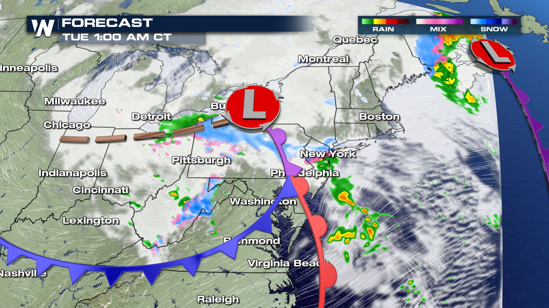
Check out how quickly this low pressure system sweeps across the Great Lakes. The fast movement of this system means extreme snowfall is not in the forecast, but a few inches of accumulation will be possible.
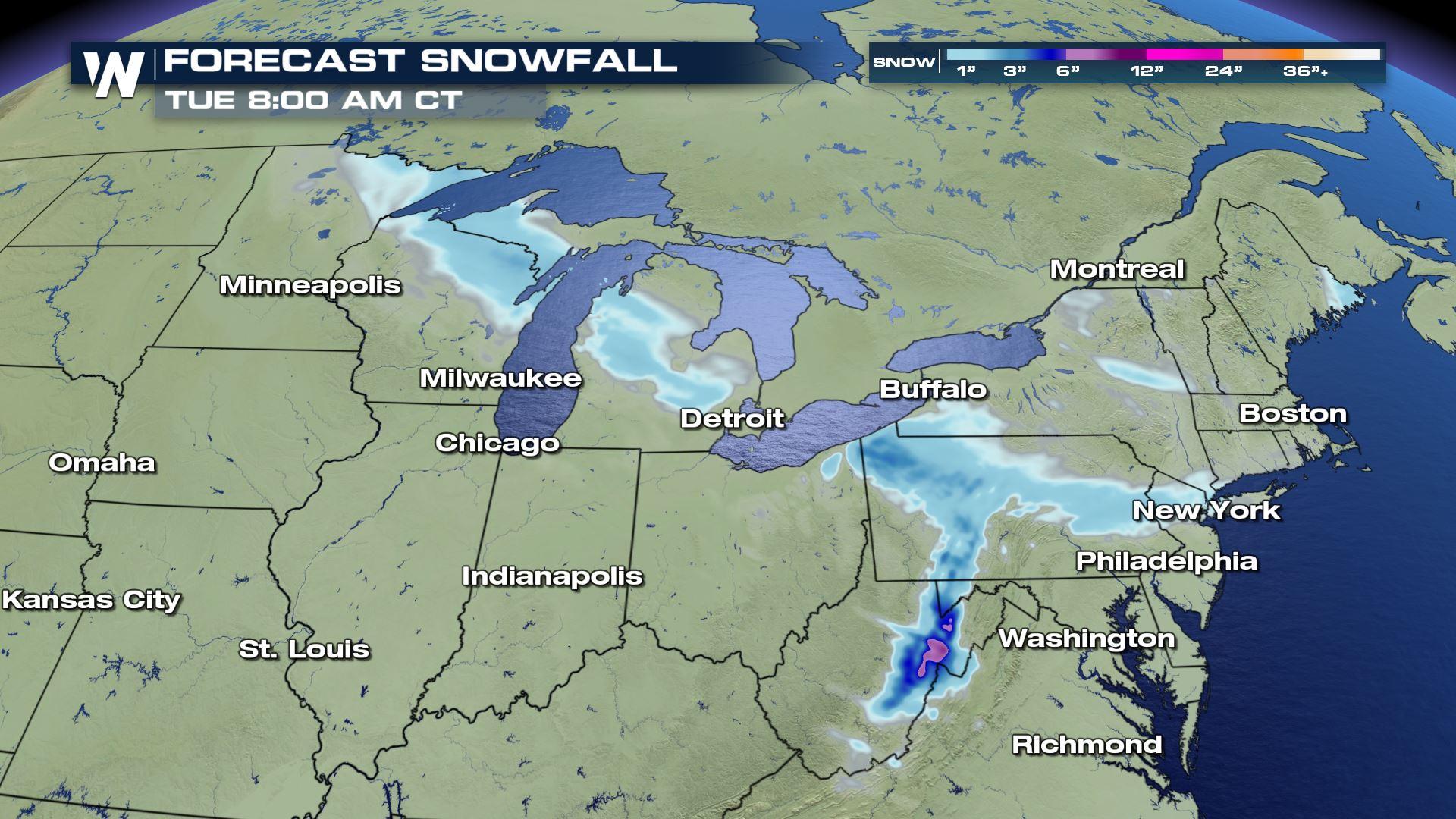
Forecast Accumulation
With this quick moving system, only a couple inches of snowfall are expected across these areas. The Appalachians of West Virginia will be under winter weather alerts this evening and may get up to 4-8 inches with this system.
Winter Weather Alerts
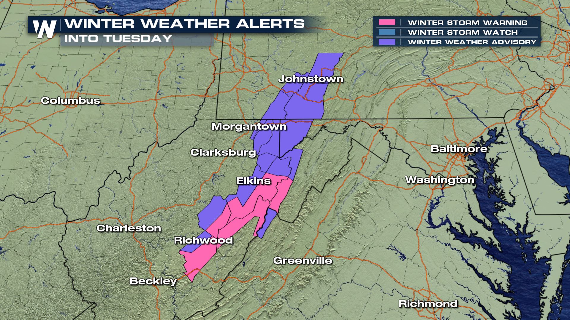
For this system, West Virginia, NE Maryland and Pennsylvania are under winter weather alerts. In purple are our winter weather advisories where 2-4" of snow are to be expected and wind gusts up to 35 mph. In pink are our winter storm warnings where 4-8" of snow can be expected and wind gusts up to 40 mph.
For more information as we track this system, be sure to tune into WeatherNation!All Weather News
More
More Storms for the East Through Monday
The threat for flooding rain continues across
3 Aug 2026 6:00 PM


After Reaching Category 5, Genevieve Weakens in the Pacific
PacificGenevieve formed last Friday south of
3 Aug 2026 12:30 AM

Flooding, Severe Storms Target the Midwest Again
After an active week of storms across the nor
1 Aug 2026 1:40 AM

Flooding Risk Increases as Heavy Rain Targets the Tri-State Area
Tuesday, heavy rainfall moved across the Nort
30 Jul 2026 12:25 AM