Significant Lake Effect Snow in New York, Michigan
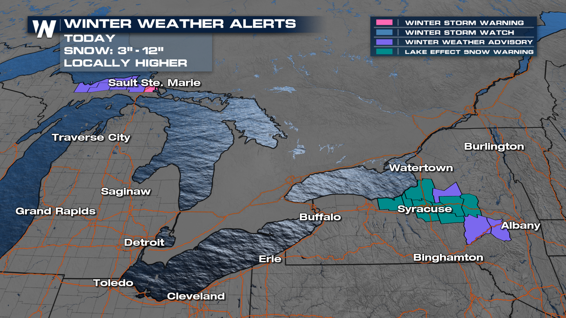
The same system and cold front that was responsible for severe storms in the Midwest, continues to produce lake-effect snow after it brought cold NW flow to the region late Wednesday. A heavy band of lake effect snow is expected to continue to impact areas around Syracuse and Oswego especially, where Lake Effect Snow Warnings are in effect.
We have some winter weather advisories and lake-effect snow warnings in Michigan and New York through Thursday night to account for localized totals upwards of a foot. Travel will be dangerous for West-facing shores.
 Lake Ontario and Lake Superior look to be the biggest snow-makers, leading to the possibility of seeing over 6" in the Upper Peninsula of Michigan and near Syracuse, NY. Locally higher totals are possible through Syracuse and the far northern U.P.
 The snow may help to reduce snow deficits for some cities around the Great Lakes, which are well below average for snowfall on the season.
