The Concern for More Flooding in the Mid-Atlantic
Special Stories
5 Jun 2018 4:46 PM
Over the last several weeks, portions of the Mid-Atlantic have received so much rain that many of the local rivers and tributaries are running bank full. Most areas are at or near flood stage.
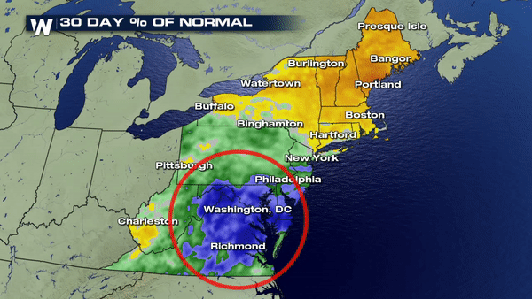
The graphic below show just how much of a surplus of rain has fallen across the area with well above average in the last 30 days.
 Baltimore, MD finished the month of May with the Top 5 wettest months on record with 2018 coming in at #3.
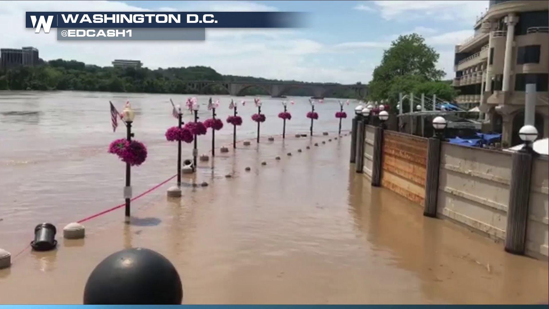
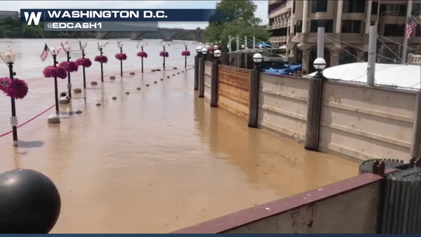
 The Potomac river at Georgetown/Washington Avenue peaked above flood stage earlier on Tuesday topping out at 9.63 feet when normal flood stage is right at 6 feet hence the video below showing just how full the river truly is.
 The one thing we have to keep in mind is that river flooding takes time. It isn't like flash flooding where its here and gone in an instant. It is a long duration process; hence, the receding takes time as well. Some rain is expected across the Mid-Atlantic this evening but the silver lining will be the somewhat extended drying period we will have Wednesday through most of the day Saturday. Hopefully, time will be on our side with helping the Potomac retreat back to normal levels.
Sunday through the beginning of next week is where we could find trouble "IF" and a big if the river doesn't recede enough as several inches of rain are likely to fall quickly as we introduce another system by late weekend. The point here is this: Even though we will see 2-3 consecutive dry days ahead, this doesn't mean the overall flooding threat isn't still imminent and being as though this river sits very close to densely populated locations means the implications could be much larger than we realize.
Meteorologist Merry Matthews
The one thing we have to keep in mind is that river flooding takes time. It isn't like flash flooding where its here and gone in an instant. It is a long duration process; hence, the receding takes time as well. Some rain is expected across the Mid-Atlantic this evening but the silver lining will be the somewhat extended drying period we will have Wednesday through most of the day Saturday. Hopefully, time will be on our side with helping the Potomac retreat back to normal levels.
Sunday through the beginning of next week is where we could find trouble "IF" and a big if the river doesn't recede enough as several inches of rain are likely to fall quickly as we introduce another system by late weekend. The point here is this: Even though we will see 2-3 consecutive dry days ahead, this doesn't mean the overall flooding threat isn't still imminent and being as though this river sits very close to densely populated locations means the implications could be much larger than we realize.
Meteorologist Merry Matthews
Baltimore, MD finished the month of May with the Top 5 wettest months on record with 2018 coming in at #3.
The Potomac river at Georgetown/Washington Avenue peaked above flood stage earlier on Tuesday topping out at 9.63 feet when normal flood stage is right at 6 feet hence the video below showing just how full the river truly is.
The one thing we have to keep in mind is that river flooding takes time. It isn't like flash flooding where its here and gone in an instant. It is a long duration process; hence, the receding takes time as well. Some rain is expected across the Mid-Atlantic this evening but the silver lining will be the somewhat extended drying period we will have Wednesday through most of the day Saturday. Hopefully, time will be on our side with helping the Potomac retreat back to normal levels.
Sunday through the beginning of next week is where we could find trouble "IF" and a big if the river doesn't recede enough as several inches of rain are likely to fall quickly as we introduce another system by late weekend. The point here is this: Even though we will see 2-3 consecutive dry days ahead, this doesn't mean the overall flooding threat isn't still imminent and being as though this river sits very close to densely populated locations means the implications could be much larger than we realize.
Meteorologist Merry Matthews
All Weather News
More

East Gears Up for Stormy, Wet Weekend
A low pressure system crashing through the Mi
1 Aug 2026 9:15 PM


Flooding, Severe Storms Target the Midwest Again
After an active week of storms across the nor
1 Aug 2026 1:40 AM

After Reaching Category 5, Genevieve Weakens in the Pacific
PacificFausto is now a post-tropical cyclone.
31 Jul 2026 1:30 AM

Flooding Risk Increases as Heavy Rain Targets the Tri-State Area
Tuesday, heavy rainfall moved across the Nort
30 Jul 2026 12:25 AM

Severe Weather: Energy From the Midwest Now in the Southeast
UPPER MIDWEST - Through Monday, dangerous tor
29 Jul 2026 10:30 PM