Cool "Fogscape" Left Behind In California
Special Stories
5 Dec 2019 6:53 PM
Following a wet week in southern California, folks were greeted to a clearer sky on Thursday...somewhat. Check it out:
https://twitter.com/NWSSanDiego/status/1202653459012415488
https://twitter.com/PGBrews/status/1202654069321433088
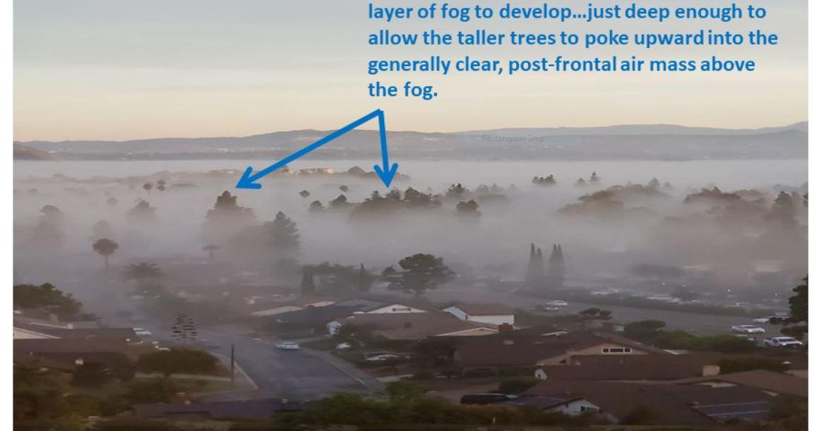
While the air was clear a little higher up, it was foggy down at ground level in the San Diego area. Surely, people in California are no stranger to the "May Gray" or "June Gloom" that visits often. The marine layer frequently moves onshore and provides thick, foggy conditions. However this instance was a little bit different. Let's explain:
It all started with the decent amount of rain that fell on Wednesday. Many areas picked up 1-2" of rainfall from Tuesday into Wednesday. The sky then cleared Wednesday night into Thursday morning. However, the ground level was still saturated. The wet ground then saturated the air around it. When saturation occurs, the temperature cools. This set up a temperature inversion.
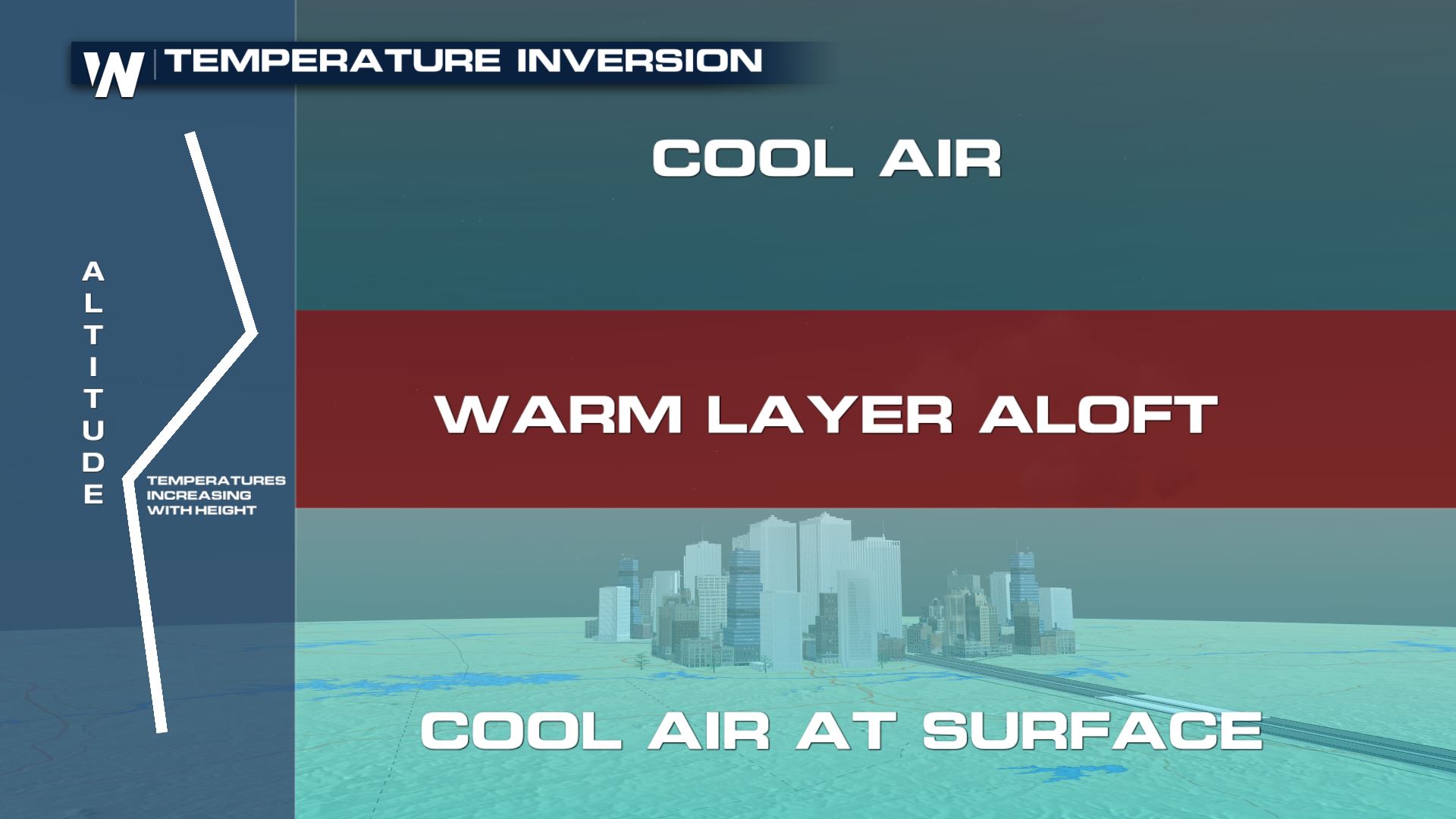 A temperature inversion means the air at the surface is cooler than the air above (or aloft). This is known as a stable environment. It means the air stays put. This allowed for the foggy landscape to greet folks heading out the door early Thursday morning!
A temperature inversion means the air at the surface is cooler than the air above (or aloft). This is known as a stable environment. It means the air stays put. This allowed for the foggy landscape to greet folks heading out the door early Thursday morning!All Weather News
More
Fronts Continue To Spark Severe Weather Across the Plains
A cold front that brought record lows to the
18 Jul 2025 10:40 PM

Extreme Heat Impacts for the East Coast & South
Extreme heat continues to impact several area
18 Jul 2025 10:05 PM

Flooding Threat Remains Elevated in the East
A cold front pushing through the Eastern Seab
18 Jul 2025 9:10 PM

EF-2 Firenado from the Deer Creek Fire in Utah
A fire tornado was spotted near La Sal, Utah
18 Jul 2025 7:30 AM

Tropical System Brings Flood Risk to the Central Gulf
Time has run out for notable tropical develop
18 Jul 2025 3:05 AM

Heavy Rain, Flooding Threat Returns to Florida
Keep the rain boots handy in Florida - heavy
13 Jul 2025 12:50 PM

Severe Storm Risk Pushes into the Great Lakes, Ohio Valley
Friday was another busy day with severe weath
12 Jul 2025 8:00 PM